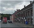
Graiguenamanagh Bridge
Main Street Lower, Tinnahinch, Graiguenamanagh, County Carlow, Ireland
(R703)

Graiguenamanagh Bridge
is a minor waterways place
on the Barrow Navigation (Non - Tidal Section) between
Grand - Barrow Junction (Junction of the Grand Canal (Barrow Line) with the River Barrow ) (38 miles and 1½ furlongs
and 20 locks
to the north) and
Ferrymountgarrett Lift Bridge (11 miles and 6¾ furlongs
and 4 locks
to the south).
The nearest place in the direction of Grand - Barrow Junction is Ballykennan Double Lock;
1 mile and 4¾ furlongs
away.
The nearest place in the direction of Ferrymountgarrett Lift Bridge is Upper Tinnahinch Lock;
1¾ furlongs
away.
Mooring here is unrated.
There is a bridge here which takes a road over the canal.
| Ballytiglea Bridge | 6 miles, ¾ furlongs | |
| Borris Lock | 5 miles, 2¾ furlongs | |
| Ballingrane Lock | 3 miles, 6 furlongs | |
| Clashganny Lock | 2 miles, 3¼ furlongs | |
| Ballykennan Double Lock | 1 mile, 4¾ furlongs | |
| Graiguenamanagh Bridge | ||
| Upper Tinnahinch Lock | 1¾ furlongs | |
| Lower Tinnahinch Lock | 1 mile, 2¼ furlongs | |
| Carriglead Lock | 2 miles | |
| St. Mullins Lock Lift Bridge | 3 miles, 6¼ furlongs | |
| St. Mullins Lock Winding Hole | 3 miles, 6¾ furlongs | |
There are no links to external websites from here.
Why not log in and add some (select "External websites" from the menu (sometimes this is under "Edit"))?
Why not log in and add some (select "External websites" from the menu (sometimes this is under "Edit"))?
Mouseover for more information or show routes to facility
Nearest place to turn
In the direction of Barrow Tidal Junction
St. Mullins Lock Winding Hole — 3 miles, 6¾ furlongs and 3 locks away
On this waterway in the direction of Barrow Tidal JunctionNo information
CanalPlan has no information on any of the following facilities within range:water point
rubbish disposal
chemical toilet disposal
self-operated pump-out
boatyard pump-out
There is no page on Wikipedia called “Graiguenamanagh Bridge”
Wikipedia pages that might relate to Graiguenamanagh Bridge
[County Kilkenny]
designed Green's Bridge in Kilkenny, Castlecomer Bridge on the Dinin (Deen) River; Thomastown Bridge on the River Nore; Graiguenamanagh Bridge on the River
[Bennettsbridge]
include Green's Bridge in Kilkenny City, Thomastown Bridge on the River Nore, Graiguenamanagh Bridge on the River Barrow, Inistioge Bridge on the Nore, Goresbridge
[Castlecomer]
"Great Flood" of 1763 (others include Green's Bridge, Graiguenamanagh Bridge and Inistioge Bridge). Robust details exhibiting high-quality stone masonry
[List of towns and villages in the Republic of Ireland]
Choirce) Gorteen Gortnahoe Gortnavern Gougane Barra Goulane Gowran Graiguenamanagh Granard Grange (Sligo) Grange (Tipperary) Grange (Waterford) Grangecon
[Thomas Cloney]
grounds in November 1804. After his release, Cloney went to live at Graiguenamanagh, County Kilkenny, where his home was nicknamed "Whitehall". Of the
[Thomastown]
Clara, Coolhill, Dunbell, Famma, Freaghana, Goresbridge, Gowran, Graiguenamanagh, Inistioge, Jerpoint Church, Kilfane, Kiltorcan, Paulstown, Pleberstown
[Alley]
Peg Washington's Lane, Graiguenamanagh, County Kilkenny, Ireland
[List of towns in the Republic of Ireland/2002 Census Records]
Gortnahoo, Tipperary South 207 Gowran, Kilkenny 454 Grahormac, Wexford 162 Graiguenamanagh- Tinnahinch, Carlow and Kilkenny 1435 Granard, Longford 1013 Grange
[Kilkenny Intermediate Hurling Championship]
Intermediate Championship was introduced in 1929 as a competition that would bridge the gap between the senior grade and the junior grade. The championship
[List of market houses in the Republic of Ireland]
Ireland. Retrieved 1 September 2020. "Graiguenamanagh Market House, Market Square, GRAIGUENAMANAGH, Graiguenamanagh, County Kilkenny". Buildings of Ireland


