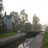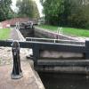
Whitsunday Pie Lock No 60
is a minor waterways place
on the Chesterfield Canal (Retford to the Trent) between
Wiseton Top Bridge No 70 (6 miles
to the north) and
West Retford Lock No 58 (Wharf Bridge) (1 mile and 6¾ furlongs
and 1 lock
to the west).
The nearest place in the direction of Wiseton Top Bridge No 70 is Whitsunday Pie Bridge No 60;
¼ furlongs
away.
The nearest place in the direction of West Retford Lock No 58 is Hop Pole Bridge No 59;
2¼ furlongs
away.
Mooring here is impossible (it may be physically impossible, forbidden, or allowed only for specific short-term purposes).
This is a lock with a rise of 4f3.
| Church Bridge No 63 | 1 mile, 3¾ furlongs | |
| Clarborough Top Bridge No 62 | 1 mile, 1¾ furlongs | |
| Gate Inn Visitor Moorings | 1 mile, 1¼ furlongs | |
| Bonemill Bridge No 61 | 3¾ furlongs | |
| Whitsunday Pie Bridge No 60 | ¼ furlongs | |
| Whitsunday Pie Lock No 60 | ||
| Hop Pole Bridge No 59 | 2¼ furlongs | |
| Leverton Road Bridge No 58 | 5¼ furlongs | |
| Grove Mill Bridge Winding Hole | 1 mile, ½ furlongs | |
| Grove Mill Bridge No 57 | 1 mile, ¾ furlongs | |
| Arlington Way Bridge No 56 | 1 mile, 2 furlongs | |
There are no links to external websites from here.
Why not log in and add some (select "External websites" from the menu (sometimes this is under "Edit"))?
Why not log in and add some (select "External websites" from the menu (sometimes this is under "Edit"))?
Mouseover for more information or show routes to facility
Nearest water point
In the direction of West Retford Lock No 58
Hop Pole Bridge No 59 — 2¼ furlongs and 1 lock away
On this waterway in the direction of West Retford Lock No 58
Forest Middle Top Lock No 55 — 4 miles, 4 furlongs and 5 locks away
Travel to West Retford Lock No 58, then on the Chesterfield Canal (Norwood to Retford) to Forest Middle Top Lock No 55
Forest Middle Top Water Point — 4 miles, 4¼ furlongs and 6 locks away
Travel to West Retford Lock No 58, then on the Chesterfield Canal (Norwood to Retford) to Forest Middle Top Water Point
Shireoaks Marina — 13 miles, 7¾ furlongs and 19 locks away
Travel to West Retford Lock No 58, then on the Chesterfield Canal (Norwood to Retford) to Shireoaks Marina
In the direction of Chesterfield Canal - River Trent Junction
Clayworth CRT Boaters Facilities — 4 miles, ½ furlongs and 1 lock away
On this waterway in the direction of Chesterfield Canal - River Trent Junction
West Stockwith Basin — 13 miles, 5½ furlongs and 5 locks away
On this waterway in the direction of Chesterfield Canal - River Trent JunctionNearest rubbish disposal
In the direction of West Retford Lock No 58
Forest Middle Top Lock No 55 — 4 miles, 4 furlongs and 5 locks away
Travel to West Retford Lock No 58, then on the Chesterfield Canal (Norwood to Retford) to Forest Middle Top Lock No 55
Shireoaks Marina — 13 miles, 7¾ furlongs and 19 locks away
Travel to West Retford Lock No 58, then on the Chesterfield Canal (Norwood to Retford) to Shireoaks Marina
In the direction of Chesterfield Canal - River Trent Junction
Clayworth CRT Boaters Facilities — 4 miles, ½ furlongs and 1 lock away
On this waterway in the direction of Chesterfield Canal - River Trent Junction
West Stockwith Basin — 13 miles, 5½ furlongs and 5 locks away
On this waterway in the direction of Chesterfield Canal - River Trent JunctionNearest chemical toilet disposal
In the direction of West Retford Lock No 58
Forest Middle Top Lock No 55 — 4 miles, 4 furlongs and 5 locks away
Travel to West Retford Lock No 58, then on the Chesterfield Canal (Norwood to Retford) to Forest Middle Top Lock No 55
Cuckoo Wharf Elsan — 11 miles, 6 furlongs and 10 locks away
Travel to West Retford Lock No 58, then on the Chesterfield Canal (Norwood to Retford) to Cuckoo Wharf Elsan
Shireoaks Marina — 13 miles, 7¾ furlongs and 19 locks away
Travel to West Retford Lock No 58, then on the Chesterfield Canal (Norwood to Retford) to Shireoaks Marina
In the direction of Chesterfield Canal - River Trent Junction
Clayworth CRT Boaters Facilities — 4 miles, ½ furlongs and 1 lock away
On this waterway in the direction of Chesterfield Canal - River Trent Junction
West Stockwith Basin — 13 miles, 5½ furlongs and 5 locks away
On this waterway in the direction of Chesterfield Canal - River Trent JunctionNearest place to turn
In the direction of West Retford Lock No 58
Grove Mill Bridge Winding Hole — 1 mile, ½ furlongs and 1 lock away
On this waterway in the direction of West Retford Lock No 58
Retford Winding Hole — 1 mile, 2¼ furlongs and 1 lock away
On this waterway in the direction of West Retford Lock No 58
Babworth Winding Hole — 2 miles, 6¼ furlongs and 3 locks away
Travel to West Retford Lock No 58, then on the Chesterfield Canal (Norwood to Retford) to Babworth Winding Hole
Forest Top Lock Winding Hole — 4 miles, 6¾ furlongs and 6 locks away
Travel to West Retford Lock No 58, then on the Chesterfield Canal (Norwood to Retford) to Forest Top Lock Winding Hole
Ranby Bridge Winding Hole — 7 miles, ¾ furlongs and 7 locks away
Travel to West Retford Lock No 58, then on the Chesterfield Canal (Norwood to Retford) to Ranby Bridge Winding Hole
High Hoe Road Bridge Winding Hole — 11 miles, ¾ furlongs and 9 locks away
Travel to West Retford Lock No 58, then on the Chesterfield Canal (Norwood to Retford) to High Hoe Road Bridge Winding Hole
Morse Lock Winding Hole — 12 miles, ¾ furlongs and 11 locks away
Travel to West Retford Lock No 58, then on the Chesterfield Canal (Norwood to Retford) to Morse Lock Winding Hole
Junction with former Lady Lee Arm — 12 miles, 5 furlongs and 12 locks away
Travel to West Retford Lock No 58, then on the Chesterfield Canal (Norwood to Retford) to Junction with former Lady Lee Arm
Shireoaks Marina — 13 miles, 7¾ furlongs and 19 locks away
Travel to West Retford Lock No 58, then on the Chesterfield Canal (Norwood to Retford) to Shireoaks Marina
Little Lane Bridge Winding Hole — 14 miles, 7½ furlongs and 27 locks away
Travel to West Retford Lock No 58, then on the Chesterfield Canal (Norwood to Retford) to Little Lane Bridge Winding Hole
Manor Road Winding Hole — 17 miles, 4¼ furlongs and 42 locks away
Travel to West Retford Lock No 58, then on the Chesterfield Canal (Norwood to Retford) to Manor Road Winding Hole
Kiveton Waters Marina — 18 miles, 2¾ furlongs and 45 locks away
Travel to West Retford Lock No 58, then on the Chesterfield Canal (Norwood to Retford) to Norwood Tunnel (eastern entrance), then on the Chesterfield Canal (Unnavigable section) to Kiveton Waters Marina
Norwood Winding Hole — 19 miles, 6¾ furlongs and 68 locks away
Travel to West Retford Lock No 58, then on the Chesterfield Canal (Norwood to Retford) to Norwood Tunnel (eastern entrance), then on the Chesterfield Canal (Unnavigable section) to Norwood Winding Hole
In the direction of Chesterfield Canal - River Trent Junction
Main Street Winding Hole — 2 miles, 3¼ furlongs and 1 lock away
On this waterway in the direction of Chesterfield Canal - River Trent Junction
Clayworth Top Bridge Winding Hole — 4 miles, 1¼ furlongs and 1 lock away
On this waterway in the direction of Chesterfield Canal - River Trent Junction
Otter's Bridge Winding Hole — 4 miles, 6 furlongs and 1 lock away
On this waterway in the direction of Chesterfield Canal - River Trent Junction
Drakeholes Visitor Moorings — 7 miles, 1¼ furlongs and 1 lock away
On this waterway in the direction of Chesterfield Canal - River Trent Junction
Drakeholes Tunnel (southern entrance) — 7 miles, 1¾ furlongs and 1 lock away
On this waterway in the direction of Chesterfield Canal - River Trent Junction
Manor Farm Winding Hole — 11 miles, 1¼ furlongs and 3 locks away
On this waterway in the direction of Chesterfield Canal - River Trent Junction
West Stockwith Basin — 13 miles, 5½ furlongs and 5 locks away
On this waterway in the direction of Chesterfield Canal - River Trent JunctionNo information
CanalPlan has no information on any of the following facilities within range:self-operated pump-out
boatyard pump-out
Direction of TV transmitter (From Wolfbane Cybernetic)
There is no page on Wikipedia called “Whitsunday Pie Lock”
Wikipedia pages that might relate to Whitsunday Pie Lock
[Chesterfield Canal]
became evident that the section of the canal between Whitsunday Pie Lock and Retford Town Lock was losing water. Investigation revealed that the plug
[Welham, Nottinghamshire]
all at Grade II designation, including: Welham Hall Welham Grange Whitsunday Pie Lock Bridge 60 over the Chesterfield Canal The Sheffield to Lincoln railway
[Retford]
became evident that the section of the canal between Whitsunday Pie Lock and Retford Town Lock was losing water. Unbeknown to the workmen, but commonly
[Clarborough and Welham]
the Baptist, Grade I, Clarborough Welham Hall, Grade II, Welham Whitsunday Pie Lock Bridge 60 over the Chesterfield Canal, Grade II, Welham Bridge 62
[St Michael and All Angels Church, Barnes]
in her 1955 novel Less Than Angels, where Pym describes High Mass on Whitsunday: So as to make sure of their favourite seat they had arrived rather too
Results of Google Search
Chesterfield Canal - WikipediaThe Chesterfield Canal is a narrow canal in the East Midlands of England and it is known ... Whitsunday Pie Lock (60) ... West Retford Lock (60) ... There was no proper system of road maintenance, and so the use of carts and wagons for the ...
Approaching Whitsunday Pie Lock, with the railway line on the left. SK7282 : Whitsunday Pie Lock No 60 by Mat Fascione · Whitsunday Pie Lock No 60.
66) (24 hours); Hayton, Gate Inn (PH) (48 hours); Above Whitsunday Pie Lock (no . 60); Retford, Hop Pole (PH) – £25 per night, refundable off you food bill in the ...
Turn right at the Hop Pole Inn into an unused section of roadway, with ample parking space. It is not easy to find your way through Retford to the A620 – we ...
Jun 24, 2015 ... It had no music or narration and featured a narrowboat cruising down the ... Mile, an embankment carrying the canal 60 feet above the town of Burnley. ... The entire canal between Whitsunday Pie Lock and Retford Town Lock ...
The wonderful named Whitsunday Pie Lock 60 on the outskirts of Retford. Camera Make: ... Cinderhill Lock No 41 the canalon the way to Turnerwood. Camera ...
Note: Whitsunday Pie Lock walls taper towards the lock floor and you need to take this into account ... Droitwich Junction Canal River Salwarpe to Hanbury Junction Lock 7 (narrow) ... Bulls Bridge to Little Venice (no locks) ... 60m 196ft 10 ".
Misterton locks (64 and 63) ... Whitsunday Pie Lock (60) ... The canal was opened throughout in 1777, but there is no record of wide-beamed boats ever using it.


