Eastmoor Railway Bridge No 2
Neil Fox Way, Heath WF1 4FU, United Kingdom
(A6194)

Eastmoor Railway Bridge No 2
is a minor waterways place
on the Aire and Calder Navigation (Wakefield Section) between
Fall Ing Junction (Junction of the Calder and Hebble Navigation and the Aire and Calder Navigation (Wakefield Section)) (1 mile and ¼ furlongs
to the southwest) and
Stanley Ferry Aqueduct (This is a pair of Aqueducts over the River Calder) (1 mile and 4¾ furlongs
and 1 lock
to the north).
The nearest place in the direction of Fall Ing Junction is Old Wharf Branch Junction (Junction of the Aire and Calder Navigation with the Barnsley Canal);
4¾ furlongs
away.
The nearest place in the direction of Stanley Ferry Aqueduct is Broadreach Weir Stream (Channel leading to the Weir - No Access);
1½ furlongs
away.
Mooring here is unrated.
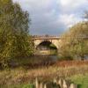
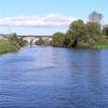
There is a bridge here which takes a railway over the canal.
Fall Ing Junction | 1 mile, ¼ furlongs | |
Foundry Shoal Railway Bridge No 1 | 6¾ furlongs | |
Wakefield New Road Bridge | 5¼ furlongs | |
Old Wharf Branch Junction | 4¾ furlongs | |
Eastmoor Railway Bridge No 2 | ||
Broadreach Weir Stream | 1½ furlongs | |
Broadreach Lock No 1 (Flood Lock) | 1¾ furlongs | |
Broadreach Footbridge No 3 | 2½ furlongs | |
Harrisons Bridge No 4 | 5¼ furlongs | |
Ramsdens Bridge Sanitary Station | 1 mile, 2¾ furlongs |
Amenities nearby at Old Wharf Branch Junction
There are no links to external websites from here.
Why not log in and add some (select "External websites" from the menu (sometimes this is under "Edit"))?
Mouseover for more information or show routes to facility
Nearest water point
In the direction of Castleford Junction
Ramsdens Bridge Sanitary Station — 1 mile, 2¾ furlongs and 1 lock away
On this waterway in the direction of Castleford Junction
Stanley Ferry Water Point — 1 mile, 3½ furlongs and 1 lock away
On this waterway in the direction of Castleford Junction
King's Road Lock No 3 — 3 miles, ½ furlongs and 2 locks away
On this waterway in the direction of Castleford Junction
Woodnook Lock No 6 — 4 miles, 2 furlongs and 3 locks away
On this waterway in the direction of Castleford Junction
Fairies Hill Moorings — 4 miles, 5½ furlongs and 5 locks away
Travel to Fairies Hill Lock Junction, then on the Aire and Calder Navigation (Wakefield Section - Fairies Hill Mooring Arm) to Fairies Hill Moorings
Castleford Sanitary Station — 6 miles, 4¾ furlongs and 5 locks away
Travel to Castleford Junction, then on the Aire and Calder Navigation (Main Line - Goole to Castleford) to Castleford Sanitary Station
Bulholme Lock No 10 — 7 miles, 1½ furlongs and 5 locks away
Travel to Castleford Junction, then on the Aire and Calder Navigation (Main Line - Goole to Castleford) to Bulholme Lock No 10
Lemonroyd Lock No 7 — 9 miles, 7¼ furlongs and 4 locks away
Travel to Castleford Junction, then on the Aire and Calder Navigation (Main Line - Castleford to Leeds) to Lemonroyd Lock No 7
Lemonroyd Marina — 10 miles, ¼ furlongs and 5 locks away
Travel to Castleford Junction, then on the Aire and Calder Navigation (Main Line - Castleford to Leeds) to Lemonroyd Marina
Woodlesford Lock No 5 — 11 miles, 2 furlongs and 5 locks away
Travel to Castleford Junction, then on the Aire and Calder Navigation (Main Line - Castleford to Leeds) to Woodlesford Lock No 5
Ferrybridge Flood Lock Footbridge — 11 miles, 7 furlongs and 6 locks away
Travel to Castleford Junction, then on the Aire and Calder Navigation (Main Line - Goole to Castleford) to Ferrybridge Flood Lock Footbridge
Ferrybridge Flood Lock No 11 — 11 miles, 7½ furlongs and 6 locks away
Travel to Castleford Junction, then on the Aire and Calder Navigation (Main Line - Goole to Castleford) to Ferrybridge Flood Lock No 11
Fishpond Lock No 4 — 12 miles, 1 furlong and 6 locks away
Travel to Castleford Junction, then on the Aire and Calder Navigation (Main Line - Castleford to Leeds) to Fishpond Lock No 4
Bank Dole Lock No 1 — 13 miles, 5¾ furlongs and 7 locks away
Travel to Castleford Junction, then on the Aire and Calder Navigation (Main Line - Goole to Castleford) to Bank Dole Junction, then on the Aire and Calder Navigation (Selby Section) to Bank Dole Lock No 1
Leeds Sanitary Station — 15 miles, 6¾ furlongs and 8 locks away
Travel to Castleford Junction, then on the Aire and Calder Navigation (Main Line - Castleford to Leeds) to Leeds Sanitary Station
Beal Bridge — 16 miles, ¼ furlongs and 8 locks away
Travel to Castleford Junction, then on the Aire and Calder Navigation (Main Line - Goole to Castleford) to Bank Dole Junction, then on the Aire and Calder Navigation (Selby Section) to Beal Bridge
Beal Lock No 2 — 16 miles, 1½ furlongs and 8 locks away
Travel to Castleford Junction, then on the Aire and Calder Navigation (Main Line - Goole to Castleford) to Bank Dole Junction, then on the Aire and Calder Navigation (Selby Section) to Beal Lock No 2
Whitley Lock No 12 — 17 miles, 3¼ furlongs and 7 locks away
Travel to Castleford Junction, then on the Aire and Calder Navigation (Main Line - Goole to Castleford) to Whitley Lock No 12
In the direction of Fall Ing Junction
Broad Cut Low Lock No 3 — 4 miles, 1 furlong and 2 locks away
Travel to Fall Ing Junction, then on the Calder and Hebble Navigation (Main Line) to Broad Cut Low Lock No 3
Shepley Bridge Sanitary Station — 10 miles, 6 furlongs and 11 locks away
Travel to Fall Ing Junction, then on the Calder and Hebble Navigation (Main Line) to Shepley Bridge Sanitary StationNearest rubbish disposal
In the direction of Castleford Junction
Ramsdens Bridge Visitor Moorings — 1 mile, 3 furlongs and 1 lock away
On this waterway in the direction of Castleford Junction
Castleford Sanitary Station — 6 miles, 4¾ furlongs and 5 locks away
Travel to Castleford Junction, then on the Aire and Calder Navigation (Main Line - Goole to Castleford) to Castleford Sanitary Station
Lemonroyd Marina — 10 miles, ¼ furlongs and 5 locks away
Travel to Castleford Junction, then on the Aire and Calder Navigation (Main Line - Castleford to Leeds) to Lemonroyd Marina
Woodlesford Lock No 5 — 11 miles, 2 furlongs and 5 locks away
Travel to Castleford Junction, then on the Aire and Calder Navigation (Main Line - Castleford to Leeds) to Woodlesford Lock No 5
Leeds Sanitary Station — 15 miles, 6¾ furlongs and 8 locks away
Travel to Castleford Junction, then on the Aire and Calder Navigation (Main Line - Castleford to Leeds) to Leeds Sanitary Station
Whitley Lock No 12 — 17 miles, 3¼ furlongs and 7 locks away
Travel to Castleford Junction, then on the Aire and Calder Navigation (Main Line - Goole to Castleford) to Whitley Lock No 12
Leeds Basin — 16 miles, 6 furlongs and 10 locks away
Travel to Castleford Junction, then on the Aire and Calder Navigation (Main Line - Castleford to Leeds) to Leeds Bridge, then on the Leeds and Liverpool Canal (Main Line - Wigan to Leeds) to Leeds Basin
In the direction of Fall Ing Junction
Horbury Basin Residential Moorings & Sanitary Station — 6 miles, 1¾ furlongs and 4 locks away
Travel to Fall Ing Junction, then on the Calder and Hebble Navigation (Main Line) to Horbury Basin Residential Moorings & Sanitary Station
Shepley Bridge Sanitary Station — 10 miles, 6 furlongs and 11 locks away
Travel to Fall Ing Junction, then on the Calder and Hebble Navigation (Main Line) to Shepley Bridge Sanitary Station
Brighouse Lower Basin Visitor Moorings — 16 miles, ½ furlongs and 16 locks away
Travel to Fall Ing Junction, then on the Calder and Hebble Navigation (Main Line) to Brighouse Lower Basin Visitor Moorings
Aspley Basin (Huddersfield) — 17 miles, 2½ furlongs and 22 locks away
Travel to Fall Ing Junction, then on the Calder and Hebble Navigation (Main Line) to Cooper Bridge Junction, then on the Huddersfield Broad Canal to Aspley Basin (Huddersfield)Nearest chemical toilet disposal
In the direction of Castleford Junction
Ramsdens Bridge Sanitary Station — 1 mile, 2¾ furlongs and 1 lock away
On this waterway in the direction of Castleford Junction
Fairies Hill Moorings — 4 miles, 5½ furlongs and 5 locks away
Travel to Fairies Hill Lock Junction, then on the Aire and Calder Navigation (Wakefield Section - Fairies Hill Mooring Arm) to Fairies Hill Moorings
Castleford Sanitary Station — 6 miles, 4¾ furlongs and 5 locks away
Travel to Castleford Junction, then on the Aire and Calder Navigation (Main Line - Goole to Castleford) to Castleford Sanitary Station
Lemonroyd Marina — 10 miles, ¼ furlongs and 5 locks away
Travel to Castleford Junction, then on the Aire and Calder Navigation (Main Line - Castleford to Leeds) to Lemonroyd Marina
Leeds Sanitary Station — 15 miles, 6¾ furlongs and 8 locks away
Travel to Castleford Junction, then on the Aire and Calder Navigation (Main Line - Castleford to Leeds) to Leeds Sanitary Station
Whitley Lock No 12 — 17 miles, 3¼ furlongs and 7 locks away
Travel to Castleford Junction, then on the Aire and Calder Navigation (Main Line - Goole to Castleford) to Whitley Lock No 12
In the direction of Fall Ing Junction
Horbury Basin Residential Moorings & Sanitary Station — 6 miles, 1¾ furlongs and 4 locks away
Travel to Fall Ing Junction, then on the Calder and Hebble Navigation (Main Line) to Horbury Basin Residential Moorings & Sanitary Station
Savile Town Wharf and Basin (Dewsbury) — 9 miles, 2½ furlongs and 7 locks away
Travel to Fall Ing Junction, then on the Calder and Hebble Navigation (Main Line) to Dewsbury Arm Junction, then on the Calder and Hebble Navigation (Dewsbury Old Cut) to Savile Town Wharf and Basin (Dewsbury)
Shepley Bridge Sanitary Station — 10 miles, 6 furlongs and 11 locks away
Travel to Fall Ing Junction, then on the Calder and Hebble Navigation (Main Line) to Shepley Bridge Sanitary Station
Brighouse Basin — 16 miles, 1 furlong and 17 locks away
Travel to Fall Ing Junction, then on the Calder and Hebble Navigation (Main Line) to Brighouse Basin
Aspley Basin (Huddersfield) — 17 miles, 2½ furlongs and 22 locks away
Travel to Fall Ing Junction, then on the Calder and Hebble Navigation (Main Line) to Cooper Bridge Junction, then on the Huddersfield Broad Canal to Aspley Basin (Huddersfield)Nearest place to turn
In the direction of Castleford Junction
Stanley Ferry Marina — 1 mile, 4¼ furlongs and 1 lock away
On this waterway in the direction of Castleford Junction
Fairies Hill Lock Arm — 4 miles, ½ furlongs and 3 locks away
On this waterway in the direction of Castleford Junction
Bulholme Lock Weir Exit — 7 miles, 1¾ furlongs and 6 locks away
Travel to Castleford Junction, then on the Aire and Calder Navigation (Main Line - Goole to Castleford) to Bulholme Lock Weir Exit
Lemonroyd Lock Weir Exit — 9 miles, 6½ furlongs and 4 locks away
Travel to Castleford Junction, then on the Aire and Calder Navigation (Main Line - Castleford to Leeds) to Lemonroyd Lock Weir Exit
Fleet Lane Arm — 10 miles, 2½ furlongs and 5 locks away
Travel to Castleford Junction, then on the Aire and Calder Navigation (Main Line - Castleford to Leeds) to Fleet Lane Arm
Junction with River Aire (Old Channel) South — 14 miles, 4¾ furlongs and 7 locks away
Travel to Castleford Junction, then on the Aire and Calder Navigation (Main Line - Castleford to Leeds) to Junction with River Aire (Old Channel) South
Bank Dole Lock Junction — 13 miles, 6 furlongs and 8 locks away
Travel to Castleford Junction, then on the Aire and Calder Navigation (Main Line - Goole to Castleford) to Bank Dole Junction, then on the Aire and Calder Navigation (Selby Section) to Bank Dole Lock Junction
Junction with River Aire (Old Channel) North — 15 miles, 1¾ furlongs and 8 locks away
Travel to Castleford Junction, then on the Aire and Calder Navigation (Main Line - Castleford to Leeds) to Junction with River Aire (Old Channel) North
Knostrop Flood Lock Weir Entrance — 15 miles, 2 furlongs and 8 locks away
Travel to Castleford Junction, then on the Aire and Calder Navigation (Main Line - Castleford to Leeds) to Knostrop Flood Lock Weir Entrance
Beal Lock No 2 Weir Entrance — 16 miles, ½ furlongs and 8 locks away
Travel to Castleford Junction, then on the Aire and Calder Navigation (Main Line - Goole to Castleford) to Bank Dole Junction, then on the Aire and Calder Navigation (Selby Section) to Beal Lock No 2 Weir Entrance
Leeds Dock Side Arm — 16 miles, 1 furlong and 9 locks away
Travel to Castleford Junction, then on the Aire and Calder Navigation (Main Line - Castleford to Leeds) to Leeds Dock Entrance, then on the Aire and Calder Navigation (Leeds Dock) to Leeds Dock Side Arm
River Aire Junction — 16 miles, 5½ furlongs and 9 locks away
Travel to Castleford Junction, then on the Aire and Calder Navigation (Main Line - Castleford to Leeds) to Leeds Bridge, then on the Leeds and Liverpool Canal (Main Line - Wigan to Leeds) to River Aire Junction
In the direction of Fall Ing Junction
Wakefield Weir Entrance — 1 mile, 4¼ furlongs and 1 lock away
Travel to Fall Ing Junction, then on the Calder and Hebble Navigation (Main Line) to Wakefield Weir Entrance
Broad Cut Weir Entrance — 4 miles, ¾ furlongs and 2 locks away
Travel to Fall Ing Junction, then on the Calder and Hebble Navigation (Main Line) to Broad Cut Weir Entrance
Waller Bridge Winding Hole — 4 miles, 2¾ furlongs and 3 locks away
Travel to Fall Ing Junction, then on the Calder and Hebble Navigation (Main Line) to Waller Bridge Winding Hole
Horbury Basin Residential Moorings & Sanitary Station — 6 miles, 1¾ furlongs and 4 locks away
Travel to Fall Ing Junction, then on the Calder and Hebble Navigation (Main Line) to Horbury Basin Residential Moorings & Sanitary Station
Dewsbury Arm Junction — 8 miles, 2½ furlongs and 7 locks away
Travel to Fall Ing Junction, then on the Calder and Hebble Navigation (Main Line) to Dewsbury Arm Junction
Savile Town Wharf and Basin (Dewsbury) — 9 miles, 2½ furlongs and 7 locks away
Travel to Fall Ing Junction, then on the Calder and Hebble Navigation (Main Line) to Dewsbury Arm Junction, then on the Calder and Hebble Navigation (Dewsbury Old Cut) to Savile Town Wharf and Basin (Dewsbury)
Shepley Bridge Marina — 10 miles, 5¾ furlongs and 11 locks away
Travel to Fall Ing Junction, then on the Calder and Hebble Navigation (Main Line) to Shepley Bridge Marina
Battye Weir Entrance — 13 miles, 1½ furlongs and 12 locks away
Travel to Fall Ing Junction, then on the Calder and Hebble Navigation (Main Line) to Battye Weir EntranceNearest self-operated pump-out
In the direction of Castleford Junction
Ramsdens Bridge Sanitary Station — 1 mile, 2¾ furlongs and 1 lock away
On this waterway in the direction of Castleford Junction
Castleford Sanitary Station — 6 miles, 4¾ furlongs and 5 locks away
Travel to Castleford Junction, then on the Aire and Calder Navigation (Main Line - Goole to Castleford) to Castleford Sanitary Station
Leeds Sanitary Station — 15 miles, 6¾ furlongs and 8 locks away
Travel to Castleford Junction, then on the Aire and Calder Navigation (Main Line - Castleford to Leeds) to Leeds Sanitary StationNearest boatyard pump-out
In the direction of Castleford Junction
Lemonroyd Marina — 10 miles, ¼ furlongs and 5 locks away
Travel to Castleford Junction, then on the Aire and Calder Navigation (Main Line - Castleford to Leeds) to Lemonroyd Marina
In the direction of Fall Ing Junction
Shepley Bridge Marina — 10 miles, 5¾ furlongs and 11 locks away
Travel to Fall Ing Junction, then on the Calder and Hebble Navigation (Main Line) to Shepley Bridge Marina
Aspley Basin (Huddersfield) — 17 miles, 2½ furlongs and 22 locks away
Travel to Fall Ing Junction, then on the Calder and Hebble Navigation (Main Line) to Cooper Bridge Junction, then on the Huddersfield Broad Canal to Aspley Basin (Huddersfield)Direction of TV transmitter (From Wolfbane Cybernetic)
There is no page on Wikipedia called “Eastmoor Railway Bridge”
Wikipedia pages that might relate to Eastmoor Railway Bridge
[Chantry Chapel of St Mary the Virgin, Wakefield]
built in 1854. The bridge chapel became a chapel-of-ease and services were held irregularly. St Mary's merged with St Andrew's, Eastmoor in the 1960s and
[Wakefield]
with strong links to the mining industry, soapworks and brickyards in Eastmoor, giving the town a diverse economy. Boats and sloops were built at yards
[List of Melbourne suburbs]
Patterson (the name of the railway station) Bentleigh East 3165 Brighton East 3187 (shared with City of Bayside) Coatesville Eastmoor Carnegie 3163 Caulfield
[Imran Ahmad Khan (British politician)]
such as Somalia and Afghanistan gives him what would be needed to build bridges between warring parties in the Brexit battle. Ahmad Khan defeated the incumbent
[Pontypool and Blaenavon Railway]
rail-over-rail bridge within preservation. The line from Brynmawr to Blaenavon was originally built under an Act of 1866 by the Brynmawr and Blaenavon Railway and
[Wakefield Kirkgate railway station]
Wakefield Kirkgate railway station is a railway station in Wakefield, West Yorkshire, England. Unlike the nearby Wakefield Westgate railway station, Kirkgate
[Wakefield Westgate railway station]
Wakefield Westgate railway station is a mainline railway station in Wakefield, West Yorkshire, England. It is 10 miles (16 km) south of Leeds to the west
[Neighborhoods in Columbus, Ohio]
often confused with Eastmoor. Eastmoor south of East Main Street is referred to as Eastmoor South. Eastminster is a subsection of Eastmoor South. Boundaries
[Sandal and Agbrigg railway station]
Sandal and Agbrigg railway station serves the Wakefield suburbs of Sandal and Agbrigg in West Yorkshire, England. It lies on the Wakefield Line and is
[California State Route 1]
stretch in Ventura and Santa Barbara counties, and across the Golden Gate Bridge. The highway is designated as an All-American Road. In addition to providing
Results of Google Search
Balfour Beatty plc: HomeYour browser does not currently recognize any of the video formats available. Click here to visit our frequently asked questions about HTML5 video. Share.
Woo o dh use Rd. Ar cli. Rd n ffe. Ar cli. Rd n ffe. EASTMOOR. KIRKTHORPE. Ar cli. Rd n ffe ... 2. 3. 4. 5. Wakefield District. Cycle Rides. 1 Eastmoor. St Swithun's Centre to Heath Common. Eastmoor ... under the railway bridge, towards the ...
This is a list of viaducts and significant bridges of the United Kingdom's railways, past and ... 2008-05 Appleford Rail Bridge (2).JPG. Arnside ..... No longer used for rail traffic, Kielder Viaduct near Kielder (1) (geograph 2376656).jpg. Kilwinning ...
5. Footpath No. 2 (Common Road to Little Ellingham - Rocklands Road). .... eastwards under Railway Bridge to join Restricted Byway No. 5. ...... Woodcock Bottom and then runs parallel to boundary joining Eastmoor Road by a field gate.
The Gwili Railway (Welsh: Rheilffordd Gwili) is a Welsh heritage railway, that operates a ... 1 Original line; 2 Gwili Railway Preservation Company .... The line carries over a redecked bridge crossing the River Gwili. ... high hopes of reaching Llanpumsaint constantly being hindered by the number of bridges en-route.
We took the saying, “live life on the edge†to a whole new level at Edge DTC. Our chic, modern one and two-bedroom apartments located in the Denver Tech ...
Sep 7, 2012 ... Free for play: http://www.arcadepolis.com/archives/railway-bridge-2/ Cool game type of bridge construction. Build railway bridges, open new ...
along a farm track, for approximately 575 metres to the Eastmoor Road at grid ... Footpath No. 3 (Gravel Pit Cottages to Footpath No. 2). Starts from Gravel Pit ...... Bridge Road in a northerly direction beside the railway into to a level crossing ...
Jul 28, 2008 ... Waste Not Want Not Part 2 ... As you may aware by now, the railways of Hull and East Yorkshire interest me greatly, and I ... Stamford Bridge.
3 days ago ... No delays reported. / ... 08.30.2018 Labor Day holiday on Monday 9/3 trains will run on a modified ... Next trains departing from Colma Station:.