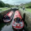
Sowerby Bridge Lock No 1
The Moorings, Canal Basin, Calderdale HX6 2AG, United Kingdom

Sowerby Bridge Lock No 1
is a minor waterways place
on the Rochdale Canal between
Tuel Lane Tunnel (western entrance) (1¾ furlongs
and 1 lock
to the west) and
Sowerby Bridge Junction (Junction of the Calder and Hebble Navigation and the Rochdale Canal) (1½ furlongs
to the east).
The nearest place in the direction of Tuel Lane Tunnel (western entrance) is Sowerby Bridge Winding Hole;
½ furlongs
away.
The nearest place in the direction of Sowerby Bridge Junction is Sowerby Bridge Lock Moorings;
¾ furlongs
away.
There may be access to the towpath here.
Mooring here is unrated.
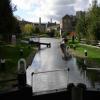
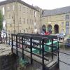
There is a bridge here which takes pedestrian traffic over the canal.
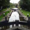
This is a lock, the rise of which is not known.
Tuel Lane Lock No 3 | 1¾ furlongs | |
Tuel Lane Tunnel (western entrance) | 1¾ furlongs | |
Tuel Lane Tunnel (eastern entrance) | 1¼ furlongs | |
Sowerby Bridge Lock No 2 | ¾ furlongs | |
Sowerby Bridge Winding Hole | ½ furlongs | |
Sowerby Bridge Lock No 1 | ||
Sowerby Bridge Lock Moorings | ¾ furlongs | |
Sowerby Bridge Junction | 1½ furlongs |
There are no links to external websites from here.
Why not log in and add some (select "External websites" from the menu (sometimes this is under "Edit"))?
Mouseover for more information or show routes to facility
Nearest water point
In the direction of Castlefield Junction
Hebden Bridge Services — 5 miles, 2¾ furlongs and 7 locks away
On this waterway in the direction of Castlefield Junction
Baltimore Marina — 9 miles, 2¼ furlongs and 16 locks away
On this waterway in the direction of Castlefield Junction
Fielden Wharf & Services — 9 miles, 5¼ furlongs and 17 locks away
On this waterway in the direction of Castlefield Junction
Travis Mill Lock No 28 — 11 miles, 2¾ furlongs and 26 locks away
On this waterway in the direction of Castlefield Junction
Littleborough Sanitary Station — 14 miles, 7¾ furlongs and 45 locks away
On this waterway in the direction of Castlefield Junction
In the direction of Sowerby Bridge Junction
Sowerby Bridge Basin — 2½ furlongs and 1 lock away
Travel to Sowerby Bridge Junction, then on the Calder and Hebble Navigation (Main Line) to Sowerby Bridge Basin
Salterhebble Junction — 2 miles, 2¼ furlongs and 1 lock away
Travel to Sowerby Bridge Junction, then on the Calder and Hebble Navigation (Main Line) to Salterhebble Junction
Salterhebble Sanitary Station — 2 miles, 2¾ furlongs and 2 locks away
Travel to Sowerby Bridge Junction, then on the Calder and Hebble Navigation (Main Line) to Salterhebble Junction, then on the Calder and Hebble Navigation (Main Line) to Salterhebble Sanitary Station
Brighouse Basin — 6 miles, 4¾ furlongs and 11 locks away
Travel to Sowerby Bridge Junction, then on the Calder and Hebble Navigation (Main Line) to Salterhebble Junction, then on the Calder and Hebble Navigation (Main Line) to Brighouse Basin
Shepley Bridge Sanitary Station — 11 miles, 7¾ furlongs and 17 locks away
Travel to Sowerby Bridge Junction, then on the Calder and Hebble Navigation (Main Line) to Salterhebble Junction, then on the Calder and Hebble Navigation (Main Line) to Shepley Bridge Sanitary Station
Aspley Basin (Huddersfield) — 12 miles, 3¼ furlongs and 24 locks away
Travel to Sowerby Bridge Junction, then on the Calder and Hebble Navigation (Main Line) to Salterhebble Junction, then on the Calder and Hebble Navigation (Main Line) to Cooper Bridge Junction, then on the Huddersfield Broad Canal to Aspley Basin (Huddersfield)
Broad Cut Low Lock No 3 — 18 miles, 4¾ furlongs and 25 locks away
Travel to Sowerby Bridge Junction, then on the Calder and Hebble Navigation (Main Line) to Salterhebble Junction, then on the Calder and Hebble Navigation (Main Line) to Broad Cut Low Lock No 3
Waterside Lock No 21E — 17 miles, ¾ furlongs and 44 locks away
Travel to Sowerby Bridge Junction, then on the Calder and Hebble Navigation (Main Line) to Salterhebble Junction, then on the Calder and Hebble Navigation (Main Line) to Cooper Bridge Junction, then on the Huddersfield Broad Canal to Aspley Basin (Huddersfield), then on the Huddersfield Narrow Canal to Waterside Lock No 21E
Slaithwaite Winding Hole — 17 miles, 1½ furlongs and 45 locks away
Travel to Sowerby Bridge Junction, then on the Calder and Hebble Navigation (Main Line) to Salterhebble Junction, then on the Calder and Hebble Navigation (Main Line) to Cooper Bridge Junction, then on the Huddersfield Broad Canal to Aspley Basin (Huddersfield), then on the Huddersfield Narrow Canal to Slaithwaite Winding HoleNearest rubbish disposal
In the direction of Castlefield Junction
Hebden Bridge Services — 5 miles, 2¾ furlongs and 7 locks away
On this waterway in the direction of Castlefield Junction
Fielden Wharf & Services — 9 miles, 5¼ furlongs and 17 locks away
On this waterway in the direction of Castlefield Junction
Littleborough Sanitary Station — 14 miles, 7¾ furlongs and 45 locks away
On this waterway in the direction of Castlefield Junction
In the direction of Sowerby Bridge Junction
Sowerby Bridge Basin — 2½ furlongs and 1 lock away
Travel to Sowerby Bridge Junction, then on the Calder and Hebble Navigation (Main Line) to Sowerby Bridge Basin
Salterhebble Sanitary Station — 2 miles, 2¾ furlongs and 2 locks away
Travel to Sowerby Bridge Junction, then on the Calder and Hebble Navigation (Main Line) to Salterhebble Junction, then on the Calder and Hebble Navigation (Main Line) to Salterhebble Sanitary Station
Brighouse Lower Basin Visitor Moorings — 6 miles, 5¼ furlongs and 12 locks away
Travel to Sowerby Bridge Junction, then on the Calder and Hebble Navigation (Main Line) to Salterhebble Junction, then on the Calder and Hebble Navigation (Main Line) to Brighouse Lower Basin Visitor Moorings
Shepley Bridge Sanitary Station — 11 miles, 7¾ furlongs and 17 locks away
Travel to Sowerby Bridge Junction, then on the Calder and Hebble Navigation (Main Line) to Salterhebble Junction, then on the Calder and Hebble Navigation (Main Line) to Shepley Bridge Sanitary Station
Aspley Basin (Huddersfield) — 12 miles, 3¼ furlongs and 24 locks away
Travel to Sowerby Bridge Junction, then on the Calder and Hebble Navigation (Main Line) to Salterhebble Junction, then on the Calder and Hebble Navigation (Main Line) to Cooper Bridge Junction, then on the Huddersfield Broad Canal to Aspley Basin (Huddersfield)
Horbury Basin Residential Moorings & Sanitary Station — 16 miles, 4¼ furlongs and 24 locks away
Travel to Sowerby Bridge Junction, then on the Calder and Hebble Navigation (Main Line) to Salterhebble Junction, then on the Calder and Hebble Navigation (Main Line) to Horbury Basin Residential Moorings & Sanitary Station
Pickle Lock No 22E — 17 miles, 2 furlongs and 45 locks away
Travel to Sowerby Bridge Junction, then on the Calder and Hebble Navigation (Main Line) to Salterhebble Junction, then on the Calder and Hebble Navigation (Main Line) to Cooper Bridge Junction, then on the Huddersfield Broad Canal to Aspley Basin (Huddersfield), then on the Huddersfield Narrow Canal to Pickle Lock No 22ENearest chemical toilet disposal
In the direction of Castlefield Junction
Hebden Bridge Services — 5 miles, 2¾ furlongs and 7 locks away
On this waterway in the direction of Castlefield Junction
Baltimore Marina — 9 miles, 2¼ furlongs and 16 locks away
On this waterway in the direction of Castlefield Junction
Littleborough Sanitary Station — 14 miles, 7¾ furlongs and 45 locks away
On this waterway in the direction of Castlefield Junction
In the direction of Sowerby Bridge Junction
Sowerby Bridge Basin — 2½ furlongs and 1 lock away
Travel to Sowerby Bridge Junction, then on the Calder and Hebble Navigation (Main Line) to Sowerby Bridge Basin
Salterhebble Sanitary Station — 2 miles, 2¾ furlongs and 2 locks away
Travel to Sowerby Bridge Junction, then on the Calder and Hebble Navigation (Main Line) to Salterhebble Junction, then on the Calder and Hebble Navigation (Main Line) to Salterhebble Sanitary Station
Brighouse Basin — 6 miles, 4¾ furlongs and 11 locks away
Travel to Sowerby Bridge Junction, then on the Calder and Hebble Navigation (Main Line) to Salterhebble Junction, then on the Calder and Hebble Navigation (Main Line) to Brighouse Basin
Shepley Bridge Sanitary Station — 11 miles, 7¾ furlongs and 17 locks away
Travel to Sowerby Bridge Junction, then on the Calder and Hebble Navigation (Main Line) to Salterhebble Junction, then on the Calder and Hebble Navigation (Main Line) to Shepley Bridge Sanitary Station
Aspley Basin (Huddersfield) — 12 miles, 3¼ furlongs and 24 locks away
Travel to Sowerby Bridge Junction, then on the Calder and Hebble Navigation (Main Line) to Salterhebble Junction, then on the Calder and Hebble Navigation (Main Line) to Cooper Bridge Junction, then on the Huddersfield Broad Canal to Aspley Basin (Huddersfield)
Savile Town Wharf and Basin (Dewsbury) — 15 miles, 3¼ furlongs and 21 locks away
Travel to Sowerby Bridge Junction, then on the Calder and Hebble Navigation (Main Line) to Salterhebble Junction, then on the Calder and Hebble Navigation (Main Line) to Dewsbury Arm Junction, then on the Calder and Hebble Navigation (Dewsbury Old Cut) to Savile Town Wharf and Basin (Dewsbury)
Horbury Basin Residential Moorings & Sanitary Station — 16 miles, 4¼ furlongs and 24 locks away
Travel to Sowerby Bridge Junction, then on the Calder and Hebble Navigation (Main Line) to Salterhebble Junction, then on the Calder and Hebble Navigation (Main Line) to Horbury Basin Residential Moorings & Sanitary Station
Waterside Lock No 21E — 17 miles, ¾ furlongs and 44 locks away
Travel to Sowerby Bridge Junction, then on the Calder and Hebble Navigation (Main Line) to Salterhebble Junction, then on the Calder and Hebble Navigation (Main Line) to Cooper Bridge Junction, then on the Huddersfield Broad Canal to Aspley Basin (Huddersfield), then on the Huddersfield Narrow Canal to Waterside Lock No 21E
Pickle Lock No 22E — 17 miles, 2 furlongs and 45 locks away
Travel to Sowerby Bridge Junction, then on the Calder and Hebble Navigation (Main Line) to Salterhebble Junction, then on the Calder and Hebble Navigation (Main Line) to Cooper Bridge Junction, then on the Huddersfield Broad Canal to Aspley Basin (Huddersfield), then on the Huddersfield Narrow Canal to Pickle Lock No 22ENearest place to turn
In the direction of Castlefield Junction
Sowerby Bridge Winding Hole — ½ furlongs and 1 lock away
On this waterway in the direction of Castlefield Junction
Tower Hill Winding Hole — 2¼ furlongs and 3 locks away
On this waterway in the direction of Castlefield Junction
Winding Hole below Lock No 5 — 2 miles, 5¼ furlongs and 3 locks away
On this waterway in the direction of Castlefield Junction
Walkley's Clog Mill — 4 miles, 4½ furlongs and 6 locks away
On this waterway in the direction of Castlefield Junction
Hebden Bridge Wharf — 5 miles, 2½ furlongs and 7 locks away
On this waterway in the direction of Castlefield Junction
Rawden Mill Lock Winding Hole — 6 miles, 4½ furlongs and 10 locks away
On this waterway in the direction of Castlefield Junction
Winding Hole below Holmcoat Lock — 7 miles, 4 furlongs and 12 locks away
On this waterway in the direction of Castlefield Junction
Stoodley Bridge Winding Hole — 7 miles, 6¼ furlongs and 13 locks away
On this waterway in the direction of Castlefield Junction
Lobb Mill Lock Winding Hole — 8 miles, 3 furlongs and 14 locks away
On this waterway in the direction of Castlefield Junction
Baltimore Winding Hole — 9 miles, 2 furlongs and 16 locks away
On this waterway in the direction of Castlefield Junction
In the direction of Sowerby Bridge Junction
Sowerby Bridge Junction — 1½ furlongs and 1 lock away
On this waterway in the direction of Sowerby Bridge Junction
Sterne Mill Winding Hole — 7¾ furlongs and 1 lock away
Travel to Sowerby Bridge Junction, then on the Calder and Hebble Navigation (Main Line) to Sterne Mill Winding Hole
Salterhebble Basin — 2 miles, 6¼ furlongs and 1 lock away
Travel to Sowerby Bridge Junction, then on the Calder and Hebble Navigation (Main Line) to Salterhebble Junction, then on the Calder and Hebble Navigation (Halifax Branch) to Salterhebble Basin
Salterhebble Sanitary Station — 2 miles, 2¾ furlongs and 2 locks away
Travel to Sowerby Bridge Junction, then on the Calder and Hebble Navigation (Main Line) to Salterhebble Junction, then on the Calder and Hebble Navigation (Main Line) to Salterhebble Sanitary Station
Salterhebble Bottom Basin Visitor Moorings — 2 miles, 3¼ furlongs and 3 locks away
Travel to Sowerby Bridge Junction, then on the Calder and Hebble Navigation (Main Line) to Salterhebble Junction, then on the Calder and Hebble Navigation (Main Line) to Salterhebble Bottom Basin Visitor Moorings
Salterhebble Wharf — 2 miles, 3½ furlongs and 3 locks away
Travel to Sowerby Bridge Junction, then on the Calder and Hebble Navigation (Main Line) to Salterhebble Junction, then on the Calder and Hebble Navigation (Main Line) to Salterhebble Wharf
Ganny Winding Hole — 5 miles, 7½ furlongs and 10 locks away
Travel to Sowerby Bridge Junction, then on the Calder and Hebble Navigation (Main Line) to Salterhebble Junction, then on the Calder and Hebble Navigation (Main Line) to Ganny Winding Hole
Brighouse Basin — 6 miles, 4¾ furlongs and 11 locks away
Travel to Sowerby Bridge Junction, then on the Calder and Hebble Navigation (Main Line) to Salterhebble Junction, then on the Calder and Hebble Navigation (Main Line) to Brighouse Basin
Cooper Bridge Junction — 8 miles, 7¼ furlongs and 15 locks away
Travel to Sowerby Bridge Junction, then on the Calder and Hebble Navigation (Main Line) to Salterhebble Junction, then on the Calder and Hebble Navigation (Main Line) to Cooper Bridge Junction
Battye Weir Entrance — 9 miles, 4¼ furlongs and 16 locks away
Travel to Sowerby Bridge Junction, then on the Calder and Hebble Navigation (Main Line) to Salterhebble Junction, then on the Calder and Hebble Navigation (Main Line) to Battye Weir EntranceNearest self-operated pump-out
In the direction of Castlefield Junction
Hebden Bridge Services — 5 miles, 2¾ furlongs and 7 locks away
On this waterway in the direction of Castlefield Junction
In the direction of Sowerby Bridge Junction
Slaithwaite Winding Hole — 17 miles, 1½ furlongs and 45 locks away
Travel to Sowerby Bridge Junction, then on the Calder and Hebble Navigation (Main Line) to Salterhebble Junction, then on the Calder and Hebble Navigation (Main Line) to Cooper Bridge Junction, then on the Huddersfield Broad Canal to Aspley Basin (Huddersfield), then on the Huddersfield Narrow Canal to Slaithwaite Winding HoleNearest boatyard pump-out
In the direction of Castlefield Junction
Pickwell and Arnold Boatyard — 8 miles, ¾ furlongs and 13 locks away
On this waterway in the direction of Castlefield Junction
In the direction of Sowerby Bridge Junction
Sowerby Bridge Basin — 2½ furlongs and 1 lock away
Travel to Sowerby Bridge Junction, then on the Calder and Hebble Navigation (Main Line) to Sowerby Bridge Basin
Shepley Bridge Marina — 12 miles and 17 locks away
Travel to Sowerby Bridge Junction, then on the Calder and Hebble Navigation (Main Line) to Salterhebble Junction, then on the Calder and Hebble Navigation (Main Line) to Shepley Bridge Marina
Aspley Basin (Huddersfield) — 12 miles, 3¼ furlongs and 24 locks away
Travel to Sowerby Bridge Junction, then on the Calder and Hebble Navigation (Main Line) to Salterhebble Junction, then on the Calder and Hebble Navigation (Main Line) to Cooper Bridge Junction, then on the Huddersfield Broad Canal to Aspley Basin (Huddersfield)Direction of TV transmitter (From Wolfbane Cybernetic)
There is no page on Wikipedia called “Sowerby Bridge Lock”
Wikipedia pages that might relate to Sowerby Bridge Lock
[Sowerby Bridge]
Sowerby Bridge (/ˌsɔːrbi/) is a market town in the Upper Calder Valley in Calderdale in West Yorkshire, England. The Calderdale Council ward population
[Tuel Lane Lock]
Tuel Lane Lock is a canal lock, situated on the Rochdale Canal in Sowerby Bridge, England. It was built in 1996 as part of the canal's restoration, and
[Rochdale Canal]
Calder and Hebble Navigation at Sowerby Bridge in West Yorkshire. As built, the canal had 92 locks. Whilst the traditional lock numbering has been retained
[Listed buildings in Sowerby Bridge]
Sowerby Bridge is a market town and a ward to the southwest of Halifax in the metropolitan borough of Calderdale, West Yorkshire, England. It contains
[The Secret Garden]
bleak moor on which it sits. Over time, she befriends her maid Martha Sowerby, who tells Mary about Lilias, who would spend hours in a private walled
[Calder and Hebble Navigation]
of the Rochdale Canal in 1804, which provided a through route from Sowerby Bridge to Manchester. There were plans to abandon the river sections completely
[South Pennine Ring]
locks and their numbers is because Tuel Lane Lock, just before Sowerby Bridge, was built as a single lock to replace the original locks 3 and 4, in order
[Huddersfield Broad Canal]
wide locks throughout and joined the Calder and Hebble Navigation at Sowerby Bridge. The canal passed into railway ownership in 1845, but prospered into
[Thirsk]
never completed, although remains can be seen of the wharf and a lock near Lock Bridge. The Thirsk Poor Law Union was formed in 1837 and covered a large
[Huddersfield Narrow Canal]
districts, Failsworth, Rochdale, Littleborough, Todmorden, Hebden Bridge, Sowerby Bridge, Elland and Brighouse. The Huddersfield Canal area is also a Site
Results of Google Search
Mar 3, 2018 - Lock No 1 Rochdale Canal Sowerby Bridge West Yorkshire England - Stock Image.
Oct 1, 2020 ... File:Lock No. 1, Sowerby Bridge.jpg. No higher resolution available. Lock_No._1, _Sowerby_Bridge.jpg ‎(800 × 501 pixels, file size: 139 KB, ...
Sep 5, 2019 - Taken at Sowerby Bridge the lock is the first one in the direction of Lancashire and sits near to the canal wharf. more pictures on my blog ...
Feb 28, 2020 ... English: Lock No 1, Rochdale Canal, Sowerby Bridge (2) Looking eastwards we see the bottom lock at the eastward end of the Rochdale ...
To the right are loading doors in each floor, there are more on the right return facing the canal, and elsewhere there are windows. II. Lock No. 1
Tuel Tunnel entrance and Bridge No 1 of the Rochdale Canal and Tuel Lane Lock 3/4 with Christ Church, Sowerby Bridge in the background. Passing through ...
SOWERBY BRIDGE ROCHDALE CANAL, SE 0623-0723 Sowerby Bridge 13/ 175 Lock No 1 onto Sowerby Basin - GV II Canal lock. c1798. For the Rochdale ...
Download this stock image: Lock No 1 Rochdale Canal Sowerby Bridge West Yorkshire England - C2F5TK from Alamy's library of millions of high resolution ...
Image: Lock No 1 Rochdale Canal Sowerby Bridge West Yorkshire England by Mark Sunderland Photography, the source for Images of Yorkshire.