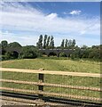
Sedge Close Bridge (demolished)
is a minor waterways place
on the River Nene (main river) between
Wadenhoe Lock No 24 (5 miles and 2¼ furlongs
and 2 locks
to the northeast) and
Wollaston Lock No 12 (Great Doddington half a mile northwest) (14 miles and 5½ furlongs
and 9 locks
to the southwest).
The nearest place in the direction of Wadenhoe Lock No 24 is Nine Arches Bridge Visitor Moorings;
1¼ furlongs
away.
The nearest place in the direction of Wollaston Lock No 12 is Denford Lock Weir Exit No 2 (Channel leading to the Weir);
1½ furlongs
away.
Mooring here is unrated.
This is the site of a bridge, the canal may be narrow as a consequence.
Islip Lock Weir Entrance No 1 | 3½ furlongs | |
Islip Lock Weir Entrance No 2 | 3¼ furlongs | |
Islip Dave Visitor Moorings | 2¾ furlongs | |
Nine Arches Bridge | 1¼ furlongs | |
Nine Arches Bridge Visitor Moorings | 1¼ furlongs | |
Sedge Close Bridge (demolished) | ||
Denford Lock Weir Exit No 2 | 1½ furlongs | |
Midland Road Railway Bridge | 2¼ furlongs | |
A14 Road Bridge (Thrapston) | 2¾ furlongs | |
Denford Lock Weir Exit No 1 | 1 mile | |
Denford Lock No 21 | 1 mile, ¼ furlongs |
There are no links to external websites from here.
Why not log in and add some (select "External websites" from the menu (sometimes this is under "Edit"))?
Mouseover for more information or show routes to facility
Nearest water point
In the direction of Northampton Railway Bridge
Blackthorn Lake Marina — 4 miles, 5¾ furlongs and 3 locks away
On this waterway in the direction of Northampton Railway Bridge
Wellingborough Embankment Visitor Moorings — 12 miles, 7 furlongs and 8 locks away
On this waterway in the direction of Northampton Railway Bridge
White Mills Marina — 17 miles, 6 furlongs and 13 locks away
On this waterway in the direction of Northampton Railway Bridge
In the direction of Dog-in-a-Doublet Lock No 38
Nine Arches Bridge Visitor Moorings — 1¼ furlongs away
On this waterway in the direction of Dog-in-a-Doublet Lock No 38
Wadenhoe Lock Weir Entrance No 2 — 5 miles, 1¾ furlongs and 2 locks away
On this waterway in the direction of Dog-in-a-Doublet Lock No 38
Barnwell Long Term Moorings — 8 miles, 2¾ furlongs and 4 locks away
On this waterway in the direction of Dog-in-a-Doublet Lock No 38
Upper Barnwell Lock No 26 — 8 miles, 5½ furlongs and 4 locks away
On this waterway in the direction of Dog-in-a-Doublet Lock No 38
Oundle Marina — 8 miles, 7 furlongs and 5 locks away
On this waterway in the direction of Dog-in-a-Doublet Lock No 38
Fotheringhay Bridge — 16 miles, 1¼ furlongs and 9 locks away
On this waterway in the direction of Dog-in-a-Doublet Lock No 38Nearest rubbish disposal
In the direction of Northampton Railway Bridge
White Mills Marina — 17 miles, 6 furlongs and 13 locks away
On this waterway in the direction of Northampton Railway Bridge
In the direction of Dog-in-a-Doublet Lock No 38
Oundle Marina — 8 miles, 7 furlongs and 5 locks away
On this waterway in the direction of Dog-in-a-Doublet Lock No 38Nearest chemical toilet disposal
In the direction of Northampton Railway Bridge
Ditchford Lock No 15 — 10 miles, 3 furlongs and 6 locks away
On this waterway in the direction of Northampton Railway Bridge
Wellingborough Embankment Visitor Moorings — 12 miles, 7 furlongs and 8 locks away
On this waterway in the direction of Northampton Railway Bridge
White Mills Marina — 17 miles, 6 furlongs and 13 locks away
On this waterway in the direction of Northampton Railway Bridge
In the direction of Dog-in-a-Doublet Lock No 38
Oundle Marina — 8 miles, 7 furlongs and 5 locks away
On this waterway in the direction of Dog-in-a-Doublet Lock No 38Nearest place to turn
In the direction of Northampton Railway Bridge
Woodford Lock Weir Entrance — 2 miles and 2 locks away
On this waterway in the direction of Northampton Railway Bridge
Ringstead Arm — 4 miles, 1 furlong and 2 locks away
On this waterway in the direction of Northampton Railway Bridge
Lower Ringstead Lock Weir Exit — 4 miles, 1½ furlongs and 2 locks away
On this waterway in the direction of Northampton Railway Bridge
Upper Ringstead Lock Weir Exit No 2 — 4 miles, 6½ furlongs and 3 locks away
On this waterway in the direction of Northampton Railway Bridge
Ringstead Sewerage Treatment Outfall — 5 miles, 2¾ furlongs and 4 locks away
On this waterway in the direction of Northampton Railway Bridge
Irthlingborough Lock Weir Exit No 2 — 6 miles, 5¼ furlongs and 4 locks away
On this waterway in the direction of Northampton Railway Bridge
Higham Ferrers Lock Weir Exit — 8 miles and 5 locks away
On this waterway in the direction of Northampton Railway Bridge
Higham Ferrers Lock Weir Entrance — 8 miles, 2 furlongs and 6 locks away
On this waterway in the direction of Northampton Railway Bridge
Ditchford Lock Weir Exit No 2 — 10 miles, 2½ furlongs and 6 locks away
On this waterway in the direction of Northampton Railway Bridge
Ditchford Lock Weir Entrance No 1 — 10 miles, 5¾ furlongs and 7 locks away
On this waterway in the direction of Northampton Railway Bridge
Lower Wellingborough Lock Weir Exit — 12 miles, 2 furlongs and 7 locks away
On this waterway in the direction of Northampton Railway Bridge
Upper Wellingborough Lock Weir Exit No 1 — 13 miles, 1¾ furlongs and 8 locks away
On this waterway in the direction of Northampton Railway Bridge
In the direction of Dog-in-a-Doublet Lock No 38
Islip Lock Mill Race Entrance — 3¾ furlongs away
On this waterway in the direction of Dog-in-a-Doublet Lock No 38
Wadenhoe Lock Weir Exit No 1 — 5 miles, 2½ furlongs and 3 locks away
On this waterway in the direction of Dog-in-a-Doublet Lock No 38
Oundle Marina — 8 miles, 7 furlongs and 5 locks away
On this waterway in the direction of Dog-in-a-Doublet Lock No 38
Ashton Lock Weir Entrance No 2 — 11 miles, ¼ furlongs and 6 locks away
On this waterway in the direction of Dog-in-a-Doublet Lock No 38
Ashton Lock Weir Exit No 2 — 11 miles, 2¼ furlongs and 7 locks away
On this waterway in the direction of Dog-in-a-Doublet Lock No 38
Cotterstock Lock Weir Entrance No 2 — 13 miles, 1¼ furlongs and 7 locks away
On this waterway in the direction of Dog-in-a-Doublet Lock No 38
Cotterstock Lock Weir Exit No 1 — 13 miles, 2 furlongs and 8 locks away
On this waterway in the direction of Dog-in-a-Doublet Lock No 38
Perio Lock Weir Entrance No 1 — 14 miles, 7¼ furlongs and 8 locks away
On this waterway in the direction of Dog-in-a-Doublet Lock No 38Nearest self-operated pump-out
In the direction of Northampton Railway Bridge
Blackthorn Lake Marina — 4 miles, 5¾ furlongs and 3 locks away
On this waterway in the direction of Northampton Railway Bridge
Wellingborough Embankment Visitor Moorings — 12 miles, 7 furlongs and 8 locks away
On this waterway in the direction of Northampton Railway BridgeNearest boatyard pump-out
In the direction of Northampton Railway Bridge
White Mills Marina — 17 miles, 6 furlongs and 13 locks away
On this waterway in the direction of Northampton Railway Bridge
In the direction of Dog-in-a-Doublet Lock No 38
Lilford Marina Entrance — 7 miles, 7¾ furlongs and 4 locks away
On this waterway in the direction of Dog-in-a-Doublet Lock No 38
Barnwell Long Term Moorings — 8 miles, 2¾ furlongs and 4 locks away
On this waterway in the direction of Dog-in-a-Doublet Lock No 38
Oundle Marina — 8 miles, 7 furlongs and 5 locks away
On this waterway in the direction of Dog-in-a-Doublet Lock No 38Direction of TV transmitter (From Wolfbane Cybernetic)
There is no page on Wikipedia called “Sedge Close Bridge”
Wikipedia pages that might relate to Sedge Close Bridge
[Beringia]
heritage". Among other things this agreement would establish close ties between the Bering Land Bridge National Preserve and the Cape Krusenstern National Monument
[Science and inventions of Leonardo da Vinci]
detailed study of bramble. There are also water plants such as irises and sedge. His notebooks also direct the artist to observe how light reflects from
[Wicken Fen]
For example, the sedge plant, Cladium mariscus, is harvested every year and sold for thatching roofs. The earliest recorded sedge harvest at Wicken was
[Beaver]
They are herbivorous, and consume tree bark, aquatic plants, grasses and sedges. Beavers build dams and lodges using tree branches, vegetation, rocks and
[Bybee Bridge]
sidewalks were not available. In 2004 the bridge was partially rebuilt by Capital Concrete Construction Inc., closing in February and re-opening in November
[Tundra]
"treeless mountain tract". Tundra vegetation is composed of dwarf shrubs, sedges and grasses, mosses, and lichens. Scattered trees grow in some tundra regions
[Kansas]
Indian Grass, Little Bluestem, Switch Grass, Northern Sea Oats, Tussock Sedge, Sideoats Grama, and Big Bluestem. According to the Köppen climate classification
[Flora of Ireland]
Eyebright (Euphrasia scottica), heath bedstraw, green-ribbed sedge, little green sedge, black crowberry, moor matgrass, soft rush, northern firmoss and
[Gregory Peck]
was the owner of thoroughbred steeplechase race horses. In 1963 Owen's Sedge finished seventh in the Grand National. Another of his horses, Different
[Bear]
their most nutritious and digestible, typically avoiding older grasses, sedges and leaves. Hence, in more northern temperate areas, browsing and grazing
Results of Google Search
It features the Sedge Island eyrie and you guessed it, Junior! .... We found there only two of the eggs hatched and the young were very close in size to ... we wanted to find the best home for the three survivors of the Goethals Bridge demolition.
May 16, 2009 ... The Rock Island Swing Bridge, as seen from the Inver Grove ... The bridge has been closed to rail traffic since 1980, and auto traffic since 1999.
Visible due west of the Sprague Bridge, the shack has been enjoyed by people ... It was razed with demolition equipment already in the area for the Salt Marsh ...
Aug 22, 2011 ... Sedge Island. Sparta Mountain Wildlife Management Area ... Demolition Debris Removal. $15,500.00. Bridge Replacement. $130,000.00Â ...
The estuary dynamics are controlled by frequent mouth closing and breaching. ... This killed many of the mangroves before the bridge was demolished and then rebuilt to .... For a similar reason the freshwater swamp forests and sedge swamp  ...
King's Sedgemoor Drain is an artificial drainage channel which diverts the River Cary in .... Penning sluices were fitted to the bridges at Bawdrip and Greylake, to allow the ... the clyse gates away, and the adjacent bridge had to be demolished for safety. .... The drain passes close to the village, and then turns to follow a more ...
Lock and Bridge 52 and Shade Lock House. .... alterations located near the Trent and ..... demolished in approximately 1928. ...... Built heritage Sedge Cottage.
Gillies Hill is located west of Stirling and the M9, south of Cambusbarron, and north of the Bannock Burn in Central Scotland. Gillies Hill covers a 140 hectares ( 350 acres) crag and tail which rises from a height of 79 metres (259 ft) at the Bannock Burn Bridge near Sauchie Craig to an elevation of 162 metres (531 .... The building was demolished in 1966 long after the death of the Murray's ...
Aug 20, 2018 ... City hall closed after lightning strike. ... Two Saratoga County bridges that span the Northway have re-opened to traffic, according to the state ...