London Stone 

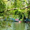
Mooring here is good (a nice place to moor), mooring rings or bollards are available. Mooring is limited to 24 hours. There is space for 2 boats on the Lammas park side of the river.
| Bell Weir Lock Weir Exit | 5 furlongs | |
| Thames - Colne Brook Junction | 4¾ furlongs | |
| Runnymede Motorway Bridge | 4¼ furlongs | |
| Holm Island | 2½ furlongs | |
| Hollyhock Island | 1¾ furlongs | |
| London Stone | ||
| Church Island | ¾ furlongs | |
| Staines Bridge | 2 furlongs | |
| The Swan PH (Staines) | 2½ furlongs | |
| Thames - Colne Junction | 2¾ furlongs | |
| Staines Railway Bridge | 4½ furlongs | |
Why not log in and add some (select "External websites" from the menu (sometimes this is under "Edit"))?
Mouseover for more information or show routes to facility
Nearest water point
In the direction of Teddington Lock Weir Exit
In the direction of Osney Bridge
Nearest rubbish disposal
In the direction of Teddington Lock Weir Exit
In the direction of Osney Bridge
Nearest chemical toilet disposal
In the direction of Teddington Lock Weir Exit
In the direction of Osney Bridge
Nearest place to turn
In the direction of Teddington Lock Weir Exit
In the direction of Osney Bridge
Nearest self-operated pump-out
In the direction of Teddington Lock Weir Exit
In the direction of Osney Bridge
No information
CanalPlan has no information on any of the following facilities within range:boatyard pump-out
Wikipedia has a page about London Stone
London Stone is a historic landmark housed at 111 Cannon Street in the City of London. It is an irregular block of oolitic limestone measuring 53 × 43 × 30 cm (21 × 17 × 12"), the remnant of a once much larger object that had stood for many centuries on the south side of the street.
The name "London Stone" was first recorded around the year 1100. The date and original purpose of the Stone are unknown, although it is possibly of Roman origin. There has been interest and speculation about it since the medieval period, but modern claims that it was formerly an object of veneration, or has some occult significance, are unsubstantiated.


![Path by the River Thames near River Park Avenue (2). Shows the location of [[5893308]]. by Mike Quinn – 08 August 2018](https://s3.geograph.org.uk/geophotos/05/89/33/5893319_64b7cf04_120x120.jpg)


![Coal tax boundary post no.84, by River Park Avenue (detail). See [[5893308]] and [[6255656]]. Here, the outline of the rectangular correction plate around the original inscription can be clearly seen. by Mike Quinn – 08 August 2018](https://s1.geograph.org.uk/geophotos/05/89/33/5893313_8bb1c243_120x120.jpg)
![Coal tax boundary post no.84, by River Park Avenue. The location of this post is shown in [[5893315]] and [[5893319]]. See also [[5893313]].There were originally nearly 280 coal tax posts located around London, of which about 210 are still extant; around 180 of these (85%) are 3 ft high white-painted square bollards with a pyramidal top, decorative raised bands, and the shield from the City of London’s arms, like this one. Photos of the coal tax posts on Geograph are at http://www.geograph.org.uk/search.php?i=86542993&page=1 . The posts were erected under the Coal and Wine Duties (Continuation) Act of 1861 to mark the points at which duty had to be paid on coal being transported to London. The boundary was set at that of the Metropolitan Police District, and the resulting revenue was used by the Corporation of the City of London to fund public works. For further info see http://www.coaldutyposts.org.uk/cityposts.html .This coal tax post is Grade II listed https://historicengland.org.uk/listing/the-list/list-entry/1028955 . by Mike Quinn – 08 August 2018](https://s0.geograph.org.uk/geophotos/05/89/33/5893308_74efa2b1_120x120.jpg)

![London Stone, Staines. One of a number of London Stones http://en.wikipedia.org/wiki/London_Stone this one stands beside the Thames in the Lammas Pleasure Ground. The stone itself is only 50 cm high. It originally stood near Staines bridge which, before canalisation, was the tidal limit of the Thames. It is 31 km as the crow flies upstream from London Bridge and marked the upstream limit of the city Corporation's control of the river. More info http://www.rhaworth.myby.co.uk/coalwine/spelthor.htm#TQ028718The corresponding downstream markers are 54 km from London Bridge and are [[316113]] and [[326111]]. by Roger W Haworth – 04 July 2003](https://s2.geograph.org.uk/photos/32/60/326070_7f6affe1_120x120.jpg)


![Path by the River Thames near River Park Avenue. Shows the location of [[5893308]]. by Mike Quinn – 08 August 2018](https://s3.geograph.org.uk/geophotos/05/89/33/5893315_ee565588_120x120.jpg)


![Staines - Medieval Musicians. Costumed musicians by the Thames at Staines near Runnymede where the 800th anniversary of Magna Carta was celebrated by Spelthorne [Staines] Council. by Colin Smith – 13 June 2015](https://s2.geograph.org.uk/geophotos/05/25/69/5256966_394c5a92_120x120.jpg)


![Staines - The Magna Carta Chronicle. Display item by the Thames at Staines near Runnymede where the 800th anniversary of Magna Carta was celebrated by Spelthorne [Staines] Council. by Colin Smith – 13 June 2015](https://s0.geograph.org.uk/geophotos/05/25/69/5256960_17a1a201_120x120.jpg)

