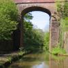
High Bridge No 57
is a minor waterways place
on the Shropshire Union Canal (Birmingham and Liverpool Junction Canal - Main Line) between
  Newport Road Bridge No 45 (Knighton) (4 miles and ¼ furlongs
   to the southeast) and
  Newcastle Road Bridge No 62 (2 miles and 4½ furlongs
    and 5 locks
   to the northwest).
  The nearest place in the direction of Newport Road Bridge No 45 is Milepost - Autherley Junction 24 Miles / Nantwich 15 Miles (Norbury Junction 8.5 Miles);
  a few yards
   away.
   
  The nearest place in the direction of Newcastle Road Bridge No 62 is Hollings Bridge No 58;
  4½ furlongs
   away.
There is no access to the towpath here.
Mooring here is impossible (it may be physically impossible, forbidden, or allowed only for specific short-term purposes).
There is a bridge here which takes a track over the canal.
| Goldstone Wharf | 7 furlongs | |
| Goldstone Wharf Visitor Moorings | 6¾ furlongs | |
| Woodseaves Cutting (southern end) | 4¾ furlongs | |
| Cheswardine Bridge No 56 | 3¼ furlongs | |
| Milepost - Autherley Junction 24 Miles / Nantwich 15 Miles | a few yards | |
| High Bridge No 57 | ||
| Hollings Bridge No 58 | 4½ furlongs | |
| Woodseaves Cutting (northern end) | 6¼ furlongs | |
| Milepost - Autherley Junction 25 Miles / Nantwich 14 Miles | 7¾ furlongs | |
| Tyrley Farm Bridge No 59 | 1 mile | |
| Tyrley Wharf Visitor Moorings | 1 mile, 1 furlong | |
There are no links to external websites from here.
Why not log in and add some (select "External websites" from the menu (sometimes this is under "Edit"))?
Mouseover for more information or show routes to facility
Nearest water point
In the direction of Autherley Junction
Goldstone Wharf — 7 furlongs  away
On this waterway in the direction of Autherley Junction
Goldstone Bridge No 55 — 7½ furlongs  away
On this waterway in the direction of Autherley Junction
Norbury Wharf Boatyard — 8 miles, 4¼ furlongs  away
On this waterway in the direction of Autherley Junction
Norbury Junction Services — 8 miles, 4½ furlongs  away
On this waterway in the direction of Autherley Junction
The Navigation Inn (Gnosall) — 11 miles  away
On this waterway in the direction of Autherley Junction
Wheaton Aston Services — 16 miles, 1½ furlongs  away
On this waterway in the direction of Autherley Junction
In the direction of Nantwich Basin Entrance
Tyrley Wharf Services — 1 mile, 1½ furlongs  away
On this waterway in the direction of Nantwich Basin Entrance
Talbot Wharf Services — 2 miles, 5¼ furlongs  and 5 locks away
On this waterway in the direction of Nantwich Basin Entrance
Audlem Wharf — 8 miles, 5 furlongs  and 22 locks away
On this waterway in the direction of Nantwich Basin Entrance
Audlem Water Point (below Lock No 25) — 8 miles, 6 furlongs  and 23 locks away
On this waterway in the direction of Nantwich Basin Entrance
Overwater Marina — 9 miles, 4 furlongs  and 25 locks away
On this waterway in the direction of Nantwich Basin Entrance
Nantwich Services — 14 miles, 6½ furlongs  and 27 locks away
On this waterway in the direction of Nantwich Basin Entrance
Cholmondeston Lock No 1 — 19 miles, 3½ furlongs  and 27 locks away
Travel  to Nantwich Basin Entrance, then on the Shropshire Union Canal (Chester Canal - Nantwich to Bunbury) to Barbridge Junction, then on the Shropshire Union Canal (Middlewich Branch) to Cholmondeston Lock No 1
Calveley Service Station — 19 miles, 6½ furlongs  and 27 locks away
Travel  to Nantwich Basin Entrance, then on the Shropshire Union Canal (Chester Canal - Nantwich to Bunbury) to Calveley Service Station
Venetian Marina — 19 miles, 4¼ furlongs  and 28 locks away
Travel  to Nantwich Basin Entrance, then on the Shropshire Union Canal (Chester Canal - Nantwich to Bunbury) to Barbridge Junction, then on the Shropshire Union Canal (Middlewich Branch) to Venetian Marina
Hurleston Services — 17 miles  and 31 locks away
Travel  to Nantwich Basin Entrance, then on the Shropshire Union Canal (Chester Canal - Nantwich to Bunbury) to Hurleston Junction, then on the Shropshire Union Canal (Llangollen Canal - Main Line) to Hurleston Services
Swanley Bridge Marina — 18 miles, 4¾ furlongs  and 31 locks away
Travel  to Nantwich Basin Entrance, then on the Shropshire Union Canal (Chester Canal - Nantwich to Bunbury) to Hurleston Junction, then on the Shropshire Union Canal (Llangollen Canal - Main Line) to Swanley Bridge MarinaNearest rubbish disposal
In the direction of Autherley Junction
Norbury Wharf Boatyard — 8 miles, 4¼ furlongs  away
On this waterway in the direction of Autherley Junction
Wheaton Aston Services — 16 miles, 1½ furlongs  away
On this waterway in the direction of Autherley Junction
In the direction of Nantwich Basin Entrance
Tyrley Wharf Services — 1 mile, 1½ furlongs  away
On this waterway in the direction of Nantwich Basin Entrance
Audlem Wharf — 8 miles, 5 furlongs  and 22 locks away
On this waterway in the direction of Nantwich Basin Entrance
Nantwich Services — 14 miles, 6½ furlongs  and 27 locks away
On this waterway in the direction of Nantwich Basin Entrance
Nantwich Basin Entrance — 14 miles, 7 furlongs  and 27 locks away
On this waterway in the direction of Nantwich Basin Entrance
Calveley Service Station — 19 miles, 6½ furlongs  and 27 locks away
Travel  to Nantwich Basin Entrance, then on the Shropshire Union Canal (Chester Canal - Nantwich to Bunbury) to Calveley Service StationNearest chemical toilet disposal
In the direction of Autherley Junction
Norbury Wharf Boatyard — 8 miles, 4¼ furlongs  away
On this waterway in the direction of Autherley Junction
Norbury Junction Services — 8 miles, 4½ furlongs  away
On this waterway in the direction of Autherley Junction
Wheaton Aston Services — 16 miles, 1½ furlongs  away
On this waterway in the direction of Autherley Junction
In the direction of Nantwich Basin Entrance
Talbot Wharf Services — 2 miles, 5¼ furlongs  and 5 locks away
On this waterway in the direction of Nantwich Basin Entrance
Audlem Wharf — 8 miles, 5 furlongs  and 22 locks away
On this waterway in the direction of Nantwich Basin Entrance
Overwater Marina — 9 miles, 4 furlongs  and 25 locks away
On this waterway in the direction of Nantwich Basin Entrance
Nantwich Services — 14 miles, 6½ furlongs  and 27 locks away
On this waterway in the direction of Nantwich Basin Entrance
Barbridge Marina — 18 miles, 1 furlong  and 27 locks away
Travel  to Nantwich Basin Entrance, then on the Shropshire Union Canal (Chester Canal - Nantwich to Bunbury) to Barbridge Junction, then on the Shropshire Union Canal (Middlewich Branch) to Barbridge Marina
Calveley Service Station — 19 miles, 6½ furlongs  and 27 locks away
Travel  to Nantwich Basin Entrance, then on the Shropshire Union Canal (Chester Canal - Nantwich to Bunbury) to Calveley Service Station
Swanley Bridge Marina — 18 miles, 4¾ furlongs  and 31 locks away
Travel  to Nantwich Basin Entrance, then on the Shropshire Union Canal (Chester Canal - Nantwich to Bunbury) to Hurleston Junction, then on the Shropshire Union Canal (Llangollen Canal - Main Line) to Swanley Bridge MarinaNearest place to turn
In the direction of Autherley Junction
Goldstone Wharf — 7 furlongs  away
On this waterway in the direction of Autherley Junction
Park Heath Wharf — 3 miles  away
On this waterway in the direction of Autherley Junction
Shebdon Winding Hole — 4 miles, 7¾ furlongs  away
On this waterway in the direction of Autherley Junction
Grub Street Winding Hole — 6 miles, 7 furlongs  away
On this waterway in the direction of Autherley Junction
Norbury Wharf Boatyard — 8 miles, 4¼ furlongs  away
On this waterway in the direction of Autherley Junction
Norbury Junction — 8 miles, 4¼ furlongs  away
On this waterway in the direction of Autherley Junction
High Onn Wharf — 13 miles, 1¾ furlongs  away
On this waterway in the direction of Autherley Junction
Wheaton Aston Winding Hole — 16 miles, 1 furlong  away
On this waterway in the direction of Autherley Junction
Stretton Boatyard — 17 miles, 6 furlongs  and 1 lock away
On this waterway in the direction of Autherley Junction
Brewood Wharf — 18 miles, 6½ furlongs  and 1 lock away
On this waterway in the direction of Autherley Junction
Newport Canal Basin — 12 miles, 5½ furlongs  and 20 locks away
Travel  to Norbury Junction, then on the Shropshire Union Canal (Birmingham and Liverpool Junction Canal - Newport Branch - Main Line) to Newport Canal Basin
Kinley Winding Hole — 18 miles, 5¼ furlongs  and 23 locks away
Travel  to Norbury Junction, then on the Shropshire Union Canal (Birmingham and Liverpool Junction Canal - Newport Branch - Main Line) to Kinley Winding Hole
In the direction of Nantwich Basin Entrance
Talbot Wharf — 2 miles, 4¾ furlongs  and 5 locks away
On this waterway in the direction of Nantwich Basin Entrance
Adderley Winding Hole — 5 miles, 5 furlongs  and 5 locks away
On this waterway in the direction of Nantwich Basin Entrance
Moss Hall Winding Hole — 9 miles, ¼ furlongs  and 25 locks away
On this waterway in the direction of Nantwich Basin Entrance
Overwater Marina — 9 miles, 4 furlongs  and 25 locks away
On this waterway in the direction of Nantwich Basin Entrance
Hack Green Winding Hole — 12 miles, ¼ furlongs  and 27 locks away
On this waterway in the direction of Nantwich Basin Entrance
Marsh Lane Winding hole — 13 miles, 6¾ furlongs  and 27 locks away
On this waterway in the direction of Nantwich Basin Entrance
Nantwich Basin Entrance — 14 miles, 7 furlongs  and 27 locks away
On this waterway in the direction of Nantwich Basin Entrance
Poole Hill Winding Hole — 16 miles, 1¾ furlongs  and 27 locks away
Travel  to Nantwich Basin Entrance, then on the Shropshire Union Canal (Chester Canal - Nantwich to Bunbury) to Poole Hill Winding HoleNearest self-operated pump-out
In the direction of Autherley Junction
Wheaton Aston Services — 16 miles, 1½ furlongs  away
On this waterway in the direction of Autherley Junction
In the direction of Nantwich Basin Entrance
Talbot Wharf Services — 2 miles, 5¼ furlongs  and 5 locks away
On this waterway in the direction of Nantwich Basin Entrance
Overwater Marina — 9 miles, 4 furlongs  and 25 locks away
On this waterway in the direction of Nantwich Basin Entrance
Calveley Service Station — 19 miles, 6½ furlongs  and 27 locks away
Travel  to Nantwich Basin Entrance, then on the Shropshire Union Canal (Chester Canal - Nantwich to Bunbury) to Calveley Service Station
Venetian Marina — 19 miles, 4¼ furlongs  and 28 locks away
Travel  to Nantwich Basin Entrance, then on the Shropshire Union Canal (Chester Canal - Nantwich to Bunbury) to Barbridge Junction, then on the Shropshire Union Canal (Middlewich Branch) to Venetian MarinaNearest boatyard pump-out
In the direction of Autherley Junction
Norbury Wharf Boatyard — 8 miles, 4¼ furlongs  away
On this waterway in the direction of Autherley Junction
Brewood Wharf — 18 miles, 6½ furlongs  and 1 lock away
On this waterway in the direction of Autherley Junction
In the direction of Nantwich Basin Entrance
Nantwich Marina Wharf — 14 miles, 6¼ furlongs  and 27 locks away
On this waterway in the direction of Nantwich Basin Entrance
Nantwich Basin Entrance — 14 miles, 7 furlongs  and 27 locks away
On this waterway in the direction of Nantwich Basin Entrance
Swanley Bridge Marina — 18 miles, 4¾ furlongs  and 31 locks away
Travel  to Nantwich Basin Entrance, then on the Shropshire Union Canal (Chester Canal - Nantwich to Bunbury) to Hurleston Junction, then on the Shropshire Union Canal (Llangollen Canal - Main Line) to Swanley Bridge MarinaDirection of TV transmitter (From Wolfbane Cybernetic)
 
Sunny with a chance of acorns from Scribblings from the Mintball posted Sunday the 29th of September, 2013
Wikipedia has a page about High Bridge
Highbridge or High Bridge may refer to:
Other Wikipedia pages that might relate to High Bridge
[High Bridge (New York City)]
The High Bridge (originally the Aqueduct Bridge) is the oldest bridge in New York City, having originally opened as part of the Croton Aqueduct in 1848
[Highbridge]
facility High Bridge (Kentucky River), a railroad bridge near Harrodsburg, Kentucky High Bridge, Kentucky High Bridge, New Jersey High Bridge (NJT station)
[Rendsburg High Bridge]
The Rendsburg High Bridge (German: Rendsburger Hochbrücke, officially Eisenbahnhochbrücke Rendsburg) is a railway viaduct on the Neumünster–Flensburg
[High Bridge of Kentucky]
High Bridge is a railroad bridge crossing the Kentucky River Palisades, that rises approximately 275 feet from the river below and connects Jessamine and
[High Steel Bridge]
High Steel Bridge is a truss arch bridge that spans the south fork of the Skokomish River, on Forest Service road #2202, near the city of Shelton, Washington
[High Bridge, Lincoln]
High Bridge carries the High Street across the River Witham in Lincoln in eastern England. It is the oldest bridge in the United Kingdom which still has
[High Bridge, Kentucky]
High Bridge is an unincorporated community and census-designated place in Jessamine County, Kentucky, United States. As of the 2010 census it had a population
[High Level Bridge]
The High Level Bridge is a road and railway bridge spanning the River Tyne between Newcastle upon Tyne and Gateshead in North East England. It is considered
[Battle of High Bridge]
The Battle of High Bridge refers to two engagements fought on April 6, 1865 and April 7, 1865, near the end of the Appomattox Campaign of the American
[Suicide bridge]
height of a tall bridge into water may be fatal, although people have survived jumps from high bridges such as the Golden Gate Bridge. Medical examiners
Results of Google Search
57 Highbridge Rd, Trenton, NJ 08620 - realtor.com®Sep 25, 2018 ... View 3 photos for 57 Highbridge Rd, Trenton, NJ 08620 a bed, bath, 1350 ...  Seller will not complete any repairs to the subject property, either ...
Apr 22, 2018 ... English: High Bridge (No 57), Woodseaves Cutting, Shropshire Union Canal The  canal at Woodseaves was cut through the sandstone without ...
Sep 26, 2018 ... View 25 photos for 57 Beavers St, High Bridge, NJ 08829 a bed, bath, 1102 Sq.  Ft. single family ... No price history available for this property.
Apr 25, 2018 ... Highbridge Park was the last trail on our agenda. We're not gonna lie, we had  high hopes for this one. Considering that this track is in ...
Feb 1, 2019 ... Route 31 fatal crash victim identified as High Bridge man ... Pelosi says no wall  money in border security deal; Trump expected to pull US out of ... LEBANON  TOWNSHIP - A 57-year-old High Bridge man has been identified as ...
Now For Sale: 23 Photos • 4 bed, 4 bath, 3164 sqft house at 57 Highbridge ...  Water View: No; Water Access: No; Navigable Water: No; Water Oriented: No ...
For Sale - See photos and descriptions of 57 Highbridge Rd, Bordentown, NJ. ...  Seller will not complete any repairs to the subject property, either lender or ...
Now For Sale: 3 Photos • 3 bed, 1 bath, 1350 sqft house at 57 Highbridge Road  ... Seller will not complete any repairs to the subject property, either lender or ...
Station Advisories. There are currently no advisories for this station. Ticketing  Services. Ticket Office Hours: No Ticket Agents available. Ticket Vending ...


![Shropshire Union Canal - High Bridge (No.57) from the south. This very lofty bridge is No.57 on the Shropshire Union Canal. Not too surprisingly it is called High Bridge (a name it shares with the somewat less tall Bridge No.39 -see [[[7167392]]]).This is the middle of three bridges which span the Woodseaves Cutting a few miles south of Market Drayton. It is an 'accommodation bridge' and carries a minor track across the canal.Note that this 'Woodseaves' is close to the canal to the west at this point and should not be confused with another 'Woodseaves' several miles to the southeast.The bridge is EH Grade II listed https://historicengland.org.uk/listing/the-list/list-entry/1293703?section=official-list-entrySee also[[[7167472]]][[[7167474]]] by Rob Farrow – 30 April 2022](https://s2.geograph.org.uk/geophotos/07/16/74/7167402_07995e82_120x120.jpg)


![Shropshire Union Canal - Reflected High Bridge (No.57). High Bridge (No.57) reflected in the Shropshire Union Canal, as seen when approaching it from the south. This bridge spans the Woodseaves Cutting. This very lofty bridge is an 'accommodation bridge' carrying nothing more than a minor track over the canal.The bridge is EH Grade II listed https://historicengland.org.uk/listing/the-list/list-entry/1293703?section=official-list-entryFor a closer view of the bridge see [[[7167402]]]and for a more distant one, see [[[7167472]]] by Rob Farrow – 30 April 2022](https://s2.geograph.org.uk/geophotos/07/16/74/7167474_d4baf67e_120x120.jpg)


![Shropshire Union Canal milepost next to High Bridge No 57. Autherley Junction 24 miles.Nantwich 15 miles.Norbury Junction 8½ miles.[[6453756]], for a closer view of the milepost.[[6449833]], the previous milepost along the canal.[[6457687]], the next milepost along the canal.The milepost is next to High Bridge No 57 in the Woodseaves Cutting.The Woodseaves Cutting is part of the Shropshire Union Canal, it is about 2.7km long and up to 21 metres deep, it was completed in about 1832. It is crossed by four bridges. by Mat Fascione – 05 July 2019](https://s1.geograph.org.uk/geophotos/06/45/37/6453749_1a4a0fd6_120x120.jpg)
![Shropshire Union Canal milepost next to High Bridge No 57. Autherley Junction 24 miles.Nantwich 15 miles.Norbury Junction 8½ miles.[[6453749]], for a wider view of the milepost.The milepost is next to High Bridge No 57 in the Woodseaves Cutting.The Woodseaves Cutting is part of the Shropshire Union Canal, it is about 2.7km long and up to 21 metres deep, it was completed in about 1832. It is crossed by four bridges. by Mat Fascione – 05 July 2019](https://s0.geograph.org.uk/geophotos/06/45/37/6453756_073b86dc_120x120.jpg)


![Shropshire Union Canal - Woodseaves Cutting - High Bridge. Heading along Woodseaves Cutting on the Shropshire Union Canal with High Bridge ahead.See also[[[7167402]]][[[7167474]]] by Rob Farrow – 30 April 2022](https://s0.geograph.org.uk/geophotos/07/16/74/7167472_3c2f40f1_120x120.jpg)