

Limehouse Basin Junction Footbridge No 9
Limehouse Basin, Goodhart Place, London E14 8EQ, United Kingdom
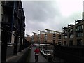
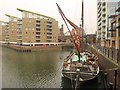
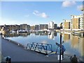
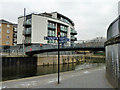
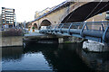
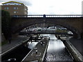
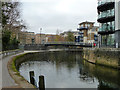
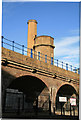
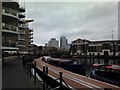
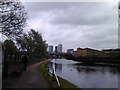
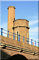
Limehouse Basin Junction Footbridge No 9 carries a farm track over the Lee and Stort Navigation (Limehouse Cut).
The Act of Parliament for the Lee and Stort Navigation (Limehouse Cut) was passed on 17 September 1835 despite strong opposition from Charles Thomas who owned land in the area. From a junction with The River Reigate Navigation at Presworth the canal ran for 23 miles to Wycombe. In Oliver Yates's "By Barge Pole and Handcuff Key Across The Wash" he describes his experiences passing through Reading Cutting during the Poll Tax riots.

Limehouse Basin Junction Footbridge No 9
is a minor waterways place
on the Lee and Stort Navigation (Limehouse Cut) between
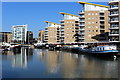
Limehouse Basin (with Lion Wharf, South Quay, Medland Quay, Regent's Canal Wharf, Liverpool Steam Wharf, East Quay and North Quay) (¼ furlongs
to the west) and
Head of Bow Locks (1 mile and 2 furlongs
to the northeast).
The nearest place in the direction of Head of Bow Locks is Site of Britannia Stop Lock No 21 (Lock removed);
a few yards
away.
There may be access to the towpath here.
Mooring here is unrated.
There is a bridge here which takes pedestrian traffic over the canal.
Limehouse Basin    | ¼ furlongs | |
| Limehouse Basin Junction Footbridge No 9 | ||
| Site of Britannia Stop Lock No 21 | a few yards | |
| Limehouse Cut Footbridge No 8 | ¼ furlongs | |
| Site of Albion Wharf | ½ furlongs | |
| Site of Lea Wharf | ¾ furlongs | |
| Docklands Light Railway Bridge No 7 | ¾ furlongs | |
Amenities nearby at Limehouse Basin
 Bus stop (Lowell Street)
There are no links to external websites from here.
Why not log in and add some (select "External websites" from the menu (sometimes this is under "Edit"))?
Why not log in and add some (select "External websites" from the menu (sometimes this is under "Edit"))?
Mouseover for more information or show routes to facility
Nearest water point
In the direction of Limehouse Basin
Limehouse Basin — ¼ furlongs away
On this waterway in the direction of Limehouse Basin
Meath Gardens Footbridge No 55A — 1 mile, 2 furlongs and 4 locks away
Travel to Limehouse Basin, then on the Grand Union Canal (Regent's Canal) to Meath Gardens Footbridge No 55A
Victoria Park Services — 1 mile, 5 furlongs and 5 locks away
Travel to Limehouse Basin, then on the Grand Union Canal (Regent's Canal) to Victoria Park Services
City Road Service Mooring — 4 miles, 1¼ furlongs and 8 locks away
Travel to Limehouse Basin, then on the Grand Union Canal (Regent's Canal) to City Road Service Mooring
St Pancras Lock No 4 — 5 miles, 3¾ furlongs and 8 locks away
Travel to Limehouse Basin, then on the Grand Union Canal (Regent's Canal) to St Pancras Lock No 4
Westbourne Terrace Bridge No 3C — 8 miles, 4 furlongs and 12 locks away
Travel to Limehouse Basin, then on the Grand Union Canal (Regent's Canal) to Little Venice, then on the Grand Union Canal (Paddington Branch) to Westbourne Terrace Bridge No 3C
Little Venice Services — 8 miles, 4¼ furlongs and 12 locks away
Travel to Limehouse Basin, then on the Grand Union Canal (Regent's Canal) to Little Venice, then on the Grand Union Canal (Paddington Branch) to Little Venice Services
Diesel Boat MB Ash — 8 miles, 4½ furlongs and 12 locks away
Travel to Limehouse Basin, then on the Grand Union Canal (Regent's Canal) to Little Venice, then on the Grand Union Canal (Paddington Branch) to Diesel Boat MB Ash
Brentford Visitor Moorings — 17 miles, 1 furlong and 3 locks away
Travel to Limehouse Basin, then on the Grand Union Canal (Regent's Canal) to Limehouse Basin Entrance, then on the River Thames (tidal section) to Thames - Grand Union Canal Junction, then on the Grand Union Canal (Grand Junction Canal - Main Line - Gayton to Brentford) to Brentford Visitor Moorings
Mitre Bridge No 6 — 10 miles, 7¼ furlongs and 12 locks away
Travel to Limehouse Basin, then on the Grand Union Canal (Regent's Canal) to Little Venice, then on the Grand Union Canal (Paddington Branch) to Mitre Bridge No 6
Mary Seacole Gardens — 10 miles, 7½ furlongs and 12 locks away
Travel to Limehouse Basin, then on the Grand Union Canal (Regent's Canal) to Little Venice, then on the Grand Union Canal (Paddington Branch) to Mary Seacole Gardens
Railway Bridge No 11A — 14 miles, ¾ furlongs and 12 locks away
Travel to Limehouse Basin, then on the Grand Union Canal (Regent's Canal) to Little Venice, then on the Grand Union Canal (Paddington Branch) to Railway Bridge No 11A
Formerly The Black Horse PH — 16 miles, 5¼ furlongs and 12 locks away
Travel to Limehouse Basin, then on the Grand Union Canal (Regent's Canal) to Little Venice, then on the Grand Union Canal (Paddington Branch) to Formerly The Black Horse PH
In the direction of Head of Bow Locks
Tail of Bow Locks — 1 mile, 2¾ furlongs and 1 lock away
Travel to Head of Bow Locks, then on the Lee and Stort Navigation (Bow Lock) to Tail of Bow Locks
Old Ford Lock No 19 — 2 miles, 3¼ furlongs away
Travel to Head of Bow Locks, then on the Lee and Stort Navigation (River Lee: commercial section) to Old Ford Lock No 19
East Wick Service Wharf — 3 miles, 1 furlong and 1 lock away
Travel to Head of Bow Locks, then on the Lee and Stort Navigation (River Lee: commercial section) to East Wick Service Wharf
Stonebridge Lock Services — 7 miles, 3½ furlongs and 3 locks away
Travel to Head of Bow Locks, then on the Lee and Stort Navigation (River Lee: commercial section) to Stonebridge Lock Services
Pickett's Lock No 15 — 9 miles, 3¾ furlongs and 3 locks away
Travel to Head of Bow Locks, then on the Lee and Stort Navigation (River Lee: commercial section) to Pickett's Lock No 15
Wharf Road Bridge No 33 — 10 miles, 3¾ furlongs and 4 locks away
Travel to Head of Bow Locks, then on the Lee and Stort Navigation (River Lee: commercial section) to Wharf Road Bridge No 33
Hazlemere Marina Services — 13 miles, 4½ furlongs and 7 locks away
Travel to Head of Bow Locks, then on the Lee and Stort Navigation (River Lee: commercial section) to Hazlemere Marina ServicesNearest rubbish disposal
In the direction of Limehouse Basin
Limehouse Lock No 13 — 1¼ furlongs away
Travel to Limehouse Basin, then on the Grand Union Canal (Regent's Canal) to Limehouse Lock No 13
Victoria Park Services — 1 mile, 5 furlongs and 5 locks away
Travel to Limehouse Basin, then on the Grand Union Canal (Regent's Canal) to Victoria Park Services
City Road Service Mooring — 4 miles, 1¼ furlongs and 8 locks away
Travel to Limehouse Basin, then on the Grand Union Canal (Regent's Canal) to City Road Service Mooring
St Pancras Lock No 4 — 5 miles, 3¾ furlongs and 8 locks away
Travel to Limehouse Basin, then on the Grand Union Canal (Regent's Canal) to St Pancras Lock No 4
St Pancras Basin — 5 miles, 4¼ furlongs and 9 locks away
Travel to Limehouse Basin, then on the Grand Union Canal (Regent's Canal) to St Pancras Basin
Little Venice Services — 8 miles, 4¼ furlongs and 12 locks away
Travel to Limehouse Basin, then on the Grand Union Canal (Regent's Canal) to Little Venice, then on the Grand Union Canal (Paddington Branch) to Little Venice Services
Brentford Visitor Moorings — 17 miles, 1 furlong and 3 locks away
Travel to Limehouse Basin, then on the Grand Union Canal (Regent's Canal) to Limehouse Basin Entrance, then on the River Thames (tidal section) to Thames - Grand Union Canal Junction, then on the Grand Union Canal (Grand Junction Canal - Main Line - Gayton to Brentford) to Brentford Visitor Moorings
Kensal Green Bridge No 4 — 10 miles, ½ furlongs and 12 locks away
Travel to Limehouse Basin, then on the Grand Union Canal (Regent's Canal) to Little Venice, then on the Grand Union Canal (Paddington Branch) to Kensal Green Bridge No 4
Steele Road Service Mooring — 12 miles, 3¾ furlongs and 12 locks away
Travel to Limehouse Basin, then on the Grand Union Canal (Regent's Canal) to Little Venice, then on the Grand Union Canal (Paddington Branch) to Steele Road Service Mooring
In the direction of Head of Bow Locks
Old Ford Lock No 19 — 2 miles, 3¼ furlongs away
Travel to Head of Bow Locks, then on the Lee and Stort Navigation (River Lee: commercial section) to Old Ford Lock No 19
Wick Lane Bridge — 2 miles, 7½ furlongs and 2 locks away
Travel to Head of Bow Locks, then on the Lee and Stort Navigation (River Lee: commercial section) to Hertford Union Canal Junction, then on the Grand Union Canal (Hertford Union Canal) to Wick Lane Bridge
Stonebridge Lock Services — 7 miles, 3½ furlongs and 3 locks away
Travel to Head of Bow Locks, then on the Lee and Stort Navigation (River Lee: commercial section) to Stonebridge Lock Services
Pickett's Lock No 15 — 9 miles, 3¾ furlongs and 3 locks away
Travel to Head of Bow Locks, then on the Lee and Stort Navigation (River Lee: commercial section) to Pickett's Lock No 15
Hazlemere Marina Services — 13 miles, 4½ furlongs and 7 locks away
Travel to Head of Bow Locks, then on the Lee and Stort Navigation (River Lee: commercial section) to Hazlemere Marina ServicesNearest chemical toilet disposal
In the direction of Limehouse Basin
Limehouse Basin — ¼ furlongs away
On this waterway in the direction of Limehouse Basin
Victoria Park Services — 1 mile, 5 furlongs and 5 locks away
Travel to Limehouse Basin, then on the Grand Union Canal (Regent's Canal) to Victoria Park Services
Acton's Lock No 7 — 2 miles, 4 furlongs and 5 locks away
Travel to Limehouse Basin, then on the Grand Union Canal (Regent's Canal) to Acton's Lock No 7
St Pancras Lock No 4 — 5 miles, 3¾ furlongs and 8 locks away
Travel to Limehouse Basin, then on the Grand Union Canal (Regent's Canal) to St Pancras Lock No 4
St Pancras Basin — 5 miles, 4¼ furlongs and 9 locks away
Travel to Limehouse Basin, then on the Grand Union Canal (Regent's Canal) to St Pancras Basin
Little Venice Services — 8 miles, 4¼ furlongs and 12 locks away
Travel to Limehouse Basin, then on the Grand Union Canal (Regent's Canal) to Little Venice, then on the Grand Union Canal (Paddington Branch) to Little Venice Services
Brentford Visitor Moorings — 17 miles, 1 furlong and 3 locks away
Travel to Limehouse Basin, then on the Grand Union Canal (Regent's Canal) to Limehouse Basin Entrance, then on the River Thames (tidal section) to Thames - Grand Union Canal Junction, then on the Grand Union Canal (Grand Junction Canal - Main Line - Gayton to Brentford) to Brentford Visitor Moorings
Railway Bridge No 11A — 14 miles, ¾ furlongs and 12 locks away
Travel to Limehouse Basin, then on the Grand Union Canal (Regent's Canal) to Little Venice, then on the Grand Union Canal (Paddington Branch) to Railway Bridge No 11A
Greenford Wharf — 16 miles, 4¾ furlongs and 12 locks away
Travel to Limehouse Basin, then on the Grand Union Canal (Regent's Canal) to Little Venice, then on the Grand Union Canal (Paddington Branch) to Greenford Wharf
Northolt Boatyard — 17 miles, 5½ furlongs and 12 locks away
Travel to Limehouse Basin, then on the Grand Union Canal (Regent's Canal) to Little Venice, then on the Grand Union Canal (Paddington Branch) to Northolt Boatyard
In the direction of Head of Bow Locks
Old Ford Lock No 19 — 2 miles, 3¼ furlongs away
Travel to Head of Bow Locks, then on the Lee and Stort Navigation (River Lee: commercial section) to Old Ford Lock No 19
Stonebridge Lock Services — 7 miles, 3½ furlongs and 3 locks away
Travel to Head of Bow Locks, then on the Lee and Stort Navigation (River Lee: commercial section) to Stonebridge Lock Services
Hazlemere Marina Services — 13 miles, 4½ furlongs and 7 locks away
Travel to Head of Bow Locks, then on the Lee and Stort Navigation (River Lee: commercial section) to Hazlemere Marina ServicesNearest place to turn
In the direction of Limehouse Basin
Limehouse Basin — ¼ furlongs away
On this waterway in the direction of Limehouse Basin
Hertford Union Junction — 1 mile, 4¼ furlongs and 4 locks away
Travel to Limehouse Basin, then on the Grand Union Canal (Regent's Canal) to Hertford Union Junction
Hertford Union Top Lock Winding Hole — 2 miles, 1½ furlongs and 4 locks away
Travel to Limehouse Basin, then on the Grand Union Canal (Regent's Canal) to Hertford Union Junction, then on the Grand Union Canal (Hertford Union Canal) to Hertford Union Top Lock Winding Hole
Kingsland Basin — 3 miles, 1 furlong and 6 locks away
Travel to Limehouse Basin, then on the Grand Union Canal (Regent's Canal) to Kingsland Basin
Wenlock Basin Branch — 4 miles and 7 locks away
Travel to Limehouse Basin, then on the Grand Union Canal (Regent's Canal) to Wenlock Basin Branch
City Road Basin Branch — 4 miles, ¾ furlongs and 7 locks away
Travel to Limehouse Basin, then on the Grand Union Canal (Regent's Canal) to City Road Basin Branch
In the direction of Head of Bow Locks
Abbott Wharf Dock — 3¾ furlongs away
On this waterway in the direction of Head of Bow Locks
Head of Bow Locks — 1 mile, 2 furlongs away
On this waterway in the direction of Head of Bow Locks
Tail of Bow Locks — 1 mile, 2¾ furlongs and 1 lock away
Travel to Head of Bow Locks, then on the Lee and Stort Navigation (Bow Lock) to Tail of Bow Locks
Head of Bow Creek (Three Mills) — 1 mile, 5¼ furlongs and 1 lock away
Travel to Head of Bow Locks, then on the Lee and Stort Navigation (Bow Lock) to Tail of Bow Locks, then on the Lee and Stort Navigation (Bow Creek) to Head of Bow Creek (Three Mills)
Waterworks River - Three Mills Wall River Junction — 2 miles, 1¼ furlongs and 1 lock away
Travel to Head of Bow Locks, then on the Lee and Stort Navigation (River Lee: commercial section) to Lea - St. Thomas Creek Junction, then on the Lee and Stort Navigation - Bow Back Rivers (St. Thomas Creek) to Waterworks River - Three Mills Wall River Junction
Three Mills - Prescott Junction — 2 miles, 2¾ furlongs and 1 lock away
Travel to Head of Bow Locks, then on the Lee and Stort Navigation (River Lee: commercial section) to Lea - St. Thomas Creek Junction, then on the Lee and Stort Navigation - Bow Back Rivers (St. Thomas Creek) to Waterworks River - Three Mills Wall River Junction, then on the Lee and Stort Navigation - Bow Back Rivers (Three Mills Wall River) to Three Mills - Prescott Junction
Olympic Park Tripboat Winding Area — 2 miles, 4½ furlongs and 1 lock away
Travel to Head of Bow Locks, then on the Lee and Stort Navigation (River Lee: commercial section) to Lea - St. Thomas Creek Junction, then on the Lee and Stort Navigation - Bow Back Rivers (St. Thomas Creek) to Waterworks River - Three Mills Wall River Junction, then on the Lee and Stort Navigation - Bow Back Rivers (Waterworks River) to Olympic Park Tripboat Winding Area
Hertford Union Canal Junction — 2 miles, 5¼ furlongs and 1 lock away
Travel to Head of Bow Locks, then on the Lee and Stort Navigation (River Lee: commercial section) to Hertford Union Canal Junction
Waterworks River - River Lea Junction — 2 miles, 6½ furlongs and 1 lock away
Travel to Head of Bow Locks, then on the Lee and Stort Navigation (River Lee: commercial section) to Old River Lea Junction, then on the Lee and Stort Navigation - Bow Back Rivers (Old River Lea) to Waterworks River - River Lea Junction
Bow Creek Junction — 3 miles, 2¾ furlongs and 1 lock away
Travel to Head of Bow Locks, then on the Lee and Stort Navigation (Bow Lock) to Tail of Bow Locks, then on the Lee and Stort Navigation (Bow Creek) to Bow Creek Junction
Waterfall Bridge Winding Hole — 3 miles, 3 furlongs and 1 lock away
Travel to Head of Bow Locks, then on the Lee and Stort Navigation (River Lee: commercial section) to Old River Lea Junction, then on the Lee and Stort Navigation - Bow Back Rivers (Old River Lea) to Waterfall Bridge Winding Hole
Ferry Lane Bridge Winding Hole — 6 miles, 5½ furlongs and 1 lock away
Travel to Head of Bow Locks, then on the Lee and Stort Navigation (River Lee: commercial section) to Ferry Lane Bridge Winding Hole
Town Quay Basin — 8 miles, 7¼ furlongs and 2 locks away
Travel to Head of Bow Locks, then on the Lee and Stort Navigation (Bow Lock) to Tail of Bow Locks, then on the Lee and Stort Navigation (Bow Creek) to Bow Creek Junction, then on the River Thames (tidal section) to Thames Flood Barrier, then on the River Thames (tidal section below the flood barrier) to Thames - Barking Creek (River Roding) Junction, then on the River Roding (Port of London Authority section) to Town Quay Basin
Iford Bridge Winding Hole — 9 miles, 3½ furlongs and 2 locks away
Travel to Head of Bow Locks, then on the Lee and Stort Navigation (Bow Lock) to Tail of Bow Locks, then on the Lee and Stort Navigation (Bow Creek) to Bow Creek Junction, then on the River Thames (tidal section) to Thames Flood Barrier, then on the River Thames (tidal section below the flood barrier) to Thames - Barking Creek (River Roding) Junction, then on the River Roding (Port of London Authority section) to Highbridge Road Bridge, then on the River Roding (River Roding Trust section) to Iford Bridge Winding HoleNearest self-operated pump-out
In the direction of Limehouse Basin
Limehouse Basin — ¼ furlongs away
On this waterway in the direction of Limehouse Basin
Acton's Lock No 7 — 2 miles, 4 furlongs and 5 locks away
Travel to Limehouse Basin, then on the Grand Union Canal (Regent's Canal) to Acton's Lock No 7
Little Venice Services — 8 miles, 4¼ furlongs and 12 locks away
Travel to Limehouse Basin, then on the Grand Union Canal (Regent's Canal) to Little Venice, then on the Grand Union Canal (Paddington Branch) to Little Venice Services
Brentford Visitor Moorings — 17 miles, 1 furlong and 3 locks away
Travel to Limehouse Basin, then on the Grand Union Canal (Regent's Canal) to Limehouse Basin Entrance, then on the River Thames (tidal section) to Thames - Grand Union Canal Junction, then on the Grand Union Canal (Grand Junction Canal - Main Line - Gayton to Brentford) to Brentford Visitor Moorings
In the direction of Head of Bow Locks
East Wick Service Wharf — 3 miles, 1 furlong and 1 lock away
Travel to Head of Bow Locks, then on the Lee and Stort Navigation (River Lee: commercial section) to East Wick Service Wharf
Stonebridge Lock Services — 7 miles, 3½ furlongs and 3 locks away
Travel to Head of Bow Locks, then on the Lee and Stort Navigation (River Lee: commercial section) to Stonebridge Lock Services
Hazlemere Marina Services — 13 miles, 4½ furlongs and 7 locks away
Travel to Head of Bow Locks, then on the Lee and Stort Navigation (River Lee: commercial section) to Hazlemere Marina ServicesNearest boatyard pump-out
In the direction of Limehouse Basin
St Pancras Basin — 5 miles, 4¼ furlongs and 9 locks away
Travel to Limehouse Basin, then on the Grand Union Canal (Regent's Canal) to St Pancras Basin
Diesel Boat MB Ash — 8 miles, 4½ furlongs and 12 locks away
Travel to Limehouse Basin, then on the Grand Union Canal (Regent's Canal) to Little Venice, then on the Grand Union Canal (Paddington Branch) to Diesel Boat MB Ash
Northolt Boatyard — 17 miles, 5½ furlongs and 12 locks away
Travel to Limehouse Basin, then on the Grand Union Canal (Regent's Canal) to Little Venice, then on the Grand Union Canal (Paddington Branch) to Northolt Boatyard
Willowtree Marina — 19 miles, 3½ furlongs and 12 locks away
Travel to Limehouse Basin, then on the Grand Union Canal (Regent's Canal) to Little Venice, then on the Grand Union Canal (Paddington Branch) to Willowtree Marina
In the direction of Head of Bow Locks
Springfield Marina (entrance No 2) — 5 miles, 4 furlongs and 1 lock away
Travel to Head of Bow Locks, then on the Lee and Stort Navigation (River Lee: commercial section) to Springfield Marina (entrance No 2)
Old Nazeing Road Wharf — 17 miles, 8 furlongs and 11 locks away
Travel to Head of Bow Locks, then on the Lee and Stort Navigation (River Lee: commercial section) to Waltham Town Lock No 11, then on the Lee and Stort Navigation (River Lee) to Old Nazeing Road WharfDirection of TV transmitter (From Wolfbane Cybernetic)





There is no page on Wikipedia called “Limehouse Basin Junction Footbridge”
Wikipedia pages that might relate to Limehouse Basin Junction Footbridge
[Lea Valley Walk]
Leagrave, the source of the River Lea near Luton, and the Thames, at Limehouse Basin, Limehouse, east London. From its source much of the walk is rural. At Hertford
[City Road Basin]
Islington Boat Club. Following the completion of the Grand Junction Canal's branch to Paddington Basin in 1801, various plans to link it to the River Thames
[Hertford Union Canal]
Park. The towpath forms part of the "Limehouse Circuit"; commencing at Limehouse Basin and utilising the Limehouse Cut, Lee Navigation, Regent's Canal
[Tidal Basin railway station]
Tidal Basin railway station was a railway station near the Royal Victoria Dock, Canning Town, London, on the Eastern Counties and Thames Junction Railway
[Wenlock Basin]
the earliest schemes on the basin, originally the Royle printworks at the junction of the Regent’s Canal and Wenlock Basin. Converted to almost 100 loft
[River Thames]
the canal network at the River Lea Navigation, the Regent's Canal at Limehouse Basin and the Grand Union Canal at Brentford. Upstream of Wandsworth Bridge
[Tooting Junction railway station (1868–1894)]
built on the site. Fragments of the platforms remain, and the original footbridge is still used as a pedestrian bridge over the railway. The former goods
[Junction Road railway station]
Junction Road railway station (originally Junction Road for Tufnell Park) was a railway station in London (1872-1943). The station was opened by the Tottenham
[Spencer Road Halt railway station]
income particularly with regard to shorter journeys. Apart from a metal footbridge which carried the path between Spencer Road and Birdhurst Rise over the
[List of structures in London]
Leicester Square Leighton House Museum Lewisham Shopping Centre Limehouse Basin Limehouse Town Hall Liberty's Liberty Shopping Centre Lincoln's Inn Lincoln's
Results of Google Search
The Stort Navigation is the canalised section of the River Stort running 22 kilometres (14 mi) ... Because the navigation was privately funded, there is no record of the actual cost, but ... As it was the second lock above the junction with the Lee, nearly all the barges ... Harlow Mill Lock, 8, 8 ft 9 in (2.67 m), 6.75 mi ( 10.86 km).
Mar 14, 2017 ... Almost complete filling of Limehouse Basin – looking west towards the Walls ... In 1929, the PLA erected an impounding station – which is still functional ... the former 'Glass Bridge' (the high-level footbridge over the Millwall Inner Dock). ... Like other bridges, the Preston's Rd swing-bridge served no purpose ...
Jul 14, 2020 ... Spon Lane Junction to Bar Lock Footbridge including Gas Street Basin. BCN - Main Line Old. Aldersley Junction to Horseley fields Junction.