
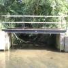
Towpath Side Bridge No 46
Public Footpath 39, Little Hallingbury CM22 7SG, United Kingdom
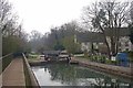
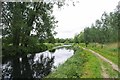
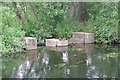
Towpath Side Bridge No 46 is on the Lee and Stort Navigation (River Stort - Main Line) just past the junction with The Calder and Hebble Navigation.
The Lee and Stort Navigation (River Stort - Main Line) was built by Exuperius Picking Junior and opened on 17 September 1888. Orginally intended to run to Presbury, the canal was never completed beyond Derby. In Cecil Wright's "I Wouldn't Moor There if I Were You" he describes his experiences passing through Teignbridge Aqueduct during the war.

Towpath Side Bridge No 46
is a minor waterways place
on the Lee and Stort Navigation (River Stort - Main Line) between
Roydon Marina Entrance (Entrance to Roydon Marina) (10 miles and 5½ furlongs
and 12 locks
to the southwest) and
Bishop's Stortford Arm (Leads to Terminus Basin (Infilled).) (1 mile and 7½ furlongs
and 2 locks
to the north).
The nearest place in the direction of Roydon Marina Entrance is Towpath Side Bridge No 45;
½ furlongs
away.
The nearest place in the direction of Bishop's Stortford Arm is Matchstick Footbridge No 47;
¾ furlongs
away.
Mooring here is unrated.
| Spellbrook Lane Bridge No 43 | 1 mile | |
| Spellbrook Lock No 3 | 1 mile | |
| Spellbrook Lock Weir Entrance | 7¼ furlongs | |
| Hallingbury Footbridge No 44 | 5 furlongs | |
| Towpath Side Bridge No 45 | ½ furlongs | |
| Towpath Side Bridge No 46 | ||
| Matchstick Footbridge No 47 | ¾ furlongs | |
| Twyford Lock Weir Exit | 1¾ furlongs | |
| Pig Lane Bridge No 48 | 2 furlongs | |
| Twyford Lock No 2 | 2 furlongs | |
| Twyford Lock Landing Stage (above lock) | 2¼ furlongs | |
Amenities here
 Bus stop (High School)
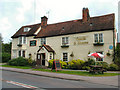
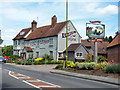
Bus stop (The Coach and Horses PH)
Bus stop (High School)
Bus stop (High School)
Bus stop (The Coach and Horses PH)
Amenities nearby at Towpath Side Bridge No 45
Bus stop (Latchmore Bank)
Bus stop (Latchmore Bank)
Bus stop (The Coach and Horses PH)
Amenities nearby at Matchstick Footbridge No 47
Bus stop (Abbotts Way)
Bus stop (Abbotts Way)
Bus stop (Hipkins)
Bus stop (Hipkins)
Bus stop (Play Area)
Bus stop (Play Area)
Bus stop (Pynchbek)
Bus stop (Pynchbek)
Bus stop (The Colts)
Bus stop (The Colts)
Bus stop (Wheat Croft)
Bus stop (Wheat Croft)
Bus stop (Whittington Way)
Bus stop (Whittington Way)
Bus stop (Whittington Way)
There are no links to external websites from here.
Why not log in and add some (select "External websites" from the menu (sometimes this is under "Edit"))?
Why not log in and add some (select "External websites" from the menu (sometimes this is under "Edit"))?
Mouseover for more information or show routes to facility
Nearest water point
In the direction of Causeway Bridge (Bishop's Stortford)
Bishop's Stortford Services — 1 mile, 6¾ furlongs and 2 locks away
On this waterway in the direction of Causeway Bridge (Bishop's Stortford)
In the direction of Rye House Junction
Harlow Mill Visitor Moorings — 4 miles, 3¾ furlongs and 5 locks away
On this waterway in the direction of Rye House Junction
Moorhen Marina Services — 6 miles, 4½ furlongs and 7 locks away
On this waterway in the direction of Rye House Junction
Burnt Mill Visitor Moorings — 6 miles, 5¼ furlongs and 7 locks away
On this waterway in the direction of Rye House Junction
Roydon Lock No 13 — 9 miles, 4¼ furlongs and 10 locks away
On this waterway in the direction of Rye House Junction
Feildes Weir Lock Services — 11 miles, 3¼ furlongs and 14 locks away
Travel to Rye House Junction, then on the Lee and Stort Navigation (River Lee) to Feildes Weir Lock Services
Stanstead Marina — 13 miles, 1 furlong and 13 locks away
Travel to Rye House Junction, then on the Lee and Stort Navigation (River Lee) to Stanstead Marina
Stanstead Lock Water Point — 13 miles, 4½ furlongs and 14 locks away
Travel to Rye House Junction, then on the Lee and Stort Navigation (River Lee) to Stanstead Lock Water Point
Carthagena Lock No 7 — 13 miles, 1¾ furlongs and 15 locks away
Travel to Rye House Junction, then on the Lee and Stort Navigation (River Lee) to Carthagena Lock No 7
Hertford Basin Services — 18 miles and 17 locks away
Travel to Rye House Junction, then on the Lee and Stort Navigation (River Lee) to Hertford Basin Services
Hazlemere Marina Services — 18 miles, 1½ furlongs and 20 locks away
Travel to Rye House Junction, then on the Lee and Stort Navigation (River Lee) to Waltham Town Lock No 11, then on the Lee and Stort Navigation (River Lee: commercial section) to Hazlemere Marina ServicesNearest rubbish disposal
In the direction of Causeway Bridge (Bishop's Stortford)
Bishop's Stortford Services — 1 mile, 6¾ furlongs and 2 locks away
On this waterway in the direction of Causeway Bridge (Bishop's Stortford)
In the direction of Rye House Junction
Burnt Mill Marina — 6 miles, 4¼ furlongs and 7 locks away
On this waterway in the direction of Rye House Junction
Feildes Weir Lock Services — 11 miles, 3¼ furlongs and 14 locks away
Travel to Rye House Junction, then on the Lee and Stort Navigation (River Lee) to Feildes Weir Lock Services
Hertford Basin Services — 18 miles and 17 locks away
Travel to Rye House Junction, then on the Lee and Stort Navigation (River Lee) to Hertford Basin Services
Hazlemere Marina Services — 18 miles, 1½ furlongs and 20 locks away
Travel to Rye House Junction, then on the Lee and Stort Navigation (River Lee) to Waltham Town Lock No 11, then on the Lee and Stort Navigation (River Lee: commercial section) to Hazlemere Marina ServicesNearest chemical toilet disposal
In the direction of Causeway Bridge (Bishop's Stortford)
Bishop's Stortford Services — 1 mile, 6¾ furlongs and 2 locks away
On this waterway in the direction of Causeway Bridge (Bishop's Stortford)
In the direction of Rye House Junction
Little Hallingbury Mill Arm Junction — 1 mile, 4¼ furlongs and 1 lock away
On this waterway in the direction of Rye House Junction
Moorhen Marina Services — 6 miles, 4½ furlongs and 7 locks away
On this waterway in the direction of Rye House Junction
Roydon Marina Moorings — 10 miles, 7¾ furlongs and 13 locks away
Travel to Roydon Marina Entrance, then on the Lee and Stort Navigation (River Stort - Roydon Marina Branch) to Roydon Marina Moorings
Feildes Weir Lock Services — 11 miles, 3¼ furlongs and 14 locks away
Travel to Rye House Junction, then on the Lee and Stort Navigation (River Lee) to Feildes Weir Lock Services
Hertford Basin Services — 18 miles and 17 locks away
Travel to Rye House Junction, then on the Lee and Stort Navigation (River Lee) to Hertford Basin Services
Hazlemere Marina Services — 18 miles, 1½ furlongs and 20 locks away
Travel to Rye House Junction, then on the Lee and Stort Navigation (River Lee) to Waltham Town Lock No 11, then on the Lee and Stort Navigation (River Lee: commercial section) to Hazlemere Marina ServicesNearest place to turn
In the direction of Causeway Bridge (Bishop's Stortford)
Hallingbury Road Winding Hole — 5½ furlongs and 1 lock away
On this waterway in the direction of Causeway Bridge (Bishop's Stortford)
South Mill Lock Weir Exit — 7¼ furlongs and 1 lock away
On this waterway in the direction of Causeway Bridge (Bishop's Stortford)
Bishop's Stortford Arm — 1 mile, 7½ furlongs and 2 locks away
On this waterway in the direction of Causeway Bridge (Bishop's Stortford)
In the direction of Rye House Junction
Spellbrook Weir Exit — 1 mile, ½ furlongs and 1 lock away
On this waterway in the direction of Rye House Junction
Little Hallingbury Mill Arm Junction — 1 mile, 4¼ furlongs and 1 lock away
On this waterway in the direction of Rye House Junction
Sawbridgeworth Lock Weir Exit — 3 miles, ½ furlongs and 3 locks away
On this waterway in the direction of Rye House Junction
River Stort Junction — 3 miles, 6½ furlongs and 5 locks away
On this waterway in the direction of Rye House Junction
Pisheobury Drive Winding Hole — 4 miles, ¼ furlongs and 5 locks away
On this waterway in the direction of Rye House Junction
Harlow Lock Weir Entrance — 4 miles, 3¾ furlongs and 5 locks away
On this waterway in the direction of Rye House Junction
Latton Lock Weir Exit — 5 miles, 5¾ furlongs and 7 locks away
On this waterway in the direction of Rye House Junction
Burnt Mill Marina — 6 miles, 4¼ furlongs and 7 locks away
On this waterway in the direction of Rye House Junction
Burnt Mill Lock Arm — 6 miles, 5½ furlongs and 7 locks away
On this waterway in the direction of Rye House Junction
Parndon Mill Arm — 7 miles, 2 furlongs and 8 locks away
On this waterway in the direction of Rye House Junction
Eastwick Road Winding Hole — 7 miles, 4¼ furlongs and 9 locks away
On this waterway in the direction of Rye House Junction
Hunsdon Mill Lock Weir Entrance — 8 miles, 3¾ furlongs and 9 locks away
On this waterway in the direction of Rye House Junction
Hunsdon Mill Lock Winding Hole — 8 miles, 4¼ furlongs and 10 locks away
On this waterway in the direction of Rye House Junction
Roydon Lock Winding Hole — 9 miles, 4½ furlongs and 11 locks away
On this waterway in the direction of Rye House Junction
Brick Lock Arm — 10 miles, 3¾ furlongs and 12 locks away
On this waterway in the direction of Rye House Junction
Rye House Junction — 11 miles, 2¼ furlongs and 13 locks away
On this waterway in the direction of Rye House Junction
Stanstead Mill Stream Junction — 12 miles, 6½ furlongs and 13 locks away
Travel to Rye House Junction, then on the Lee and Stort Navigation (River Lee) to Stanstead Mill Stream JunctionNearest self-operated pump-out
In the direction of Causeway Bridge (Bishop's Stortford)
Bishop's Stortford Services — 1 mile, 6¾ furlongs and 2 locks away
On this waterway in the direction of Causeway Bridge (Bishop's Stortford)
In the direction of Rye House Junction
Moorhen Marina Services — 6 miles, 4½ furlongs and 7 locks away
On this waterway in the direction of Rye House Junction
Hazlemere Marina Services — 18 miles, 1½ furlongs and 20 locks away
Travel to Rye House Junction, then on the Lee and Stort Navigation (River Lee) to Waltham Town Lock No 11, then on the Lee and Stort Navigation (River Lee: commercial section) to Hazlemere Marina ServicesNearest boatyard pump-out
In the direction of Rye House Junction
Little Hallingbury Mill Arm Junction — 1 mile, 4¼ furlongs and 1 lock away
On this waterway in the direction of Rye House Junction
Roydon Marina Moorings — 10 miles, 7¾ furlongs and 13 locks away
Travel to Roydon Marina Entrance, then on the Lee and Stort Navigation (River Stort - Roydon Marina Branch) to Roydon Marina Moorings
Stanstead Marina — 13 miles, 1 furlong and 13 locks away
Travel to Rye House Junction, then on the Lee and Stort Navigation (River Lee) to Stanstead Marina
Old Nazeing Road Wharf — 13 miles, 6¼ furlongs and 16 locks away
Travel to Rye House Junction, then on the Lee and Stort Navigation (River Lee) to Old Nazeing Road WharfDirection of TV transmitter (From Wolfbane Cybernetic)













There is no page on Wikipedia called “Towpath Side Bridge”
Wikipedia pages that might relate to Towpath Side Bridge
[Towpath]
A towpath is a road or trail on the bank of a river, canal, or other inland waterway. The purpose of a towpath is to allow a land vehicle, beasts of burden
[Roving bridge]
bridge, changeline bridge or turnover bridge is a bridge over a canal constructed to allow a horse towing a boat to cross the canal when the towpath changes
[Thames Path]
Today, between the canal entrance and Putney Bridge, the towpath still allows access by foot to at least one side of the river for almost the whole length
[Spiral bridge]
and the towpath. Hairpin turn Roads section of railway spiral article Historic American Engineering Record (HAER) No. SD-54, "Pigtail Bridge, Hot Springs
[The Iron Bridge]
of the bridge was decreased to 90 feet (27 m), and then increased again to 100 feet 6 inches (30.6 m), possibly in order to accommodate a towpath. The site
[Hope Memorial Bridge]
River in Cleveland, Ohio. The bridge connects Lorain Avenue on Cleveland's west side and Carnegie Avenue on the east side, terminating just short of Progressive
[Chain Bridge (Potomac River)]
Canal towpath via a ramp. The bridge also carries water mains which provides Arlington County with water from the Washington Aqueduct. The first bridge at
[Schuylkill River Trail]
with the Union Canal towpath. The trail begins in North Reading, along Riverview Drive, then quickly crosses an old railroad bridge into West Reading. It
[Chesapeake and Ohio Canal]
Spillways are made of concrete, and can be on either side, but if on the towpath side, have a bridge so people (and mules) can cross without getting the
[Cuyahoga Valley National Park]
the Ledges. The park has many trails, most notably the 20-mile (32 km) Towpath Trail, which follows a former stretch of the 308-mile (496 km) Ohio and