CanalPlanAC

Burton Hall Bridge

 
Burton Bridge, Burn YO8 9BF, United Kingdom
 
Information about the place
Burton Hall Bridge is a minor waterways place on the Aire and Calder Navigation (Selby Section) between Paper House Bridge (1 mile and 1¼ furlongs to the southwest) and Selby Junction (River Ouse) (Junction of Selby Canal and River Ouse (Yorkshire)) (3 miles and 2¾ furlongs and 1 lock to the northeast).
 
 
The nearest place in the direction of Paper House Bridge is East Coast Railway Bridge; 3¼ furlongs away.
 
The nearest place in the direction of Selby Junction (River Ouse) is Burn Bridge; 6¼ furlongs away.

This is a pinch point. The normal maximum dimensions for a boat on this waterway are 78 feet and 6 inches long, 18 feet and 8 inches wide, 10 feet and 5 inches high and 6 feet and 7 inches deep, but to pass through here the maximum dimensions are 10 feet and 5 inches high.

Mooring here is unrated.

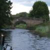
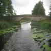
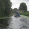
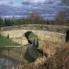
There is a bridge here which takes a track over the canal.

Tankards Bridge Narrows1 mile, 5¾ furlongs
Paper House Bridge1 mile, 1¼ furlongs
Gateforth Landing Narrows6 furlongs
Gateforth Landing4¾ furlongs
East Coast Railway Bridge3¼ furlongs
Burton Hall Bridge
Burn Bridge6¼ furlongs
Henwick Hall Lane Narrows1 mile, 2 furlongs
Henwick Hall Lane Bridge1 mile, 4 furlongs
Brayton Bridge1 mile, 5 furlongs
Brayton Railway Bridge1 mile, 7½ furlongs
 
 
Amenities
 
Maps
If you are a user and are logged on, or if you are actively planning a route, a map will be displayed here.
Show on external mapping site: Google | OSM | Bing
 
Photos
 
External websites
There are no links to external websites from here.
Why not log in and add some (select "External websites" from the menu (sometimes this is under "Edit"))?
 
Nearest facilities

Mouseover for more information or show routes to facility

Nearest water point

In the direction of Selby Junction (River Ouse)

Selby Basin2 miles, 6¾ furlongs away
On this waterway in the direction of Selby Junction (River Ouse)
Naburn Lock16 miles, 6¾ furlongs and 1 lock away
Travel to Selby Junction (River Ouse), then on the River Ouse : Yorkshire (tidal section - Naburn to Goole) to Naburn Lock
Goole Marina20 miles and 2 locks away
Travel to Selby Junction (River Ouse), then on the River Ouse : Yorkshire (tidal section - Naburn to Goole) to Ouse - Aire and Calder Junction, then on the Aire and Calder Navigation (Main Line - Goole to Castleford) to Goole Marina

In the direction of Bank Dole Junction

Beal Lock No 25 miles, 6 furlongs and 1 lock away
On this waterway in the direction of Bank Dole Junction
Beal Bridge5 miles, 7¼ furlongs and 2 locks away
On this waterway in the direction of Bank Dole Junction
Bank Dole Lock No 18 miles, 1¾ furlongs and 2 locks away
On this waterway in the direction of Bank Dole Junction
Ferrybridge Flood Lock No 1110 miles and 3 locks away
Travel to Bank Dole Junction, then on the Aire and Calder Navigation (Main Line - Goole to Castleford) to Ferrybridge Flood Lock No 11
Ferrybridge Flood Lock Footbridge10 miles, ¼ furlongs and 4 locks away
Travel to Bank Dole Junction, then on the Aire and Calder Navigation (Main Line - Goole to Castleford) to Ferrybridge Flood Lock Footbridge
Whitley Lock No 1212 miles, 3 furlongs and 3 locks away
Travel to Bank Dole Junction, then on the Aire and Calder Navigation (Main Line - Goole to Castleford) to Whitley Lock No 12
Bulholme Lock No 1014 miles, 6 furlongs and 4 locks away
Travel to Bank Dole Junction, then on the Aire and Calder Navigation (Main Line - Goole to Castleford) to Bulholme Lock No 10
Castleford Sanitary Station15 miles, 2¾ furlongs and 5 locks away
Travel to Bank Dole Junction, then on the Aire and Calder Navigation (Main Line - Goole to Castleford) to Castleford Sanitary Station
Pollington Manor Swing Bridge16 miles, 1¼ furlongs and 5 locks away
Travel to Bank Dole Junction, then on the Aire and Calder Navigation (Main Line - Goole to Castleford) to Pollington Manor Swing Bridge
Pollington Visitor Mooring16 miles, 1½ furlongs and 5 locks away
Travel to Bank Dole Junction, then on the Aire and Calder Navigation (Main Line - Goole to Castleford) to Pollington Visitor Mooring
Woodnook Lock No 617 miles, 5¼ furlongs and 6 locks away
Travel to Bank Dole Junction, then on the Aire and Calder Navigation (Main Line - Goole to Castleford) to Castleford Junction, then on the Aire and Calder Navigation (Wakefield Section) to Woodnook Lock No 6
Fairies Hill Moorings17 miles, 4 furlongs and 7 locks away
Travel to Bank Dole Junction, then on the Aire and Calder Navigation (Main Line - Goole to Castleford) to Castleford Junction, then on the Aire and Calder Navigation (Wakefield Section) to Fairies Hill Lock Junction, then on the Aire and Calder Navigation (Wakefield Section - Fairies Hill Mooring Arm) to Fairies Hill Moorings
Lemonroyd Lock No 718 miles, 7¼ furlongs and 6 locks away
Travel to Bank Dole Junction, then on the Aire and Calder Navigation (Main Line - Goole to Castleford) to Castleford Junction, then on the Aire and Calder Navigation (Main Line - Castleford to Leeds) to Lemonroyd Lock No 7
Lemonroyd Marina19 miles and 7 locks away
Travel to Bank Dole Junction, then on the Aire and Calder Navigation (Main Line - Goole to Castleford) to Castleford Junction, then on the Aire and Calder Navigation (Main Line - Castleford to Leeds) to Lemonroyd Marina
King's Road Lock No 318 miles, 6¾ furlongs and 7 locks away
Travel to Bank Dole Junction, then on the Aire and Calder Navigation (Main Line - Goole to Castleford) to Castleford Junction, then on the Aire and Calder Navigation (Wakefield Section) to King's Road Lock No 3

Nearest chemical toilet disposal

In the direction of Selby Junction (River Ouse)

Selby Basin2 miles, 6¾ furlongs away
On this waterway in the direction of Selby Junction (River Ouse)
Naburn Lock16 miles, 6¾ furlongs and 1 lock away
Travel to Selby Junction (River Ouse), then on the River Ouse : Yorkshire (tidal section - Naburn to Goole) to Naburn Lock
Goole Marina20 miles and 2 locks away
Travel to Selby Junction (River Ouse), then on the River Ouse : Yorkshire (tidal section - Naburn to Goole) to Ouse - Aire and Calder Junction, then on the Aire and Calder Navigation (Main Line - Goole to Castleford) to Goole Marina

In the direction of Bank Dole Junction

Whitley Lock No 1212 miles, 3 furlongs and 3 locks away
Travel to Bank Dole Junction, then on the Aire and Calder Navigation (Main Line - Goole to Castleford) to Whitley Lock No 12
Castleford Sanitary Station15 miles, 2¾ furlongs and 5 locks away
Travel to Bank Dole Junction, then on the Aire and Calder Navigation (Main Line - Goole to Castleford) to Castleford Sanitary Station
Fairies Hill Moorings17 miles, 4 furlongs and 7 locks away
Travel to Bank Dole Junction, then on the Aire and Calder Navigation (Main Line - Goole to Castleford) to Castleford Junction, then on the Aire and Calder Navigation (Wakefield Section) to Fairies Hill Lock Junction, then on the Aire and Calder Navigation (Wakefield Section - Fairies Hill Mooring Arm) to Fairies Hill Moorings
Lemonroyd Marina19 miles and 7 locks away
Travel to Bank Dole Junction, then on the Aire and Calder Navigation (Main Line - Goole to Castleford) to Castleford Junction, then on the Aire and Calder Navigation (Main Line - Castleford to Leeds) to Lemonroyd Marina

Nearest place to turn

In the direction of Selby Junction (River Ouse)

Selby Basin2 miles, 6¾ furlongs away
On this waterway in the direction of Selby Junction (River Ouse)
Naburn Lock Winding Hole16 miles, 7½ furlongs and 2 locks away
Travel to Selby Junction (River Ouse), then on the River Ouse : Yorkshire (tidal section - Naburn to Goole) to Naburn Lock, then on the River Ouse : Yorkshire (non-tidal section) to Naburn Lock Winding Hole
Naburn Lock Weir Entrance17 miles, 1 furlong and 2 locks away
Travel to Selby Junction (River Ouse), then on the River Ouse : Yorkshire (tidal section - Naburn to Goole) to Naburn Lock, then on the River Ouse : Yorkshire (non-tidal section) to Naburn Lock Weir Entrance

In the direction of Bank Dole Junction

Haddlesey Junction1 mile, 7½ furlongs and 1 lock away
On this waterway in the direction of Bank Dole Junction
Beal Lock No 2 Weir Entrance5 miles, 7 furlongs and 2 locks away
On this waterway in the direction of Bank Dole Junction
Bank Dole Lock Junction8 miles, 1½ furlongs and 2 locks away
On this waterway in the direction of Bank Dole Junction
Bulholme Lock Weir Exit14 miles, 5½ furlongs and 4 locks away
Travel to Bank Dole Junction, then on the Aire and Calder Navigation (Main Line - Goole to Castleford) to Bulholme Lock Weir Exit
Lemonroyd Lock Weir Exit18 miles, 6¼ furlongs and 6 locks away
Travel to Bank Dole Junction, then on the Aire and Calder Navigation (Main Line - Goole to Castleford) to Castleford Junction, then on the Aire and Calder Navigation (Main Line - Castleford to Leeds) to Lemonroyd Lock Weir Exit
Fairies Hill Lock Arm17 miles, 7 furlongs and 7 locks away
Travel to Bank Dole Junction, then on the Aire and Calder Navigation (Main Line - Goole to Castleford) to Castleford Junction, then on the Aire and Calder Navigation (Wakefield Section) to Fairies Hill Lock Arm
Fleet Lane Arm19 miles, 2¼ furlongs and 7 locks away
Travel to Bank Dole Junction, then on the Aire and Calder Navigation (Main Line - Goole to Castleford) to Castleford Junction, then on the Aire and Calder Navigation (Main Line - Castleford to Leeds) to Fleet Lane Arm

Nearest self-operated pump-out

Direction of TV transmitter (From Wolfbane Cybernetic)
 
 
Geograph
 
Wikipedia

There is no page on Wikipedia called “Burton Hall Bridge”

Wikipedia pages that might relate to Burton Hall Bridge
[Burton upon Trent] the Peak District National Park. Burton is known for its brewing. The town grew up around Burton Abbey. Burton Bridge was also the site of two battles [Cliff Burton] and Roll Hall of Fame as a member of Metallica on April 4, 2009. Clifford Lee Burton was born in Castro Valley, California, to Ray and Jan Burton. He had [James Burton] James Edward Burton (born August 21, 1939, in Dubberly, Louisiana) is an American guitarist. A member of the Rock and Roll Hall of Fame since 2001 (his [Burton Constable Hall] Burton Constable Hall is a large Elizabethan country house in England, with 18th- and 19th-century interiors and a fine 18th-century cabinet of curiosities [Housing at the Massachusetts Institute of Technology] residential floors on the Burton side and four on the Conner side. In the 1960s, a dining hall was added at the rear of Burton-Conner, on the side away [Battle of Burton Bridge (1643)] Burton Derby Ashby-de-la-Zouch Stafford Lichfield Tutbury The Battle of Burton Bridge was fought between Royalist and Parliamentarian forces at Burton [Selby Canal] bridge. A similar feature at Lund Tunnel carries a drain under the canal. The East Coast Main Line crosses next, after which comes Burton Hall Bridge [Bass Reeves] player Ryan Reaves. Historian Art Burton stated that Reeves was the inspiration for the character of the Lone Ranger, Burton makes this argument based on the [Walton-on-Trent] parish include Catton Hall, Walton Hall and The Old Hall house. Today the village is very close to Burton upon Trent). The original bridge was built in 1834 [Edward Burton Hughes] graduated. E. Burton Hughes joined the New York State Department of Public Works in 1925 as a junior civil engineer in the Bureau of Bridges and Grade Crossings
 
Google

Results of Google Search

Arch Burton Hall Bridge - Gateforth, UK - Stone Bridges on ...
Aug 30, 2015 ... Selby steadily declined after that, although traffic to York still used the canal. The bridge known as Burton Hall Bridge became an English ...
File:Selby Canal Burton Hall Bridge - geograph.org.uk - 1727110.jpg
File:Selby Canal Burton Hall Bridge - geograph.org.uk - 1727110.jpg. Language; Watch · Edit. File; File history; File usage on Commons; Metadata. File:Selby ...
'The Entrance of Wensleydale from near Middleham Bridge, and the ...
Artwork page for 'The Entrance of Wensleydale from near Middleham Bridge, and the Entrance Front of Constable Burton Hall near Leyburn', Joseph Mallord ...
The Selby Canal at Burton Hall Bridge © Graham Hogg :: Geograph ...
Oct 17, 2017 ... SE5829 :: The Selby Canal at Burton Hall Bridge, near to Burn, North Yorkshire, Great Britain by Graham Hogg.
CONSTABLE BURTON HALL, Constable Burton - 1001060 | Historic ...
Heritage List Entry Summary for Constable Burton Hall. ... where gates lead to a drive which runs north over a stream via a bridge to the west side of the Hall.
Capability Brown's Bridge - Picture of Burton Constable Hall ...
Jul 24, 2016 ... Burton Constable Hall, Kingston-upon-Hull Picture: Capability Brown's Bridge - Check out Tripadvisor members' 10687 candid photos and ...
Capability Brown Parkland :: East Yorkshires ... - Burton Constable
Burton Constable Hall is surrounded by 330 acres of stunning historic grade II* ... stable block as they approached through the park across Brown's new bridge, ...
Capability Brown's Bridge - Picture of Burton Constable Hall ...
Burton Constable Hall, Kingston-upon-Hull Picture: Capability Brown's Bridge - Check out Tripadvisor members' 10687 candid photos and videos of Burton ...
QE2 Captains
fleet in several years, Burton-Hall ... Above right: On the bridge of QE2. Captain Paul ... rooms. Above right: Captain Hassell on the bridge wing in New York.