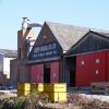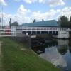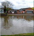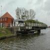
Hempsted Bridge 
No access to vehicular traffic since the opening of Netheridge Bridge
Gloucester GL2 5, United Kingdom

Hempsted Bridge
is a place on the waterways
on the Gloucester and Sharpness Canal between
Saul Junction (Junction of the Gloucester and Sharpness Canal with the Stroudwater Navigation) (6 miles and 3½ furlongs
to the southwest) and
Gloucester Docks (Waterways Office (South Wales and Severn Waterways) - Canal & River Trust (Water area of 14 acres)) (1 mile and 2¼ furlongs
to the northeast).
The nearest place in the direction of Saul Junction is Hempsted Historic Dry Dock;
1½ furlongs
away.
The nearest place in the direction of Gloucester Docks is Monk Meadow Wharf;
4½ furlongs
away.
Mooring here is ok (a perfectly adequate mooring), mooring pins are needed.
There is a swing bridge here.
Two Mile Bend (west arm) | 6 furlongs | |
Netheridge Bridge | 5 furlongs | |
Two Mile Bend (east arm) | 4¼ furlongs | |
Gloucester Rowing Club | 2¼ furlongs | |
Hempsted Historic Dry Dock | 1½ furlongs | |
Hempsted Bridge | ||
Monk Meadow Wharf | 4½ furlongs | |
Monk Meadow Dock | 6¼ furlongs | |
High Orchard Bridge | 7¾ furlongs | |
Llanthony Pontoons | 1 mile, ½ furlongs | |
Llanthony Road Bridge | 1 mile, 1½ furlongs |
There are no links to external websites from here.
Why not log in and add some (select "External websites" from the menu (sometimes this is under "Edit"))?
Mouseover for more information or show routes to facility
Nearest water point
In the direction of Gloucester / Sharpness - Severn Junction
Llanthony Pontoons — 1 mile, ½ furlongs away
On this waterway in the direction of Gloucester / Sharpness - Severn Junction
Llanthony Road Bridge — 1 mile, 1½ furlongs away
On this waterway in the direction of Gloucester / Sharpness - Severn Junction
Gloucester Waterways Museum Arm — 1 mile, 1¾ furlongs away
On this waterway in the direction of Gloucester / Sharpness - Severn Junction
Gloucester Dock Lock — 1 mile, 2¾ furlongs away
On this waterway in the direction of Gloucester / Sharpness - Severn Junction
Tewkesbury Lower Lode — 13 miles, ½ furlongs and 1 lock away
Travel to Gloucester / Sharpness - Severn Junction, then on the River Severn (main river - Worcester to Gloucester) to Tewkesbury Lower Lode
Upper Lode Lock No 5 — 13 miles, 6¾ furlongs and 1 lock away
Travel to Gloucester / Sharpness - Severn Junction, then on the River Severn (main river - Worcester to Gloucester) to Upper Lode Lock No 5
Tewkesbury Services — 14 miles, 4¾ furlongs and 3 locks away
Travel to Gloucester / Sharpness - Severn Junction, then on the River Severn (main river - Worcester to Gloucester) to Tewkesbury Junction, then on the River Avon - Warwickshire (Lower Avon Navigation) to Tewkesbury Services
Bredon — 18 miles, ½ furlongs and 3 locks away
Travel to Gloucester / Sharpness - Severn Junction, then on the River Severn (main river - Worcester to Gloucester) to Tewkesbury Junction, then on the River Avon - Warwickshire (Lower Avon Navigation) to Bredon
In the direction of Sharpness Junction
Sellars Bridge — 2 miles, 5½ furlongs away
On this waterway in the direction of Sharpness Junction
Saul Junction Winding Hole — 6 miles, 3¾ furlongs away
On this waterway in the direction of Sharpness Junction
Saul Junction Marina — 6 miles, 4½ furlongs away
Travel to Saul Junction, then on the Cotswold Canals (Stroudwater Navigation - Navigable Section) to Saul Junction Marina
Cotswold Canals Trust Visitor Centre - Saul Junction — 6 miles, 4½ furlongs away
On this waterway in the direction of Sharpness Junction
Fretherne Bridge — 7 miles, 1¾ furlongs away
On this waterway in the direction of Sharpness Junction
Splatt Bridge — 8 miles, 2½ furlongs away
On this waterway in the direction of Sharpness Junction
Patch Bridge — 10 miles, 1½ furlongs away
On this waterway in the direction of Sharpness Junction
Purton Lower Bridge — 12 miles, 5 furlongs away
On this waterway in the direction of Sharpness JunctionNearest rubbish disposal
In the direction of Gloucester / Sharpness - Severn Junction
Llanthony Road Bridge — 1 mile, 1½ furlongs away
On this waterway in the direction of Gloucester / Sharpness - Severn Junction
Tewkesbury Services — 14 miles, 4¾ furlongs and 3 locks away
Travel to Gloucester / Sharpness - Severn Junction, then on the River Severn (main river - Worcester to Gloucester) to Tewkesbury Junction, then on the River Avon - Warwickshire (Lower Avon Navigation) to Tewkesbury Services
In the direction of Sharpness Junction
Sellars Bridge — 2 miles, 5½ furlongs away
On this waterway in the direction of Sharpness Junction
Parkend Bridge — 4 miles, 6¾ furlongs away
On this waterway in the direction of Sharpness Junction
Saul Junction Winding Hole — 6 miles, 3¾ furlongs away
On this waterway in the direction of Sharpness Junction
Saul Junction Marina — 6 miles, 4½ furlongs away
Travel to Saul Junction, then on the Cotswold Canals (Stroudwater Navigation - Navigable Section) to Saul Junction Marina
Fretherne Bridge — 7 miles, 1¾ furlongs away
On this waterway in the direction of Sharpness Junction
Splatt Bridge — 8 miles, 2½ furlongs away
On this waterway in the direction of Sharpness Junction
Patch Bridge — 10 miles, 1½ furlongs away
On this waterway in the direction of Sharpness Junction
Purton Lower Bridge — 12 miles, 5 furlongs away
On this waterway in the direction of Sharpness Junction
Sharpness Barge Arm — 14 miles, ¼ furlongs away
On this waterway in the direction of Sharpness JunctionNearest chemical toilet disposal
In the direction of Gloucester / Sharpness - Severn Junction
Llanthony Road Bridge — 1 mile, 1½ furlongs away
On this waterway in the direction of Gloucester / Sharpness - Severn Junction
In the direction of Sharpness Junction
Saul Junction Marina — 6 miles, 4½ furlongs away
Travel to Saul Junction, then on the Cotswold Canals (Stroudwater Navigation - Navigable Section) to Saul Junction Marina
Cotswold Canals Trust Visitor Centre - Saul Junction — 6 miles, 4½ furlongs away
On this waterway in the direction of Sharpness Junction
Sharpness Barge Arm — 14 miles, ¼ furlongs away
On this waterway in the direction of Sharpness JunctionNearest place to turn
In the direction of Gloucester / Sharpness - Severn Junction
Monk Meadow Dock — 6¼ furlongs away
On this waterway in the direction of Gloucester / Sharpness - Severn Junction
Gloucester Docks — 1 mile, 2¼ furlongs away
On this waterway in the direction of Gloucester / Sharpness - Severn Junction
Waterways Office (South Wales and Severn Waterways) - Canal & River Trust — 1 mile, 2½ furlongs away
On this waterway in the direction of Gloucester / Sharpness - Severn Junction
Gloucester / Sharpness - Severn Junction — 1 mile, 3 furlongs and 1 lock away
On this waterway in the direction of Gloucester / Sharpness - Severn Junction
Upper Parting Junction — 3 miles, 7¾ furlongs and 1 lock away
Travel to Gloucester / Sharpness - Severn Junction, then on the River Severn (main river - Worcester to Gloucester) to Upper Parting Junction
Over Winding Hole — 3 miles, 2¾ furlongs and 2 locks away
Travel to Gloucester / Sharpness - Severn Junction, then on the River Severn (old river navigation) to Lower Parting, then on the River Severn (Maisemore Channel - Southern Section) to Over Junction, then on the Hereford and Gloucester Canal to Over Winding Hole
Upper Lode Lock Weir Exit — 13 miles, 4¾ furlongs and 1 lock away
Travel to Gloucester / Sharpness - Severn Junction, then on the River Severn (main river - Worcester to Gloucester) to Upper Lode Lock Weir Exit
Upper Lode Lock Weir Entrance — 13 miles, 7¾ furlongs and 2 locks away
Travel to Gloucester / Sharpness - Severn Junction, then on the River Severn (main river - Worcester to Gloucester) to Upper Lode Lock Weir Entrance
Avon Lock Junction — 14 miles, 4½ furlongs and 3 locks away
Travel to Gloucester / Sharpness - Severn Junction, then on the River Severn (main river - Worcester to Gloucester) to Tewkesbury Junction, then on the River Avon - Warwickshire (Lower Avon Navigation) to Avon Lock Junction
Abbey Mill Tewkesbury — 14 miles, 5½ furlongs and 3 locks away
Travel to Gloucester / Sharpness - Severn Junction, then on the River Severn (main river - Worcester to Gloucester) to Tewkesbury Junction, then on the River Avon - Warwickshire (Lower Avon Navigation) to Avon Lock Junction, then on the River Avon - Warwickshire (Mill Avon) to Abbey Mill Tewkesbury
Tewkesbury Marina Entrance No 2 — 15 miles, ½ furlongs and 3 locks away
Travel to Gloucester / Sharpness - Severn Junction, then on the River Severn (main river - Worcester to Gloucester) to Tewkesbury Junction, then on the River Avon - Warwickshire (Lower Avon Navigation) to Tewkesbury Marina Entrance No 2
In the direction of Sharpness Junction
Quedgeley Oil Depot — 2 miles, 4 furlongs away
On this waterway in the direction of Sharpness Junction
Pegthorne Bridge Winding Hole — 5 miles, 6½ furlongs away
On this waterway in the direction of Sharpness Junction
Saul Junction Winding Hole — 6 miles, 3¾ furlongs away
On this waterway in the direction of Sharpness Junction
Sharpness Barge Arm — 14 miles, ¼ furlongs away
On this waterway in the direction of Sharpness Junction
The Ocean — 10 miles, 2 furlongs and 8 locks away
Travel to Saul Junction, then on the Cotswold Canals (Stroudwater Navigation - Navigable Section) to Walk Bridge, then on the Cotswold Canals (Stroudwater Navigation - Un-navigable Section) to The Ocean
Ryeford Winding Hole — 11 miles, 1¾ furlongs and 8 locks away
Travel to Saul Junction, then on the Cotswold Canals (Stroudwater Navigation - Navigable Section) to Walk Bridge, then on the Cotswold Canals (Stroudwater Navigation - Un-navigable Section) to Ryeford Winding Hole
Brimscombe Port — 16 miles, ½ furlongs and 19 locks away
Travel to Saul Junction, then on the Cotswold Canals (Stroudwater Navigation - Navigable Section) to Walk Bridge, then on the Cotswold Canals (Stroudwater Navigation - Un-navigable Section) to Site of Entrance to Wallbridge Basin, then on the Cotswold Canals (Thames and Severn Canal - Wide section) to Brimscombe PortNearest self-operated pump-out
In the direction of Gloucester / Sharpness - Severn Junction
Llanthony Pontoons — 1 mile, ½ furlongs away
On this waterway in the direction of Gloucester / Sharpness - Severn Junction
In the direction of Sharpness Junction
Cotswold Canals Trust Visitor Centre - Saul Junction — 6 miles, 4½ furlongs away
On this waterway in the direction of Sharpness Junction
Purton Lower Bridge — 12 miles, 5 furlongs away
On this waterway in the direction of Sharpness JunctionNearest boatyard pump-out
In the direction of Sharpness Junction
Saul Junction Marina — 6 miles, 4½ furlongs away
Travel to Saul Junction, then on the Cotswold Canals (Stroudwater Navigation - Navigable Section) to Saul Junction Marina
Patch Bridge — 10 miles, 1½ furlongs away
On this waterway in the direction of Sharpness JunctionDirection of TV transmitter (From Wolfbane Cybernetic)
There is no page on Wikipedia called “Hempsted Bridge”
Wikipedia pages that might relate to Hempsted Bridge
[Hemel Hempsted railway station]
Hemel Hempsted station was a railway station in the town of Hemel Hempstead in Hertfordshire, England. UK. It was opened in 1877 by the Midland Railway
[Hemel Hempstead]
and Berkhamsted. The settlement was called by the name Henamsted or Hean-Hempsted in Anglo-Saxon times and in William the Conqueror's time by the name of
[Nickey line]
design found a sponsor and following an Act of Parliament in 1863 the Hemel Hempsted and London & North Western Railway Company (HH&L&NWR) was formed to construct
[Quedgeley]
area of Netheridge, just south of the River Severn was transferred to Hempsted. In 1900, Lower Tuffley was added to Quedgeley and the population of the
[List of places in Gloucestershire]
Hill, Hartpury, Hasfield, Hatherop, Hawkesbury Upton, Hawling, Hazleton, Hempsted, Henbury, Hewelsfield, Hidcote Boyce, Highnam, Hillesley, Hinchwick, Hinton
[Peter Clover]
Children's (London, England), 1994 The Best Pony for Me!, Macdonald (Hemel Hempsted, England), 1995 The Phantom Pony, Corgi (London, England), 1999 The Storm
[Gloucester]
Abbeymead Alney Island Barnwood Barton and Tredworth Coney Hill Elmbridge Hempsted Hucclecote Kingsholm Linden Longlevens Matson Podsmead Quedgeley † St.
[Heath Park Halt railway station]
who agreed to fund the project. Originally the line terminated at Hemel Hempsted (Midland) but demand for coal supplies to Duckhall Gasworks meant that
[Croxley Green railway station]
Canal bridge was removed to make way for a new Ascot Road to improve traffic flow to the nearby business park. It was considered uneconomical to bridge the
[List of baronetcies in the Baronetage of England]
of Westminster. Guise of Elmore 1661 Guise extinct 1783 Guldeford of Hempsted Place 1686 Guldeford extinct 1740 Gurney of London 1641 Gurney extinct
Results of Google Search
Contact us Gloucester Hempsted TEC, Secunda Way, Hempsted ...Gloucester Hempsted TEC,. Secunda Way, Hempsted Bridge,. Gloucester, GL2 5BT. ○. Highly prominent warehouse with 2 storey offices. ○. Low site coverage.
Aug 29, 2019 ... 6 bridge over Hempstead Road and Union Pacific Corp. railroad tracks. The following closures are set to go into effect 9 p.m. Friday, Sept. 6 ...
Aug 21, 2018 ... ... Gloucester & Sharpness Canal at Hempsted Meadows (1 mile south of Gloucester Docks) between Hempsted Bridge & Netheredge Bridge.
Bristol Road (Burger King to Old Hempsted Bridge). Important note: Segment placings and history are only available to Strava Subscribers - More info.
Jul 27, 2019 ... The Arkansas Highway Commission unanimously approved the proposal to rename a Hempstead County Bridge after four-year-old Maleah ...
Find the perfect hempsted bridge stock photo. Huge collection, amazing choice, 100+ million high quality, affordable RF and RM images. No need to register, ...
Jul 25, 2009 ... File:Hempsted Bridge - geograph.org.uk - 1471965.jpg. Language; Watch · Edit. File; File ... English: Hempsted Bridge. Date, 25 July 2009.
Jul 27, 2019 ... The Arkansas Highway Commission unanimously approved the proposal to rename a Hempstead County Bridge after four-year-old Maleah ...
Gloucester. Gloucester. Hempsted Bridge. Gloucester. GL2 5BT. Get directions. Contact. Mon-Fri : 08:00-18:00; Saturday : 08:00-13:00; 01452 525144 ...