Medway Mill Footbridge
Maidstone United FC, Kent Messenger Millenium Bridge, Maidstone ME14 1GL, United Kingdom

Medway Mill Footbridge
is a minor waterways place
on the River Medway (Non-tidal section) between
Maidstone (College Gardens) (7¼ furlongs
to the southeast) and
Allington Lock No 10 (1 mile and 4¾ furlongs
to the northwest).
The nearest place in the direction of Maidstone is Maidstone Canoe Club;
1¾ furlongs
away.
The nearest place in the direction of Allington Lock No 10 is Medway Mill;
¼ furlongs
away.
There may be access to the towpath here.
Mooring here is unrated.
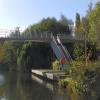
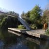
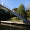
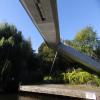
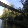
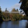
There is a bridge here which takes pedestrian traffic over the canal.
Broadway Bridge (Maidstone) | 5½ furlongs | |
St Peter's Bridge | 4¾ furlongs | |
Fairmeadow Moorings | 4¼ furlongs | |
Maidstone East Railway Bridge | 2 furlongs | |
Maidstone Canoe Club | 1¾ furlongs | |
Medway Mill Footbridge | ||
Medway Mill | ¼ furlongs | |
Kerry Hill Way Footbridge | 2¼ furlongs | |
Castle Quay | 5¼ furlongs | |
Allington Marina | 1 mile, 1¼ furlongs | |
Malta Inn Moorings | 1 mile, 3¼ furlongs |
Amenities nearby at Maidstone Canoe Club
Amenities nearby at Medway Mill
Amenities in Maidstone
Amenities at other places in Maidstone
at
at
at
at
at
at
at
at
at
at
at
at
at
at
at
at
at
at
at
at
at
at
at
at
at
at
at
at
at
at
at
at
at
at
at
at
at
at
at
at
at
at
at
at
at
at
at
at
at
at
at
at
at
at
at
at
at
at
at
at
at
at
at
at
at
at
at
at
at
at
at
at
at
There are no links to external websites from here.
Why not log in and add some (select "External websites" from the menu (sometimes this is under "Edit"))?
Mouseover for more information or show routes to facility
Nearest place to turn
In the direction of Allington Lock No 10
Allington Lock Weir Entrance — 1 mile, 3¾ furlongs away
On this waterway in the direction of Allington Lock No 10
Allington Lock Weir Exit — 1 mile, 5½ furlongs and 1 lock away
Travel to Allington Lock No 10, then on the River Medway (Tidal section) to Allington Lock Weir Exit
In the direction of Tonbridge Rail Bridge
Farleigh Lock Weir Exit — 2 miles, 7½ furlongs away
On this waterway in the direction of Tonbridge Rail Bridge
Teston Lock Weir Exit — 5 miles, ¾ furlongs and 1 lock away
On this waterway in the direction of Tonbridge Rail Bridge
Teston Lock Weir Entrance — 5 miles, 1¼ furlongs and 2 locks away
On this waterway in the direction of Tonbridge Rail Bridge
Hampstead Lock Weir Exit — 7 miles, 7½ furlongs and 2 locks away
On this waterway in the direction of Tonbridge Rail Bridge
Stoneham Lock Weir Exit — 9 miles, 3½ furlongs and 3 locks away
On this waterway in the direction of Tonbridge Rail Bridge
Sluice Weir Lock Weir Exit — 10 miles, 4¾ furlongs and 3 locks away
On this waterway in the direction of Tonbridge Rail Bridge
Oak Weir Lock Weir Exit — 11 miles, 7¾ furlongs and 4 locks away
On this waterway in the direction of Tonbridge Rail Bridge
East Lock Weir Exit — 12 miles, 5 furlongs and 5 locks away
On this waterway in the direction of Tonbridge Rail Bridge
East Lock Weir Entrance — 12 miles, 6¾ furlongs and 6 locks away
On this waterway in the direction of Tonbridge Rail Bridge
Porter's Lock Weir Exit — 13 miles, 7 furlongs and 6 locks away
On this waterway in the direction of Tonbridge Rail Bridge
Porter's Lock Weir Entrance — 14 miles, 1 furlong and 7 locks away
On this waterway in the direction of Tonbridge Rail Bridge
Eldridge's Lock Winding Hole — 14 miles, 6¾ furlongs and 7 locks away
On this waterway in the direction of Tonbridge Rail Bridge
Tonbridge Town Lock Weir Exit No 1 — 16 miles, 2¼ furlongs and 8 locks away
On this waterway in the direction of Tonbridge Rail Bridge
Tonbridge Town Lock Weir Entrance No 1 — 16 miles, 2¾ furlongs and 9 locks away
On this waterway in the direction of Tonbridge Rail Bridge
Tonbridge Junction (northern route) — 17 miles, 1¾ furlongs and 9 locks away
On this waterway in the direction of Tonbridge Rail BridgeNo information
CanalPlan has no information on any of the following facilities within range:water point
rubbish disposal
chemical toilet disposal
self-operated pump-out
boatyard pump-out
Direction of TV transmitter (From Wolfbane Cybernetic)
There is no page on Wikipedia called “Medway Mill Footbridge”
Wikipedia pages that might relate to Medway Mill Footbridge
[River Medway]
The River Medway is a river in South East England. It rises in the High Weald, Sussex and flows through Tonbridge, Maidstone and the Medway conurbation
[Chatham, Kent]
Chatham (/ˈtʃætəm/ CHAT-əm) is a town located within the Medway unitary authority, in North Kent, in South East England. The town developed around Chatham
[Medway watermills]
The Medway and its tributaries and sub-tributaries have been used for over 1,150 years as a source of power. There are over two hundred sites where the
[Medway watermills (lower tributaries)]
feed into the River Medway. The tributaries that powered watermills will be described in the order that they feed in. The mills are described in order
[East Farleigh railway station]
East Farleigh railway station is on the Medway Valley Line in Kent, England, located to the south-west of Maidstone and close to the village of East Farleigh
[List of bridges in the United Kingdom]
Bridges in the United Kingdom is a link page for any road bridges or footbridges in the United Kingdom. Railway bridges are listed under: List of railway
[Gravesend railway station]
the Gravesend & Rochester Railway (G&RR) who had purchased the Thames and Medway Canal and its tunnel between Strood and Higham. The G&RR ran the first train
[Stone Crossing railway station]
copy as title (link) "Timetable 5: London to Dartford, Gravesend and The Medway Towns" (PDF). Southeastern, December 2019. "Timetable 06: Luton to Dartford
[Wye railway station]
when John Rennie the Elder proposed building a canal to connect the River Medway in North Kent with the River Rother in East Sussex. A tramway would connect
[Bekesbourne railway station]
Dover Railway and opened on 22 July 1861. The platforms are linked by a footbridge. The country-bound platform is accessible by public footpath. Nearby is
Results of Google Search
River Medway - WikipediaThe River Medway is a river in South East England. It rises in the High Weald, Sussex, and flows through Tonbridge, Maidstone and the Medway conurbation in Kent before emptying into the Thames Estuary near Sheerness, a total distance of 70 miles (113 km). About 13 miles (21 km) of the river lies in Sussex, with the ...
Medway Mill Antiques and More, Medway, Massachusetts. 644 likes. Medway Mill Antiques and More is an Antique Shop. We offer furniture, home décor and...
This was a paper mill. There were two mills here in the thirteenth century, separated by a ford that passed through the tail race of the Upper Mill. The Upper Mill was removed c.1300 and as a result the ford became deep and impassable. In 1303, Henry de Cobham built a bridge at ...
Locate. “ Now Located in Rabbit Hill Plaza! Come visit our Multi-Dealer shop located in a historic renovated mill. Voted #1 Antique / Vintage shop in Medway 3 years in a row! E-bay consignments welcome..... â€Â ...
LUXE delivers a unique vibe, giving you the energetic feel of downtown Boston in the more relaxed, metro-west suburb of Medway, MA. Our hair, makeup, and micro-blading services are second to none! We listen to your needs ... Medway Mills, 165 Main Street (Rt 109), Suite 208, Medway, MA. schedule an appointment ...
Find Therapists in Medway, Norfolk County, Massachusetts, Psychologists, Marriage Counseling, Therapy, Counselors, Psychiatrists, Child Psychologists and Couples Counseling.
Profiles of 30 bridge soffits (the underside of the bridge) on the navigable River Medway.
Winslows Mills Bridge Rehabilitation/located on Cross Street over the Medomak River approximately 0.1 mile easterly of Route 32 junction. Awarded to Wyman & Simpson Inc, Richmond, Maine on January 08, 2018. Click to view contract info, 1 /9/2018. 12/13/2017, 018951.00, Waterville - Region 2Â ...
Environment Agency River Medway. A user's guide 5. TESTON. LOCK. 10.4km. TESTON. BRIDGE. Headrm. 2.55m. BARMING. FOOTBRIDGE. Headrm. 2.55m .... GOLDEN GREEN. BARNES. STREET. LITTLE. MILL. SNOLL. HATCH. EAST PECKHAM. OAK WEIR LOCK. 20.8km. FORD GREEN. BRIDGE. Headrm. 2.55m.
The Bissell Covered Bridge, built in 1951, crosses Mill Brook just north of Charlemont. The bridge is closed to vehicles but open to pedestrians. The bridge is the second covered bridge at this location. One-span variation of a Long truss; 60 feet long. Parking on the north side of bridge along Route 8A, on the east side of the ...