
Navigation Way Swing Bridge
is a minor waterways place
on the River Ribble (Preston Dock Branch) between
Preston Marina Junction (Junction of the River Ribble and the Preston Marina Arm) (3¼ furlongs
and 1 lock
to the west) and
Preston Dock (Eastern end) (3 furlongs
to the east).
The nearest place in the direction of Preston Marina Junction is Preston Marina Lock;
¼ furlongs
away.
The nearest place in the direction of Preston Dock is Preston Dock Control Tower (Operating swing bridge and lock gates);
¼ furlongs
away.
Mooring here is unrated.
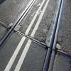
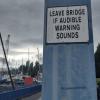
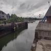
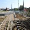
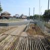
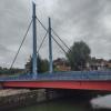
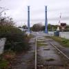
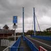
There is a swing bridge here.
| Preston Marina Junction | 3¼ furlongs | |
| Preston Marina Tidal Gates | 2 furlongs | |
| Preston Marina Outer Basin | 1¼ furlongs | |
| Preston Marina Lock | ¼ furlongs | |
| Navigation Way Swing Bridge | ||
| Preston Dock Control Tower | ¼ furlongs | |
| Preston Marina | 1¼ furlongs | |
| Preston Dock Wave Attenuator | 1½ furlongs | |
| Preston Lighthouse | 2 furlongs | |
| Preston Dock | 3 furlongs | |
There are no links to external websites from here.
Why not log in and add some (select "External websites" from the menu (sometimes this is under "Edit"))?
Why not log in and add some (select "External websites" from the menu (sometimes this is under "Edit"))?
Mouseover for more information or show routes to facility
Nearest water point
In the direction of Preston Marina Junction
Spark Bridge Sanitary Station — 12 miles, 5¾ furlongs and 2 locks away
Travel to Preston Marina Junction, then on the River Ribble (Main River) to Astland Lamp, then on the River Douglas to Tarleton Junction, then on the Leeds and Liverpool Canal (Rufford Branch) to Spark Bridge Sanitary Station
Woodplumpton Road Bridge No 12 — 5 miles, 6 furlongs and 10 locks away
Travel to Preston Marina Junction, then on the River Ribble (Main River) to Ribble - Savick Brook Junction, then on the River Ribble (Ribble Link) to Ribble Link - Lancaster Canal Junction, then on the Lancaster Canal (Main Line) to Woodplumpton Road Bridge No 12
St Mary's Marina — 13 miles, 5½ furlongs and 2 locks away
Travel to Preston Marina Junction, then on the River Ribble (Main River) to Astland Lamp, then on the River Douglas to Tarleton Junction, then on the Leeds and Liverpool Canal (Rufford Branch) to St Mary's Marina
Blackleach Lane Marina — 10 miles, 1½ furlongs and 10 locks away
Travel to Preston Marina Junction, then on the River Ribble (Main River) to Ribble - Savick Brook Junction, then on the River Ribble (Ribble Link) to Ribble Link - Lancaster Canal Junction, then on the Lancaster Canal (Main Line) to Blackleach Lane Marina
Swill Brook Basin — 10 miles, 4¾ furlongs and 10 locks away
Travel to Preston Marina Junction, then on the River Ribble (Main River) to Ribble - Savick Brook Junction, then on the River Ribble (Ribble Link) to Ribble Link - Lancaster Canal Junction, then on the Lancaster Canal (Main Line) to Swill Brook Basin
Bilsborrow Winding Hole — 15 miles, 1¼ furlongs and 10 locks away
Travel to Preston Marina Junction, then on the River Ribble (Main River) to Ribble - Savick Brook Junction, then on the River Ribble (Ribble Link) to Ribble Link - Lancaster Canal Junction, then on the Lancaster Canal (Main Line) to Bilsborrow Winding Hole
Burscough Bridge Wharf — 17 miles, 3¼ furlongs and 9 locks away
Travel to Preston Marina Junction, then on the River Ribble (Main River) to Astland Lamp, then on the River Douglas to Tarleton Junction, then on the Leeds and Liverpool Canal (Rufford Branch) to Lathom Junction, then on the Leeds and Liverpool Canal (Main Line - Liverpool to Wigan) to Burscough Bridge WharfNearest rubbish disposal
In the direction of Preston Marina Junction
Spark Bridge Sanitary Station — 12 miles, 5¾ furlongs and 2 locks away
Travel to Preston Marina Junction, then on the River Ribble (Main River) to Astland Lamp, then on the River Douglas to Tarleton Junction, then on the Leeds and Liverpool Canal (Rufford Branch) to Spark Bridge Sanitary Station
Woodplumpton Road Bridge No 12 — 5 miles, 6 furlongs and 10 locks away
Travel to Preston Marina Junction, then on the River Ribble (Main River) to Ribble - Savick Brook Junction, then on the River Ribble (Ribble Link) to Ribble Link - Lancaster Canal Junction, then on the Lancaster Canal (Main Line) to Woodplumpton Road Bridge No 12
Bilsborrow Winding Hole — 15 miles, 1¼ furlongs and 10 locks away
Travel to Preston Marina Junction, then on the River Ribble (Main River) to Ribble - Savick Brook Junction, then on the River Ribble (Ribble Link) to Ribble Link - Lancaster Canal Junction, then on the Lancaster Canal (Main Line) to Bilsborrow Winding Hole
Moss Bridge No 35 — 17 miles, 5 furlongs and 9 locks away
Travel to Preston Marina Junction, then on the River Ribble (Main River) to Astland Lamp, then on the River Douglas to Tarleton Junction, then on the Leeds and Liverpool Canal (Rufford Branch) to Lathom Junction, then on the Leeds and Liverpool Canal (Main Line - Liverpool to Wigan) to Moss Bridge No 35Nearest chemical toilet disposal
In the direction of Preston Marina Junction
Spark Bridge Sanitary Station — 12 miles, 5¾ furlongs and 2 locks away
Travel to Preston Marina Junction, then on the River Ribble (Main River) to Astland Lamp, then on the River Douglas to Tarleton Junction, then on the Leeds and Liverpool Canal (Rufford Branch) to Spark Bridge Sanitary Station
Woodplumpton Road Bridge No 12 — 5 miles, 6 furlongs and 10 locks away
Travel to Preston Marina Junction, then on the River Ribble (Main River) to Ribble - Savick Brook Junction, then on the River Ribble (Ribble Link) to Ribble Link - Lancaster Canal Junction, then on the Lancaster Canal (Main Line) to Woodplumpton Road Bridge No 12
St Mary's Marina — 13 miles, 5½ furlongs and 2 locks away
Travel to Preston Marina Junction, then on the River Ribble (Main River) to Astland Lamp, then on the River Douglas to Tarleton Junction, then on the Leeds and Liverpool Canal (Rufford Branch) to St Mary's Marina
Bilsborrow Winding Hole — 15 miles, 1¼ furlongs and 10 locks away
Travel to Preston Marina Junction, then on the River Ribble (Main River) to Ribble - Savick Brook Junction, then on the River Ribble (Ribble Link) to Ribble Link - Lancaster Canal Junction, then on the Lancaster Canal (Main Line) to Bilsborrow Winding Hole
Burscough Bridge Wharf — 17 miles, 3¼ furlongs and 9 locks away
Travel to Preston Marina Junction, then on the River Ribble (Main River) to Astland Lamp, then on the River Douglas to Tarleton Junction, then on the Leeds and Liverpool Canal (Rufford Branch) to Lathom Junction, then on the Leeds and Liverpool Canal (Main Line - Liverpool to Wigan) to Burscough Bridge WharfNearest place to turn
In the direction of Preston Marina Junction
Winding Hole above Lock No 8 — 3 miles, ¼ furlongs and 3 locks away
Travel to Preston Marina Junction, then on the River Ribble (Main River) to Ribble - Savick Brook Junction, then on the River Ribble (Ribble Link) to Winding Hole above Lock No 8
Ribble Link Lock No 5 Winding Hole — 4 miles, 1¾ furlongs and 6 locks away
Travel to Preston Marina Junction, then on the River Ribble (Main River) to Ribble - Savick Brook Junction, then on the River Ribble (Ribble Link) to Ribble Link Lock No 5 Winding Hole
Ribble Link Staircase Winding Hole — 4 miles, 6 furlongs and 7 locks away
Travel to Preston Marina Junction, then on the River Ribble (Main River) to Ribble - Savick Brook Junction, then on the River Ribble (Ribble Link) to Ribble Link Staircase Winding Hole
Tarleton Boat Yard — 9 miles, 4 furlongs and 2 locks away
Travel to Preston Marina Junction, then on the River Ribble (Main River) to Astland Lamp, then on the River Douglas to Tarleton Junction, then on the Leeds and Liverpool Canal (Rufford Branch) to Tarleton Boat Yard
Bank Bridge Winding Hole — 10 miles, 4¾ furlongs and 2 locks away
Travel to Preston Marina Junction, then on the River Ribble (Main River) to Astland Lamp, then on the River Douglas to Tarleton Junction, then on the Leeds and Liverpool Canal (Rufford Branch) to Bank Bridge Winding Hole
Ribble Link - Lancaster Canal Junction — 4 miles, 6¾ furlongs and 10 locks away
Travel to Preston Marina Junction, then on the River Ribble (Main River) to Ribble - Savick Brook Junction, then on the River Ribble (Ribble Link) to Ribble Link - Lancaster Canal Junction
Tom Benson Way Bridge Winding Hole — 5 miles, ¼ furlongs and 10 locks away
Travel to Preston Marina Junction, then on the River Ribble (Main River) to Ribble - Savick Brook Junction, then on the River Ribble (Ribble Link) to Ribble Link - Lancaster Canal Junction, then on the Lancaster Canal (Main Line) to Tom Benson Way Bridge Winding Hole
Bexhill Road Winding Hole — 5 miles, 2 furlongs and 10 locks away
Travel to Preston Marina Junction, then on the River Ribble (Main River) to Ribble - Savick Brook Junction, then on the River Ribble (Ribble Link) to Ribble Link - Lancaster Canal Junction, then on the Lancaster Canal (Main Line) to Bexhill Road Winding Hole
Fettlers Wharf Marina — 13 miles, 5½ furlongs and 2 locks away
Travel to Preston Marina Junction, then on the River Ribble (Main River) to Astland Lamp, then on the River Douglas to Tarleton Junction, then on the Leeds and Liverpool Canal (Rufford Branch) to Fettlers Wharf Marina
St Mary's Marina — 13 miles, 5½ furlongs and 2 locks away
Travel to Preston Marina Junction, then on the River Ribble (Main River) to Astland Lamp, then on the River Douglas to Tarleton Junction, then on the Leeds and Liverpool Canal (Rufford Branch) to St Mary's Marina
Ashton Basin — 6 miles, 2 furlongs and 10 locks away
Travel to Preston Marina Junction, then on the River Ribble (Main River) to Ribble - Savick Brook Junction, then on the River Ribble (Ribble Link) to Ribble Link - Lancaster Canal Junction, then on the Lancaster Canal (Main Line) to Ashton Basin
Ward's House Winding Hole No 1 — 7 miles, 1 furlong and 10 locks away
Travel to Preston Marina Junction, then on the River Ribble (Main River) to Ribble - Savick Brook Junction, then on the River Ribble (Ribble Link) to Ribble Link - Lancaster Canal Junction, then on the Lancaster Canal (Main Line) to Ward's House Winding Hole No 1
Ward's House Winding Hole No 2 — 7 miles, 3 furlongs and 10 locks away
Travel to Preston Marina Junction, then on the River Ribble (Main River) to Ribble - Savick Brook Junction, then on the River Ribble (Ribble Link) to Ribble Link - Lancaster Canal Junction, then on the Lancaster Canal (Main Line) to Ward's House Winding Hole No 2
Marsh Meadow Winding Hole — 14 miles, 1 furlong and 3 locks away
Travel to Preston Marina Junction, then on the River Ribble (Main River) to Astland Lamp, then on the River Douglas to Tarleton Junction, then on the Leeds and Liverpool Canal (Rufford Branch) to Marsh Meadow Winding Hole
Salwick Hall Winding Hole — 7 miles, 5¼ furlongs and 10 locks away
Travel to Preston Marina Junction, then on the River Ribble (Main River) to Ribble - Savick Brook Junction, then on the River Ribble (Ribble Link) to Ribble Link - Lancaster Canal Junction, then on the Lancaster Canal (Main Line) to Salwick Hall Winding Hole
Swill Brook Basin — 10 miles, 4¾ furlongs and 10 locks away
Travel to Preston Marina Junction, then on the River Ribble (Main River) to Ribble - Savick Brook Junction, then on the River Ribble (Ribble Link) to Ribble Link - Lancaster Canal Junction, then on the Lancaster Canal (Main Line) to Swill Brook Basin
Moons Bridge Marina — 12 miles, 1 furlong and 10 locks away
Travel to Preston Marina Junction, then on the River Ribble (Main River) to Ribble - Savick Brook Junction, then on the River Ribble (Ribble Link) to Ribble Link - Lancaster Canal Junction, then on the Lancaster Canal (Main Line) to Moons Bridge Marina
Hollowforth Winding Hole — 12 miles, 1¾ furlongs and 10 locks away
Travel to Preston Marina Junction, then on the River Ribble (Main River) to Ribble - Savick Brook Junction, then on the River Ribble (Ribble Link) to Ribble Link - Lancaster Canal Junction, then on the Lancaster Canal (Main Line) to Hollowforth Winding Hole
Park Head Winding Hole — 13 miles and 10 locks away
Travel to Preston Marina Junction, then on the River Ribble (Main River) to Ribble - Savick Brook Junction, then on the River Ribble (Ribble Link) to Ribble Link - Lancaster Canal Junction, then on the Lancaster Canal (Main Line) to Park Head Winding Hole
White Horse Winding Hole — 14 miles, ¼ furlongs and 10 locks away
Travel to Preston Marina Junction, then on the River Ribble (Main River) to Ribble - Savick Brook Junction, then on the River Ribble (Ribble Link) to Ribble Link - Lancaster Canal Junction, then on the Lancaster Canal (Main Line) to White Horse Winding HoleNearest self-operated pump-out
In the direction of Preston Marina Junction
Spark Bridge Sanitary Station — 12 miles, 5¾ furlongs and 2 locks away
Travel to Preston Marina Junction, then on the River Ribble (Main River) to Astland Lamp, then on the River Douglas to Tarleton Junction, then on the Leeds and Liverpool Canal (Rufford Branch) to Spark Bridge Sanitary StationNearest boatyard pump-out
In the direction of Preston Marina Junction
Fettlers Wharf Marina — 13 miles, 5½ furlongs and 2 locks away
Travel to Preston Marina Junction, then on the River Ribble (Main River) to Astland Lamp, then on the River Douglas to Tarleton Junction, then on the Leeds and Liverpool Canal (Rufford Branch) to Fettlers Wharf Marina
St Mary's Marina — 13 miles, 5½ furlongs and 2 locks away
Travel to Preston Marina Junction, then on the River Ribble (Main River) to Astland Lamp, then on the River Douglas to Tarleton Junction, then on the Leeds and Liverpool Canal (Rufford Branch) to St Mary's MarinaDirection of TV transmitter (From Wolfbane Cybernetic)
There is no page on Wikipedia called “Navigation Way Swing Bridge”
Wikipedia pages that might relate to Navigation Way Swing Bridge
[Swing bridge]
A swing bridge is a movable bridge that has as its primary structural support a vertical locating pin and support ring, usually at or near to its center
[Mission Railway Bridge]
barges, which are permitted to use the navigation channel beneath the fixed span between piers 5 and 6. The swing span is used for wood chip barges and
[Rendsburg High Bridge]
railway line between Neumünster and Flensburg for which two parallel swing bridges were built. In 1907 it was decided to enlarge the canal and in the course
[Spuyten Duyvil Bridge]
Spuyten Duyvil Bridge is a railroad swing bridge that spans the Spuyten Duyvil Creek between Manhattan and the Bronx, in New York City. The bridge is located
[Burlington Northern Railroad Bridge 5.1]
later the main span was converted from a swing-type to a vertical-lift type, in order to widen the navigation channel. The lift span is one of the highest
[West Seattle Bridge]
The navigational clearance height of the high-level West Seattle Bridge is 140 feet (42.6 meters). The low-level Spokane Street Bridge of swing-span
[Dumbarton Rail Bridge]
hundred piles. The original bridge design for the San Francisco Bay span called for trestle approaches all the way to the swing span. On 21 August 1907,
[Burlington Northern Railroad Bridge 9.6]
surviving swing-span bridges in the Portland metropolitan area, which once had several bridges of that type. The other survivor is another BNSF bridge located
[Jackson Street Bridge]
The Jackson Street Bridge is a bridge on the Passaic River between Newark and Harrison, New Jersey. The swing bridge is the 6th bridge from the river's
[Manchester Ship Canal]
the scheme included the Barton Swing Aqueduct, the first swing aqueduct in the world, and a neighbouring swing bridge for road traffic at Barton, both
Results of Google Search
Navigation Way Swing Bridge in Lea, GB, United Kingdom - bridge ...Navigation Way Swing Bridge, Lea, GB, United Kingdom Marina. Find marina reviews, phone number, boat and yacht docks, slips, and moorings for rent at ...
Mar 23, 2018 ... The Swing Bridge on Navigation Way has re-opened a day earlier than ... Service 75 will revert to normal route and serve Navigation Way as ...
Prince Street Swingbridge is passed on the way. If your vessel is over 24 metres in length and you want to move in the harbour then you must tell us and get a ...
A swing bridge is a movable bridge that has as its primary structural support a vertical locating ... In its closed position, a swing bridge carrying a road or railway over a river or canal, for example, allows traffic to cross. ... or one-quarter turn; however, a bridge which intersects the navigation channel at an oblique angle may be ...
If you've never navigated a draw- or swing bridge, at first you may feel a little ... ( such as a boat ramp on the other side), or large vessel traffic with right of way.
... was built in 1983 to replace the original (1900) swing bridge. ... Although the bridge carries an unclassified road linking ...
Learn more about Bridge Navigation at tidelandsignal.com. ... standard pedestals for upright installations or swing arm mounting of hot-dipped galvanised steel ...
The Driffield Navigation is an 11-mile (18 km) waterway, through the heart of the Holderness .... The new navigation soon paid its way and had repaid its debts by 1820. ... In 1955, the swing bridge across the navigation at Whinhill was fixed, ...
building), Navigation Way, Ashton-on-Ribble, Preston PR2 2YJ. ... pyramid- shaped control centre, opened in 1983. Swing bridge. River. Ribble. Nelson. Buoys.
Swing bridge / Navigation Way LC (TMOB). Maritime Way LC (TMOB). Exchange Sidings. Strand Road LC (TMOB). Ribble Steam Railway. Network Rail. To Preston and West Coast Main Line. The Ribble Steam Railway is a standard gauge preserved railway in Lancashire, in the United ...







![Ribble Steam Railway train on swing bridge. The train is crossing the road & rail swing bridge across the seaward end of Preston Dock (Albert Edward Dock).See [[3089971]] for details of the locomotive. by Ian Taylor – 19 August 2012](https://s1.geograph.org.uk/geophotos/03/08/99/3089973_7a1c4227_120x120.jpg)


