Goole Marina

Goole Marina formally known as Goole Boat House
Viking Marina, Albert Street, Goole DN14 5SY, United Kingdom

Goole Marina
is a minor waterways place
on the Aire and Calder Navigation (Main Line - Goole to Castleford) between
Ouse - Aire and Calder Junction (Junction of the River Ouse (Yorkshire) with the Aire and Calder Navigation.) (6¾ furlongs
and 1 lock
to the east) and
Sykehouse Junction (Junction of Aire and Calder (Main Line) and Sheffield and South Yorkshire New Junction Canal) (6 miles and 3 furlongs
to the west).
The nearest place in the direction of Ouse - Aire and Calder Junction is South Dock Basins;
2¼ furlongs
away.
The nearest place in the direction of Sykehouse Junction is Viking Marina;
¾ furlongs
away.
There is access (suitable for wheels) to the towpath here.
Mooring here is excellent (this is a really good mooring), mooring rings or bollards are available. Mooring is limited to 72 hours. Friendly, pretty quiet, toilet / Elsan/ water points, chandlery plus car park.
Facilities: diesel for sale, chemical toilet disposal, gas for sale, coal for sale, boatyard pump-out, rubbish disposal, showers, toilets, water point, laundrette and electric hook up.
Ouse - Aire and Calder Junction | 6¾ furlongs | |
Ocean Lock No 13 | 5½ furlongs | |
North Docks | 4¾ furlongs | |
South Dock Bridge | 3¼ furlongs | |
South Dock Basins | 2¼ furlongs | |
Goole Marina | ||
Viking Marina | ¾ furlongs | |
Dutch Riverside | 1½ furlongs | |
Dutch Riverside Aqueduct | 3 furlongs | |
Dutch Narrows | 3¼ furlongs | |
Doncaster Line Pipe Bridge | 3½ furlongs |
- Goole Marina — associated with this page
- Goole Marina Website
Mouseover for more information or show routes to facility
Nearest water point
The nearest water point is here. Others are at:
In the direction of Castleford Junction
Dutch Riverside — 1½ furlongs away
On this waterway in the direction of Castleford Junction
Pollington Visitor Mooring — 8 miles, 3½ furlongs away
On this waterway in the direction of Castleford Junction
Pollington Manor Swing Bridge — 8 miles, 3¾ furlongs away
On this waterway in the direction of Castleford Junction
Bramwith Lock No 14 — 12 miles, 1¼ furlongs and 1 lock away
Travel to Sykehouse Junction, then on the Sheffield and South Yorkshire Navigation (New Junction Canal) to Bramwith Junction, then on the Sheffield and South Yorkshire Navigation (Bramwith to Stainforth) to Bramwith Lock No 14
Whitley Lock No 12 — 12 miles, 2 furlongs and 1 lock away
On this waterway in the direction of Castleford Junction
Barnby Dun Lift Bridge — 12 miles, 7½ furlongs and 1 lock away
Travel to Sykehouse Junction, then on the Sheffield and South Yorkshire Navigation (New Junction Canal) to Bramwith Junction, then on the Sheffield and South Yorkshire Navigation (Main Line) to Barnby Dun Lift Bridge
Bramwith Swing Bridge — 12 miles, 4 furlongs and 2 locks away
Travel to Sykehouse Junction, then on the Sheffield and South Yorkshire Navigation (New Junction Canal) to Bramwith Junction, then on the Sheffield and South Yorkshire Navigation (Bramwith to Stainforth) to Bramwith Swing Bridge
Long Sandall Lock No 13 — 15 miles, ¾ furlongs and 1 lock away
Travel to Sykehouse Junction, then on the Sheffield and South Yorkshire Navigation (New Junction Canal) to Bramwith Junction, then on the Sheffield and South Yorkshire Navigation (Main Line) to Long Sandall Lock No 13
Bank Dole Lock No 1 — 16 miles, 3¼ furlongs and 2 locks away
Travel to Bank Dole Junction, then on the Aire and Calder Navigation (Selby Section) to Bank Dole Lock No 1
Thorne Visitor Moorings — 16 miles, 6½ furlongs and 3 locks away
Travel to Sykehouse Junction, then on the Sheffield and South Yorkshire Navigation (New Junction Canal) to Bramwith Junction, then on the Sheffield and South Yorkshire Navigation (Bramwith to Stainforth) to Stainforth Junction, then on the Sheffield and South Yorkshire Navigation (Stainforth and Keadby Canal) to Thorne Visitor Moorings
Ferrybridge Flood Lock No 11 — 17 miles, 5¾ furlongs and 2 locks away
On this waterway in the direction of Castleford Junction
Doncaster Visitor Pontoon Moorings — 18 miles, 2¼ furlongs and 2 locks away
Travel to Sykehouse Junction, then on the Sheffield and South Yorkshire Navigation (New Junction Canal) to Bramwith Junction, then on the Sheffield and South Yorkshire Navigation (Main Line) to Doncaster Visitor Pontoon Moorings
Ferrybridge Flood Lock Footbridge — 17 miles, 6 furlongs and 3 locks away
On this waterway in the direction of Castleford Junction
Doncaster Town Lock No 12 — 18 miles, 4½ furlongs and 2 locks away
Travel to Sykehouse Junction, then on the Sheffield and South Yorkshire Navigation (New Junction Canal) to Bramwith Junction, then on the Sheffield and South Yorkshire Navigation (Main Line) to Doncaster Town Lock No 12
Beal Bridge — 18 miles, 5¾ furlongs and 3 locks away
Travel to Bank Dole Junction, then on the Aire and Calder Navigation (Selby Section) to Beal Bridge
Beal Lock No 2 — 18 miles, 7 furlongs and 3 locks away
Travel to Bank Dole Junction, then on the Aire and Calder Navigation (Selby Section) to Beal Lock No 2
In the direction of Ouse - Aire and Calder Junction
Selby Basin — 17 miles, 1 furlong and 2 locks away
Travel to Ouse - Aire and Calder Junction, then on the River Ouse : Yorkshire (tidal section - Naburn to Goole) to Selby Junction (River Ouse), then on the Aire and Calder Navigation (Selby Section) to Selby Basin
Keadby Visitor Moorings — 18 miles and 2 locks away
Travel to Ouse - Aire and Calder Junction, then on the River Ouse : Yorkshire (tidal section - Goole to Trent Falls) to Trent Falls, then on the River Trent (tidal section - Keadby to Trent Falls) to Keadby Junction, then on the Sheffield and South Yorkshire Navigation (Stainforth and Keadby Canal) to Keadby Visitor MooringsNearest rubbish disposal
The nearest rubbish disposal is here. Others are at:
In the direction of Castleford Junction
Dutch Riverside — 1½ furlongs away
On this waterway in the direction of Castleford Junction
Whitley Lock No 12 — 12 miles, 2 furlongs and 1 lock away
On this waterway in the direction of Castleford Junction
Barnby Dun Lift Bridge — 12 miles, 7½ furlongs and 1 lock away
Travel to Sykehouse Junction, then on the Sheffield and South Yorkshire Navigation (New Junction Canal) to Bramwith Junction, then on the Sheffield and South Yorkshire Navigation (Main Line) to Barnby Dun Lift Bridge
Bramwith Swing Bridge — 12 miles, 4 furlongs and 2 locks away
Travel to Sykehouse Junction, then on the Sheffield and South Yorkshire Navigation (New Junction Canal) to Bramwith Junction, then on the Sheffield and South Yorkshire Navigation (Bramwith to Stainforth) to Bramwith Swing Bridge
Thorne Visitor Moorings — 16 miles, 6½ furlongs and 3 locks away
Travel to Sykehouse Junction, then on the Sheffield and South Yorkshire Navigation (New Junction Canal) to Bramwith Junction, then on the Sheffield and South Yorkshire Navigation (Bramwith to Stainforth) to Stainforth Junction, then on the Sheffield and South Yorkshire Navigation (Stainforth and Keadby Canal) to Thorne Visitor Moorings
Doncaster Visitor Pontoon Moorings — 18 miles, 2¼ furlongs and 2 locks away
Travel to Sykehouse Junction, then on the Sheffield and South Yorkshire Navigation (New Junction Canal) to Bramwith Junction, then on the Sheffield and South Yorkshire Navigation (Main Line) to Doncaster Visitor Pontoon Moorings
In the direction of Ouse - Aire and Calder Junction
Selby Basin — 17 miles, 1 furlong and 2 locks away
Travel to Ouse - Aire and Calder Junction, then on the River Ouse : Yorkshire (tidal section - Naburn to Goole) to Selby Junction (River Ouse), then on the Aire and Calder Navigation (Selby Section) to Selby Basin
Keadby Visitor Moorings — 18 miles and 2 locks away
Travel to Ouse - Aire and Calder Junction, then on the River Ouse : Yorkshire (tidal section - Goole to Trent Falls) to Trent Falls, then on the River Trent (tidal section - Keadby to Trent Falls) to Keadby Junction, then on the Sheffield and South Yorkshire Navigation (Stainforth and Keadby Canal) to Keadby Visitor MooringsNearest chemical toilet disposal
The nearest chemical toilet disposal is here. Others are at:
In the direction of Castleford Junction
Dutch Riverside — 1½ furlongs away
On this waterway in the direction of Castleford Junction
Whitley Lock No 12 — 12 miles, 2 furlongs and 1 lock away
On this waterway in the direction of Castleford Junction
Barnby Dun Lift Bridge — 12 miles, 7½ furlongs and 1 lock away
Travel to Sykehouse Junction, then on the Sheffield and South Yorkshire Navigation (New Junction Canal) to Bramwith Junction, then on the Sheffield and South Yorkshire Navigation (Main Line) to Barnby Dun Lift Bridge
Bramwith Swing Bridge — 12 miles, 4 furlongs and 2 locks away
Travel to Sykehouse Junction, then on the Sheffield and South Yorkshire Navigation (New Junction Canal) to Bramwith Junction, then on the Sheffield and South Yorkshire Navigation (Bramwith to Stainforth) to Bramwith Swing Bridge
Thorne Visitor Moorings — 16 miles, 6½ furlongs and 3 locks away
Travel to Sykehouse Junction, then on the Sheffield and South Yorkshire Navigation (New Junction Canal) to Bramwith Junction, then on the Sheffield and South Yorkshire Navigation (Bramwith to Stainforth) to Stainforth Junction, then on the Sheffield and South Yorkshire Navigation (Stainforth and Keadby Canal) to Thorne Visitor Moorings
In the direction of Ouse - Aire and Calder Junction
Selby Basin — 17 miles, 1 furlong and 2 locks away
Travel to Ouse - Aire and Calder Junction, then on the River Ouse : Yorkshire (tidal section - Naburn to Goole) to Selby Junction (River Ouse), then on the Aire and Calder Navigation (Selby Section) to Selby Basin
Keadby Visitor Moorings — 18 miles and 2 locks away
Travel to Ouse - Aire and Calder Junction, then on the River Ouse : Yorkshire (tidal section - Goole to Trent Falls) to Trent Falls, then on the River Trent (tidal section - Keadby to Trent Falls) to Keadby Junction, then on the Sheffield and South Yorkshire Navigation (Stainforth and Keadby Canal) to Keadby Visitor MooringsNearest place to turn
In the direction of Castleford Junction
Viking Marina — ¾ furlongs away
On this waterway in the direction of Castleford Junction
Huddle Grounds Winding Hole — 14 miles, 3¼ furlongs and 2 locks away
Travel to Sykehouse Junction, then on the Sheffield and South Yorkshire Navigation (New Junction Canal) to Bramwith Junction, then on the Sheffield and South Yorkshire Navigation (Bramwith to Stainforth) to Stainforth Junction, then on the Sheffield and South Yorkshire Navigation (Stainforth and Keadby Canal) to Huddle Grounds Winding Hole
Wheatley Hall Road Winding Hole — 16 miles, 1½ furlongs and 2 locks away
Travel to Sykehouse Junction, then on the Sheffield and South Yorkshire Navigation (New Junction Canal) to Bramwith Junction, then on the Sheffield and South Yorkshire Navigation (Main Line) to Wheatley Hall Road Winding Hole
Bank Dole Lock Junction — 16 miles, 3½ furlongs and 3 locks away
Travel to Bank Dole Junction, then on the Aire and Calder Navigation (Selby Section) to Bank Dole Lock Junction
Gas House Bight — 18 miles, ¾ furlongs and 2 locks away
Travel to Sykehouse Junction, then on the Sheffield and South Yorkshire Navigation (New Junction Canal) to Bramwith Junction, then on the Sheffield and South Yorkshire Navigation (Main Line) to Gas House Bight
Doncaster Visitor Pontoon Moorings — 18 miles, 2¼ furlongs and 2 locks away
Travel to Sykehouse Junction, then on the Sheffield and South Yorkshire Navigation (New Junction Canal) to Bramwith Junction, then on the Sheffield and South Yorkshire Navigation (Main Line) to Doncaster Visitor Pontoon Moorings
Beal Lock No 2 Weir Entrance — 18 miles, 6 furlongs and 3 locks away
Travel to Bank Dole Junction, then on the Aire and Calder Navigation (Selby Section) to Beal Lock No 2 Weir Entrance
In the direction of Ouse - Aire and Calder Junction
River Foulness Junction — 15 miles and 2 locks away
Travel to Ouse - Aire and Calder Junction, then on the River Ouse : Yorkshire (tidal section - Goole to Trent Falls) to Trent Falls, then on the River Humber to Humber - Market Weighton Junction, then on the Market Weighton Canal to River Foulness Junction
Selby Basin — 17 miles, 1 furlong and 2 locks away
Travel to Ouse - Aire and Calder Junction, then on the River Ouse : Yorkshire (tidal section - Naburn to Goole) to Selby Junction (River Ouse), then on the Aire and Calder Navigation (Selby Section) to Selby BasinNearest self-operated pump-out
In the direction of Castleford Junction
Long Sandall Lock No 13 — 15 miles, ¾ furlongs and 1 lock away
Travel to Sykehouse Junction, then on the Sheffield and South Yorkshire Navigation (New Junction Canal) to Bramwith Junction, then on the Sheffield and South Yorkshire Navigation (Main Line) to Long Sandall Lock No 13Nearest boatyard pump-out
The nearest boatyard pump-out is here. Others are at:
In the direction of Castleford Junction
Thorne Swing Bridge — 16 miles, 7 furlongs and 3 locks away
Travel to Sykehouse Junction, then on the Sheffield and South Yorkshire Navigation (New Junction Canal) to Bramwith Junction, then on the Sheffield and South Yorkshire Navigation (Bramwith to Stainforth) to Stainforth Junction, then on the Sheffield and South Yorkshire Navigation (Stainforth and Keadby Canal) to Thorne Swing Bridge
Blue Water Marina — 17 miles, 3¾ furlongs and 3 locks away
Travel to Sykehouse Junction, then on the Sheffield and South Yorkshire Navigation (New Junction Canal) to Bramwith Junction, then on the Sheffield and South Yorkshire Navigation (Bramwith to Stainforth) to Stainforth Junction, then on the Sheffield and South Yorkshire Navigation (Stainforth and Keadby Canal) to Blue Water MarinaDirection of TV transmitter (From Wolfbane Cybernetic)
There is no page on Wikipedia called “Goole Marina”
Wikipedia pages that might relate to Goole Marina
[Goole]
the mining industry, the former Timber Pond is now a marina, trading under the name Goole Boathouse. It has berths for 150 boats. After a period of decline
[2006 New Year Honours]
Hollowell, Northamptonshire. Frank Ella. For services to the community in Goole, East Riding of Yorkshire. Ellen Maud Emms. For services to the community
Results of Google Search
Goole BoathouseGoole Boathouse is a marina established in 1993 and located in a basin beside the Aire and Calder Canal close to the commercial port of Goole. Mooring is to ...
Goole Boathouse is located in a basin connecting to the Aire and Calder Canal close to the commercial port of Goole in the East Riding of Yorkshire. The marina ...
Goole Boathouse Marina, Goole, UK. 40 likes. Local Business.
Oct 9, 2010 ... GOOLE BOATHOUSE is located in a basin beside the Aire & Calder Canal which was formerly used for storage of timber. The water is kept at a ...
Marine Property for sale in Goole Boathouse, Dutch River Side, Goole - Rightmove. ... Established 150 berth marina with associated facilities beside the Aire and ...
With the demise of the mining industry, the former Timber Pond is now a marina, trading under the name Goole Boathouse. It has berths for 150 boats.
Find Goole Boathouse in Goole, DN14. Get contact details, videos, photos, opening times and map directions. Search for local Marinas near you on Yell.
North Star Marina Club - Goole, Goole. 709 likes · 2 talking about this · 1009 were here. North Star Marina Club is a friendly little club that welcomes...
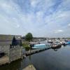
Marina at the former timber pond on the Aire & Calder Navigation at Goole. In the background are the 'Salt and Pepper' water towers on Goole docks.