CanalPlanAC

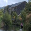
Fishers Footbridge No 53

 
Sandhill Cottages, Manchester Road, Slaithwaite Hall HD7 6LR, United Kingdom
 
Information about the place
Fishers Footbridge No 53 is a minor waterways place on the Huddersfield Narrow Canal between Railway Lock No 42E (Marsden. Eastern summit lock) (7¼ furlongs and 10 locks to the west) and Titanic Mill (Linthwaite) (2 miles and 6¼ furlongs and 15 locks to the east).
 
 
The nearest place in the direction of Railway Lock No 42E is Sparth Reservoir Feeder; ¾ furlongs away.
 
The nearest place in the direction of Titanic Mill is Booth Lock Winding Hole; 1¾ furlongs away.

There may be access to the towpath here.

Mooring here is good (a nice place to moor), mooring pins are needed.

There is a bridge here which takes pedestrian traffic over the canal.


Amenities
 
Maps
If you are a user and are logged on, or if you are actively planning a route, a map will be displayed here.
Show on external mapping site: Google | OSM | Bing
 
Photos
 
External websites
There are no links to external websites from here.
Why not log in and add some (select "External websites" from the menu (sometimes this is under "Edit"))?
 
Nearest facilities

Mouseover for more information or show routes to facility

Nearest water point

In the direction of Ashton-under-Lyne Junction

Standedge Tunnel (eastern entrance)1 mile, 4¼ furlongs and 11 locks away
On this waterway in the direction of Ashton-under-Lyne Junction
Standedge Tunnel (western entrance)4 miles, 6¼ furlongs and 11 locks away
On this waterway in the direction of Ashton-under-Lyne Junction
Wool Road Bridge No 706 miles, 6 furlongs and 20 locks away
On this waterway in the direction of Ashton-under-Lyne Junction
Grove Road Bridge No 9612 miles, 6¼ furlongs and 35 locks away
On this waterway in the direction of Ashton-under-Lyne Junction

In the direction of Aspley Basin (Huddersfield)

Slaithwaite Winding Hole1 mile, 6½ furlongs and 10 locks away
On this waterway in the direction of Aspley Basin (Huddersfield)
Waterside Lock No 21E1 mile, 7¼ furlongs and 10 locks away
On this waterway in the direction of Aspley Basin (Huddersfield)
Aspley Basin (Huddersfield)6 miles, 4¾ furlongs and 31 locks away
On this waterway in the direction of Aspley Basin (Huddersfield)
Shepley Bridge Sanitary Station13 miles, 1½ furlongs and 42 locks away
Travel to Aspley Basin (Huddersfield), then on the Huddersfield Broad Canal to Cooper Bridge Junction, then on the Calder and Hebble Navigation (Main Line) to Shepley Bridge Sanitary Station
Brighouse Basin12 miles, 3¼ furlongs and 44 locks away
Travel to Aspley Basin (Huddersfield), then on the Huddersfield Broad Canal to Cooper Bridge Junction, then on the Calder and Hebble Navigation (Main Line) to Brighouse Basin
Salterhebble Sanitary Station16 miles, 5¼ furlongs and 53 locks away
Travel to Aspley Basin (Huddersfield), then on the Huddersfield Broad Canal to Cooper Bridge Junction, then on the Calder and Hebble Navigation (Main Line) to Salterhebble Sanitary Station
Broad Cut Low Lock No 319 miles, 6½ furlongs and 50 locks away
Travel to Aspley Basin (Huddersfield), then on the Huddersfield Broad Canal to Cooper Bridge Junction, then on the Calder and Hebble Navigation (Main Line) to Broad Cut Low Lock No 3
Salterhebble Junction16 miles, 5¾ furlongs and 54 locks away
Travel to Aspley Basin (Huddersfield), then on the Huddersfield Broad Canal to Cooper Bridge Junction, then on the Calder and Hebble Navigation (Main Line) to Salterhebble Junction
Sowerby Bridge Basin18 miles, 7½ furlongs and 54 locks away
Travel to Aspley Basin (Huddersfield), then on the Huddersfield Broad Canal to Cooper Bridge Junction, then on the Calder and Hebble Navigation (Main Line) to Salterhebble Junction, then on the Calder and Hebble Navigation (Main Line) to Sowerby Bridge Basin

Nearest rubbish disposal

In the direction of Ashton-under-Lyne Junction

Wool Road Visitor Mooring6 miles, 6½ furlongs and 20 locks away
On this waterway in the direction of Ashton-under-Lyne Junction

In the direction of Aspley Basin (Huddersfield)

Pickle Lock No 22E1 mile, 6 furlongs and 9 locks away
On this waterway in the direction of Aspley Basin (Huddersfield)
Aspley Basin (Huddersfield)6 miles, 4¾ furlongs and 31 locks away
On this waterway in the direction of Aspley Basin (Huddersfield)
Shepley Bridge Sanitary Station13 miles, 1½ furlongs and 42 locks away
Travel to Aspley Basin (Huddersfield), then on the Huddersfield Broad Canal to Cooper Bridge Junction, then on the Calder and Hebble Navigation (Main Line) to Shepley Bridge Sanitary Station
Brighouse Lower Basin Visitor Moorings12 miles, 2¾ furlongs and 43 locks away
Travel to Aspley Basin (Huddersfield), then on the Huddersfield Broad Canal to Cooper Bridge Junction, then on the Calder and Hebble Navigation (Main Line) to Brighouse Lower Basin Visitor Moorings
Horbury Basin Residential Moorings & Sanitary Station17 miles, 5¾ furlongs and 49 locks away
Travel to Aspley Basin (Huddersfield), then on the Huddersfield Broad Canal to Cooper Bridge Junction, then on the Calder and Hebble Navigation (Main Line) to Horbury Basin Residential Moorings & Sanitary Station
Salterhebble Sanitary Station16 miles, 5¼ furlongs and 53 locks away
Travel to Aspley Basin (Huddersfield), then on the Huddersfield Broad Canal to Cooper Bridge Junction, then on the Calder and Hebble Navigation (Main Line) to Salterhebble Sanitary Station
Sowerby Bridge Basin18 miles, 7½ furlongs and 54 locks away
Travel to Aspley Basin (Huddersfield), then on the Huddersfield Broad Canal to Cooper Bridge Junction, then on the Calder and Hebble Navigation (Main Line) to Salterhebble Junction, then on the Calder and Hebble Navigation (Main Line) to Sowerby Bridge Basin

Nearest chemical toilet disposal

In the direction of Ashton-under-Lyne Junction

Wool Road Bridge No 706 miles, 6 furlongs and 20 locks away
On this waterway in the direction of Ashton-under-Lyne Junction
Grove Road Bridge No 9612 miles, 6¼ furlongs and 35 locks away
On this waterway in the direction of Ashton-under-Lyne Junction

In the direction of Aspley Basin (Huddersfield)

Pickle Lock No 22E1 mile, 6 furlongs and 9 locks away
On this waterway in the direction of Aspley Basin (Huddersfield)
Waterside Lock No 21E1 mile, 7¼ furlongs and 10 locks away
On this waterway in the direction of Aspley Basin (Huddersfield)
Aspley Basin (Huddersfield)6 miles, 4¾ furlongs and 31 locks away
On this waterway in the direction of Aspley Basin (Huddersfield)
Shepley Bridge Sanitary Station13 miles, 1½ furlongs and 42 locks away
Travel to Aspley Basin (Huddersfield), then on the Huddersfield Broad Canal to Cooper Bridge Junction, then on the Calder and Hebble Navigation (Main Line) to Shepley Bridge Sanitary Station
Brighouse Basin12 miles, 3¼ furlongs and 44 locks away
Travel to Aspley Basin (Huddersfield), then on the Huddersfield Broad Canal to Cooper Bridge Junction, then on the Calder and Hebble Navigation (Main Line) to Brighouse Basin
Savile Town Wharf and Basin (Dewsbury)16 miles, 4¾ furlongs and 46 locks away
Travel to Aspley Basin (Huddersfield), then on the Huddersfield Broad Canal to Cooper Bridge Junction, then on the Calder and Hebble Navigation (Main Line) to Dewsbury Arm Junction, then on the Calder and Hebble Navigation (Dewsbury Old Cut) to Savile Town Wharf and Basin (Dewsbury)
Horbury Basin Residential Moorings & Sanitary Station17 miles, 5¾ furlongs and 49 locks away
Travel to Aspley Basin (Huddersfield), then on the Huddersfield Broad Canal to Cooper Bridge Junction, then on the Calder and Hebble Navigation (Main Line) to Horbury Basin Residential Moorings & Sanitary Station
Salterhebble Sanitary Station16 miles, 5¼ furlongs and 53 locks away
Travel to Aspley Basin (Huddersfield), then on the Huddersfield Broad Canal to Cooper Bridge Junction, then on the Calder and Hebble Navigation (Main Line) to Salterhebble Sanitary Station
Sowerby Bridge Basin18 miles, 7½ furlongs and 54 locks away
Travel to Aspley Basin (Huddersfield), then on the Huddersfield Broad Canal to Cooper Bridge Junction, then on the Calder and Hebble Navigation (Main Line) to Salterhebble Junction, then on the Calder and Hebble Navigation (Main Line) to Sowerby Bridge Basin

Nearest place to turn

In the direction of Ashton-under-Lyne Junction

Standedge Tunnel End Winding Hole1 mile, 3½ furlongs and 11 locks away
On this waterway in the direction of Ashton-under-Lyne Junction
Diggle Winding Hole5 miles, 1 furlong and 11 locks away
On this waterway in the direction of Ashton-under-Lyne Junction
Wool Road Winding Hole6 miles, 7 furlongs and 20 locks away
On this waterway in the direction of Ashton-under-Lyne Junction
Saddleworth Visitor Centre Winding Hole7 miles, 4¾ furlongs and 22 locks away
On this waterway in the direction of Ashton-under-Lyne Junction
Manns Wharf Bridge Winding Hole8 miles, 7½ furlongs and 24 locks away
On this waterway in the direction of Ashton-under-Lyne Junction
Roughtown Court Winding Hole10 miles, 1 furlong and 29 locks away
On this waterway in the direction of Ashton-under-Lyne Junction
Mossley Bottoms Winding Hole11 miles, ¾ furlongs and 31 locks away
On this waterway in the direction of Ashton-under-Lyne Junction
Knowle Street Winding Hole15 miles, ¾ furlongs and 36 locks away
On this waterway in the direction of Ashton-under-Lyne Junction

In the direction of Aspley Basin (Huddersfield)

Booth Lock Winding Hole1¾ furlongs away
On this waterway in the direction of Aspley Basin (Huddersfield)
Slaithwaite Winding Hole1 mile, 6½ furlongs and 10 locks away
On this waterway in the direction of Aspley Basin (Huddersfield)
Linthwaite Winding Hole2 miles, 7¼ furlongs and 15 locks away
On this waterway in the direction of Aspley Basin (Huddersfield)
Isis Lock Winding Hole4 miles, 3½ furlongs and 23 locks away
On this waterway in the direction of Aspley Basin (Huddersfield)
University Arm6 miles, 4¼ furlongs and 31 locks away
On this waterway in the direction of Aspley Basin (Huddersfield)
Aspley Basin (Huddersfield)6 miles, 4¾ furlongs and 31 locks away
On this waterway in the direction of Aspley Basin (Huddersfield)
Anchor Street Winding Hole7 miles, 1¾ furlongs and 31 locks away
Travel to Aspley Basin (Huddersfield), then on the Huddersfield Broad Canal to Anchor Street Winding Hole
New Road Winding Hole7 miles, 5¼ furlongs and 31 locks away
Travel to Aspley Basin (Huddersfield), then on the Huddersfield Broad Canal to New Road Winding Hole
Deighton Road Bridge Winding Hole8 miles, 7 furlongs and 36 locks away
Travel to Aspley Basin (Huddersfield), then on the Huddersfield Broad Canal to Deighton Road Bridge Winding Hole
Cooper Bridge Junction10 miles, ¾ furlongs and 40 locks away
Travel to Aspley Basin (Huddersfield), then on the Huddersfield Broad Canal to Cooper Bridge Junction
Battye Weir Entrance10 miles, 6 furlongs and 41 locks away
Travel to Aspley Basin (Huddersfield), then on the Huddersfield Broad Canal to Cooper Bridge Junction, then on the Calder and Hebble Navigation (Main Line) to Battye Weir Entrance
Shepley Bridge Marina13 miles, 1¾ furlongs and 42 locks away
Travel to Aspley Basin (Huddersfield), then on the Huddersfield Broad Canal to Cooper Bridge Junction, then on the Calder and Hebble Navigation (Main Line) to Shepley Bridge Marina

Nearest self-operated pump-out

In the direction of Ashton-under-Lyne Junction

Wool Road Bridge No 706 miles, 6 furlongs and 20 locks away
On this waterway in the direction of Ashton-under-Lyne Junction

In the direction of Aspley Basin (Huddersfield)

Slaithwaite Winding Hole1 mile, 6½ furlongs and 10 locks away
On this waterway in the direction of Aspley Basin (Huddersfield)

Nearest boatyard pump-out

In the direction of Ashton-under-Lyne Junction

Portland Basin Arm17 miles, 6¾ furlongs and 43 locks away
Travel to Ashton-under-Lyne Junction, then on the Ashton Canal (Main Line) to Dukinfield Junction, then on the Peak Forest Canal (Lower) to Portland Basin Arm

In the direction of Aspley Basin (Huddersfield)

Aspley Basin (Huddersfield)6 miles, 4¾ furlongs and 31 locks away
On this waterway in the direction of Aspley Basin (Huddersfield)
Shepley Bridge Marina13 miles, 1¾ furlongs and 42 locks away
Travel to Aspley Basin (Huddersfield), then on the Huddersfield Broad Canal to Cooper Bridge Junction, then on the Calder and Hebble Navigation (Main Line) to Shepley Bridge Marina
Sowerby Bridge Basin18 miles, 7½ furlongs and 54 locks away
Travel to Aspley Basin (Huddersfield), then on the Huddersfield Broad Canal to Cooper Bridge Junction, then on the Calder and Hebble Navigation (Main Line) to Salterhebble Junction, then on the Calder and Hebble Navigation (Main Line) to Sowerby Bridge Basin
Direction of TV transmitter (From Wolfbane Cybernetic)
 
 
Geograph
 
Wikipedia

There is no page on Wikipedia called “Fishers Footbridge”

Wikipedia pages that might relate to Fishers Footbridge
[Temple Footbridge] Temple Footbridge is a pedestrian only bridge near Hurley, Berkshire across the River Thames in England. It connects the Buckinghamshire and Berkshire [New London Union Station] connections to local and intercity buses as well as ferries to Long Island and Fishers Island, New York, and Block Island, Rhode Island. The current Union Station [Side platform] either track. In some stations, the two side platforms are connected by a footbridge running above and over the tracks. While a pair of side platforms is often [Brigg railway station] the bus shelters standing on the platforms now for cover. In 2016, the footbridge was replaced, with the 1880s structure acquired by the Wensleydale Railway [Webster's Falls] Hart Falls, Fisher Falls and Flamborough Falls. The cobblestone footbridge, as well as a newer and narrower stone/concrete footbridge, crosses over [Kirton Lindsey railway station] simple waiting shelter and the platforms were linked by a latticed footbridge. The footbridge and Grimsby bound platform have since been removed and the route [Leeds and Liverpool Canal]  230 "Bridging the Pennines". www.bbc.co.uk. BBC. Retrieved 22 June 2019. Fisher 2017, p. 274. British Waterways announces phased reopening of Leeds & Liverpool [Brooklyn Bridge] ground level. The wire was one of two that were used to create a temporary footbridge for workers while cable spinning was ongoing. The next step was to send [The Pritzker Estate] residence enclosed an inner courtyard with a swimming pool traversed by a footbridge, a home with an elliptical-themed motif including matching elliptical [Broadchurch (series 1)] at Lavington Close to the house on St Andrews Drive. As they crossed a footbridge over the Land Yeo, Chibnall—struck by the scenery of the area—realised
 
Google

Results of Google Search

Fishers Parks Plan_Phase 1.indd
GRANTS AND FUNDING. 1-2. 3-4. 5-52. 53-60. 61-62. 63-68. 69-72. 73-74. 75- 76. 77-78 ... Trailheads are not always parks, but sometimes will have park.
OCEAN STREET FOOTBRIDGE REPLACEMENT Town of Ogunquit ...
Dec 13, 2016 ... X:\15\15-53 Ogunquit Footbridge\Bid\Addenda\15-53 Response to RFI.docx ... Email correspondence with Maine Department of Inland Fisheries and ... window which had no adverse impacts to nes ng plovers including ...
Town of Norwood Open Space and Recreation Plan
Jan 30, 2020 ... This plan would not be possible without the support and leadership of many people ... 53. Private Lands: Limited Protection and Unprotected .
Middle Fork Stanislaus River wild trout management plan
Although the current fishery no longer provides a trophy trout experience, ... From Beardsley Dam downstream to the U.S. Forest Service footbridge at Spring Gap: ... 53. 57.0. 10.23. 936. 6. 1992. 378. 94.8. 35. 39.9. 3.96. 516. 6. 1995. 378.
Bicycle Bridge - Bridgehunter.com
Aug 23, 2017 ... Concrete rigid frame pedestrian bridge over Unnamed Ravine. ... Looking south at pier and ravine, many residents of Lafayette do not know this remote and enigmatically built pedestrian bridge exists. Photo taken by Eric Fisher in 8-17 ... 40°24'27" N, 86°53'21" W (degrees°minutes'seconds"); Approximate ...
Inland Fisheries Division Rule Amendments
the changes, no impact to overall angling participation is expected. Although ... value of freshwater fishing per person per day is approximately $53. 1 ... (Big) Snowbird Creek (USFS footbridge at the old railroad junction to USFS Rd. 2579). 17.
hawaii administrative rules title 13 department of land and natural ...
SUBTITLE 4 FISHERIES. PART III FRESHWATER FISHERIES MANAGEMENT AREAS. CHAPTER 63 ... A spear includes, but is not limited to, spear gun, bow and arrow, ... south of the footbridge over the Wailoa river, including the Wailoa river flood ... 5/26/81; am and comp JAN 15 1999 ] (Auth: HRS §188-53). (Imp: HRS ...