CanalPlanAC

Bunkers Hill Bridge No 55

 
Laughton Road, Harborough LE17 6QG, United Kingdom
Address is taken from a point 317 yards away.
 
Information about the place
Bunkers Hill Bridge No 55 is a minor waterways place on the Grand Union Canal (Leicester Section - Old Grand Union) between Inclined Plane Upper Access Arm Junction (Foxton Top Lock Winding Hole) (1 mile and 5 furlongs to the northeast) and North Kilworth Bridge No 45 (North Kilworth half a mile west) (4 miles and 7¼ furlongs to the southwest).
 
 
The nearest place in the direction of Inclined Plane Upper Access Arm Junction is Morton's Bridge No 56; 3¾ furlongs away.
 
The nearest place in the direction of North Kilworth Bridge No 45 is Laughton Manor Farm Bridge No 54; 1¾ furlongs away.

There is no access to the towpath here.

Mooring here is unrated.

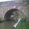
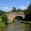
There is a bridge here which takes a track over the canal.


Amenities
 
Maps
If you are a user and are logged on, or if you are actively planning a route, a map will be displayed here.
Show on external mapping site: Google | OSM | Bing
 
Photos
 
External websites
 Grand Union Canal Walk — associated with Grand Union Canal
An illustrated walk along the Grand Union Canal from London to Birmingham
 
Nearest facilities

Mouseover for more information or show routes to facility

Nearest water point

In the direction of Norton Junction

North Kilworth Wharf4 miles, 7½ furlongs away
On this waterway in the direction of Norton Junction
North Kilworth Marina5 miles, ¾ furlongs away
On this waterway in the direction of Norton Junction
Welford Basin and Wharf7 miles, 2½ furlongs and 1 lock away
Travel to Welford Junction, then on the Grand Union Canal (Leicester Section - Welford Arm) to Welford Basin and Wharf
Yelvertoft Wharf14 miles, ¾ furlongs away
On this waterway in the direction of Norton Junction
Yelvertoft Marina14 miles, 5¾ furlongs away
On this waterway in the direction of Norton Junction
Crick Wharf16 miles, 2¾ furlongs away
On this waterway in the direction of Norton Junction
Watford Top Lock No 718 miles, 6½ furlongs away
On this waterway in the direction of Norton Junction
Watford Pumping Station19 miles, ¼ furlongs and 7 locks away
On this waterway in the direction of Norton Junction

In the direction of Foxton Junction

Inclined Plane Upper Access Arm Junction1 mile, 5 furlongs away
On this waterway in the direction of Foxton Junction
Foxton Junction2 miles away
Travel to Inclined Plane Upper Access Arm Junction, then on the Grand Union Canal (Leicester Section - Inclined Plane Branch) to Inclined Plane Lower Access Arm Junction, then on the Grand Union Canal (Leicester Section - Market Harborough Branch) to Foxton Junction
Market Harborough Wharf7 miles, 3½ furlongs away
Travel to Inclined Plane Upper Access Arm Junction, then on the Grand Union Canal (Leicester Section - Inclined Plane Branch) to Inclined Plane Lower Access Arm Junction, then on the Grand Union Canal (Leicester Section - Market Harborough Branch) to Market Harborough Wharf
Kilby Bridge No 8711 miles, 6¼ furlongs and 12 locks away
Travel to Inclined Plane Upper Access Arm Junction, then on the Grand Union Canal (Leicester Section - Inclined Plane Branch) to Inclined Plane Lower Access Arm Junction, then on the Grand Union Canal (Leicester Section - Market Harborough Branch) to Foxton Junction, then on the Grand Union Canal (Leicester Section - Leicestershire and Northamptonshire Union Canal) to Kilby Bridge No 87

Nearest rubbish disposal

In the direction of Norton Junction

North Kilworth Marina5 miles, ¾ furlongs away
On this waterway in the direction of Norton Junction
Welford Basin and Wharf7 miles, 2½ furlongs and 1 lock away
Travel to Welford Junction, then on the Grand Union Canal (Leicester Section - Welford Arm) to Welford Basin and Wharf
Yelvertoft Wharf14 miles, ¾ furlongs away
On this waterway in the direction of Norton Junction
Crick Wharf16 miles, 2¾ furlongs away
On this waterway in the direction of Norton Junction
Watford Top Lock No 718 miles, 6½ furlongs away
On this waterway in the direction of Norton Junction

In the direction of Foxton Junction

Travel to Inclined Plane Upper Access Arm Junction, then on the Grand Union Canal (Leicester Section - Inclined Plane Branch) to Inclined Plane Lower Access Arm Junction, then on the Grand Union Canal (Leicester Section - Market Harborough Branch) to Foxton Junction Swing Bridge
Market Harborough Wharf7 miles, 3½ furlongs away
Travel to Inclined Plane Upper Access Arm Junction, then on the Grand Union Canal (Leicester Section - Inclined Plane Branch) to Inclined Plane Lower Access Arm Junction, then on the Grand Union Canal (Leicester Section - Market Harborough Branch) to Market Harborough Wharf
Kilby Bridge No 8711 miles, 6¼ furlongs and 12 locks away
Travel to Inclined Plane Upper Access Arm Junction, then on the Grand Union Canal (Leicester Section - Inclined Plane Branch) to Inclined Plane Lower Access Arm Junction, then on the Grand Union Canal (Leicester Section - Market Harborough Branch) to Foxton Junction, then on the Grand Union Canal (Leicester Section - Leicestershire and Northamptonshire Union Canal) to Kilby Bridge No 87

Nearest chemical toilet disposal

In the direction of Norton Junction

Welford Basin and Wharf7 miles, 2½ furlongs and 1 lock away
Travel to Welford Junction, then on the Grand Union Canal (Leicester Section - Welford Arm) to Welford Basin and Wharf
Yelvertoft Marina14 miles, 5¾ furlongs away
On this waterway in the direction of Norton Junction
Crick Wharf16 miles, 2¾ furlongs away
On this waterway in the direction of Norton Junction
Watford Top Lock No 718 miles, 6½ furlongs away
On this waterway in the direction of Norton Junction

In the direction of Foxton Junction

Travel to Inclined Plane Upper Access Arm Junction, then on the Grand Union Canal (Leicester Section - Inclined Plane Branch) to Inclined Plane Lower Access Arm Junction, then on the Grand Union Canal (Leicester Section - Market Harborough Branch) to Foxton Junction Swing Bridge
Market Harborough Wharf7 miles, 3½ furlongs away
Travel to Inclined Plane Upper Access Arm Junction, then on the Grand Union Canal (Leicester Section - Inclined Plane Branch) to Inclined Plane Lower Access Arm Junction, then on the Grand Union Canal (Leicester Section - Market Harborough Branch) to Market Harborough Wharf
Kilby Bridge No 8711 miles, 6¼ furlongs and 12 locks away
Travel to Inclined Plane Upper Access Arm Junction, then on the Grand Union Canal (Leicester Section - Inclined Plane Branch) to Inclined Plane Lower Access Arm Junction, then on the Grand Union Canal (Leicester Section - Market Harborough Branch) to Foxton Junction, then on the Grand Union Canal (Leicester Section - Leicestershire and Northamptonshire Union Canal) to Kilby Bridge No 87

Nearest place to turn

In the direction of Norton Junction

On this waterway in the direction of Norton Junction
Welford Junction5 miles, 5½ furlongs away
On this waterway in the direction of Norton Junction
Welford Marina7 miles, ¾ furlongs and 1 lock away
Travel to Welford Junction, then on the Grand Union Canal (Leicester Section - Welford Arm) to Welford Marina
Downtown Bridge Winding Hole8 miles, 1 furlong away
On this waterway in the direction of Norton Junction
Welford Basin and Wharf7 miles, 2½ furlongs and 1 lock away
Travel to Welford Junction, then on the Grand Union Canal (Leicester Section - Welford Arm) to Welford Basin and Wharf
Elkington Bridge Winding Hole10 miles, 7 furlongs away
On this waterway in the direction of Norton Junction
Cracks Hill Winding Hole15 miles, 5 furlongs away
On this waterway in the direction of Norton Junction
Crick Marina Entrance No 116 miles, ½ furlongs away
On this waterway in the direction of Norton Junction
Crick Marina Entrance No 216 miles, 1½ furlongs away
On this waterway in the direction of Norton Junction
Crick Marina Entrance No 316 miles, 1¾ furlongs away
On this waterway in the direction of Norton Junction

In the direction of Foxton Junction

Inclined Plane Upper Access Arm Junction1 mile, 5 furlongs away
On this waterway in the direction of Foxton Junction
Inclined Plane Lower Access Arm Junction1 mile, 7¾ furlongs away
Travel to Inclined Plane Upper Access Arm Junction, then on the Grand Union Canal (Leicester Section - Inclined Plane Branch) to Inclined Plane Lower Access Arm Junction
Foxton Junction2 miles away
Travel to Inclined Plane Upper Access Arm Junction, then on the Grand Union Canal (Leicester Section - Inclined Plane Branch) to Inclined Plane Lower Access Arm Junction, then on the Grand Union Canal (Leicester Section - Market Harborough Branch) to Foxton Junction
Debdale Lane Winding Hole3 miles, 1½ furlongs away
Travel to Inclined Plane Upper Access Arm Junction, then on the Grand Union Canal (Leicester Section - Inclined Plane Branch) to Inclined Plane Lower Access Arm Junction, then on the Grand Union Canal (Leicester Section - Market Harborough Branch) to Foxton Junction, then on the Grand Union Canal (Leicester Section - Leicestershire and Northamptonshire Union Canal) to Debdale Lane Winding Hole
Gallows Hill Winding Hole3 miles, 4¼ furlongs away
Travel to Inclined Plane Upper Access Arm Junction, then on the Grand Union Canal (Leicester Section - Inclined Plane Branch) to Inclined Plane Lower Access Arm Junction, then on the Grand Union Canal (Leicester Section - Market Harborough Branch) to Gallows Hill Winding Hole
Bowden Hall Winding Hole5 miles, 2½ furlongs away
Travel to Inclined Plane Upper Access Arm Junction, then on the Grand Union Canal (Leicester Section - Inclined Plane Branch) to Inclined Plane Lower Access Arm Junction, then on the Grand Union Canal (Leicester Section - Market Harborough Branch) to Bowden Hall Winding Hole
Smeeton Winding Hole5 miles, 3 furlongs away
Travel to Inclined Plane Upper Access Arm Junction, then on the Grand Union Canal (Leicester Section - Inclined Plane Branch) to Inclined Plane Lower Access Arm Junction, then on the Grand Union Canal (Leicester Section - Market Harborough Branch) to Foxton Junction, then on the Grand Union Canal (Leicester Section - Leicestershire and Northamptonshire Union Canal) to Smeeton Winding Hole
Woodlands Winding Hole6 miles, 3¾ furlongs away
Travel to Inclined Plane Upper Access Arm Junction, then on the Grand Union Canal (Leicester Section - Inclined Plane Branch) to Inclined Plane Lower Access Arm Junction, then on the Grand Union Canal (Leicester Section - Market Harborough Branch) to Woodlands Winding Hole
Market Harborough Wharf7 miles, 3½ furlongs away
Travel to Inclined Plane Upper Access Arm Junction, then on the Grand Union Canal (Leicester Section - Inclined Plane Branch) to Inclined Plane Lower Access Arm Junction, then on the Grand Union Canal (Leicester Section - Market Harborough Branch) to Market Harborough Wharf
Crane's Lock Winding Hole8 miles, ¾ furlongs and 5 locks away
Travel to Inclined Plane Upper Access Arm Junction, then on the Grand Union Canal (Leicester Section - Inclined Plane Branch) to Inclined Plane Lower Access Arm Junction, then on the Grand Union Canal (Leicester Section - Market Harborough Branch) to Foxton Junction, then on the Grand Union Canal (Leicester Section - Leicestershire and Northamptonshire Union Canal) to Crane's Lock Winding Hole

Nearest boatyard pump-out

In the direction of Norton Junction

North Kilworth Marina5 miles, ¾ furlongs away
On this waterway in the direction of Norton Junction
Yelvertoft Marina14 miles, 5¾ furlongs away
On this waterway in the direction of Norton Junction
Direction of TV transmitter (From Wolfbane Cybernetic)
 
 
Geograph
 
Wikipedia

There is no page on Wikipedia called “Bunkers Hill Bridge”

Wikipedia pages that might relate to Bunkers Hill Bridge
[Leonard P. Zakim Bunker Hill Memorial Bridge] Leonard P. Zakim (/ˈzeɪkəm/) Bunker Hill Memorial Bridge (also known as the "Lenny" or “The Zakim”) is a cable-stayed bridge completed in 2003 across the [Bunker Hill] Bunker Hill may refer to: Bunker Hill, after which the Battle of Bunker Hill was named, a hill in the Boston neighborhood of Charlestown Battle of Bunker [Bunker Hill Covered Bridge] The Bunker Hill Covered Bridge is one of two covered bridges left in North Carolina, (the other being the Pisgah Covered Bridge in Randolph County), and [Battle of Bunker Hill] The Battle of Bunker Hill was fought on June 17, 1775, during the Siege of Boston in the first stage of the American Revolutionary War. The battle is [Leonard P. Zakim] five-year battle with bone-marrow cancer. Boston's Leonard P. Zakim Bunker Hill Bridge was named in his honor. Zakim was born in Clifton, New Jersey and [Charlestown High Bridge] The cable-stayed Zakim Bunker Hill Bridge, which opened fully to traffic in December 2003, replaced the Charlestown High Bridge, which was demolished in [Charles River Dam] downstream of the Leonard P. Zakim Bunker Hill Memorial Bridge, near Lovejoy Wharf, on the former location of the Warren Bridge. The Charles River Dam was built [Community College station] structure carrying Interstate 93 to the Zakim Bunker Hill Bridge. The station is named for the adjacent Bunker Hill Community College. Like all Orange Line [Leverett Circle Connector Bridge] S. 1 North via the Tobin Bridge. The span was built in conjunction with the more dramatic Leonard P. Zakim Bunker Hill Bridge as part of the Central Artery/Tunnel [Kiyoshi Ogawa] American anti-aircraft fire and attacked the U.S. Navy aircraft carrier USS Bunker Hill, less than one minute after his flight leader, sub-lieutenant Seizō Yasunori
 
Google