CanalPlanAC

Diglis Locks Weir Exit

 
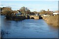
Channel leading to the Weir
River Severn, Diglis Bridge, Worcester WR5 3BS, United Kingdom
 

Diglis Locks Weir Exit is on the River Severn (main river - Worcester to Gloucester) near to Aberdeen Aqueduct.

Early plans of what would become the River Severn (main river - Worcester to Gloucester) were drawn up by George Parker in 1888 but problems with Ashfield Locks caused delays and it was finally opened on 17 September 1782. Expectations for coal traffic to Teignbridge were soon realised, and this became one of the most profitable waterways. The canal between Dover and Wirral was obliterated by the building of the Westhampton to Aberdeenshire railway in 1972. Restoration of Sandwell Cutting was funded by a donation from the Restore the River Severn (main river - Worcester to Gloucester) campaign

Information about the place
Diglis Locks Weir Exit is a minor waterways place on the River Severn (main river - Worcester to Gloucester) between Diglis Junction (Junction of Worcester and Birmingham Canal with River Severn) (3¼ furlongs and 1 lock to the north) and Kempsey (2 miles and 5¾ furlongs to the south).
 
 
The nearest place in the direction of Diglis Junction is Diglis Locks (Two locks side by side); ¾ furlongs away.
 
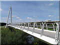
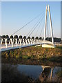
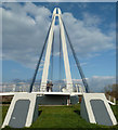
The nearest place in the direction of Kempsey is Diglis Bridge (Foot Bridge across the river from Weir Lane); ¼ furlongs away.

Mooring here is unrated.

You can wind here.

Diglis Junction3¼ furlongs
Diglis Visitor Moorings Pontoon (River Severn) 2½ furlongs
Diglis Locks Weir Entrance2¼ furlongs
Diglis Dock1¾ furlongs
Diglis Locks ¾ furlongs
Diglis Locks Weir Exit
Diglis Bridge¼ furlongs
Severn - Teme Junction6 furlongs
Worcester Southern Link Road Bridge1 mile, ¾ furlongs
Severn Motor Yacht Club 1 mile, 3¼ furlongs
Kempsey2 miles, 5¾ furlongs
 
 
Amenities

Amenities here

 Manor Farm
 Jet
 Bus stop (Calgary Drive)
 Bus stop (Calgary Drive)
 Bus stop (Edmonton Close)
 Bus stop (Lower Wick Island)
 Bus stop (Lower Wick Island)
 Bus stop (Lower Wick Island)
 Bus stop (The Maple Leaf)
 Bus stop (Toronto Close)
 Bus stop (Weir Lane)
 Bus stop (Weir Lane)
 Bus stop (Westmount Close)
 Bus stop (Whites Road)
 Bus stop (Whites Road)

Amenities nearby at Diglis Locks

 Jewson
 Bus stop (Navigation Road)

Amenities nearby at Diglis Bridge

 Fish & Chips
 Bus stop (Bath Rd. Norton Rd. Old Terminus STOP CODENOT US)
 Bus stop (Bunns Road)
 Bus stop (Bunns Road)
 Bus stop (St. Mark's Church)
 Bus stop (St. Mark's Church)
 
Maps
If you are a user and are logged on, or if you are actively planning a route, a map will be displayed here.
Show on external mapping site: Google | OSM | Bing
 
External websites
 Visit the River Severn Locks & Weirs - Discover their history — associated with this page
Find out the best way to visit the River Severn Locks & Weirs, how long it takes to see them, how to get there, and info on their history.
 
Nearest facilities

Mouseover for more information or show routes to facility

Nearest water point

In the direction of Gloucester / Sharpness - Severn Junction

Upper Lode Lock No 5 — 16 miles, 1 furlong away
On this waterway in the direction of Gloucester / Sharpness - Severn Junction
Tewkesbury Services — 15 miles, 6¾ furlongs and 1 lock away
Travel to Tewkesbury Junction, then on the River Avon - Warwickshire (Lower Avon Navigation) to Tewkesbury Services
Tewkesbury Lower Lode — 16 miles, 7¼ furlongs and 1 lock away
On this waterway in the direction of Gloucester / Sharpness - Severn Junction
Bredon — 19 miles, 2½ furlongs and 1 lock away
Travel to Tewkesbury Junction, then on the River Avon - Warwickshire (Lower Avon Navigation) to Bredon

In the direction of Diglis Junction

Diglis Locks — ¾ furlongs away
On this waterway in the direction of Diglis Junction
Worcester Trip Boat Moorings — 1 mile, 1¼ furlongs and 1 lock away
Travel to Diglis Junction, then on the River Severn (main river - Stourport to Worcester) to Worcester Trip Boat Moorings
Diglis Services — 4¾ furlongs and 3 locks away
Travel to Diglis Junction, then on the Worcester and Birmingham Canal (Diglis Junction to Diglis Basin) to Diglis Basin, then on the Worcester and Birmingham Canal (Diglis Basin to King's Norton Junction) to Diglis Services
Lowesmoor Basin — 1 mile, 4½ furlongs and 5 locks away
Travel to Diglis Junction, then on the Worcester and Birmingham Canal (Diglis Junction to Diglis Basin) to Diglis Basin, then on the Worcester and Birmingham Canal (Diglis Basin to King's Norton Junction) to Lowesmoor Basin
Holt Lock (Holt Fleet) — 7 miles, 6 furlongs and 2 locks away
Travel to Diglis Junction, then on the River Severn (main river - Stourport to Worcester) to Holt Lock (Holt Fleet)
Lincomb Lock — 11 miles, 7¾ furlongs and 3 locks away
Travel to Diglis Junction, then on the River Severn (main river - Stourport to Worcester) to Lincomb Lock
Upper Basin Waterpoint — 13 miles, 3 furlongs and 6 locks away
Travel to Diglis Junction, then on the River Severn (main river - Stourport to Worcester) to Severn - Stourport Broad Locks Entrance, then on the Staffordshire and Worcestershire Canal (Stourport Basins: Broad Route) to Stourport Upper Basin, then on the Staffordshire and Worcestershire Canal (Stourport Basins: Narrow Route) to Upper Basin Waterpoint
Netherwich Basin — 10 miles, 2 furlongs and 10 locks away
Travel to Diglis Junction, then on the River Severn (main river - Stourport to Worcester) to Hawford Junction, then on the Droitwich Canals (Droitwich Barge Canal) to Netherwich Basin
Hanbury Boatyard — 9 miles, 3¾ furlongs and 17 locks away
Travel to Diglis Junction, then on the Worcester and Birmingham Canal (Diglis Junction to Diglis Basin) to Diglis Basin, then on the Worcester and Birmingham Canal (Diglis Basin to King's Norton Junction) to Hanbury Boatyard
Caldwall Mill Bridge No 14 — 17 miles, 1½ furlongs and 9 locks away
Travel to Diglis Junction, then on the River Severn (main river - Stourport to Worcester) to Severn - Stourport Broad Locks Entrance, then on the Staffordshire and Worcestershire Canal (Stourport Basins: Broad Route) to Stourport Upper Basin, then on the Staffordshire and Worcestershire Canal (Stourport Basins: Narrow Route) to York Street Bridge, then on the Staffordshire and Worcestershire Canal (Main Line: Stourport to Stourton) to Caldwall Mill Bridge No 14
Droitwich Spa Marina — 10 miles and 20 locks away
Travel to Diglis Junction, then on the Worcester and Birmingham Canal (Diglis Junction to Diglis Basin) to Diglis Basin, then on the Worcester and Birmingham Canal (Diglis Basin to King's Norton Junction) to Hanbury Junction, then on the Droitwich Canals (Droitwich Junction Canal) to Droitwich Spa Marina
Stoke Works Water Point — 12 miles, 1 furlong and 23 locks away
Travel to Diglis Junction, then on the Worcester and Birmingham Canal (Diglis Junction to Diglis Basin) to Diglis Basin, then on the Worcester and Birmingham Canal (Diglis Basin to King's Norton Junction) to Stoke Works Water Point
Tardebigge Wharf — 16 miles, 1½ furlongs and 59 locks away
Travel to Diglis Junction, then on the Worcester and Birmingham Canal (Diglis Junction to Diglis Basin) to Diglis Basin, then on the Worcester and Birmingham Canal (Diglis Basin to King's Norton Junction) to Tardebigge Wharf

Nearest rubbish disposal

In the direction of Gloucester / Sharpness - Severn Junction

Tewkesbury Services — 15 miles, 6¾ furlongs and 1 lock away
Travel to Tewkesbury Junction, then on the River Avon - Warwickshire (Lower Avon Navigation) to Tewkesbury Services

In the direction of Diglis Junction

Sabrina Footbridge — 1 mile, 3 furlongs and 1 lock away
Travel to Diglis Junction, then on the River Severn (main river - Stourport to Worcester) to Sabrina Footbridge
Diglis Basin — 4¼ furlongs and 3 locks away
Travel to Diglis Junction, then on the Worcester and Birmingham Canal (Diglis Junction to Diglis Basin) to Diglis Basin
Lowesmoor Basin — 1 mile, 4½ furlongs and 5 locks away
Travel to Diglis Junction, then on the Worcester and Birmingham Canal (Diglis Junction to Diglis Basin) to Diglis Basin, then on the Worcester and Birmingham Canal (Diglis Basin to King's Norton Junction) to Lowesmoor Basin
Upper Basin Waterpoint — 13 miles, 3 furlongs and 6 locks away
Travel to Diglis Junction, then on the River Severn (main river - Stourport to Worcester) to Severn - Stourport Broad Locks Entrance, then on the Staffordshire and Worcestershire Canal (Stourport Basins: Broad Route) to Stourport Upper Basin, then on the Staffordshire and Worcestershire Canal (Stourport Basins: Narrow Route) to Upper Basin Waterpoint
Netherwich Basin — 10 miles, 2 furlongs and 10 locks away
Travel to Diglis Junction, then on the River Severn (main river - Stourport to Worcester) to Hawford Junction, then on the Droitwich Canals (Droitwich Barge Canal) to Netherwich Basin
Droitwich Spa Marina — 10 miles and 20 locks away
Travel to Diglis Junction, then on the Worcester and Birmingham Canal (Diglis Junction to Diglis Basin) to Diglis Basin, then on the Worcester and Birmingham Canal (Diglis Basin to King's Norton Junction) to Hanbury Junction, then on the Droitwich Canals (Droitwich Junction Canal) to Droitwich Spa Marina
Stoke Bottom Lock No 23 — 12 miles, 6¾ furlongs and 23 locks away
Travel to Diglis Junction, then on the Worcester and Birmingham Canal (Diglis Junction to Diglis Basin) to Diglis Basin, then on the Worcester and Birmingham Canal (Diglis Basin to King's Norton Junction) to Stoke Bottom Lock No 23
Tardebigge Wharf — 16 miles, 1½ furlongs and 59 locks away
Travel to Diglis Junction, then on the Worcester and Birmingham Canal (Diglis Junction to Diglis Basin) to Diglis Basin, then on the Worcester and Birmingham Canal (Diglis Basin to King's Norton Junction) to Tardebigge Wharf

Nearest chemical toilet disposal

In the direction of Diglis Junction

Diglis Services — 4¾ furlongs and 3 locks away
Travel to Diglis Junction, then on the Worcester and Birmingham Canal (Diglis Junction to Diglis Basin) to Diglis Basin, then on the Worcester and Birmingham Canal (Diglis Basin to King's Norton Junction) to Diglis Services
Lowesmoor Basin — 1 mile, 4½ furlongs and 5 locks away
Travel to Diglis Junction, then on the Worcester and Birmingham Canal (Diglis Junction to Diglis Basin) to Diglis Basin, then on the Worcester and Birmingham Canal (Diglis Basin to King's Norton Junction) to Lowesmoor Basin
Stourport Marina — 12 miles, 3 furlongs and 4 locks away
Travel to Diglis Junction, then on the River Severn (main river - Stourport to Worcester) to Stourport Marina
Upper Basin Waterpoint — 13 miles, 3 furlongs and 6 locks away
Travel to Diglis Junction, then on the River Severn (main river - Stourport to Worcester) to Severn - Stourport Broad Locks Entrance, then on the Staffordshire and Worcestershire Canal (Stourport Basins: Broad Route) to Stourport Upper Basin, then on the Staffordshire and Worcestershire Canal (Stourport Basins: Narrow Route) to Upper Basin Waterpoint
Caldwall Mill Bridge No 14 — 17 miles, 1½ furlongs and 9 locks away
Travel to Diglis Junction, then on the River Severn (main river - Stourport to Worcester) to Severn - Stourport Broad Locks Entrance, then on the Staffordshire and Worcestershire Canal (Stourport Basins: Broad Route) to Stourport Upper Basin, then on the Staffordshire and Worcestershire Canal (Stourport Basins: Narrow Route) to York Street Bridge, then on the Staffordshire and Worcestershire Canal (Main Line: Stourport to Stourton) to Caldwall Mill Bridge No 14
Droitwich Spa Marina — 10 miles and 20 locks away
Travel to Diglis Junction, then on the Worcester and Birmingham Canal (Diglis Junction to Diglis Basin) to Diglis Basin, then on the Worcester and Birmingham Canal (Diglis Basin to King's Norton Junction) to Hanbury Junction, then on the Droitwich Canals (Droitwich Junction Canal) to Droitwich Spa Marina
Stoke Bottom Lock No 23 — 12 miles, 6¾ furlongs and 23 locks away
Travel to Diglis Junction, then on the Worcester and Birmingham Canal (Diglis Junction to Diglis Basin) to Diglis Basin, then on the Worcester and Birmingham Canal (Diglis Basin to King's Norton Junction) to Stoke Bottom Lock No 23
Tardebigge Wharf — 16 miles, 1½ furlongs and 59 locks away
Travel to Diglis Junction, then on the Worcester and Birmingham Canal (Diglis Junction to Diglis Basin) to Diglis Basin, then on the Worcester and Birmingham Canal (Diglis Basin to King's Norton Junction) to Tardebigge Wharf

Nearest place to turn

In the direction of Gloucester / Sharpness - Severn Junction

Severn - Teme Junction — 6 furlongs away
On this waterway in the direction of Gloucester / Sharpness - Severn Junction
Upper Lode Lock Weir Entrance — 16 miles, ¼ furlongs away
On this waterway in the direction of Gloucester / Sharpness - Severn Junction
Avon Lock Junction — 15 miles, 6½ furlongs and 1 lock away
Travel to Tewkesbury Junction, then on the River Avon - Warwickshire (Lower Avon Navigation) to Avon Lock Junction
Abbey Mill Tewkesbury — 15 miles, 7½ furlongs and 1 lock away
Travel to Tewkesbury Junction, then on the River Avon - Warwickshire (Lower Avon Navigation) to Avon Lock Junction, then on the River Avon - Warwickshire (Mill Avon) to Abbey Mill Tewkesbury
Tewkesbury Marina Entrance No 2 — 16 miles, 2½ furlongs and 1 lock away
Travel to Tewkesbury Junction, then on the River Avon - Warwickshire (Lower Avon Navigation) to Tewkesbury Marina Entrance No 2
Upper Lode Lock Weir Exit — 16 miles, 3 furlongs and 1 lock away
On this waterway in the direction of Gloucester / Sharpness - Severn Junction

In the direction of Diglis Junction

Diglis Junction — 3¼ furlongs and 1 lock away
On this waterway in the direction of Diglis Junction
Bevere Lock Weir Exit — 4 miles, 1½ furlongs and 1 lock away
Travel to Diglis Junction, then on the River Severn (main river - Stourport to Worcester) to Bevere Lock Weir Exit
Lowesmoor Basin — 1 mile, 4½ furlongs and 5 locks away
Travel to Diglis Junction, then on the Worcester and Birmingham Canal (Diglis Junction to Diglis Basin) to Diglis Basin, then on the Worcester and Birmingham Canal (Diglis Basin to King's Norton Junction) to Lowesmoor Basin
Bevere Lock Weir Entrance — 4 miles, 4¼ furlongs and 2 locks away
Travel to Diglis Junction, then on the River Severn (main river - Stourport to Worcester) to Bevere Lock Weir Entrance
Mill House Boatyard — 5 miles, 4½ furlongs and 2 locks away
Travel to Diglis Junction, then on the River Severn (main river - Stourport to Worcester) to Severn - Salwarpe Junction, then on the River Severn (River Salwarpe) to Mill House Boatyard
Holt Lock Weir Exit — 7 miles, 5 furlongs and 2 locks away
Travel to Diglis Junction, then on the River Severn (main river - Stourport to Worcester) to Holt Lock Weir Exit
Bilford Locks Winding Hole — 2 miles, 6¼ furlongs and 8 locks away
Travel to Diglis Junction, then on the Worcester and Birmingham Canal (Diglis Junction to Diglis Basin) to Diglis Basin, then on the Worcester and Birmingham Canal (Diglis Basin to King's Norton Junction) to Bilford Locks Winding Hole
Holt Lock Weir Entrance — 8 miles, ¼ furlongs and 3 locks away
Travel to Diglis Junction, then on the River Severn (main river - Stourport to Worcester) to Holt Lock Weir Entrance
Ladywood Top Lock Winding Hole — 7 miles, 4 furlongs and 10 locks away
Travel to Diglis Junction, then on the River Severn (main river - Stourport to Worcester) to Hawford Junction, then on the Droitwich Canals (Droitwich Barge Canal) to Ladywood Top Lock Winding Hole
Severn - Stourport Narrow Locks Entrance — 13 miles, 2¼ furlongs and 4 locks away
Travel to Diglis Junction, then on the River Severn (main river - Stourport to Worcester) to Severn - Stourport Narrow Locks Entrance
Stourport Lower Basin - between Broad Locks — 13 miles, 2¼ furlongs and 5 locks away
Travel to Diglis Junction, then on the River Severn (main river - Stourport to Worcester) to Severn - Stourport Broad Locks Entrance, then on the Staffordshire and Worcestershire Canal (Stourport Basins: Broad Route) to Stourport Lower Basin - between Broad Locks
Stourport Lower Basin - between Narrow Locks — 13 miles, 2¾ furlongs and 5 locks away
Travel to Diglis Junction, then on the River Severn (main river - Stourport to Worcester) to Severn - Stourport Broad Locks Entrance, then on the Staffordshire and Worcestershire Canal (Stourport Basins: Broad Route) to Stourport Lower Basin - between Broad Locks, then on the Staffordshire and Worcestershire Canal (Stourport Basins: Broad Locks to Narrow Locks to Stourport Lower Basin - between Narrow Locks
Stourport Upper Basin — 13 miles, 3 furlongs and 6 locks away
Travel to Diglis Junction, then on the River Severn (main river - Stourport to Worcester) to Severn - Stourport Broad Locks Entrance, then on the Staffordshire and Worcestershire Canal (Stourport Basins: Broad Route) to Stourport Upper Basin
Stourport Clock Basin — 13 miles, 3½ furlongs and 6 locks away
Travel to Diglis Junction, then on the River Severn (main river - Stourport to Worcester) to Severn - Stourport Broad Locks Entrance, then on the Staffordshire and Worcestershire Canal (Stourport Basins: Broad Route) to Stourport Upper Basin, then on the Staffordshire and Worcestershire Canal (Stourport Basins: Narrow Route) to Stourport Clock Basin

Nearest boatyard pump-out

In the direction of Diglis Junction

Lowesmoor Basin — 1 mile, 4½ furlongs and 5 locks away
Travel to Diglis Junction, then on the Worcester and Birmingham Canal (Diglis Junction to Diglis Basin) to Diglis Basin, then on the Worcester and Birmingham Canal (Diglis Basin to King's Norton Junction) to Lowesmoor Basin
Stourport Marina — 12 miles, 3 furlongs and 4 locks away
Travel to Diglis Junction, then on the River Severn (main river - Stourport to Worcester) to Stourport Marina
Stourport Upper Basin — 13 miles, 3 furlongs and 6 locks away
Travel to Diglis Junction, then on the River Severn (main river - Stourport to Worcester) to Severn - Stourport Broad Locks Entrance, then on the Staffordshire and Worcestershire Canal (Stourport Basins: Broad Route) to Stourport Upper Basin
Upper Staircase Lock Landing Pontoon — 13 miles, 3¾ furlongs and 6 locks away
Travel to Diglis Junction, then on the River Severn (main river - Stourport to Worcester) to Severn - Stourport Broad Locks Entrance, then on the Staffordshire and Worcestershire Canal (Stourport Basins: Broad Route) to Stourport Upper Basin, then on the Staffordshire and Worcestershire Canal (Stourport Basins: Narrow Route) to Upper Staircase Lock Landing Pontoon
Dunhampstead Boatyard — 7 miles, 5½ furlongs and 17 locks away
Travel to Diglis Junction, then on the Worcester and Birmingham Canal (Diglis Junction to Diglis Basin) to Diglis Basin, then on the Worcester and Birmingham Canal (Diglis Basin to King's Norton Junction) to Dunhampstead Boatyard
Hanbury Boatyard — 9 miles, 3¾ furlongs and 17 locks away
Travel to Diglis Junction, then on the Worcester and Birmingham Canal (Diglis Junction to Diglis Basin) to Diglis Basin, then on the Worcester and Birmingham Canal (Diglis Basin to King's Norton Junction) to Hanbury Boatyard
Direction of TV transmitter (From Wolfbane Cybernetic)
 
 
Geograph
 
Wikipedia

There is no page on Wikipedia called “Diglis Locks Weir Exit”

Wikipedia pages that might relate to Diglis Locks Weir Exit
[River Severn] a navigable channel south. Between the docks and Lower Parting Llanthony Weir marks the Normal Tidal Limit (NTL) of the East Channel of the river. In the
 
Google

Results of Google Search