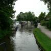
Garstang Road Narrows
is a minor waterways place
on the Lancaster Canal (Main Line) between
Ribble Link - Lancaster Canal Junction (10 miles and ½ furlongs
to the south) and
Lodge Hill Junction (Junction with Lancaster Canal - Glasson Dock Branch) (12 miles and 4¼ furlongs
to the north).
The nearest place in the direction of Ribble Link - Lancaster Canal Junction is Roebuck Bridge No 44;
½ furlongs
away.
The nearest place in the direction of Lodge Hill Junction is Roebuck Aqueduct;
¼ furlongs
away.
Mooring here is unrated.
This is the site of a bridge, the canal may be narrow as a consequence.
| Park Head Winding Hole | 1 mile, 7¼ furlongs | |
| White Horse Bridge No 42 | 1 mile, 1¼ furlongs | |
| White Horse Winding Hole | 7 furlongs | |
| Head Nook Bridge No 43 | 4¼ furlongs | |
| Roebuck Bridge No 44 | ½ furlongs | |
| Garstang Road Narrows | ||
| Roebuck Aqueduct | ¼ furlongs | |
| Bilsborrow Winding Hole | 2 furlongs | |
| Myerscough Hall Bridge No 45 | 2½ furlongs | |
| Myerscough Aqueduct | 3¼ furlongs | |
| Brock Aqueduct No 46 | 5½ furlongs | |
Amenities nearby at Roebuck Bridge No 44
There are no links to external websites from here.
Why not log in and add some (select "External websites" from the menu (sometimes this is under "Edit"))?
Mouseover for more information or show routes to facility
Nearest water point
In the direction of Preston Terminus
Swill Brook Basin — 4 miles, 2½ furlongs away
On this waterway in the direction of Preston Terminus
Blackleach Lane Marina — 4 miles, 5¾ furlongs away
On this waterway in the direction of Preston Terminus
Woodplumpton Road Bridge No 12 — 10 miles, 7¾ furlongs away
On this waterway in the direction of Preston Terminus
In the direction of Tewitfield
Bilsborrow Winding Hole — 2 furlongs away
On this waterway in the direction of Tewitfield
Moss Lane Bridge No 63 — 5 miles, 2¾ furlongs away
On this waterway in the direction of Tewitfield
Ratcliffe Bridge No 75 — 9 miles, 3¾ furlongs away
On this waterway in the direction of Tewitfield
Lodge Hill Junction — 12 miles, 4¼ furlongs away
On this waterway in the direction of Tewitfield
Brows Bridge No 8 — 15 miles, ¼ furlongs and 6 locks away
Travel to Lodge Hill Junction, then on the Lancaster Canal (Glasson Branch) to Brows Bridge No 8
Glasson Visitor Moorings — 15 miles, 1 furlong and 6 locks away
Travel to Lodge Hill Junction, then on the Lancaster Canal (Glasson Branch) to Glasson Visitor Moorings
Glasson Basin — 15 miles, 2¼ furlongs and 6 locks away
Travel to Lodge Hill Junction, then on the Lancaster Canal (Glasson Branch) to Glasson BasinNearest rubbish disposal
In the direction of Preston Terminus
Woodplumpton Road Bridge No 12 — 10 miles, 7¾ furlongs away
On this waterway in the direction of Preston Terminus
In the direction of Tewitfield
Bilsborrow Winding Hole — 2 furlongs away
On this waterway in the direction of TewitfieldNearest chemical toilet disposal
In the direction of Preston Terminus
Woodplumpton Road Bridge No 12 — 10 miles, 7¾ furlongs away
On this waterway in the direction of Preston Terminus
In the direction of Tewitfield
Bilsborrow Winding Hole — 2 furlongs away
On this waterway in the direction of TewitfieldNearest place to turn
In the direction of Preston Terminus
White Horse Winding Hole — 7 furlongs away
On this waterway in the direction of Preston Terminus
Park Head Winding Hole — 1 mile, 7¼ furlongs away
On this waterway in the direction of Preston Terminus
Hollowforth Winding Hole — 2 miles, 5½ furlongs away
On this waterway in the direction of Preston Terminus
Moons Bridge Marina — 2 miles, 6¼ furlongs away
On this waterway in the direction of Preston Terminus
Swill Brook Basin — 4 miles, 2½ furlongs away
On this waterway in the direction of Preston Terminus
Salwick Hall Winding Hole — 7 miles, 2 furlongs away
On this waterway in the direction of Preston Terminus
Ward's House Winding Hole No 2 — 7 miles, 4¼ furlongs away
On this waterway in the direction of Preston Terminus
Ward's House Winding Hole No 1 — 7 miles, 6½ furlongs away
On this waterway in the direction of Preston Terminus
Tom Benson Way Bridge Winding Hole — 9 miles, 7 furlongs away
On this waterway in the direction of Preston Terminus
In the direction of Tewitfield
Bilsborrow Winding Hole — 2 furlongs away
On this waterway in the direction of Tewitfield
Catterall Bridge Winding Hole — 3 miles, ¼ furlongs away
On this waterway in the direction of Tewitfield
Greenhalgh Castle Bridge Winding Hole — 4 miles, 1 furlong away
On this waterway in the direction of Tewitfield
Dimples Bridge Winding Hole — 4 miles, 2¾ furlongs away
On this waterway in the direction of Tewitfield
The Moorings Basin — 5 miles, ¾ furlongs away
On this waterway in the direction of Tewitfield
Kepple Lane Bridge Winding Hole — 5 miles, 1¼ furlongs away
On this waterway in the direction of Tewitfield
Moss Lane Bridge Winding Hole (south) — 5 miles, 2¾ furlongs away
On this waterway in the direction of Tewitfield
Moss Lane Bridge Winding Hole (north) — 5 miles, 2¾ furlongs away
On this waterway in the direction of Tewitfield
Cathouse Bridge Winding Hole — 5 miles, 4¾ furlongs away
On this waterway in the direction of Tewitfield
Bells Bridge Winding Hole — 6 miles, 7¼ furlongs away
On this waterway in the direction of Tewitfield
Ratcliffe Bridge Winding Hole — 9 miles, 2¾ furlongs away
On this waterway in the direction of TewitfieldNo information
CanalPlan has no information on any of the following facilities within range:self-operated pump-out
boatyard pump-out
Direction of TV transmitter (From Wolfbane Cybernetic)
There is no page on Wikipedia called “Garstang Road Narrows”
Results of Google Search
Oct 19, 2019 ... The work is taking place on Garstang Road just north of Garstang ... footway on only one side of the road, which narrows as it rounds a corner.
Mallard Duck Anas platyrhynchos adult female standing on 'Road Narrows' sign in shallow ... Mallard (Anas platyrhynchos) duck and drake in snow at Garstang ...
Location, Tm Only - Junct Of Beach Road And Laidleys Wak ... harbour to skippool improvement scheme gyratory management with lane narrows on all approaches to skippool roundabout ... Location, Longhouse Lane To Garstang Road West ...
Find properties to buy in Garstang Road, Fulwood, Preston PR2 with the UK's largest data-driven property portal. View our wide selection of houses and flats for ...
The average price for a property in Garstang Road, Fulwood, Preston, Lancashire, PR2 is £263333 over the last year. Use Rightmove online house price ...
Jul 26, 2018 ... ... to the other, it narrows your options - you have to go through town, leaving Strand Road, Garstang Road and Walton-le-Dale congested.

![Lancaster Canal Walk. A view along the Lancaster Canal. The buildings on the right are 'Owd Nell's Canalside Tavern. For views of this tavern refer to picture [[4499295]]. For the next viewing point on the walk refer to picture [[4499898]]. by Len Williams – 23 May 2015](https://s2.geograph.org.uk/geophotos/04/49/98/4499886_218f072c_120x120.jpg)


![Narrowboats at Bilsborrow. Narrowboats moored on the Lancaster Canal, outside [[[2526634]]] at Bilsborrow by David Dixon – 26 July 2011](https://s3.geograph.org.uk/geophotos/02/52/66/2526623_5e34f2c7_120x120.jpg)


!['Owd Nell's Tavern at Bilsborrow. This is a view down the simulated street at the rear of 'Owd Nell's Tavern. For a view of the other end of the street refer to picture [[4499312]]. by Len Williams – 23 May 2015](https://s1.geograph.org.uk/geophotos/04/49/93/4499301_3bbe3557_120x120.jpg)


!['Owd Nell's Tavern street. This view of 'Owd Nell's Tavern shows the simulated street which has shop fronts pretending to be commercial establishments e.g. Saddlery. Note the collection of old style advertisments. For a view of the associated motel refer to picture [[4499320]]. by Len Williams – 23 May 2015](https://s0.geograph.org.uk/geophotos/04/49/93/4499312_4f6979a6_120x120.jpg)


!['Owd Nell's Tavern. 'Owd Nell's Tavern is situated on the Lancaster Canal and comprises an old canal public house with simulated village with a restaurant and motel. For another picture of the establishment refer to [[4499301]]. by Len Williams – 23 May 2015](https://s3.geograph.org.uk/geophotos/04/49/92/4499295_469ea804_120x120.jpg)


![Lancaster Canal walk. This view looks back along the Lancaster canal showing part of the village of Bilsborrow. For the view further along the canal refer to picture [[4499915]]. by Len Williams – 23 May 2015](https://s3.geograph.org.uk/geophotos/04/49/99/4499907_b661056a_120x120.jpg)