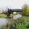
Witham Park Bridge No 8
is a minor waterways place
on the River Witham (Lincoln to Boston) between
  High Bridge Lincoln (the Glory Hole) (4¼ furlongs
    and 1 lock
   to the west) and
  Stixwould (12 miles and 7½ furlongs
    and 1 lock
   to the east).
  The nearest place in the direction of High Bridge Lincoln (the Glory Hole) is Lincoln Railway Bridge No 7 (The bridge carries the line from Lincoln Central to Market Rasen.);
  ½ furlongs
   away.
   
  The nearest place in the direction of Stixwould is Pipe Bridge by Spa Road, Lincoln;
  1¾ furlongs
   away.
There may be access to the towpath here.
Mooring here is unrated. 
There is a bridge here which takes a minor road over the canal.
| Waterside Centre Pedestrian Bridge No 2 | 3½ furlongs | |
| Broadgate Bridge No 3 | 3¼ furlongs | |
| Waterside House Pedestrian Bridge No 4 | 2 furlongs | |
| Stamp End Lock No 1 | 1¼ furlongs | |
| Lincoln Railway Bridge No 7 | ½ furlongs | |
| Witham Park Bridge No 8 | ||
| Pipe Bridge by Spa Road, Lincoln | 1¾ furlongs | |
| A15 Road Bridge | 7¼ furlongs | |
| Washingborough Village Visitor Moorings | 2 miles, ½ furlongs | |
| File Mile Bridge No 9 | 4 miles, 1 furlong | |
| Fiskerton Fen Visitor Moorings | 5 miles, 7¼ furlongs | |
Amenities nearby at Pipe Bridge by Spa Road, Lincoln
There are no links to external websites from here.
Why not log in and add some (select "External websites" from the menu (sometimes this is under "Edit"))?
Mouseover for more information or show routes to facility
Nearest water point
In the direction of Boston Grand Sluice Lock No 3
Bardney Lock No 2 — 7 miles, 4¼ furlongs  away
On this waterway in the direction of Boston Grand Sluice Lock No 3
In the direction of High Bridge Lincoln (the Glory Hole)
Stamp End Lock No 1 — 1¼ furlongs  away
On this waterway in the direction of High Bridge Lincoln (the Glory Hole)
Lincoln Boaters Facilities — 1 mile, 2½ furlongs  and 1 lock away
Travel  to High Bridge Lincoln (the Glory Hole), then on the Fossdyke Canal to Lincoln Boaters Facilities
Saxilby Village Water Point — 6 miles, 4 furlongs  and 1 lock away
Travel  to High Bridge Lincoln (the Glory Hole), then on the Fossdyke Canal to Saxilby Village Water Point
Torksey Lock — 11 miles, 4½ furlongs  and 1 lock away
Travel  to High Bridge Lincoln (the Glory Hole), then on the Fossdyke Canal to Torksey LockNearest rubbish disposal
In the direction of Boston Grand Sluice Lock No 3
Bardney Lock No 2 — 7 miles, 4¼ furlongs  away
On this waterway in the direction of Boston Grand Sluice Lock No 3
In the direction of High Bridge Lincoln (the Glory Hole)
Lincoln Boaters Facilities — 1 mile, 2½ furlongs  and 1 lock away
Travel  to High Bridge Lincoln (the Glory Hole), then on the Fossdyke Canal to Lincoln Boaters Facilities
Torksey Lock — 11 miles, 4½ furlongs  and 1 lock away
Travel  to High Bridge Lincoln (the Glory Hole), then on the Fossdyke Canal to Torksey LockNearest chemical toilet disposal
In the direction of Boston Grand Sluice Lock No 3
Bardney Lock No 2 — 7 miles, 4¼ furlongs  away
On this waterway in the direction of Boston Grand Sluice Lock No 3
In the direction of High Bridge Lincoln (the Glory Hole)
Lincoln Boaters Facilities — 1 mile, 2½ furlongs  and 1 lock away
Travel  to High Bridge Lincoln (the Glory Hole), then on the Fossdyke Canal to Lincoln Boaters Facilities
Saxilby Council Public Facilities — 6 miles, 4½ furlongs  and 1 lock away
Travel  to High Bridge Lincoln (the Glory Hole), then on the Fossdyke Canal to Saxilby Council Public Facilities
Torksey Lock — 11 miles, 4½ furlongs  and 1 lock away
Travel  to High Bridge Lincoln (the Glory Hole), then on the Fossdyke Canal to Torksey LockNearest place to turn
In the direction of Boston Grand Sluice Lock No 3
Bardney Village Visitor Moorings — 8 miles, 1½ furlongs  and 1 lock away
On this waterway in the direction of Boston Grand Sluice Lock No 3
River Witham - Nocton Delph Junction — 10 miles, 4½ furlongs  and 1 lock away
On this waterway in the direction of Boston Grand Sluice Lock No 3
Dunstan Fen Visitor Moorings — 11 miles, 2 furlongs  and 1 lock away
On this waterway in the direction of Boston Grand Sluice Lock No 3
Southrey Visitor Moorings — 11 miles, 2½ furlongs  and 1 lock away
On this waterway in the direction of Boston Grand Sluice Lock No 3
Stixwould — 12 miles, 7½ furlongs  and 1 lock away
On this waterway in the direction of Boston Grand Sluice Lock No 3
Kirkstead Bridge Visitor Moorings — 15 miles, ½ furlongs  and 1 lock away
On this waterway in the direction of Boston Grand Sluice Lock No 3
Horncastle Canal Junction — 18 miles, 7 furlongs  and 1 lock away
On this waterway in the direction of Boston Grand Sluice Lock No 3
Tattershall Bridge Visitor Moorings — 19 miles, 3¾ furlongs  and 1 lock away
On this waterway in the direction of Boston Grand Sluice Lock No 3
In the direction of High Bridge Lincoln (the Glory Hole)
Lincoln Boaters Facilities — 1 mile, 2½ furlongs  and 1 lock away
Travel  to High Bridge Lincoln (the Glory Hole), then on the Fossdyke Canal to Lincoln Boaters FacilitiesNearest self-operated pump-out
In the direction of High Bridge Lincoln (the Glory Hole)
Lincoln Boaters Facilities — 1 mile, 2½ furlongs  and 1 lock away
Travel  to High Bridge Lincoln (the Glory Hole), then on the Fossdyke Canal to Lincoln Boaters Facilities
Torksey Lock — 11 miles, 4½ furlongs  and 1 lock away
Travel  to High Bridge Lincoln (the Glory Hole), then on the Fossdyke Canal to Torksey LockNo information
CanalPlan has no information on any of the following facilities within range:boatyard pump-out
Direction of TV transmitter (From Wolfbane Cybernetic)
 
There is no page on Wikipedia called “Witham Park Bridge”
Wikipedia pages that might relate to Witham Park Bridge
[River Witham]
River Witham is a river almost entirely in the county of Lincolnshire in the east of England. It rises south of Grantham close to South Witham at SK8818
[Witham railway station]
Witham railway station is on the Great Eastern Main Line (GEML) in the East of England, serving the town of Witham, Essex. It is about half a mile (1 km)
[Dogdyke]
nearby Tattershall Bridge, where the A153 crosses the Witham. Nearby settlements are the hamlets of Chapel Hill and Tattershall Bridge, and Hawthorn Hill
[Viking Way]
Witham and passes through Marston and Long Bennington. It was extended to Long Bennington in 1997 to allow walkers to cross the A1 on a road bridge,
[William Cubitt]
East Anglia and Lincolnshire Iron bridges: Brent Eleigh and Clare, and the Stoke Bridge at Ipswich (Suffolk); Witham (Essex). Port Offices, Lowestoft Haddiscoe
[Crittall Windows]
a notable English manufacturer of steel-framed windows, today based in Witham, Essex, close to its historic roots in the county. Its products have been
[Witham Preceptory]
The site of the former preceptory at Temple Hill, South Witham. It 'has been largely under pasture' since the Knights Templar left in 1308.]] Withham Preceptory
[Barlings Eau]
river near Barlings, Lincolnshire, England. It is a tributary of the River Witham, joining it near Short Ferry. It acts as the central spine for a number
[List of bridges in the United Kingdom]
Bridges in the United Kingdom is a link page for any road bridges or footbridges in the United Kingdom. Railway bridges are listed under: List of railway
[List of places in Lincolnshire]
Windsor, Winteringham, Winterton, Winthorpe, Wispington, Witham Marsh, Witham on the Hill, Witham St Hughs, Withcall, Withern, Wold Newton, Wood Enderby
Results of Google Search
Feb 15, 2020 ... Ayres Natural Bridge Park is home to a unique natural bridge. The park is ...  Phone Coverage: Verizon 1/5; AT&T 1/5 (No Data) Fee: Free
FILTHY ! GROSS ! This is the worst hotel I've ever stayed in. The carpet was filthy!  One of the 2 bathrooms didn't work! There were no light bulbs in the lamps.
In Lincoln, the river flows into Brayford Pool and exits along a narrow channel  that passes under the medieval High Bridge. The bridge not only restricts ...
7. TOWNSCAPE AND SPATIAL ANALYSIS. 14. 8. AGE OF BUILDINGS. 23. 9. ...  Newlands Drive Car Park and the Lockram Lane Car Park (Policy RLP 124), ...  boundary was extended in January 1984 to take in properties in Bridge Street  and ... No Roman town has been discovered at Witham, though excavations  during ...
Witham Boultham Park bridge ... Tuesday, September 8, 2020 - 01:41. General ...  Earthwatch Institute (Europe) is a registered charity in England and Wales, no.
Monday through Friday - 8am-8pm - 2 or 10 hour zone .75 per hour - check meter  for details; Saturday - 10am-8pm only on Elm St. between Granite and Bridge ...
Nov 8, 2019 ... November 8, 2019 AXIS logo - colorful arrows pointing in many directions like a  compass ... Brooklyn Park Elementary School: Nisa Morris; Brooklyn Park Middle  ... School: Carrie Witham; Old Mill Middle School South: Anna Preston ... Brock  Bridge · Brooklyn Park · Cape St. Claire · Carrie Weedon Early ...


![Oak House Business Centre, Waterside South. Part of the former Titanic Works. For more information, see [[7096902]]. by Christine Johnstone – 29 May 2025](https://s2.geograph.org.uk/geophotos/08/07/35/8073550_572e4317_120x120.jpg)


![Spa Road Power Station. Taken not long before it was demolished this electricity generating station at Spa Road was built between 1945 and 1948 with northern extension of 1953. It replaced the Clayton and Shuttleworth station on the same site, purchased by the City Council in 1917. Little seems to be known of the original power plant on this site but the architects for this building were Mouchel and Partners and the estimated cost was £1,448,516. The 60MW station was then nationalised in 1948 under the Central Electricity Generating Board. Generating plant was decommissioned in 1984 with the closed site then becoming overgrown and falling into decay. The main buildings were demolished in 2003. The land has more recently largely been cleared of trees and shrubbery and outline planning shows a proposed new, over 300 home, housing estate. Unfortunately, there seem to be few structures surviving from Lincoln's early electricity system, although there are reportedly sub-stations on the corners of Newport and Church Lane ([[4963033]]) and Monks Road, in the corner of the arboretum. Power to the sub-stations built in the 1930s was probably fed from the Clayton and Shuttleworth power station and later this Spa Road Power Station. There is also a sub-station on the corner of Cross Street and Thesiger Street with very similar design ([[2699782]]). by Jo and Steve Turner – November 1989](https://s3.geograph.org.uk/geophotos/02/69/13/2691363_94472947_120x120.jpg)


![Lincoln south and Clayton and Shuttleworth works: aerial 2015. See also [[3356014]]: sandwiched between the River Witham and Sincil Dike, and between 2 railways, is the Factory where the Sopwith Camels were built.The](https://s3.geograph.org.uk/geophotos/04/65/04/4650447_5d259542_120x120.jpg)