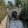
Tollgate Road Bridge
bridge below Culham Lock
Culham Cut, Tollgate Road, South Oxfordshire OX14 4NE, United Kingdom

Tollgate Road Bridge
is a minor waterways place
on the River Thames (below Oxford) between
Jubilee Junction (New junction between River Thames and the Wilts and Berks Canal) (7 furlongs
and 1 lock
to the west) and
Clifton Lock Weir Exit No 2 (Channel leading to the Weir and Long Wittenham) (3 miles and 1¾ furlongs
and 1 lock
to the east).
The nearest place in the direction of Jubilee Junction is Culham Lock;
½ furlongs
away.
The nearest place in the direction of Clifton Lock Weir Exit No 2 is Culham Lock Weir Exit (Channel leading to the Weir and Sutton Pools);
1 furlong
away.
There may be access to the towpath here.
Mooring here is unrated.
There is a bridge here which takes a minor road over the canal.
| Abingdon Lock Weir Exit (Swift Ditch) | 7¾ furlongs | |
| Jubilee Junction | 7 furlongs | |
| Culham Lock Weir Entrance | 6¾ furlongs | |
| Culham Cut Footbridge | 3 furlongs | |
| Culham Lock | ½ furlongs | |
| Tollgate Road Bridge | ||
| Culham Lock Weir Exit | 1 furlong | |
| Didcot Power Station Outlet | 4¼ furlongs | |
| Appleford Railway Bridge | 1 mile, 3 furlongs | |
| Clifton Lock Weir Entrance No 2 | 2 miles, 4 furlongs | |
| Clifton Cut Bridge | 2 miles, 7 furlongs | |
There are no links to external websites from here.
Why not log in and add some (select "External websites" from the menu (sometimes this is under "Edit"))?
Mouseover for more information or show routes to facility
Nearest water point
In the direction of Teddington Lock Weir Exit
Cleeve Lock — 17 miles, ¾ furlongs and 3 locks away
On this waterway in the direction of Teddington Lock Weir Exit
In the direction of Osney Bridge
Abingdon Bridge Marine — 1 mile, ¾ furlongs and 1 lock away
On this waterway in the direction of Osney Bridge
Abingdon Lock — 1 mile, 4½ furlongs and 1 lock away
On this waterway in the direction of Osney Bridge
Oxford Visitor Moorings — 10 miles, 4¾ furlongs and 6 locks away
Travel to Osney Bridge, then on the River Thames (above Oxford) to Sheepwash Channel Junction, then on the River Thames (Sheepwash Channel) to Isis Lock Junction, then on the Oxford Canal (Southern Section - Main Line) to Oxford Visitor Moorings
St Edwards Lift Bridge No 238 — 11 miles, 7¾ furlongs and 6 locks away
Travel to Osney Bridge, then on the River Thames (above Oxford) to Sheepwash Channel Junction, then on the River Thames (Sheepwash Channel) to Isis Lock Junction, then on the Oxford Canal (Southern Section - Main Line) to St Edwards Lift Bridge No 238
Wolvercote Sanitary Station — 13 miles, ½ furlongs and 7 locks away
Travel to Osney Bridge, then on the River Thames (above Oxford) to Sheepwash Channel Junction, then on the River Thames (Sheepwash Channel) to Isis Lock Junction, then on the Oxford Canal (Southern Section - Main Line) to Wolvercote Sanitary Station
Wolvercote Junction Water Point — 13 miles, 4¾ furlongs and 8 locks away
Travel to Osney Bridge, then on the River Thames (above Oxford) to Sheepwash Channel Junction, then on the River Thames (Sheepwash Channel) to Isis Lock Junction, then on the Oxford Canal (Southern Section - Main Line) to Wolvercote Junction Water Point
Eynsham Lock — 16 miles, 2¾ furlongs and 7 locks away
Travel to Osney Bridge, then on the River Thames (above Oxford) to Eynsham Lock
Langford Lane Bridge No 224 — 16 miles, 4¾ furlongs and 10 locks away
Travel to Osney Bridge, then on the River Thames (above Oxford) to Sheepwash Channel Junction, then on the River Thames (Sheepwash Channel) to Isis Lock Junction, then on the Oxford Canal (Southern Section - Main Line) to Langford Lane Bridge No 224
Aubreys Lift Bridge No 221 — 17 miles, 2 furlongs and 10 locks away
Travel to Osney Bridge, then on the River Thames (above Oxford) to Sheepwash Channel Junction, then on the River Thames (Sheepwash Channel) to Isis Lock Junction, then on the Oxford Canal (Southern Section - Main Line) to Aubreys Lift Bridge No 221
Thrupp Cruising Club — 17 miles, 2¼ furlongs and 10 locks away
Travel to Osney Bridge, then on the River Thames (above Oxford) to Sheepwash Channel Junction, then on the River Thames (Sheepwash Channel) to Isis Lock Junction, then on the Oxford Canal (Southern Section - Main Line) to Thrupp Cruising ClubNearest rubbish disposal
In the direction of Teddington Lock Weir Exit
Day's Lock — 6 miles, 5¾ furlongs and 1 lock away
On this waterway in the direction of Teddington Lock Weir Exit
Goring Lock — 17 miles, 5¾ furlongs and 4 locks away
On this waterway in the direction of Teddington Lock Weir Exit
In the direction of Osney Bridge
Abingdon Lock — 1 mile, 4½ furlongs and 1 lock away
On this waterway in the direction of Osney Bridge
Wolvercote Sanitary Station — 13 miles, ½ furlongs and 7 locks away
Travel to Osney Bridge, then on the River Thames (above Oxford) to Sheepwash Channel Junction, then on the River Thames (Sheepwash Channel) to Isis Lock Junction, then on the Oxford Canal (Southern Section - Main Line) to Wolvercote Sanitary Station
Eynsham Lock — 16 miles, 2¾ furlongs and 7 locks away
Travel to Osney Bridge, then on the River Thames (above Oxford) to Eynsham Lock
Aubreys Lift Bridge No 221 — 17 miles, 2 furlongs and 10 locks away
Travel to Osney Bridge, then on the River Thames (above Oxford) to Sheepwash Channel Junction, then on the River Thames (Sheepwash Channel) to Isis Lock Junction, then on the Oxford Canal (Southern Section - Main Line) to Aubreys Lift Bridge No 221
Thrupp Cruising Club — 17 miles, 2¼ furlongs and 10 locks away
Travel to Osney Bridge, then on the River Thames (above Oxford) to Sheepwash Channel Junction, then on the River Thames (Sheepwash Channel) to Isis Lock Junction, then on the Oxford Canal (Southern Section - Main Line) to Thrupp Cruising ClubNearest chemical toilet disposal
In the direction of Teddington Lock Weir Exit
Day's Lock — 6 miles, 5¾ furlongs and 1 lock away
On this waterway in the direction of Teddington Lock Weir Exit
In the direction of Osney Bridge
Abingdon Lock — 1 mile, 4½ furlongs and 1 lock away
On this waterway in the direction of Osney Bridge
Wolvercote Sanitary Station — 13 miles, ½ furlongs and 7 locks away
Travel to Osney Bridge, then on the River Thames (above Oxford) to Sheepwash Channel Junction, then on the River Thames (Sheepwash Channel) to Isis Lock Junction, then on the Oxford Canal (Southern Section - Main Line) to Wolvercote Sanitary Station
Eynsham Lock — 16 miles, 2¾ furlongs and 7 locks away
Travel to Osney Bridge, then on the River Thames (above Oxford) to Eynsham Lock
Thrupp Cruising Club — 17 miles, 2¼ furlongs and 10 locks away
Travel to Osney Bridge, then on the River Thames (above Oxford) to Sheepwash Channel Junction, then on the River Thames (Sheepwash Channel) to Isis Lock Junction, then on the Oxford Canal (Southern Section - Main Line) to Thrupp Cruising ClubNearest place to turn
In the direction of Teddington Lock Weir Exit
Little Wittenham Cut — 6 miles, 7¼ furlongs and 2 locks away
On this waterway in the direction of Teddington Lock Weir Exit
Thames - Thame Junction — 7 miles, 4½ furlongs and 2 locks away
On this waterway in the direction of Teddington Lock Weir Exit
Benson Lock Weir Entrance — 10 miles, 4¾ furlongs and 2 locks away
On this waterway in the direction of Teddington Lock Weir Exit
Benson Lock Weir Exit — 10 miles, 6¾ furlongs and 3 locks away
On this waterway in the direction of Teddington Lock Weir Exit
Cleeve Lock Weir Entrance — 17 miles and 3 locks away
On this waterway in the direction of Teddington Lock Weir Exit
In the direction of Osney Bridge
Culham Lock Weir Entrance — 6¾ furlongs and 1 lock away
On this waterway in the direction of Osney Bridge
Abingdon Bridge Winding Hole — 1 mile, ¾ furlongs and 1 lock away
On this waterway in the direction of Osney Bridge
Abingdon Lock Weir Exit No 1 — 1 mile, 3¾ furlongs and 1 lock away
On this waterway in the direction of Osney Bridge
Sandford Lock Weir Exit (Thames) — 6 miles and 2 locks away
On this waterway in the direction of Osney Bridge
Iffley Lock Weir Exit No 1 — 7 miles, 5¾ furlongs and 3 locks away
On this waterway in the direction of Osney Bridge
Iffley Lock Weir Entrance No 1 — 7 miles, 6¾ furlongs and 4 locks away
On this waterway in the direction of Osney Bridge
Thames - Cherwell Junction — 8 miles, 6 furlongs and 4 locks away
On this waterway in the direction of Osney Bridge
Osney Lock Weir Exit — 10 miles, ¼ furlongs and 4 locks away
On this waterway in the direction of Osney Bridge
Sheepwash Channel Junction — 10 miles, 3 furlongs and 5 locks away
Travel to Osney Bridge, then on the River Thames (above Oxford) to Sheepwash Channel Junction
Castle Mill Stream Junction — 10 miles, 3¾ furlongs and 5 locks away
Travel to Osney Bridge, then on the River Thames (above Oxford) to Sheepwash Channel Junction, then on the River Thames (Sheepwash Channel) to Castle Mill Stream Junction
Bossoms Boat Yard — 11 miles, 1 furlong and 5 locks away
Travel to Osney Bridge, then on the River Thames (above Oxford) to Bossoms Boat Yard
Hythe Bridge Arm Winding Hole — 10 miles, 4¼ furlongs and 6 locks away
Travel to Osney Bridge, then on the River Thames (above Oxford) to Sheepwash Channel Junction, then on the River Thames (Sheepwash Channel) to Isis Lock Junction, then on the Oxford Canal (Southern Section - Main Line) to Hythe Bridge Arm Winding Hole
End of Hythe Bridge Arm — 10 miles, 4¾ furlongs and 6 locks away
Travel to Osney Bridge, then on the River Thames (above Oxford) to Sheepwash Channel Junction, then on the River Thames (Sheepwash Channel) to Isis Lock Junction, then on the Oxford Canal (Southern Section - Main Line) to End of Hythe Bridge Arm
Wolvercote Junction — 13 miles, 4 furlongs and 7 locks away
Travel to Osney Bridge, then on the River Thames (above Oxford) to Sheepwash Channel Junction, then on the River Thames (Sheepwash Channel) to Isis Lock Junction, then on the Oxford Canal (Southern Section - Main Line) to Wolvercote Junction
Duke's Cut Junction — 13 miles, 6¼ furlongs and 7 locks away
Travel to Osney Bridge, then on the River Thames (above Oxford) to Duke's Cut JunctionNearest self-operated pump-out
In the direction of Osney Bridge
Abingdon Lock — 1 mile, 4½ furlongs and 1 lock away
On this waterway in the direction of Osney Bridge
Eynsham Lock — 16 miles, 2¾ furlongs and 7 locks away
Travel to Osney Bridge, then on the River Thames (above Oxford) to Eynsham Lock
Aubreys Lift Bridge No 221 — 17 miles, 2 furlongs and 10 locks away
Travel to Osney Bridge, then on the River Thames (above Oxford) to Sheepwash Channel Junction, then on the River Thames (Sheepwash Channel) to Isis Lock Junction, then on the Oxford Canal (Southern Section - Main Line) to Aubreys Lift Bridge No 221
Thrupp Cruising Club — 17 miles, 2¼ furlongs and 10 locks away
Travel to Osney Bridge, then on the River Thames (above Oxford) to Sheepwash Channel Junction, then on the River Thames (Sheepwash Channel) to Isis Lock Junction, then on the Oxford Canal (Southern Section - Main Line) to Thrupp Cruising ClubNearest boatyard pump-out
In the direction of Osney Bridge
Abingdon Bridge Marine — 1 mile, ¾ furlongs and 1 lock away
On this waterway in the direction of Osney Bridge
Oxford Cruisers Marina — 17 miles, 2½ furlongs and 8 locks away
Travel to Osney Bridge, then on the River Thames (above Oxford) to Oxford Cruisers Marina
Enslow Wharf — 19 miles, 5¾ furlongs and 12 locks away
Travel to Osney Bridge, then on the River Thames (above Oxford) to Sheepwash Channel Junction, then on the River Thames (Sheepwash Channel) to Isis Lock Junction, then on the Oxford Canal (Southern Section - Main Line) to Enslow WharfDirection of TV transmitter (From Wolfbane Cybernetic)
Wikipedia has a page about Tollgate Road Bridge
Sutton Bridge is a village and civil parish in the South Holland district of Lincolnshire, England. It is situated on the A17 road, 7 miles (11 km) north from Wisbech and 9 miles (14 km) west from King's Lynn. The village includes a commercial dock on the west bank of the River Nene over which spans a swing bridge, and the parish, two 19th-century lighthouses 3 miles (5 km) to the north from the village on the river Nene.
Other Wikipedia pages that might relate to Tollgate Road Bridge
[Sutton Bridge]
Sutton Bridge is a village and civil parish in the South Holland district of Lincolnshire, England. It is situated on the A17 road, 7 miles (11 km) north
[RAF Sutton Bridge]
Royal Air Force Sutton Bridge or more simply RAF Sutton Bridge is a former Royal Air Force station found next to the village of Sutton Bridge in the south-east
[Midland and Great Northern Joint Railway]
The line connecting Wisbech to Sutton Bridge was considered important because Sutton Bridge was an important inland port. Wisbech would have
[Sutton Courtenay]
twelfth-century Norman hall, the Sutton Bridge, and Didcot power station. A Neolithic stone hand axe was found at Sutton Courtenay. Petrological analysis
[Sutton]
Leicestershire Sutton Bridge, Lincolnshire Sutton-on-Sea, part of Mablethorpe and Sutton, Lincolnshire Long Sutton, Lincolnshire Sutton, London (in Surrey
[Sutton Bridge Power Station]
Sutton Bridge Power Station is an 819 MW gas-fired power station in Sutton Bridge in the south-east of Lincolnshire in South Holland, England. It is situated
[Sutton Bridge, Oxfordshire]
Sutton Bridge, Oxfordshire is a road bridge across the River Thames near the village of Sutton Courtenay, Oxfordshire, England. It is a stone structure
[Crosskeys Bridge]
Crosskeys Bridge is a swing bridge that spans the tidal River Nene in Sutton Bridge, Lincolnshire. When it was built in 1897, it was the third bridge to cross
[RAF Holbeach]
to and established by Royal Air Force Practice Camp Sutton Bridge (later named RAF Sutton Bridge). Use of the range began on 27 September 1926, with biplanes
[Eastern and Midlands Railway]
Peterborough, Wisbech and Sutton Bridge Railway, opened 1866 Midland & Eastern Railway (incorporating Lynn and Sutton Bridge Railway, Norwich & Spalding
Results of Google Search
Sutton Bridge - WHERE THAMES SMOOTH WATERS GLIDEBoating Guide to Sutton Bridge over River Thames below Culham Lock,UK.
Sutton Bridge, Oxfordshire is a road bridge across the River Thames near the village of Sutton Courtenay, Oxfordshire, England. It is a stone structure built in 1807 with three arches over the main river and two smaller ones across the flood plain. An extension was built in 1809 across the Culham Cut, just below Culham  ...
Apr 15, 2015 ... File:Sutton Bridge extension (Culham Lock).JPG ... English: Culham Cut Bridge, Culham, Oxfordshire ... Category:Sutton Bridge, Oxfordshire ...
Culham Bridge is a mediaeval bridge crossing a present backwater of the River Thames in ... Crossings of the River Thames · Sutton Bridge, Oxfordshire ...
Das Culham Lock ist eine Schleuse in der Themse bei Culham in Oxfordshire, England. Die Schleuse liegt im Culham Cut, einem Kanal, der nördlich des Hauptarms liegt, der bei Sutton ... Sutton Pools abtrennt. Die Schleuse kann von Süden her über die Sutton Bridge oder aus Norden von Culham aus erreicht werden.
Along The Thames Path walking from the centre of Abingdon in Oxfordshire the short distance to Culham Cut and Culham Lock - via Sutton Bridge.
The old bridge is built across the site of the ancient ford known as Culham Hyth. At the other end of the village near Sutton Bridge is Culham Lock, situated in the  ...
The Thames Path from Culham Cut to Clifton Hampden is around a 3 mile walk and there are no river crossings along the way. Sutton Bridge just visible from ...
Soon the narrow Sutton Bridge can be seen ahead, marking the edge of Culham to the right of the river. The three arched bridge crosses the Thames, whilst a ...
Appleford Rail Bridge · Sutton Bridge · Culham Cut Bridge · Abbingdon Bridge · Nunham Rail Bridge · Kennington Rail Bridge · Isis Bridge · Donnington Bridge ...


![Sutton Bridge bench mark. Not the easiest one to get a photo of due to the slope it is on, one slip and you're in the cut below. [[2186004]] by Bill Nicholls – 28 November 2010](https://s3.geograph.org.uk/geophotos/02/18/60/2186011_77c2d20d_120x120.jpg)