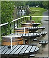
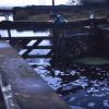
Temple Lock No 27
is a minor waterways place
on the Forth and Clyde Canal (Main Line) between
Stockingfield Junction (Junction with the Port Dundas branch) (1 mile and 4¼ furlongs
and 6 locks
to the east) and
Clyde Canal Junction (Junction of the River Clyde and the Forth and Clyde Canal) (7 miles and 7¾ furlongs
and 13 locks
to the west).
The nearest place in the direction of Stockingfield Junction is Lock 27 PH (Glasgow) (Canalside);
¼ furlongs
away.
The nearest place in the direction of Clyde Canal Junction is Temple Road Bridge;
½ furlongs
away.
There may be access to the towpath here.
Mooring here is unrated.
There is a bridge here which takes pedestrian traffic over the canal.
This is a lock, the rise of which is not known.
| Gas Board Aqueduct No 17 | 3¾ furlongs | |
| Stobcross Rail Aqueduct | 1¾ furlongs | |
| Temple Lock No 26 | 1 furlong | |
| Temple Rail Aqueduct | ¼ furlongs | |
| Lock 27 PH (Glasgow) | ¼ furlongs | |
| Temple Lock No 27 | ||
| Temple Road Bridge | ½ furlongs | |
| Howth Drive Bridge | 1½ furlongs | |
| Old Farm Road Bridge | 3¼ furlongs | |
| Westerton Footbridge | 7½ furlongs | |
| Clobberhill Top Lock No 28 | 1 mile, 2¼ furlongs | |
- Youtube — associated with Forth and Clyde Canal
- The official reopening of the canal
Mouseover for more information or show routes to facility
Nearest place to turn
In the direction of River Carron - Forth and Clyde Canal Junction
Applecross Street Basin — 3 miles, 3½ furlongs and 7 locks away
Travel to Stockingfield Junction, then on the Forth and Clyde Canal (Port Dundas Branch - Main Line) to Firhill Road Basin (northern entrance), then on the Forth and Clyde Canal (Port Dundas Branch - Firhill Road Basin) to Firhill Road Basin (southern entrance), then on the Forth and Clyde Canal (Port Dundas Branch - Main Line) to Applecross Street Basin
Craighall Road Basin Western Winding Hole — 3 miles, 7½ furlongs and 8 locks away
Travel to Stockingfield Junction, then on the Forth and Clyde Canal (Port Dundas Branch - Main Line) to Firhill Road Basin (northern entrance), then on the Forth and Clyde Canal (Port Dundas Branch - Firhill Road Basin) to Firhill Road Basin (southern entrance), then on the Forth and Clyde Canal (Port Dundas Branch - Main Line) to Craighall Road Basin Western Winding Hole
Craighall Road Basin — 4 miles and 8 locks away
Travel to Stockingfield Junction, then on the Forth and Clyde Canal (Port Dundas Branch - Main Line) to Firhill Road Basin (northern entrance), then on the Forth and Clyde Canal (Port Dundas Branch - Firhill Road Basin) to Firhill Road Basin (southern entrance), then on the Forth and Clyde Canal (Port Dundas Branch - Main Line) to Craighall Road Basin
Port Dundas Basin — 4 miles, 2 furlongs and 9 locks away
Travel to Stockingfield Junction, then on the Forth and Clyde Canal (Port Dundas Branch - Main Line) to Firhill Road Basin (northern entrance), then on the Forth and Clyde Canal (Port Dundas Branch - Firhill Road Basin) to Firhill Road Basin (southern entrance), then on the Forth and Clyde Canal (Port Dundas Branch - Main Line) to Port Dundas Basin
Luggiebank Road Winding Hole — 8 miles, 4¼ furlongs and 7 locks away
On this waterway in the direction of River Carron - Forth and Clyde Canal Junction
Auchinstarry Winding Hole — 13 miles, 6¼ furlongs and 7 locks away
On this waterway in the direction of River Carron - Forth and Clyde Canal Junction
Craigmarloch Basin — 14 miles, 5 furlongs and 7 locks away
On this waterway in the direction of River Carron - Forth and Clyde Canal Junction
Wyndford Lock Winding Hole — 15 miles, 7½ furlongs and 7 locks away
On this waterway in the direction of River Carron - Forth and Clyde Canal Junction
In the direction of Clyde Canal Junction
Bowling Basin — 7 miles, 6¼ furlongs and 13 locks away
On this waterway in the direction of Clyde Canal JunctionNo information
CanalPlan has no information on any of the following facilities within range:water point
rubbish disposal
chemical toilet disposal
self-operated pump-out
boatyard pump-out
Direction of TV transmitter (From Wolfbane Cybernetic)
Wikipedia has a page about Temple Lock
Temple Lock is a lock and weir situated on the Buckinghamshire bank of the River Thames near Temple Mill Island opposite Temple Meadows and not far from Hurley, Berkshire. It was first built by the Thames Navigation Commissioners in 1773.
The weir runs across from the lock to the Berkshire bank a short distance upstream of the lock.
Other Wikipedia pages that might relate to Temple Lock
[Marlow Lock]
itself. Temple Mill Island is just downstream of Temple Lock. Temple Regatta takes place in early May between Marlow Bridge and Temple Lock, and Marlow
[Forth and Clyde Canal]
Maryhill Bottom Lock No. 25 26 – Kelvindale (Temple Lock No. 26) 27 – Temple Lock No. 27 28 – Cloberhill Top Lock No. 28 29 – Cloberhill Middle Lock No. 29 30
[Temple Mill Island]
Temple Mill Island is an island in the River Thames in England upstream of Marlow, and just downstream of Temple Lock. It is on the southern Berkshire
[Lock-in amplifier]
Play media A lock-in amplifier is a type of amplifier that can extract a signal with a known carrier wave from an extremely noisy environment. Depending
[Ambalappuzha Sree Krishna Swamy Temple]
Krishna Temple Chuttuvilakku Temple Lock Holy well Ambalappuzha Sree Krishna Temple and pond Ficus religiosa Temples of Kerala Temple festivals of Kerala Ramaswamy
[Temple Footbridge]
Buckinghamshire and Berkshire banks. It crosses the Thames just above Temple Lock. The bridge was built in 1989 specifically for walkers on the Thames
[Padmanabhaswamy Temple]
collection of articles that are traditionally kept under lock and key. A detailed inventory of the temple assets, consisting of gold, jewels, and other valuables
[Marlow Bridge]
Berkshire. It crosses the Thames just upstream of Marlow Lock, on the reach to Temple Lock. The bridge is a Grade I listed building. There has been a
[Temple of Janus (Roman Forum)]
interpreted as saying peace or is Janus himself is kept in the temple locked into the temple. This lack of clarity by the Romans themselves demonstrates
Results of Google Search
Temple Beth Or. 5275 Marshall Rd Dayton, OH 45429 United States. Events at this location. Current Month. No Events on The List at This Time. CENTERVILLE ...
Oliver Sacks's 1993 profile of Temple Grandin. “What is it like to be keenly ... December 27, 1993 ... There are no secrets, no locked doors—nothing is hidden.
Nov 27, 2007 ... Crime Report for 11/27 ... Campus Police arrested a non-Temple affiliated male after he forcibly took a ... No force found with no lock on locker.
Feb 16, 2020 ... Temple matchup 10000 times. ... 16 predictions by model on 42-27 roll ... will look to clinch a share of the Philadelphia Big 5 championship when they host the No. ... Even so, the Wildcats aren't a lock to cover the Villanova vs.
Lock 27: Great re-addition to Temple/Anniesland - See 70 traveler reviews, 14 candid ... This review is the subjective opinion of a TripAdvisor member and not of ...
Nov 11, 2015 ... 3) I want blank quick-release mounts with no adhesive attached so that I can use dual-lock instead of their Templeboards adhesive. Are the ...
Nov 15, 2019 ... 27, no undergraduate classes will be held, but the university will function ... be sure your door and window locks work properly;; check smoke ...
The Fort Hood Sentinel (Temple, Tex.), Vol. 54, No. 27, Ed. 1 Thursday, March 23 , 1995 Page: 34 of 42. forty two pages : ill. ; page 30 x 19 in. This newspaper is ...
The Master Lock No. 27 Laminated Steel Padlock features a 2in (51mm) wide reinforced laminated steel lock body providing extra strength and a 1in (25mm) tall ...


![Forth and Clyde Canal [52]. This plaque by lock 27 gives the distances to Stockingfield Junction and to Bowling.The Forth and Clyde Canal was completed in 1790 and it provided a route for vessels between the Firth of Forth and the Firth of Clyde at the narrowest part (35 miles, 56km) of the Scottish Lowlands. Closed in 1963, the canal became semi-derelict. Millennium funds were used to regenerate the canal. The main line of the canal is a Scheduled Monument with details at: http://portal.historicenvironment.scot/designation/SM6774 by Michael Dibb – 25 June 2019](https://s1.geograph.org.uk/geophotos/06/25/03/6250305_091da981_120x120.jpg)
![Forth and Clyde Canal [51]. An information board by lock 27 giving details of the re-alignment of the road to Bearsden.The Forth and Clyde Canal was completed in 1790 and it provided a route for vessels between the Firth of Forth and the Firth of Clyde at the narrowest part (35 miles, 56km) of the Scottish Lowlands. Closed in 1963, the canal became semi-derelict. Millennium funds were used to regenerate the canal. The main line of the canal is a Scheduled Monument with details at: http://portal.historicenvironment.scot/designation/SM6774 by Michael Dibb – 25 June 2019](https://s0.geograph.org.uk/geophotos/06/25/03/6250304_48373a21_120x120.jpg)


![Lock 27. Canal-side pub beside the Forth & Clyde Canal at Temple. In the distance is one of the Category B listed [http://portal.historicenvironment.scot/designation/LB52443] gasometers from the former Temple Gasworks. by Richard Sutcliffe – 25 June 2019](https://s3.geograph.org.uk/geophotos/06/20/14/6201411_8a859850_120x120.jpg)
![Glasgow buildings [15]. Lock 27 provides refreshments on the bank of the Forth and Clyde Canal. by Michael Dibb – 25 June 2019](https://s3.geograph.org.uk/geophotos/06/25/03/6250303_9784c0c5_120x120.jpg)


![Sign for Lock 27. Pub beside the Forth & Clyde Canal [https://www.geograph.org.uk/photo/6201411]. by Richard Sutcliffe – 25 June 2019](https://s0.geograph.org.uk/geophotos/06/20/14/6201408_cd173e19_120x120.jpg)