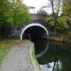
Mile End Road Bridge No 56
Regents Canal, Mile End Road, London E1 4PA, United Kingdom
(75998)

Mile End Road Bridge No 56
is a minor waterways place
on the Grand Union Canal (Regent's Canal) between
Limehouse Basin (with Lion Wharf, South Quay, Medland Quay, Regent's Canal Wharf, Liverpool Steam Wharf, East Quay and North Quay) (7½ furlongs
and 3 locks
to the south) and
Hertford Union Junction (Junction of Regent's and Hertford Union Canals) (4¼ furlongs
and 1 lock
to the northwest).
The nearest place in the direction of Limehouse Basin is Solebay Street Bridge;
¾ furlongs
away.
The nearest place in the direction of Hertford Union Junction is Mile End Lock No 9;
½ furlongs
away.
This is a pinch point. The normal maximum dimensions for a boat on this waterway are 72 feet long, 14 feet wide, 9 feet and 2 inches high and 4 feet and 10 inches deep, but to pass through here the maximum dimensions are 9 feet and 2 inches high.
There may be access to the towpath here.
Mooring here is unrated.
There is a bridge here which takes a major road over the canal.
Johnson's Lock No 10 | 2½ furlongs | |
Newcastle Wharf | 2 furlongs | |
Riga Wharf (Stepney) | 1½ furlongs | |
Devon Wharf | 1 furlong | |
Solebay Street Bridge | ¾ furlongs | |
Mile End Road Bridge No 56 | ||
Mile End Lock No 9 | ½ furlongs | |
Liverpool Street to Stratford Railway Bridge | 1¾ furlongs | |
Meath Gardens Footbridge No 55A | 2 furlongs | |
Palmer's Wharf | 2½ furlongs | |
The Palm Tree PH | 2¾ furlongs |
- Grand Union Canal Walk — associated with Grand Union Canal
- An illustrated walk along the Grand Union Canal from London to Birmingham
Mouseover for more information or show routes to facility
Nearest water point
In the direction of Little Venice
Meath Gardens Footbridge No 55A — 2 furlongs and 1 lock away
On this waterway in the direction of Little Venice
Victoria Park Services — 5¼ furlongs and 2 locks away
On this waterway in the direction of Little Venice
East Wick Service Wharf — 2 miles, 1 furlong and 4 locks away
Travel to Hertford Union Junction, then on the Grand Union Canal (Hertford Union Canal) to Hertford Union Canal Junction, then on the Lee and Stort Navigation (River Lee: commercial section) to East Wick Service Wharf
Old Ford Lock No 19 — 1 mile, 7 furlongs and 4 locks away
Travel to Hertford Union Junction, then on the Grand Union Canal (Hertford Union Canal) to Hertford Union Canal Junction, then on the Lee and Stort Navigation (River Lee: commercial section) to Old Ford Lock No 19
City Road Service Mooring — 3 miles, 1½ furlongs and 5 locks away
On this waterway in the direction of Little Venice
St Pancras Lock No 4 — 4 miles, 4 furlongs and 5 locks away
On this waterway in the direction of Little Venice
Stonebridge Lock Services — 6 miles, 3½ furlongs and 6 locks away
Travel to Hertford Union Junction, then on the Grand Union Canal (Hertford Union Canal) to Hertford Union Canal Junction, then on the Lee and Stort Navigation (River Lee: commercial section) to Stonebridge Lock Services
Pickett's Lock No 15 — 8 miles, 3½ furlongs and 6 locks away
Travel to Hertford Union Junction, then on the Grand Union Canal (Hertford Union Canal) to Hertford Union Canal Junction, then on the Lee and Stort Navigation (River Lee: commercial section) to Pickett's Lock No 15
Westbourne Terrace Bridge No 3C — 7 miles, 4 furlongs and 9 locks away
Travel to Little Venice, then on the Grand Union Canal (Paddington Branch) to Westbourne Terrace Bridge No 3C
Little Venice Services — 7 miles, 4¼ furlongs and 9 locks away
Travel to Little Venice, then on the Grand Union Canal (Paddington Branch) to Little Venice Services
Diesel Boat MB Ash — 7 miles, 4¾ furlongs and 9 locks away
Travel to Little Venice, then on the Grand Union Canal (Paddington Branch) to Diesel Boat MB Ash
Wharf Road Bridge No 33 — 9 miles, 3¾ furlongs and 7 locks away
Travel to Hertford Union Junction, then on the Grand Union Canal (Hertford Union Canal) to Hertford Union Canal Junction, then on the Lee and Stort Navigation (River Lee: commercial section) to Wharf Road Bridge No 33
Mitre Bridge No 6 — 9 miles, 7½ furlongs and 9 locks away
Travel to Little Venice, then on the Grand Union Canal (Paddington Branch) to Mitre Bridge No 6
Mary Seacole Gardens — 9 miles, 7¾ furlongs and 9 locks away
Travel to Little Venice, then on the Grand Union Canal (Paddington Branch) to Mary Seacole Gardens
Railway Bridge No 11A — 13 miles, 1 furlong and 9 locks away
Travel to Little Venice, then on the Grand Union Canal (Paddington Branch) to Railway Bridge No 11A
Hazlemere Marina Services — 12 miles, 5 furlongs and 10 locks away
Travel to Hertford Union Junction, then on the Grand Union Canal (Hertford Union Canal) to Hertford Union Canal Junction, then on the Lee and Stort Navigation (River Lee: commercial section) to Hazlemere Marina Services
Greenford Wharf — 15 miles, 5 furlongs and 9 locks away
Travel to Little Venice, then on the Grand Union Canal (Paddington Branch) to Greenford Wharf
In the direction of Limehouse Basin Entrance
Limehouse Basin — 7½ furlongs and 3 locks away
On this waterway in the direction of Limehouse Basin Entrance
Tail of Bow Locks — 2 miles, 2¾ furlongs and 4 locks away
Travel to Limehouse Basin, then on the Lee and Stort Navigation (Limehouse Cut) to Head of Bow Locks, then on the Lee and Stort Navigation (Bow Lock) to Tail of Bow Locks
Brentford Visitor Moorings — 18 miles and 6 locks away
Travel to Limehouse Basin Entrance, then on the River Thames (tidal section) to Thames - Grand Union Canal Junction, then on the Grand Union Canal (Grand Junction Canal - Main Line - Gayton to Brentford) to Brentford Visitor MooringsNearest rubbish disposal
In the direction of Little Venice
Victoria Park Services — 5¼ furlongs and 2 locks away
On this waterway in the direction of Little Venice
Wick Lane Bridge — 1 mile, 2¾ furlongs and 3 locks away
Travel to Hertford Union Junction, then on the Grand Union Canal (Hertford Union Canal) to Wick Lane Bridge
Old Ford Lock No 19 — 1 mile, 7 furlongs and 4 locks away
Travel to Hertford Union Junction, then on the Grand Union Canal (Hertford Union Canal) to Hertford Union Canal Junction, then on the Lee and Stort Navigation (River Lee: commercial section) to Old Ford Lock No 19
City Road Service Mooring — 3 miles, 1½ furlongs and 5 locks away
On this waterway in the direction of Little Venice
St Pancras Lock No 4 — 4 miles, 4 furlongs and 5 locks away
On this waterway in the direction of Little Venice
St Pancras Basin — 4 miles, 4¼ furlongs and 6 locks away
On this waterway in the direction of Little Venice
Stonebridge Lock Services — 6 miles, 3½ furlongs and 6 locks away
Travel to Hertford Union Junction, then on the Grand Union Canal (Hertford Union Canal) to Hertford Union Canal Junction, then on the Lee and Stort Navigation (River Lee: commercial section) to Stonebridge Lock Services
Pickett's Lock No 15 — 8 miles, 3½ furlongs and 6 locks away
Travel to Hertford Union Junction, then on the Grand Union Canal (Hertford Union Canal) to Hertford Union Canal Junction, then on the Lee and Stort Navigation (River Lee: commercial section) to Pickett's Lock No 15
Little Venice Services — 7 miles, 4¼ furlongs and 9 locks away
Travel to Little Venice, then on the Grand Union Canal (Paddington Branch) to Little Venice Services
Kensal Green Bridge No 4 — 9 miles, ¾ furlongs and 9 locks away
Travel to Little Venice, then on the Grand Union Canal (Paddington Branch) to Kensal Green Bridge No 4
Steele Road Service Mooring — 11 miles, 4 furlongs and 9 locks away
Travel to Little Venice, then on the Grand Union Canal (Paddington Branch) to Steele Road Service Mooring
Greenford Wharf — 15 miles, 5 furlongs and 9 locks away
Travel to Little Venice, then on the Grand Union Canal (Paddington Branch) to Greenford Wharf
Feildes Weir Lock Services — 19 miles, 2¾ furlongs and 16 locks away
Travel to Hertford Union Junction, then on the Grand Union Canal (Hertford Union Canal) to Hertford Union Canal Junction, then on the Lee and Stort Navigation (River Lee: commercial section) to Waltham Town Lock No 11, then on the Lee and Stort Navigation (River Lee) to Feildes Weir Lock Services
In the direction of Limehouse Basin Entrance
Limehouse Lock No 13 — 1 mile, ¼ furlongs and 3 locks away
On this waterway in the direction of Limehouse Basin Entrance
Brentford Visitor Moorings — 18 miles and 6 locks away
Travel to Limehouse Basin Entrance, then on the River Thames (tidal section) to Thames - Grand Union Canal Junction, then on the Grand Union Canal (Grand Junction Canal - Main Line - Gayton to Brentford) to Brentford Visitor MooringsNearest chemical toilet disposal
In the direction of Little Venice
Victoria Park Services — 5¼ furlongs and 2 locks away
On this waterway in the direction of Little Venice
Acton's Lock No 7 — 1 mile, 4¼ furlongs and 2 locks away
On this waterway in the direction of Little Venice
Old Ford Lock No 19 — 1 mile, 7 furlongs and 4 locks away
Travel to Hertford Union Junction, then on the Grand Union Canal (Hertford Union Canal) to Hertford Union Canal Junction, then on the Lee and Stort Navigation (River Lee: commercial section) to Old Ford Lock No 19
St Pancras Lock No 4 — 4 miles, 4 furlongs and 5 locks away
On this waterway in the direction of Little Venice
St Pancras Basin — 4 miles, 4¼ furlongs and 6 locks away
On this waterway in the direction of Little Venice
Stonebridge Lock Services — 6 miles, 3½ furlongs and 6 locks away
Travel to Hertford Union Junction, then on the Grand Union Canal (Hertford Union Canal) to Hertford Union Canal Junction, then on the Lee and Stort Navigation (River Lee: commercial section) to Stonebridge Lock Services
Little Venice Services — 7 miles, 4¼ furlongs and 9 locks away
Travel to Little Venice, then on the Grand Union Canal (Paddington Branch) to Little Venice Services
Railway Bridge No 11A — 13 miles, 1 furlong and 9 locks away
Travel to Little Venice, then on the Grand Union Canal (Paddington Branch) to Railway Bridge No 11A
Greenford Wharf — 15 miles, 5 furlongs and 9 locks away
Travel to Little Venice, then on the Grand Union Canal (Paddington Branch) to Greenford Wharf
Northolt Boatyard — 16 miles, 5¾ furlongs and 9 locks away
Travel to Little Venice, then on the Grand Union Canal (Paddington Branch) to Northolt Boatyard
Feildes Weir Lock Services — 19 miles, 2¾ furlongs and 16 locks away
Travel to Hertford Union Junction, then on the Grand Union Canal (Hertford Union Canal) to Hertford Union Canal Junction, then on the Lee and Stort Navigation (River Lee: commercial section) to Waltham Town Lock No 11, then on the Lee and Stort Navigation (River Lee) to Feildes Weir Lock Services
In the direction of Limehouse Basin Entrance
Limehouse Basin — 7½ furlongs and 3 locks away
On this waterway in the direction of Limehouse Basin Entrance
Brentford Visitor Moorings — 18 miles and 6 locks away
Travel to Limehouse Basin Entrance, then on the River Thames (tidal section) to Thames - Grand Union Canal Junction, then on the Grand Union Canal (Grand Junction Canal - Main Line - Gayton to Brentford) to Brentford Visitor MooringsNearest place to turn
In the direction of Little Venice
Hertford Union Junction — 4¼ furlongs and 1 lock away
On this waterway in the direction of Little Venice
Hertford Union Top Lock Winding Hole — 1 mile, 1¾ furlongs and 1 lock away
Travel to Hertford Union Junction, then on the Grand Union Canal (Hertford Union Canal) to Hertford Union Top Lock Winding Hole
Kingsland Basin — 2 miles, 1¼ furlongs and 3 locks away
On this waterway in the direction of Little Venice
Hertford Union Canal Junction — 1 mile, 5¼ furlongs and 4 locks away
Travel to Hertford Union Junction, then on the Grand Union Canal (Hertford Union Canal) to Hertford Union Canal Junction
Wenlock Basin Branch — 3 miles, ¼ furlongs and 4 locks away
On this waterway in the direction of Little Venice
City Road Basin Branch — 3 miles, 1 furlong and 4 locks away
On this waterway in the direction of Little Venice
Waterworks River - River Lea Junction — 2 miles, 2¾ furlongs and 6 locks away
Travel to Hertford Union Junction, then on the Grand Union Canal (Hertford Union Canal) to Hertford Union Canal Junction, then on the Lee and Stort Navigation (River Lee: commercial section) to Old River Lea Junction, then on the Lee and Stort Navigation - Bow Back Rivers (Old River Lea) to Waterworks River - River Lea Junction
Olympic Park Tripboat Winding Area — 2 miles, 5¼ furlongs and 6 locks away
Travel to Hertford Union Junction, then on the Grand Union Canal (Hertford Union Canal) to Hertford Union Canal Junction, then on the Lee and Stort Navigation (River Lee: commercial section) to Old River Lea Junction, then on the Lee and Stort Navigation - Bow Back Rivers (Old River Lea) to Waterworks River - River Lea Junction, then on the Lee and Stort Navigation - Bow Back Rivers (Waterworks River) to Olympic Park Tripboat Winding Area
Waterfall Bridge Winding Hole — 2 miles, 7¼ furlongs and 6 locks away
Travel to Hertford Union Junction, then on the Grand Union Canal (Hertford Union Canal) to Hertford Union Canal Junction, then on the Lee and Stort Navigation (River Lee: commercial section) to Old River Lea Junction, then on the Lee and Stort Navigation - Bow Back Rivers (Old River Lea) to Waterfall Bridge Winding Hole
Battlebridge Basin — 4 miles, 1 furlong and 5 locks away
On this waterway in the direction of Little Venice
Kings Cross Railway Aqueduct Winding Hole — 4 miles, 1¾ furlongs and 5 locks away
On this waterway in the direction of Little Venice
St Pancras Lock Winding Hole — 4 miles, 3 furlongs and 5 locks away
On this waterway in the direction of Little Venice
In the direction of Limehouse Basin Entrance
Limehouse Basin — 7½ furlongs and 3 locks away
On this waterway in the direction of Limehouse Basin Entrance
Abbott Wharf Dock — 1 mile, 3½ furlongs and 3 locks away
Travel to Limehouse Basin, then on the Lee and Stort Navigation (Limehouse Cut) to Abbott Wharf Dock
Head of Bow Locks — 2 miles, 1¾ furlongs and 3 locks away
Travel to Limehouse Basin, then on the Lee and Stort Navigation (Limehouse Cut) to Head of Bow Locks
Tail of Bow Locks — 2 miles, 2¾ furlongs and 4 locks away
Travel to Limehouse Basin, then on the Lee and Stort Navigation (Limehouse Cut) to Head of Bow Locks, then on the Lee and Stort Navigation (Bow Lock) to Tail of Bow Locks
Head of Bow Creek (Three Mills) — 2 miles, 5 furlongs and 4 locks away
Travel to Limehouse Basin, then on the Lee and Stort Navigation (Limehouse Cut) to Head of Bow Locks, then on the Lee and Stort Navigation (Bow Lock) to Tail of Bow Locks, then on the Lee and Stort Navigation (Bow Creek) to Head of Bow Creek (Three Mills)
Waterworks River - Three Mills Wall River Junction — 3 miles, 1 furlong and 4 locks away
Travel to Limehouse Basin, then on the Lee and Stort Navigation (Limehouse Cut) to Head of Bow Locks, then on the Lee and Stort Navigation (River Lee: commercial section) to Lea - St. Thomas Creek Junction, then on the Lee and Stort Navigation - Bow Back Rivers (St. Thomas Creek) to Waterworks River - Three Mills Wall River Junction
Three Mills - Prescott Junction — 3 miles, 2¾ furlongs and 4 locks away
Travel to Limehouse Basin, then on the Lee and Stort Navigation (Limehouse Cut) to Head of Bow Locks, then on the Lee and Stort Navigation (River Lee: commercial section) to Lea - St. Thomas Creek Junction, then on the Lee and Stort Navigation - Bow Back Rivers (St. Thomas Creek) to Waterworks River - Three Mills Wall River Junction, then on the Lee and Stort Navigation - Bow Back Rivers (Three Mills Wall River) to Three Mills - Prescott Junction
Bow Creek Junction — 4 miles, 2¾ furlongs and 4 locks away
Travel to Limehouse Basin, then on the Lee and Stort Navigation (Limehouse Cut) to Head of Bow Locks, then on the Lee and Stort Navigation (Bow Lock) to Tail of Bow Locks, then on the Lee and Stort Navigation (Bow Creek) to Bow Creek JunctionNearest self-operated pump-out
In the direction of Little Venice
Acton's Lock No 7 — 1 mile, 4¼ furlongs and 2 locks away
On this waterway in the direction of Little Venice
East Wick Service Wharf — 2 miles, 1 furlong and 4 locks away
Travel to Hertford Union Junction, then on the Grand Union Canal (Hertford Union Canal) to Hertford Union Canal Junction, then on the Lee and Stort Navigation (River Lee: commercial section) to East Wick Service Wharf
Stonebridge Lock Services — 6 miles, 3½ furlongs and 6 locks away
Travel to Hertford Union Junction, then on the Grand Union Canal (Hertford Union Canal) to Hertford Union Canal Junction, then on the Lee and Stort Navigation (River Lee: commercial section) to Stonebridge Lock Services
Little Venice Services — 7 miles, 4¼ furlongs and 9 locks away
Travel to Little Venice, then on the Grand Union Canal (Paddington Branch) to Little Venice Services
In the direction of Limehouse Basin Entrance
Limehouse Basin — 7½ furlongs and 3 locks away
On this waterway in the direction of Limehouse Basin Entrance
Brentford Visitor Moorings — 18 miles and 6 locks away
Travel to Limehouse Basin Entrance, then on the River Thames (tidal section) to Thames - Grand Union Canal Junction, then on the Grand Union Canal (Grand Junction Canal - Main Line - Gayton to Brentford) to Brentford Visitor MooringsNearest boatyard pump-out
In the direction of Little Venice
Springfield Marina (entrance No 2) — 4 miles, 3¾ furlongs and 4 locks away
Travel to Hertford Union Junction, then on the Grand Union Canal (Hertford Union Canal) to Hertford Union Canal Junction, then on the Lee and Stort Navigation (River Lee: commercial section) to Springfield Marina (entrance No 2)
St Pancras Basin — 4 miles, 4¼ furlongs and 6 locks away
On this waterway in the direction of Little Venice
Diesel Boat MB Ash — 7 miles, 4¾ furlongs and 9 locks away
Travel to Little Venice, then on the Grand Union Canal (Paddington Branch) to Diesel Boat MB Ash
Northolt Boatyard — 16 miles, 5¾ furlongs and 9 locks away
Travel to Little Venice, then on the Grand Union Canal (Paddington Branch) to Northolt Boatyard
Willowtree Marina — 18 miles, 3¾ furlongs and 9 locks away
Travel to Little Venice, then on the Grand Union Canal (Paddington Branch) to Willowtree Marina
Old Nazeing Road Wharf — 16 miles, 7¾ furlongs and 14 locks away
Travel to Hertford Union Junction, then on the Grand Union Canal (Hertford Union Canal) to Hertford Union Canal Junction, then on the Lee and Stort Navigation (River Lee: commercial section) to Waltham Town Lock No 11, then on the Lee and Stort Navigation (River Lee) to Old Nazeing Road WharfDirection of TV transmitter (From Wolfbane Cybernetic)
There is no page on Wikipedia called “Mile End Road Bridge”
Wikipedia pages that might relate to Mile End Road Bridge
[Mile End]
1300. Mile End Road is an ancient route from London to the East. It was moved to its present-day alignment after the foundation of Bow Bridge in 1110
[Mile End Park]
opened in July 1999, was built over the Mile End Road, which bisects the park, near Mile End tube station. The bridge was designed by Piers Gough. Prior to
[Land's End to John o' Groats]
the road end, is mainland England's most westerly point. The most southerly point is Lizard Point, about 9 miles (14 km) further south. Land's End is sometimes
[Forth Road Bridge]
Forth Road Bridge is a suspension bridge in east central Scotland. The bridge opened in 1964 and at the time was the longest suspension bridge in the
[Chesapeake Bay Bridge–Tunnel]
Chesapeake Bay Bridge–Tunnel (CBBT) is a 17.6-mile (28.3 km) bridge–tunnel crossing at the mouth of the Chesapeake Bay, the Hampton Roads harbor, and nearby
[Roads and freeways in metropolitan Detroit]
Road—Brewer Road, Drahner Road 34 Mile Road—Mack Road, Lakeville Road 35 Mile Road—Frick Road 36 Mile Road—Noble Road 37 Mile Road—Oakwood Road 38 Mile Road—Davison
[London Inner Ring Road]
The London Inner Ring Road, or Ring Road as signposted, is a 12-mile (19 km) route with an average diameter of 2.75–5.5 miles (4.43–8.85 km) formed from
[Overseas Highway]
Key, roughly the midway point of the Seven Mile Bridge, served as the headquarters for the "Overseas Road and Toll District." The toll for automobiles
[Pamban Bridge]
constructed parallel to the rail bridge. This road bridge is also known as Indira Gandhi Road Bridge. The Pamban Road Bridge connects the National Highway (NH 49)
[Miles Glacier Bridge]
The Miles Glacier Bridge, also known as the Million Dollar Bridge, was built in the early 1900s across the Copper River fifty miles from Cordova in what
Results of Google Search
Hampstead Road Locks No 1A & 1B. Hampstead Road Locks No 1A & 1B ... Mile End Road Bridge No 56. Mile End Road Bridge No 56 ...
Maryland Route 56 (MD 56) is a state highway in the U.S. state of Maryland. Known as Big Pool Road, the state highway runs 8.08 miles (13.00 km) from Interstate 70 (I-70) in Big Pool east to MD 68 near Pinesburg in western Washington County. MD 56, which features a pair of one-lane bridges, provides access to Fort ... on a one-lane bridge built in 1907 prior to intersecting Dam Number 5 Road, ...
Jun 18, 2020 ... Bid Number: SAP-17(56) ... 0.385 miles of Bridge and Approaches - SAP-17 (56) Ingrams Mill Road ... GUARD RAIL, BRIDGE END SECTION,.
East end, US 301 in Zephyrhills. Location. Counties, Pasco. Highway system. Florida State Highway System · Interstate · U.S. · SR · Former · Pre-1945 · Toll · Scenic. ← SR 55 · SR 57 →. State Road 56 (SR 56) is a six lane state highway 6.732 miles (10.834 km) in length that runs ... major intersection with Morris Bridge Road (CR 579) before terminating at US ...
The project proposes to improve approximately 12.5 miles of Highway 14 ... 43 ( SE 44th Avenue, east of Owatonna) to Highway 56 North (190th Avenue, west of Dodge Center). ... Additionally, there are numerous local road intersections and driveway ... 74025); Dodge County State Aid Highway 1/West Street (Bridge No.
There will be no holiday lane closure exception due to continued low traffic volumes ... 56) near mile marker 10 is shifted to the temporary Kapaa Stream Bridge ... bridge, right turns off Kuhio Highway onto Mailihuna Road are not permitted.
Willapa Hills Trail spans 56 mi. from Near end of SW Hillburger Rd. (Chehalis) ... is underway to re-deck a railroad bridge (known as Bridge #5) that is currently closed. ... SW Sylvenus Street, and then turn right onto SW Hillburger Road in 0.3 mile. ... Paved portion of the Willapa Hills Trail is short, 5 1/2 miles, narrow and not ...
About a dozen and a half road photos on this page cover the Kuhio Highway on ... Just a little more to the west, near mile 25.5 on route 56, this bridge sweeps ... the west end of the Kuhio Highway, looks inviting but is posted "no swimming.
the eastern (Homestead/Greendale) end. Total bridge length ... 3“Bridge Plans for Spans over 20 Feet on State Road No. 56, Section T,” ... “seven miles of roadway on 56 from Greendale north” in the list of projects for bid would be a necessary ...