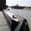
Tidal Basin Gates
is a minor waterways place
on the Gloucester and Sharpness Canal between
Sharpness Junction (Junction of Gloucester and Sharpness Ship Canal with the River Severn) (2¾ furlongs
to the west) and
Sharpness Barge Arm (Junction of old and new lines of canal. Long term private mooring.) (4½ furlongs
and 1 lock
to the northeast).
The nearest place in the direction of Sharpness Barge Arm is Tidal Basin;
½ furlongs
away.
Mooring here is unrated.
Sharpness Junction | 2¾ furlongs | |
Tidal Basin Gates | ||
Tidal Basin | ½ furlongs | |
Sharpness Lock | 1 furlong | |
Sharpness Docks, Upper Basin | 1¾ furlongs | |
Low Level Swing Bridge | 3½ furlongs | |
High Level Swing Bridge | 4 furlongs |
There are no links to external websites from here.
Why not log in and add some (select "External websites" from the menu (sometimes this is under "Edit"))?
Mouseover for more information or show routes to facility
Nearest water point
In the direction of Gloucester / Sharpness - Severn Junction
Purton Lower Bridge — 1 mile, 7¾ furlongs and 1 lock away
On this waterway in the direction of Gloucester / Sharpness - Severn Junction
Patch Bridge — 4 miles, 3¼ furlongs and 1 lock away
On this waterway in the direction of Gloucester / Sharpness - Severn Junction
Splatt Bridge — 6 miles, 2¼ furlongs and 1 lock away
On this waterway in the direction of Gloucester / Sharpness - Severn Junction
Fretherne Bridge — 7 miles, 3 furlongs and 1 lock away
On this waterway in the direction of Gloucester / Sharpness - Severn Junction
Cotswold Canals Trust Visitor Centre - Saul Junction — 8 miles, ¼ furlongs and 1 lock away
On this waterway in the direction of Gloucester / Sharpness - Severn Junction
Saul Junction Winding Hole — 8 miles, 1 furlong and 1 lock away
On this waterway in the direction of Gloucester / Sharpness - Severn Junction
Saul Junction Marina — 8 miles, 2¼ furlongs and 1 lock away
Travel to Saul Junction, then on the Cotswold Canals (Stroudwater Navigation - Navigable Section) to Saul Junction Marina
Sellars Bridge — 11 miles, 7¼ furlongs and 1 lock away
On this waterway in the direction of Gloucester / Sharpness - Severn Junction
Llanthony Pontoons — 15 miles, 5¼ furlongs and 1 lock away
On this waterway in the direction of Gloucester / Sharpness - Severn Junction
Llanthony Road Bridge — 15 miles, 6 furlongs and 1 lock away
On this waterway in the direction of Gloucester / Sharpness - Severn Junction
Gloucester Waterways Museum Arm — 15 miles, 6½ furlongs and 1 lock away
On this waterway in the direction of Gloucester / Sharpness - Severn Junction
Gloucester Dock Lock — 15 miles, 7½ furlongs and 1 lock away
On this waterway in the direction of Gloucester / Sharpness - Severn JunctionNearest rubbish disposal
In the direction of Gloucester / Sharpness - Severn Junction
Sharpness Barge Arm — 4½ furlongs and 1 lock away
On this waterway in the direction of Gloucester / Sharpness - Severn Junction
Purton Lower Bridge — 1 mile, 7¾ furlongs and 1 lock away
On this waterway in the direction of Gloucester / Sharpness - Severn Junction
Patch Bridge — 4 miles, 3¼ furlongs and 1 lock away
On this waterway in the direction of Gloucester / Sharpness - Severn Junction
Splatt Bridge — 6 miles, 2¼ furlongs and 1 lock away
On this waterway in the direction of Gloucester / Sharpness - Severn Junction
Fretherne Bridge — 7 miles, 3 furlongs and 1 lock away
On this waterway in the direction of Gloucester / Sharpness - Severn Junction
Saul Junction Winding Hole — 8 miles, 1 furlong and 1 lock away
On this waterway in the direction of Gloucester / Sharpness - Severn Junction
Saul Junction Marina — 8 miles, 2¼ furlongs and 1 lock away
Travel to Saul Junction, then on the Cotswold Canals (Stroudwater Navigation - Navigable Section) to Saul Junction Marina
Parkend Bridge — 9 miles, 6 furlongs and 1 lock away
On this waterway in the direction of Gloucester / Sharpness - Severn Junction
Sellars Bridge — 11 miles, 7¼ furlongs and 1 lock away
On this waterway in the direction of Gloucester / Sharpness - Severn Junction
Llanthony Road Bridge — 15 miles, 6 furlongs and 1 lock away
On this waterway in the direction of Gloucester / Sharpness - Severn JunctionNearest chemical toilet disposal
In the direction of Gloucester / Sharpness - Severn Junction
Sharpness Barge Arm — 4½ furlongs and 1 lock away
On this waterway in the direction of Gloucester / Sharpness - Severn Junction
Cotswold Canals Trust Visitor Centre - Saul Junction — 8 miles, ¼ furlongs and 1 lock away
On this waterway in the direction of Gloucester / Sharpness - Severn Junction
Saul Junction Marina — 8 miles, 2¼ furlongs and 1 lock away
Travel to Saul Junction, then on the Cotswold Canals (Stroudwater Navigation - Navigable Section) to Saul Junction Marina
Llanthony Road Bridge — 15 miles, 6 furlongs and 1 lock away
On this waterway in the direction of Gloucester / Sharpness - Severn JunctionNearest place to turn
In the direction of Gloucester / Sharpness - Severn Junction
Sharpness Barge Arm — 4½ furlongs and 1 lock away
On this waterway in the direction of Gloucester / Sharpness - Severn Junction
Saul Junction Winding Hole — 8 miles, 1 furlong and 1 lock away
On this waterway in the direction of Gloucester / Sharpness - Severn Junction
Pegthorne Bridge Winding Hole — 8 miles, 6¼ furlongs and 1 lock away
On this waterway in the direction of Gloucester / Sharpness - Severn Junction
Quedgeley Oil Depot — 12 miles, ¾ furlongs and 1 lock away
On this waterway in the direction of Gloucester / Sharpness - Severn Junction
Monk Meadow Dock — 15 miles, 3 furlongs and 1 lock away
On this waterway in the direction of Gloucester / Sharpness - Severn Junction
Gloucester Docks — 15 miles, 6¾ furlongs and 1 lock away
On this waterway in the direction of Gloucester / Sharpness - Severn Junction
Waterways Office (South Wales and Severn Waterways) - Canal & River Trust — 15 miles, 7¼ furlongs and 1 lock away
On this waterway in the direction of Gloucester / Sharpness - Severn Junction
Gloucester / Sharpness - Severn Junction — 15 miles, 7¾ furlongs and 2 locks away
On this waterway in the direction of Gloucester / Sharpness - Severn Junction
The Ocean — 12 miles and 9 locks away
Travel to Saul Junction, then on the Cotswold Canals (Stroudwater Navigation - Navigable Section) to Walk Bridge, then on the Cotswold Canals (Stroudwater Navigation - Un-navigable Section) to The Ocean
Upper Parting Junction — 18 miles, 4½ furlongs and 2 locks away
Travel to Gloucester / Sharpness - Severn Junction, then on the River Severn (main river - Worcester to Gloucester) to Upper Parting Junction
Over Winding Hole — 17 miles, 7½ furlongs and 3 locks away
Travel to Gloucester / Sharpness - Severn Junction, then on the River Severn (old river navigation) to Lower Parting, then on the River Severn (Maisemore Channel - Southern Section) to Over Junction, then on the Hereford and Gloucester Canal to Over Winding Hole
Ryeford Winding Hole — 12 miles, 7¾ furlongs and 9 locks away
Travel to Saul Junction, then on the Cotswold Canals (Stroudwater Navigation - Navigable Section) to Walk Bridge, then on the Cotswold Canals (Stroudwater Navigation - Un-navigable Section) to Ryeford Winding Hole
Brimscombe Port — 17 miles, 6¼ furlongs and 20 locks away
Travel to Saul Junction, then on the Cotswold Canals (Stroudwater Navigation - Navigable Section) to Walk Bridge, then on the Cotswold Canals (Stroudwater Navigation - Un-navigable Section) to Site of Entrance to Wallbridge Basin, then on the Cotswold Canals (Thames and Severn Canal - Wide section) to Brimscombe PortNearest self-operated pump-out
In the direction of Gloucester / Sharpness - Severn Junction
Purton Lower Bridge — 1 mile, 7¾ furlongs and 1 lock away
On this waterway in the direction of Gloucester / Sharpness - Severn Junction
Cotswold Canals Trust Visitor Centre - Saul Junction — 8 miles, ¼ furlongs and 1 lock away
On this waterway in the direction of Gloucester / Sharpness - Severn Junction
Llanthony Pontoons — 15 miles, 5¼ furlongs and 1 lock away
On this waterway in the direction of Gloucester / Sharpness - Severn JunctionNearest boatyard pump-out
In the direction of Gloucester / Sharpness - Severn Junction
Patch Bridge — 4 miles, 3¼ furlongs and 1 lock away
On this waterway in the direction of Gloucester / Sharpness - Severn Junction
Saul Junction Marina — 8 miles, 2¼ furlongs and 1 lock away
Travel to Saul Junction, then on the Cotswold Canals (Stroudwater Navigation - Navigable Section) to Saul Junction MarinaDirection of TV transmitter (From Wolfbane Cybernetic)
There is no page on Wikipedia called “Tidal Basin Gates”
Wikipedia pages that might relate to Tidal Basin Gates
[Tidal Basin]
The Tidal Basin is a man-made reservoir located between the Potomac River and the Washington Channel in Washington, D.C. It is part of West Potomac Park
[Tidal barrage]
seal a basin where it is not sealed by caissons. The sluice gates applicable to tidal power are the flap gate, vertical rising gate, radial gate, and rising
[Dock (maritime)]
is impounded either by dock gates or by a lock, thus allowing ships to remain afloat at low tide in places with high tidal ranges. The level of water in
[Tidal power]
Tidal power or tidal energy is harnessed by converting energy from tides into useful forms of power, mainly electricity using various methods. Although
[Tidal bore]
Play media A tidal bore, often simply given as bore in context, is a tidal phenomenon in which the leading edge of the incoming tide forms a wave (or
[Lock (water navigation)]
gate or stop gate is the cheaper equivalent of a flood lock. Only one set of gates exist, and so when the river is higher than the canal, the gates are
[Bay of Fundy]
River had one of the world's largest tidal bores, up to 2 metres (6.6 ft) high. Since the opening of the causeway gates in 2010, the bore has been coming
[Floodgate]
Floodgates, also called stop gates, are adjustable gates used to control water flow in flood barriers, reservoir, river, stream, or levee systems. They
[Bristol Harbour]
19th century by installing lock gates on a tidal stretch of the River Avon in the centre of the city and providing a tidal by-pass for the river. It is often
[Tide]
marine tidal movement. Dissipation arises as basin-scale tidal flows drive smaller-scale flows which experience turbulent dissipation. This tidal drag creates
Results of Google Search
How Does the National Mall Tidal Basin Actually Work?Nov 7, 2019 ... The inlet gates shut with changing currents. Water can only exit from the outlet gate and through the Washington Channel. The sudden flush of ...
Jul 5, 2018 ... Twice a day at high tide, 250 million US gallons of water from the Potomac River enter the Tidal Basin through the inlet gates. As the tide turns, ...
May 12, 2020 ... That system no longer works today as the gates are silted shut. Despite the gate system designed to protect it, the Tidal Basin is sinking due to the ...
The inlet gates, located on the Potomac side of the basin, allow water to enter the basin during high tide. During this time, the outlet gates, on the Washington ...
In 1887, engineers installed gates at the entrance and exit of a newly formed pond (now the Tidal Basin). At high tide, the gates open and fill the pond with water.
Oct 28, 2013 ... Meanwhile, at the Tidal Basin's eastern end, an outlet gate leads to the Washington Channel. There, the gates open from the Basin to the ...
Photo, Print, Drawing How a Tidal Basin Works - Tidal Reservoir, Between ... lock gates: - bridges: - channels: - District Of Columbia -- District Of Columbia -- ...
Sep 24, 2020 ... Sluice gates on the barrage control water levels and flow rates to allow the tidal basin to fill on the incoming high tides and to empty through an ...
Tidal basin definition is - a dock or basin communicating with tidal water usually through lock gates or locks.
The Tidal Basin and Washington Channel in Washington, DC are on the Total ... of fecal coliform under the influences of flap gate operations and tidal elevation.