River Hull - Humber Junction
Kingston-upon-Hull
Quebec Cottages, North Lincolnshire DN19 7EW, United Kingdom
Address is taken from a point 1727 yards away.

River Hull - Humber Junction
is a place on the waterways
at the junction of
the River Hull (Main Line)
with
the River Humber.
Weel
is on
the River Hull (Main Line),
10 miles and 7 furlongs
to the northwest.
Barton-upon-Humber
is on
the River Humber,
4 miles and 5½ furlongs
to the west.
Humber - Louth Junction (Junction of the River Humber with the Louth Navigation)
is on
the River Humber,
20 miles and 6¾ furlongs
to the southeast.
The nearest place in the direction of Weel is Myton Bridge;
1 mile and ½ furlongs
away.
The nearest place in the direction of Barton-upon-Humber is Hull Marina Entrance;
½ furlongs
away.
The nearest place in the direction of Humber - Louth Junction is Queen Alexandra Dock Entrance;
1 mile and 4¾ furlongs
away.
Mooring here is unrated.
River Humber | ||
---|---|---|
Humber Bridge | 5 miles | |
Barton-upon-Humber | 4 miles, 5½ furlongs | |
New Holland | 1 mile, 5¾ furlongs | |
Albert Dock Entrance | 1 furlong | |
Hull Marina Entrance | ½ furlongs | |
River Hull - Humber Junction | ||
Queen Alexandra Dock Entrance | 1 mile, 4¾ furlongs | |
King George and Queen Elizabeth Docks Entrance | 2 miles, ¼ furlongs | |
Paull | 3 miles, 5¼ furlongs | |
Port of Killingholme | 7 miles, ¼ furlongs | |
Port of Immingham | 9 miles, 6¾ furlongs | |
River Hull (Main Line) | ||
River Hull - Humber Junction | ||
Myton Bridge | 1 mile, ½ furlongs | |
River Hull Tidal Barrier | 1 mile, ¾ furlongs | |
Garrison Road Bridge | 1 mile, 1¼ furlongs | |
Scale Lane Swing Bridge | 1 mile, 2¼ furlongs | |
Tower Street Basin | 1 mile, 3½ furlongs |
Amenities nearby at Myton Bridge
There are no links to external websites from here.
Why not log in and add some (select "External websites" from the menu (sometimes this is under "Edit"))?
Mouseover for more information or show routes to facility
Nearest water point
In the direction of Struncheon Hill Locks Nos 6 and 7
Beverley Beck Visitor Moorings — 12 miles and 1 lock away
Travel to Grovehill Junction, then on the River Hull (Beverley Beck) to Beverley Beck Visitor MooringsNearest place to turn
In the direction of Struncheon Hill Locks Nos 6 and 7
Tower Street Basin — 1 mile, 3½ furlongs away
On the River Hull (Main Line) in the direction of Struncheon Hill Locks Nos 6 and 7
Beverley Beck Wharves — 11 miles, 7½ furlongs and 1 lock away
Travel to Grovehill Junction, then on the River Hull (Beverley Beck) to Beverley Beck Wharves
Aike Beck Junction — 16 miles, ¾ furlongs away
On the River Hull (Main Line) in the direction of Struncheon Hill Locks Nos 6 and 7
In the direction of Trent Falls
Old River Ancholme Northern Junction — 16 miles, 6½ furlongs and 1 lock away
Travel to Humber - Ancholme Junction, then on the River Ancholme (Main River) to Old River Ancholme Northern Junction
Old River Ancholme Southern Junction — 18 miles, ¾ furlongs and 1 lock away
Travel to Humber - Ancholme Junction, then on the River Ancholme (Main River) to Old River Ancholme Southern JunctionNo information
CanalPlan has no information on any of the following facilities within range:rubbish disposal
chemical toilet disposal
self-operated pump-out
boatyard pump-out
Direction of TV transmitter (From Wolfbane Cybernetic)
There is no page on Wikipedia called “River Hull - Humber Junction”
Wikipedia pages that might relate to River Hull - Humber Junction
[Humber]
and under the Humber Bridge; between Barton-upon-Humber on the south bank and Kingston upon Hull on the north bank (where the River Hull joins), then meets
[Humber Bridge]
The Humber Bridge, near Kingston upon Hull, East Riding of Yorkshire, England, is a 2.22 km (2,430 yd; 7,300 ft; 1.38 mi) single-span road suspension bridge
[Port of Hull]
The Port of Hull is a port at the confluence of the River Hull and the Humber Estuary in Kingston upon Hull, in the East Riding of Yorkshire, England
[Yorkshire and the Humber]
Bradford, Hull, and York. The population in 2011 was 5,284,000. The committees for the regions, including the one for Yorkshire and the Humber, ceased to
[Humber Ferry]
The Humber Ferry was a ferry service on the Humber between Kingston upon Hull and New Holland in Lincolnshire which operated until the completion of the
[River Hull]
series of springs to the west of Driffield, and enters the Humber Estuary at Kingston upon Hull. Following a period when the Archbishops of York charged
[Barton-upon-Humber]
the Humber Estuary at the southern end of the Humber Bridge. It is 46 miles (74 km) east of Leeds, 6 miles (10 km) south-west of Kingston upon Hull and
[Brough, East Riding of Yorkshire]
Brough is situated on the northern bank of the Humber Estuary, approximately 12 miles (19 km) west of Hull city centre. Brough has a long association with
[A15 road (England)]
its junction with the M180 near Scawby. The road restarts 10 miles (16 km) east, and then continues north past Barton-upon-Humber, crossing the Humber on
[Hull Paragon Interchange]
terminal, Manor House Street station, adjacent to the Humber Dock, near the old town. Subsequently, the Hull and Selby Railway entered into working arrangements
Results of Google Search
Humber - WikipediaSituated at the end of the River Hull where it meets the Humber. The Humber Estuary and Spurn Head looking north-east from over North Lincolnshire. Historical railway map of Hull showing the ferry route and the layout of docks. The Humber /ˈhʌmbər/ is a large tidal estuary on the east coast of Northern England. ... Below Trent Falls, the Humber passes the junction with the Market Weighton ...
It lies on the north bank of the River Humber estuary at its junction with the River Hull, 22 miles (35 km) from the North Sea. Hull was a medieval wool.
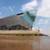
Download this stock image: The Deep at the junction of the River Hull and the River Humber - KGHD1N from Alamy's library of millions of high resolution stock ...
They chose a place at the junction of the rivers Hull and Humber to build a quay. —Kingston upon Hull. William's men burnt whole villages from the Humber to ...
The Kingston upon Hull City Council (hereinafter referred to as “the Council”) ... of the River Hull approximately 16 metres south of the junction of Humber Street ...
Yorkshire port at the junction of the river Hull with the Humber, usually called just ' Hull'. It originated as a monastic wool-exporting port, but was acquired and ...
They built a quay at the junction of the rivers Hull and Humber and this place later became known as the Port of Wyke upon Hull (often simply called Wyke or ...
... municipal, county and parliamentary borough, and seaport in the East Riding of Yorkshire, England, at the junction of the river Hull with the Humber, 22 m. 0. 0.