CanalPlanAC

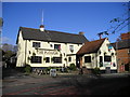
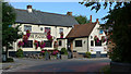
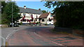
The Plough PH (Milton Keynes)

 
Bletchley MK6 3AH, United Kingdom
 

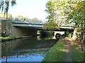
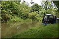
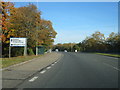
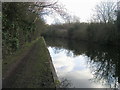
The Plough PH (Milton Keynes) is on the Grand Union Canal (Grand Junction Canal - Main Line - Gayton to Brentford).

Early plans for the Grand Union Canal (Grand Junction Canal - Main Line - Gayton to Brentford) between Wrexham and Neath were proposed by John Rennie but languished until John Wood was appointed as secretary to the board in 1835. Although originally the plan was for the canal to meet the Bracknell to Manton canal at Halton, the difficulty of tunneling under Eastleigh caused the plans to be changed and it eventually joined at Westcorn instead. Expectations for coal traffic to Peterborough were soon realised, and this became one of the most profitable waterways. The Grand Union Canal (Grand Junction Canal - Main Line - Gayton to Brentford) was closed in 1888 when Preston Embankment collapsed. Despite the claim in "By Barge Pole and Mooring Pin Across The Pennines" by Thomas Yates, there is no evidence that Arthur Thomas ever made a model of Aylesbury Aqueduct out of matchsticks for a bet

Information about the place
The Plough PH (Milton Keynes) is a place on the waterways on the Grand Union Canal (Grand Junction Canal - Main Line - Gayton to Brentford) between Little Woolstone Bridge No 83 (Little Woolstone a quarter of a mile east) (1 mile and 6¾ furlongs to the northwest) and Simpson Bridge No 92 (With pipe bridge alongside) (3 furlongs to the southeast).
 
 
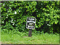
The nearest place in the direction of Little Woolstone Bridge No 83 is Milepost - Braunston 37 Miles; ¼ furlongs away.
 
The nearest place in the direction of Simpson Bridge No 92 is Simpson Cattle Creep; 1 furlong away.

Mooring here is unrated.


Amenities

Amenities nearby at Milepost - Braunston 37 Miles

 Bus stop (St Thomas Church)
 Bus stop (St Thomas Church)
 Bus stop (Walton Manor)

Amenities nearby at Simpson Cattle Creep

 Bus stop (Ashland Roundabout East)
 Bus stop (Ashland Roundabout East)
 Bus stop (Ashland Roundabout North)
 Bus stop (Ashland Roundabout North)
 Bus stop (Ashland Roundabout South)
 Bus stop (Ashland Roundabout South)
 Bus stop (Simpson Roundabout North)
 Bus stop (Simpson Roundabout South)
 Bus stop (Simpson Roundabout South)
 Bus stop (Simpson Roundabout West)
 
Maps
If you are a user and are logged on, or if you are actively planning a route, a map will be displayed here.
Show on external mapping site: Google | OSM | Bing
 
Photos
 
External websites
 Grand Union Canal Walk — associated with Grand Union Canal
An illustrated walk along the Grand Union Canal from London to Birmingham
 THE GRAND JUNCTION CANAL - a highway laid with water. — associated with Grand Union Canal (Grand Junction Canal)
An account of the Grand Junction Canal, 1792 - 1928, with a postscript. By Ian Petticrew and Wendy Austin.
 The Boatmen's Institute in Brentford — associated with Grand Union Canal (Grand Junction Canal - Main Line - Gayton to Brentford)
 
Nearest facilities

Mouseover for more information or show routes to facility

Nearest water point

In the direction of Gayton Junction

Peartree Bridge No 88 — 7½ furlongs away
On this waterway in the direction of Gayton Junction
Giffard Park Sanitary Station — 4 miles, 4 furlongs away
On this waterway in the direction of Gayton Junction
Winding Hole below Cosgrove Lock — 9 miles, 5½ furlongs away
On this waterway in the direction of Gayton Junction
Cosgrove Sanitary Station — 9 miles, 6¾ furlongs and 1 lock away
On this waterway in the direction of Gayton Junction
Stoke Bruerne Services — 15 miles, 4¼ furlongs and 1 lock away
On this waterway in the direction of Gayton Junction
Stoke Bruerne Bottom Lock No 20 — 15 miles, 4½ furlongs and 1 lock away
On this waterway in the direction of Gayton Junction
The Boat Inn (Stoke Bruerne) — 16 miles, 2¾ furlongs and 8 locks away
On this waterway in the direction of Gayton Junction

In the direction of Thames - Grand Union Canal Junction
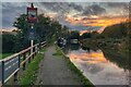
Fenny Stratford Services — 1 mile, 2 furlongs and 1 lock away
On this waterway in the direction of Thames - Grand Union Canal Junction
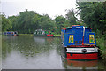
Willowbridge Marina — 3 miles, ½ furlongs and 1 lock away
On this waterway in the direction of Thames - Grand Union Canal Junction
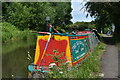
Soulbury Bottom Lock No 24 — 5 miles, 2¾ furlongs and 2 locks away
On this waterway in the direction of Thames - Grand Union Canal Junction
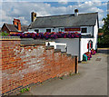
Rothschild Road Wharf — 8 miles, 6½ furlongs and 6 locks away
On this waterway in the direction of Thames - Grand Union Canal Junction
Leighton Linslade Services — 9 miles, 3 furlongs and 6 locks away
On this waterway in the direction of Thames - Grand Union Canal Junction
Slapton Wharf — 13 miles, ¾ furlongs and 9 locks away
On this waterway in the direction of Thames - Grand Union Canal Junction
Marsworth Services — 17 miles, 3 furlongs and 17 locks away
On this waterway in the direction of Thames - Grand Union Canal Junction
Winding Hole near Bulbourne Bridge — 18 miles, 6 furlongs and 24 locks away
On this waterway in the direction of Thames - Grand Union Canal Junction
Nearest rubbish disposal

In the direction of Thames - Grand Union Canal Junction

Fenny Stratford Services — 1 mile, 2 furlongs and 1 lock away
On this waterway in the direction of Thames - Grand Union Canal Junction
Soulbury Middle Lock No 25 — 5 miles, 3¼ furlongs and 3 locks away
On this waterway in the direction of Thames - Grand Union Canal Junction
Leighton Rubbish Disposal — 9 miles, 3½ furlongs and 6 locks away
On this waterway in the direction of Thames - Grand Union Canal Junction
Town Field Farm Bridge No 130 — 17 miles, 1½ furlongs and 17 locks away
On this waterway in the direction of Thames - Grand Union Canal Junction
Marsworth Services — 17 miles, 3 furlongs and 17 locks away
On this waterway in the direction of Thames - Grand Union Canal Junction

In the direction of Gayton Junction

Newport Pagnell Road Bridge No 76 — 5 miles, 3½ furlongs away
On this waterway in the direction of Gayton Junction
Cosgrove Sanitary Station — 9 miles, 6¾ furlongs and 1 lock away
On this waterway in the direction of Gayton Junction
Stoke Bruerne Services — 15 miles, 4¼ furlongs and 1 lock away
On this waterway in the direction of Gayton Junction
Waterside CafĂ© — 16 miles, 2¾ furlongs and 8 locks away
On this waterway in the direction of Gayton Junction

Nearest chemical toilet disposal

In the direction of Thames - Grand Union Canal Junction

Fenny Stratford Services — 1 mile, 2 furlongs and 1 lock away
On this waterway in the direction of Thames - Grand Union Canal Junction
Leighton Linslade Services — 9 miles, 3 furlongs and 6 locks away
On this waterway in the direction of Thames - Grand Union Canal Junction
Marsworth Services — 17 miles, 3 furlongs and 17 locks away
On this waterway in the direction of Thames - Grand Union Canal Junction

In the direction of Gayton Junction

Giffard Park Sanitary Station — 4 miles, 4 furlongs away
On this waterway in the direction of Gayton Junction
Cosgrove Sanitary Station — 9 miles, 6¾ furlongs and 1 lock away
On this waterway in the direction of Gayton Junction
Stoke Bruerne Services — 15 miles, 4¼ furlongs and 1 lock away
On this waterway in the direction of Gayton Junction

Nearest place to turn

In the direction of Gayton Junction

Milton Keynes Marina — 7 furlongs away
On this waterway in the direction of Gayton Junction
Little Woolstone Winding Hole — 1 mile, 6¾ furlongs away
On this waterway in the direction of Gayton Junction
Blue Bridge Winding Hole — 2 miles, 1¾ furlongs away
On this waterway in the direction of Gayton Junction
Linford Wharf Winding Hole — 4 miles, 6½ furlongs away
On this waterway in the direction of Gayton Junction
Linford Winding Hole — 4 miles, 7 furlongs away
On this waterway in the direction of Gayton Junction
New Bradwell Winding Hole — 7 miles, 1¾ furlongs away
On this waterway in the direction of Gayton Junction
Galleon Wharf — 9 miles away
On this waterway in the direction of Gayton Junction
Winding Hole below Cosgrove Lock — 9 miles, 5½ furlongs away
On this waterway in the direction of Gayton Junction
Junction with Old Stratford Arm — 9 miles, 6 furlongs and 1 lock away
On this waterway in the direction of Gayton Junction
Site of Bridge 1 and End of Navigation — 9 miles, 7 furlongs and 1 lock away
Travel to Junction with Old Stratford Arm, then on the Grand Union Canal (Grand Junction Canal - Old Stratford Arm) to Site of Bridge 1 and End of Navigation
Thrupp Wharf Marina — 10 miles, 7¼ furlongs and 1 lock away
On this waterway in the direction of Gayton Junction
Kingfisher Marina — 12 miles, 6¼ furlongs and 1 lock away
On this waterway in the direction of Gayton Junction

In the direction of Thames - Grand Union Canal Junction
Fenny Stratford Basin — 1 mile, 3¾ furlongs and 1 lock away
On this waterway in the direction of Thames - Grand Union Canal Junction
Water Eaton Winding Hole — 2 miles, 2 furlongs and 1 lock away
On this waterway in the direction of Thames - Grand Union Canal Junction
Winding Hole below Stoke Hammond Lock — 4 miles and 1 lock away
On this waterway in the direction of Thames - Grand Union Canal Junction
Old Linslade Winding Hole — 7 miles, ¼ furlongs and 5 locks away
On this waterway in the direction of Thames - Grand Union Canal Junction
Rothschild Road Wharf — 8 miles, 6½ furlongs and 6 locks away
On this waterway in the direction of Thames - Grand Union Canal Junction
Bossington Lane Winding Hole — 8 miles, 7¼ furlongs and 6 locks away
On this waterway in the direction of Thames - Grand Union Canal Junction
Leighton Buzzard Bridge Winding Hole — 9 miles, 3¼ furlongs and 6 locks away
On this waterway in the direction of Thames - Grand Union Canal Junction
Grove Lock Arm — 10 miles, 5¾ furlongs and 6 locks away
On this waterway in the direction of Thames - Grand Union Canal Junction

Nearest self-operated pump-out

In the direction of Thames - Grand Union Canal Junction

Willowbridge Marina — 3 miles, ½ furlongs and 1 lock away
On this waterway in the direction of Thames - Grand Union Canal Junction
Marsworth Services — 17 miles, 3 furlongs and 17 locks away
On this waterway in the direction of Thames - Grand Union Canal Junction

Nearest boatyard pump-out

In the direction of Gayton Junction

Milton Keynes Marina — 7 furlongs away
On this waterway in the direction of Gayton Junction
Campbell Wharf Marina — 2 miles, 1¼ furlongs away
On this waterway in the direction of Gayton Junction
Yardley Wharf — 12 miles, 6 furlongs and 1 lock away
On this waterway in the direction of Gayton Junction

In the direction of Thames - Grand Union Canal Junction

Rothschild Road Wharf — 8 miles, 6½ furlongs and 6 locks away
On this waterway in the direction of Thames - Grand Union Canal Junction
Grove Lock Marina — 10 miles, 6½ furlongs and 7 locks away
On this waterway in the direction of Thames - Grand Union Canal Junction
Cheddington Wharf — 15 miles, 7¾ furlongs and 15 locks away
On this waterway in the direction of Thames - Grand Union Canal Junction
Direction of TV transmitter (From Wolfbane Cybernetic)
 
 
Geograph
 
Wikipedia

There is no page on Wikipedia called “The Plough PH”

Wikipedia pages that might relate to The Plough PH
[Hardpan] common soil condition related to hardpan is soil pH. Acid soils are most often affected due to the propensity of certain mineral salts, most notably [List of S&P 500 companies] (including the 30 companies that compose the Dow Jones Industrial Average), and covers about 80 percent of the American equity market by capitalization. The index [Downburst] known as plough winds, thundergusts and hurricanes of the prairie) are very strong winds that can produce damage, demonstrating a lack of the rotational [Margaret Guido] Eve Machin (in 1982–83), to assess plough damage. In 1984, she was elected to the position of Vice President of the Wiltshire Archaeological and Natural [Jean-Pierre Garnier] University in Strasbourg. He joined the Belgian subsidiary of Schering-Plough in 1978. From 1989-90 he was the Manager of the USA pharmaceuticals products division [Greek alphabet] "ox-turning", after the manner of an ox ploughing a field) was common, until in the classical period the left-to-right writing direction became the norm. Individual [Telemachus] and the latter feigned idiocy, placed the infant Telemachus before the plough with which Odysseus was ploughing (Hygin. Fab. 95; Serv. ad Aen. ii. 81; [Nile] were domesticated and used for ploughing—or in the camels' case, carriage. Water was vital to both people and livestock. The Nile was also a convenient and [Ragnar Lodbrok] has received. The shield depicts the assault on Jörmunrek, the Hjaðningavíg tale, the ploughing of Gefjon, and Thor's struggle with the Midgard Serpent [Dr. Seuss] ISBN 978-1-933160-01-6. Geisel, Theodor (1987). Minnear, Richard (ed.). The Tough Coughs as He Ploughs the Dough: Early Writings and Cartoons by Dr. Seuss. New York:
 
Google