CanalPlanAC

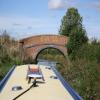
Motorway Field Bridge No 159

 
M40, Little Bourton OX16 2DQ, United Kingdom (M40)
 
Information about the place
Motorway Field Bridge No 159 is a minor waterways place on the Oxford Canal (Southern Section - Main Line) between Concorde Avenue Bridge No 165 (2 miles and 2 locks to the southwest) and Caves Bridge No 157 (1 mile and ¾ furlongs and 1 lock to the north).
 
 
The nearest place in the direction of Concorde Avenue Bridge No 165 is Hardwick Lock Motorway Bridge No 159A; 1¼ furlongs away.
 
The nearest place in the direction of Caves Bridge No 157 is Little Bourton Lock No 27; 3¾ furlongs away.

There is access (unofficial access) to the towpath here.

Mooring here is unrated.

There is a bridge here which takes a track over the canal.


Amenities
 
Maps
If you are a user and are logged on, or if you are actively planning a route, a map will be displayed here.
Show on external mapping site: Google | OSM | Bing
 
Additional information

The works that were being carried out were in connection with the Banbury Flood Alleviation Scheme commissioned by the Environment Agency. This is to the East of the bridge and extends to (Little) Bourton Lock No 27. Earth movers crossed this bridge carrying earth for the 2.9 metre high embankment in which two flow regulating flumes have been installed to back up the water flowing in the River Cherwell to fill a temporary catchment on the fields behind the embankment. There are no moving parts in the project. It is designed to keep the levels in the river below the barrier to within those expected of a "100 year event".In the past two years it has been in full operation once already.
A map is available at http://www.environment-agency.gov.uk/static/documents/Leisure/Banbury_FAS_Masterplan.pdf

 
Photos
 
External websites
 Oxford Canal Walk - Part One - Oxford to Thrupp - YouTube — associated with Oxford Canal
A walk along the Oxford Canal (Southern Section) from Oxford to Thrupp Wide
 
Nearest facilities

Mouseover for more information or show routes to facility

Nearest water point

In the direction of Napton Junction

Cropredy Services2 miles, 3¾ furlongs and 2 locks away
On this waterway in the direction of Napton Junction
Cropredy Marina (southern basin)3 miles, ½ furlongs and 3 locks away
On this waterway in the direction of Napton Junction
Cropredy Marina (northern basins)3 miles, ¾ furlongs and 3 locks away
On this waterway in the direction of Napton Junction
Fenny Compton Wharf8 miles, 6¼ furlongs and 11 locks away
On this waterway in the direction of Napton Junction
Marston Doles Water Point16 miles, 2 furlongs and 11 locks away
On this waterway in the direction of Napton Junction
Water Point at Bottom of Napton Locks18 miles, 2¼ furlongs and 20 locks away
On this waterway in the direction of Napton Junction

In the direction of End of Hythe Bridge Arm

Sovereign Wharf1 mile, 5¾ furlongs and 1 lock away
On this waterway in the direction of End of Hythe Bridge Arm
Banbury Lock No 292 miles and 1 lock away
On this waterway in the direction of End of Hythe Bridge Arm
Cherwell Street Facilities2 miles, ¼ furlongs and 2 locks away
On this waterway in the direction of End of Hythe Bridge Arm
Aynho Wharf8 miles, 6 furlongs and 6 locks away
On this waterway in the direction of End of Hythe Bridge Arm
Heyford Wharf14 miles, 6¼ furlongs and 9 locks away
On this waterway in the direction of End of Hythe Bridge Arm
Heyford Wharf Bridge No 20614 miles, 6½ furlongs and 9 locks away
On this waterway in the direction of End of Hythe Bridge Arm

Nearest rubbish disposal

In the direction of Napton Junction

Cropredy Services2 miles, 3¾ furlongs and 2 locks away
On this waterway in the direction of Napton Junction
Cropredy Marina (southern basin)3 miles, ½ furlongs and 3 locks away
On this waterway in the direction of Napton Junction
Cropredy Marina (northern basins)3 miles, ¾ furlongs and 3 locks away
On this waterway in the direction of Napton Junction
Fenny Compton Marina8 miles, 3½ furlongs and 11 locks away
On this waterway in the direction of Napton Junction
Napton Sanitary Station18 miles, 2 furlongs and 20 locks away
On this waterway in the direction of Napton Junction

In the direction of End of Hythe Bridge Arm

Sovereign Wharf1 mile, 5¾ furlongs and 1 lock away
On this waterway in the direction of End of Hythe Bridge Arm
Cherwell Street Facilities2 miles, ¼ furlongs and 2 locks away
On this waterway in the direction of End of Hythe Bridge Arm
Aynho Wharf8 miles, 6 furlongs and 6 locks away
On this waterway in the direction of End of Hythe Bridge Arm
Heyford Wharf14 miles, 6¼ furlongs and 9 locks away
On this waterway in the direction of End of Hythe Bridge Arm
Heyford Wharf Bridge No 20614 miles, 6½ furlongs and 9 locks away
On this waterway in the direction of End of Hythe Bridge Arm

Nearest chemical toilet disposal

In the direction of Napton Junction

Cropredy Services2 miles, 3¾ furlongs and 2 locks away
On this waterway in the direction of Napton Junction
Cropredy Marina (southern basin)3 miles, ½ furlongs and 3 locks away
On this waterway in the direction of Napton Junction
Napton Sanitary Station18 miles, 2 furlongs and 20 locks away
On this waterway in the direction of Napton Junction

In the direction of End of Hythe Bridge Arm

Sovereign Wharf1 mile, 5¾ furlongs and 1 lock away
On this waterway in the direction of End of Hythe Bridge Arm
Cherwell Street Facilities2 miles, ¼ furlongs and 2 locks away
On this waterway in the direction of End of Hythe Bridge Arm

Nearest place to turn

In the direction of Napton Junction

Cropredy Services2 miles, 3¾ furlongs and 2 locks away
On this waterway in the direction of Napton Junction
Cropredy Marina (southern basin)3 miles, ½ furlongs and 3 locks away
On this waterway in the direction of Napton Junction
Cropredy Marina (northern basins)3 miles, ¾ furlongs and 3 locks away
On this waterway in the direction of Napton Junction
Clattercote Bridge Winding Hole4 miles, 3¾ furlongs and 6 locks away
On this waterway in the direction of Napton Junction
Fenny Compton Marina8 miles, 3½ furlongs and 11 locks away
On this waterway in the direction of Napton Junction
Fenny Compton Wharf8 miles, 6¼ furlongs and 11 locks away
On this waterway in the direction of Napton Junction
Marston Doles Top Lock Winding Hole16 miles, 2¼ furlongs and 11 locks away
On this waterway in the direction of Napton Junction
Old Engine House Arm Junction17 miles, 1 furlong and 13 locks away
On this waterway in the direction of Napton Junction

In the direction of End of Hythe Bridge Arm

Southam Road Footbridge Arm6¾ furlongs and 1 lock away
On this waterway in the direction of End of Hythe Bridge Arm
Southam Road Winding Hole1 mile, 1¼ furlongs and 1 lock away
On this waterway in the direction of End of Hythe Bridge Arm
Grimsbury Wharf1 mile, 2¾ furlongs and 1 lock away
On this waterway in the direction of End of Hythe Bridge Arm
Calthorpe Winding Hole2 miles, 5¾ furlongs and 2 locks away
On this waterway in the direction of End of Hythe Bridge Arm
Twyford Wharf Winding Hole4 miles, 6¼ furlongs and 3 locks away
On this waterway in the direction of End of Hythe Bridge Arm
Winding Hole above Nell Bridge Lock7 miles, 3¼ furlongs and 4 locks away
On this waterway in the direction of End of Hythe Bridge Arm
Aynho Wharf8 miles, 6 furlongs and 6 locks away
On this waterway in the direction of End of Hythe Bridge Arm
Somerton Deep Lock Winding Hole10 miles, 4 furlongs and 6 locks away
On this waterway in the direction of End of Hythe Bridge Arm
Heyford Wharf Winding Hole14 miles, 6 furlongs and 9 locks away
On this waterway in the direction of End of Hythe Bridge Arm
Heyford Wharf14 miles, 6¼ furlongs and 9 locks away
On this waterway in the direction of End of Hythe Bridge Arm
The Cleeves Winding Hole15 miles, 2 furlongs and 9 locks away
On this waterway in the direction of End of Hythe Bridge Arm
Kirtlington Winding Hole18 miles, ½ furlongs and 11 locks away
On this waterway in the direction of End of Hythe Bridge Arm

Nearest self-operated pump-out

In the direction of Napton Junction

Cropredy Marina (southern basin)3 miles, ½ furlongs and 3 locks away
On this waterway in the direction of Napton Junction

Nearest boatyard pump-out

In the direction of Napton Junction

Cropredy Marina (southern basin)3 miles, ½ furlongs and 3 locks away
On this waterway in the direction of Napton Junction

In the direction of End of Hythe Bridge Arm

Sovereign Wharf1 mile, 5¾ furlongs and 1 lock away
On this waterway in the direction of End of Hythe Bridge Arm
Twyford Wharf4 miles, 6½ furlongs and 3 locks away
On this waterway in the direction of End of Hythe Bridge Arm
Aynho Wharf8 miles, 6 furlongs and 6 locks away
On this waterway in the direction of End of Hythe Bridge Arm
Heyford Wharf14 miles, 6¼ furlongs and 9 locks away
On this waterway in the direction of End of Hythe Bridge Arm
Enslow Wharf19 miles, 7¼ furlongs and 12 locks away
On this waterway in the direction of End of Hythe Bridge Arm
Direction of TV transmitter (From Wolfbane Cybernetic)
 
 
Geograph
 
Wikipedia

There is no page on Wikipedia called “Motorway Field Bridge”

Wikipedia pages that might relate to Motorway Field Bridge
[Auchenshuggle Bridge] Auchenshuggle Bridge is the latest bridge to be built over the Clyde in the Auchenshuggle district of Glasgow, carrying the M74 motorway over the river and onto [List of bridges in Croatia] This list of bridges in Croatia lists bridges of particular historical, scenic, architectural or engineering interest. Road and railway bridges, viaducts [Second Severn Crossing] Hafren)—officially renamed the Prince of Wales Bridge (Welsh: Pont Tywysog Cymru)—is the M4 motorway bridge over the River Severn between England and Wales [A1 motorway (Serbia)] The A1 motorway (Serbian: Аутопут А1, romanized: Autoput A1) is a motorway in Serbia and at 588 kilometers (365 mi) it is the longest motorway in Serbia [M6 Motorway (Sydney)] pedestrian bridge across President Avenue. There will also be an upgrade of the Princes Highway and President Avenue intersection. As part of the motorway, a [Adriatic–Ionian motorway] Croatia as part of A1 motorway. Road will be connected to Montenegro through Croatia if currently halted construction of Pelješac Bridge is to be continued [Controlled-access highway] between motorways or a split/merge of two motorways. The motorway rules ends at exits, but not at junctions. At not so few bridges, motorways without [Zwolle] A28 motorway. Another local bridge is adjacent to this bridge. A third bridge carries rail traffic to Leeuwarden and Groningen. Numerous local bridges exist [M2 motorway (Great Britain)] The M2 is a motorway in Kent, England. It is 26 miles (42 km) long and acts as a bypass of the section of the A2 road to run past the Medway Towns, Sittingbourne [Queensferry Crossing] Replacement Crossing) is a road bridge in Scotland. It was built alongside the existing Forth Road Bridge and carries the M90 motorway across the Firth of Forth
 
Google

Results of Google Search

DESIGN AND CONSTRUCTION OF BRIDGE APPROACHES
SYNTHESIS OF HIGHWAY PROGRAM159. PRACTICE. DESIGN ... Cooperative Highway Research Program do not endorse products or manufactur- ers. Trade or ... prediction of field settlement rates, the rate of construction or the duration of  ...
23456 SW 159
into a database the address field should contain the house number, ... The following are standardized examples of county, state, and local highways (see ...
Federal Highway Administration Research List of Online Reports ...
If the publication you seek is not on the list, you may contact the FHWA Research ... Adaptive Highway Bridge Bearings Towards Intelligent Infrastructure Systems ... Crosswalk Marking Field Visibility Study, FHWA-HRT-10-067, October 2010 ... Learned on the Central Artery/Tunnel Project, FHWA-HRT-05-159, June 2006.
Motorway Bridge / Motorway Junction / Sicily / Italy | HD Stock Video ...
This high-quality Rights Managed stock shot in HD from the Motorway Bridge / Motorway Junction / Sicily / Italy stock footage collection is ready for ... [RM] # 159 -170-412 ... Motorway Bridge, Sicily, Grain Field, Hilly Region, Road Traffic, Car, ... Olive Grove, Motorway Bridge, Viniculture, Sicily, Shadow, Non Urban Scene, ...
Two Bay Area Bridges - General Highway History - Highway History
The Golden Gate Bridge, the symbol of San Francisco, is not on the Interstate System. ... were held a month later, on February 26 at the Presidio's Crissy Field. ... 159-160), the RFC financing had created difficulties for the Golden Gate Bridge .
Interstate 5 in Washington - Wikipedia
Interstate 5 (I-5) is an Interstate Highway on the West Coast of the United States, serving as the ... I-5 enters Washington on the Interstate Bridge, a pair of vertical- lift bridges that span the Columbia ... Highway 1 under the state's new highway numbering system, but was not signed to give priority to the overlapping US 99.
MaineDOT 2018-2019-2020 Work Plan
Jan 2, 2018 ... and cannot be used to support non-highway-and-bridge needs. • State General Obligation Bond funding must be used on capital projects and ...