CanalPlanAC

Single Bridge No 202

 
Upper Heyford Common, Upper Heyford OX25 5NQ, United Kingdom
 
Information about the place
Single Bridge No 202 is a minor waterways place on the Oxford Canal (Southern Section - Main Line) between Allen's Lock No 36 (Bridge leads to Upper Heyford village) (2¾ furlongs to the southeast) and Somerton Bridge No 196 (2 miles and ½ furlongs and 1 lock to the north).
 
 
The nearest place in the direction of Allen's Lock No 36 is Double Bridge No 203; 1¾ furlongs away.
 
The nearest place in the direction of Somerton Bridge No 196 is Heyford Common Railway Bridge No 201; 1½ furlongs away.

There is no access to the towpath here.

Mooring here is unrated.

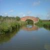
There is a bridge here which takes a track over the canal.


Amenities
 
Maps
If you are a user and are logged on, or if you are actively planning a route, a map will be displayed here.
Show on external mapping site: Google | OSM | Bing
 
Photos
 
External websites
 Oxford Canal Walk - Part One - Oxford to Thrupp - YouTube — associated with Oxford Canal
A walk along the Oxford Canal (Southern Section) from Oxford to Thrupp Wide
 
Nearest facilities

Mouseover for more information or show routes to facility

Nearest water point

In the direction of Napton Junction

Aynho Wharf4 miles, 4¼ furlongs and 2 locks away
On this waterway in the direction of Napton Junction
Cherwell Street Facilities11 miles, 1¾ furlongs and 6 locks away
On this waterway in the direction of Napton Junction
Banbury Lock No 2911 miles, 2 furlongs and 6 locks away
On this waterway in the direction of Napton Junction
Sovereign Wharf11 miles, 4¼ furlongs and 7 locks away
On this waterway in the direction of Napton Junction
Cropredy Services15 miles, 6 furlongs and 10 locks away
On this waterway in the direction of Napton Junction
Cropredy Marina (southern basin)16 miles, 2½ furlongs and 11 locks away
On this waterway in the direction of Napton Junction
Cropredy Marina (northern basins)16 miles, 2¾ furlongs and 11 locks away
On this waterway in the direction of Napton Junction

In the direction of End of Hythe Bridge Arm

Heyford Wharf1 mile, 4 furlongs and 1 lock away
On this waterway in the direction of End of Hythe Bridge Arm
Heyford Wharf Bridge No 2061 mile, 4¼ furlongs and 1 lock away
On this waterway in the direction of End of Hythe Bridge Arm
Thrupp Cruising Club9 miles, ½ furlongs and 6 locks away
On this waterway in the direction of End of Hythe Bridge Arm
Aubreys Lift Bridge No 2219 miles, ¾ furlongs and 6 locks away
On this waterway in the direction of End of Hythe Bridge Arm
Langford Lane Bridge No 2249 miles, 6 furlongs and 6 locks away
On this waterway in the direction of End of Hythe Bridge Arm
Wolvercote Junction Water Point12 miles, 6 furlongs and 8 locks away
On this waterway in the direction of End of Hythe Bridge Arm
Wolvercote Sanitary Station13 miles, 2¼ furlongs and 9 locks away
On this waterway in the direction of End of Hythe Bridge Arm
St Edwards Lift Bridge No 23814 miles, 3 furlongs and 10 locks away
On this waterway in the direction of End of Hythe Bridge Arm
Oxford Visitor Moorings15 miles, 7½ furlongs and 10 locks away
On this waterway in the direction of End of Hythe Bridge Arm
Eynsham Lock16 miles, 1½ furlongs and 10 locks away
Travel to Wolvercote Junction, then on the Oxford Canal (Duke's Cut) to Duke's Cut Junction, then on the River Thames (above Oxford) to Eynsham Lock

Nearest rubbish disposal

In the direction of Napton Junction

Aynho Wharf4 miles, 4¼ furlongs and 2 locks away
On this waterway in the direction of Napton Junction
Cherwell Street Facilities11 miles, 1¾ furlongs and 6 locks away
On this waterway in the direction of Napton Junction
Sovereign Wharf11 miles, 4¼ furlongs and 7 locks away
On this waterway in the direction of Napton Junction
Cropredy Services15 miles, 6 furlongs and 10 locks away
On this waterway in the direction of Napton Junction
Cropredy Marina (southern basin)16 miles, 2½ furlongs and 11 locks away
On this waterway in the direction of Napton Junction
Cropredy Marina (northern basins)16 miles, 2¾ furlongs and 11 locks away
On this waterway in the direction of Napton Junction

In the direction of End of Hythe Bridge Arm

Heyford Wharf1 mile, 4 furlongs and 1 lock away
On this waterway in the direction of End of Hythe Bridge Arm
Heyford Wharf Bridge No 2061 mile, 4¼ furlongs and 1 lock away
On this waterway in the direction of End of Hythe Bridge Arm
Thrupp Cruising Club9 miles, ½ furlongs and 6 locks away
On this waterway in the direction of End of Hythe Bridge Arm
Aubreys Lift Bridge No 2219 miles, ¾ furlongs and 6 locks away
On this waterway in the direction of End of Hythe Bridge Arm
Wolvercote Sanitary Station13 miles, 2¼ furlongs and 9 locks away
On this waterway in the direction of End of Hythe Bridge Arm
Eynsham Lock16 miles, 1½ furlongs and 10 locks away
Travel to Wolvercote Junction, then on the Oxford Canal (Duke's Cut) to Duke's Cut Junction, then on the River Thames (above Oxford) to Eynsham Lock

Nearest chemical toilet disposal

In the direction of Napton Junction

Cherwell Street Facilities11 miles, 1¾ furlongs and 6 locks away
On this waterway in the direction of Napton Junction
Sovereign Wharf11 miles, 4¼ furlongs and 7 locks away
On this waterway in the direction of Napton Junction
Cropredy Services15 miles, 6 furlongs and 10 locks away
On this waterway in the direction of Napton Junction
Cropredy Marina (southern basin)16 miles, 2½ furlongs and 11 locks away
On this waterway in the direction of Napton Junction

In the direction of End of Hythe Bridge Arm

Thrupp Cruising Club9 miles, ½ furlongs and 6 locks away
On this waterway in the direction of End of Hythe Bridge Arm
Wolvercote Sanitary Station13 miles, 2¼ furlongs and 9 locks away
On this waterway in the direction of End of Hythe Bridge Arm
Eynsham Lock16 miles, 1½ furlongs and 10 locks away
Travel to Wolvercote Junction, then on the Oxford Canal (Duke's Cut) to Duke's Cut Junction, then on the River Thames (above Oxford) to Eynsham Lock

Nearest place to turn

In the direction of Napton Junction

Somerton Deep Lock Winding Hole2 miles, 6 furlongs and 2 locks away
On this waterway in the direction of Napton Junction
Aynho Wharf4 miles, 4¼ furlongs and 2 locks away
On this waterway in the direction of Napton Junction
Winding Hole above Nell Bridge Lock5 miles, 6¾ furlongs and 4 locks away
On this waterway in the direction of Napton Junction
Twyford Wharf Winding Hole8 miles, 3¾ furlongs and 5 locks away
On this waterway in the direction of Napton Junction
Calthorpe Winding Hole10 miles, 4½ furlongs and 6 locks away
On this waterway in the direction of Napton Junction
Grimsbury Wharf11 miles, 7½ furlongs and 7 locks away
On this waterway in the direction of Napton Junction
Southam Road Winding Hole12 miles, ¾ furlongs and 7 locks away
On this waterway in the direction of Napton Junction
Southam Road Footbridge Arm12 miles, 3¼ furlongs and 7 locks away
On this waterway in the direction of Napton Junction
Cropredy Services15 miles, 6 furlongs and 10 locks away
On this waterway in the direction of Napton Junction

In the direction of End of Hythe Bridge Arm

Heyford Wharf Winding Hole1 mile, 4 furlongs and 1 lock away
On this waterway in the direction of End of Hythe Bridge Arm
Heyford Wharf1 mile, 4 furlongs and 1 lock away
On this waterway in the direction of End of Hythe Bridge Arm
The Cleeves Winding Hole2 miles and 1 lock away
On this waterway in the direction of End of Hythe Bridge Arm
Kirtlington Winding Hole4 miles, 6½ furlongs and 3 locks away
On this waterway in the direction of End of Hythe Bridge Arm
Enslow Winding Hole6 miles, 4 furlongs and 4 locks away
On this waterway in the direction of End of Hythe Bridge Arm
Shipton Weir Junction8 miles and 5 locks away
On this waterway in the direction of End of Hythe Bridge Arm
Thrupp Wide9 miles, ½ furlongs and 6 locks away
On this waterway in the direction of End of Hythe Bridge Arm
Wolvercote Junction12 miles, 6¾ furlongs and 9 locks away
On this waterway in the direction of End of Hythe Bridge Arm
Bypass Reservoir Junction13 miles, ¾ furlongs and 10 locks away
Travel to Wolvercote Junction, then on the Oxford Canal (Duke's Cut) to Bypass Reservoir Junction
Duke's Cut Junction13 miles, 5 furlongs and 10 locks away
Travel to Wolvercote Junction, then on the Oxford Canal (Duke's Cut) to Duke's Cut Junction
Hythe Bridge Arm Winding Hole15 miles, 6½ furlongs and 10 locks away
On this waterway in the direction of End of Hythe Bridge Arm

Nearest self-operated pump-out

In the direction of Napton Junction

Cropredy Marina (southern basin)16 miles, 2½ furlongs and 11 locks away
On this waterway in the direction of Napton Junction

In the direction of End of Hythe Bridge Arm

Thrupp Cruising Club9 miles, ½ furlongs and 6 locks away
On this waterway in the direction of End of Hythe Bridge Arm
Aubreys Lift Bridge No 2219 miles, ¾ furlongs and 6 locks away
On this waterway in the direction of End of Hythe Bridge Arm
Eynsham Lock16 miles, 1½ furlongs and 10 locks away
Travel to Wolvercote Junction, then on the Oxford Canal (Duke's Cut) to Duke's Cut Junction, then on the River Thames (above Oxford) to Eynsham Lock

Nearest boatyard pump-out

In the direction of Napton Junction

Aynho Wharf4 miles, 4¼ furlongs and 2 locks away
On this waterway in the direction of Napton Junction
Twyford Wharf8 miles, 3½ furlongs and 5 locks away
On this waterway in the direction of Napton Junction
Sovereign Wharf11 miles, 4¼ furlongs and 7 locks away
On this waterway in the direction of Napton Junction
Cropredy Marina (southern basin)16 miles, 2½ furlongs and 11 locks away
On this waterway in the direction of Napton Junction

In the direction of End of Hythe Bridge Arm

Heyford Wharf1 mile, 4 furlongs and 1 lock away
On this waterway in the direction of End of Hythe Bridge Arm
Enslow Wharf6 miles, 5 furlongs and 4 locks away
On this waterway in the direction of End of Hythe Bridge Arm
Oxford Cruisers Marina17 miles, 1¼ furlongs and 11 locks away
Travel to Wolvercote Junction, then on the Oxford Canal (Duke's Cut) to Duke's Cut Junction, then on the River Thames (above Oxford) to Oxford Cruisers Marina
Direction of TV transmitter (From Wolfbane Cybernetic)
 
 
Geograph
 
Wikipedia

There is no page on Wikipedia called “Single Bridge”

Wikipedia pages that might relate to Single Bridge
[Bascule bridge] It may be single- or double-leafed. The name comes from the French term for balance scale, which employs the same principle. Bascule bridges are the most [Spanning Tree Protocol] network of connected layer-2 bridges, and disables those links that are not part of the spanning tree, leaving a single active path between any two network [Bridging (networking)] A network bridge is a computer networking device that creates a single, aggregate network from multiple communication networks or network segments. This [Silver Bridge] the failure of a single eyebar in a suspension chain, due to a small defect 0.1 inches (2.5 mm) deep. Analysis showed that the bridge was carrying much [Frankie Bridge] musical television program, I Dream. Bridge played a main role in the show and went onto release the duet single "Dreaming" along with fellow S Club 8 [Dua Lipa discography] "New Rules" earned Lipa her first UK number one single while she featured on the charity single "Bridge over Troubled Water" as part of Artists for Grenfell [Under the Bridge] "Under the Bridge" is a song by American rock band Red Hot Chili Peppers. It is the eleventh track on the group's fifth studio album, Blood Sugar Sex Magik [NVLink] NVLink-Bridge") GeForce RTX 2080 Ti based on TU102 (with single bridge "GeForce RTX NVLink-Bridge") Quadro RTX 5000 based on TU104 (with single bridge "NVLink" [Forth Bridge] When it opened it had the longest single cantilever bridge span in the world, until 1919 when the Quebec Bridge in Canada was completed. It continues [Interstate Bridge] The Interstate Bridge (also Columbia River Interstate Bridge, I-5 Bridge, Portland-Vancouver Interstate Bridge, Vancouver-Portland Bridge) is a pair of
 
Google