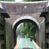
Forest Road Bridge No 108  
 
Wootton Rivers SN8 4NN, United Kingdom 

Forest Road Bridge No 108
is a minor waterways place
on the Kennet and Avon Canal (Main Line) between
  Newbury Bridge No 60 (20 miles
    and 35 locks
   to the east) and
  Pewsey Wharf (2 miles and 7¼ furlongs
   to the west).
  The nearest place in the direction of Newbury Bridge No 60 is Wootton Rivers Bottom Lock No 51 (Wootton Rivers);
  a few yards
   away.
   
  The nearest place in the direction of Pewsey Wharf is Wootton Rivers Farm Bridge No 109;
  1¼ furlongs
   away.
There may be access to the towpath here.
Mooring here is impossible (it may be physically impossible, forbidden, or allowed only for specific short-term purposes).
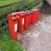
Facilities: rubbish disposal, paper recycling, tin can recycling and aluminium can recycling.
There is a bridge here which takes a minor road over the canal.
| Brimslade Bridge No 106 | 6 furlongs | |
| Heathy Close Lock No 52 | 2¼ furlongs | |
| Heathy Close Bridge | 2 furlongs | |
| Wootton Rivers Visitor Moorings | ½ furlongs | |
| Wootton Rivers Bottom Lock No 51 | a few yards | |
| Forest Road Bridge No 108 | ||
| Wootton Rivers Farm Bridge No 109 | 1¼ furlongs | |
| Wootton Rivers Farm Bridge Winding Hole | 1½ furlongs | |
| Wootton Rivers Bridge No 110 | 3¼ furlongs | |
| New Mill Bridge | 1 mile, ¼ furlongs | |
| Milkhouse Water Winding Hole | 1 mile, 3½ furlongs | |
There are no links to external websites from here.
Why not log in and add some (select "External websites" from the menu (sometimes this is under "Edit"))?
Mouseover for more information or show routes to facility
Nearest water point
In the direction of River Avon Junction
Pewsey Wharf — 2 miles, 7¼ furlongs  away
On this waterway in the direction of River Avon Junction
Honeystreet Wharf — 6 miles, 3 furlongs  away
On this waterway in the direction of River Avon Junction
Devizes Wharf — 13 miles, 5¾ furlongs  away
On this waterway in the direction of River Avon Junction
Devizes Lock 45 Services — 14 miles, 6 furlongs  and 6 locks away
On this waterway in the direction of River Avon Junction
Sells Green Visitor Moorings — 17 miles, 4¼ furlongs  and 29 locks away
On this waterway in the direction of River Avon Junction
Seend Wharf — 18 miles, 6¼ furlongs  and 32 locks away
On this waterway in the direction of River Avon Junction
In the direction of Northcroft Lane Arm
Wootton Rivers Visitor Moorings — ½ furlongs  and 1 lock away
On this waterway in the direction of Northcroft Lane Arm
Crofton Lock No 60 — 4 miles, 2 furlongs  and 9 locks away
On this waterway in the direction of Northcroft Lane Arm
Great Bedwyn Wharf — 6 miles  and 14 locks away
On this waterway in the direction of Northcroft Lane Arm
Station Road Bridge No 83 — 10 miles, 7¾ furlongs  and 24 locks away
On this waterway in the direction of Northcroft Lane Arm
Kintbury Services — 13 miles, 7½ furlongs  and 27 locks away
On this waterway in the direction of Northcroft Lane ArmNearest rubbish disposal
The nearest rubbish disposal is here.  Others are at:
In the direction of River Avon Junction
Pewsey Wharf — 2 miles, 7¼ furlongs  away
On this waterway in the direction of River Avon Junction
Devizes Wharf — 13 miles, 5¾ furlongs  away
On this waterway in the direction of River Avon Junction
Devizes Lock 45 Services — 14 miles, 6 furlongs  and 6 locks away
On this waterway in the direction of River Avon Junction
Sells Green Visitor Moorings — 17 miles, 4¼ furlongs  and 29 locks away
On this waterway in the direction of River Avon Junction
Seend Wharf Bridge No 153 — 18 miles, 5¾ furlongs  and 32 locks away
On this waterway in the direction of River Avon Junction
In the direction of Northcroft Lane Arm
Crofton Lock No 60 — 4 miles, 2 furlongs  and 9 locks away
On this waterway in the direction of Northcroft Lane Arm
Great Bedwyn Wharf — 6 miles  and 14 locks away
On this waterway in the direction of Northcroft Lane Arm
Kintbury Services — 13 miles, 7½ furlongs  and 27 locks away
On this waterway in the direction of Northcroft Lane ArmNearest chemical toilet disposal
In the direction of River Avon Junction
Pewsey Wharf — 2 miles, 7¼ furlongs  away
On this waterway in the direction of River Avon Junction
Devizes Marina — 12 miles, 1¼ furlongs  away
On this waterway in the direction of River Avon Junction
Devizes Wharf — 13 miles, 5¾ furlongs  away
On this waterway in the direction of River Avon Junction
Devizes Lock 45 Services — 14 miles, 6 furlongs  and 6 locks away
On this waterway in the direction of River Avon Junction
Caen Hill Marina — 16 miles, 4¾ furlongs  and 29 locks away
On this waterway in the direction of River Avon Junction
Seend Wharf — 18 miles, 6¼ furlongs  and 32 locks away
On this waterway in the direction of River Avon Junction
In the direction of Northcroft Lane Arm
Great Bedwyn Wharf — 6 miles  and 14 locks away
On this waterway in the direction of Northcroft Lane Arm
Station Road Bridge No 83 — 10 miles, 7¾ furlongs  and 24 locks away
On this waterway in the direction of Northcroft Lane Arm
Kintbury Services — 13 miles, 7½ furlongs  and 27 locks away
On this waterway in the direction of Northcroft Lane ArmNearest place to turn
In the direction of River Avon Junction
Wootton Rivers Farm Bridge Winding Hole — 1½ furlongs  away
On this waterway in the direction of River Avon Junction
Milkhouse Water Winding Hole — 1 mile, 3½ furlongs  away
On this waterway in the direction of River Avon Junction
Pewsey Winding Hole — 3 miles, 1 furlong  away
On this waterway in the direction of River Avon Junction
Wilcot Wide — 4 miles, 4¾ furlongs  away
On this waterway in the direction of River Avon Junction
Alton Valley Bridge No 123 Winding Hole — 6 miles  away
On this waterway in the direction of River Avon Junction
Allington Swing Bridge No 129 Winding Hole — 8 miles, 4¼ furlongs  away
On this waterway in the direction of River Avon Junction
Horton Bridge Winding Hole — 10 miles, 5¾ furlongs  away
On this waterway in the direction of River Avon Junction
Devizes Marina Winding Hole — 12 miles, ¼ furlongs  away
On this waterway in the direction of River Avon Junction
Devizes Wharf Winding Hole — 13 miles, 6½ furlongs  away
On this waterway in the direction of River Avon Junction
In the direction of Northcroft Lane Arm
Burbage Wharf — 1 mile, 5 furlongs  and 4 locks away
On this waterway in the direction of Northcroft Lane Arm
Winding Hole above Crofton Top Lock — 3 miles, 3 furlongs  and 4 locks away
On this waterway in the direction of Northcroft Lane Arm
Crofton Lock No 60 Winding Hole — 4 miles, 2¼ furlongs  and 10 locks away
On this waterway in the direction of Northcroft Lane Arm
Winding Hole above Crofton Bottom Lock No 63 — 5 miles, ½ furlongs  and 12 locks away
On this waterway in the direction of Northcroft Lane Arm
Great Bedwyn Winding Hole — 5 miles, 7½ furlongs  and 14 locks away
On this waterway in the direction of Northcroft Lane Arm
Frith Copse Winding Hole — 8 miles, 1¼ furlongs  and 18 locks away
On this waterway in the direction of Northcroft Lane Arm
Froxfield Bridge Winding Hole — 8 miles, 4¾ furlongs  and 20 locks away
On this waterway in the direction of Northcroft Lane Arm
Winding Hole above Station Road Bridge — 10 miles, 7½ furlongs  and 24 locks away
On this waterway in the direction of Northcroft Lane Arm
Dunn Mill Winding Hole — 11 miles, 5¼ furlongs  and 24 locks away
On this waterway in the direction of Northcroft Lane Arm
Denford Mill Winding Hole — 11 miles, 7¼ furlongs  and 25 locks away
On this waterway in the direction of Northcroft Lane Arm
Wire Bridge Winding Hole — 12 miles, 4¼ furlongs  and 26 locks away
On this waterway in the direction of Northcroft Lane ArmNearest self-operated pump-out
In the direction of River Avon Junction
Pewsey Wharf — 2 miles, 7¼ furlongs  away
On this waterway in the direction of River Avon Junction
Devizes Wharf — 13 miles, 5¾ furlongs  away
On this waterway in the direction of River Avon Junction
Devizes Lock 45 Services — 14 miles, 6 furlongs  and 6 locks away
On this waterway in the direction of River Avon Junction
Seend Wharf — 18 miles, 6¼ furlongs  and 32 locks away
On this waterway in the direction of River Avon Junction
In the direction of Northcroft Lane Arm
Great Bedwyn Wharf — 6 miles  and 14 locks away
On this waterway in the direction of Northcroft Lane Arm
Kintbury Services — 13 miles, 7½ furlongs  and 27 locks away
On this waterway in the direction of Northcroft Lane ArmNearest boatyard pump-out
In the direction of River Avon Junction
Old Builders Wharf — 6 miles, 1½ furlongs  away
On this waterway in the direction of River Avon Junction
Devizes Marina — 12 miles, 1¼ furlongs  away
On this waterway in the direction of River Avon Junction
Caen Hill Marina — 16 miles, 4¾ furlongs  and 29 locks away
On this waterway in the direction of River Avon JunctionDirection of TV transmitter (From Wolfbane Cybernetic)
 
There is no page on Wikipedia called “Forest Road Bridge”
Wikipedia pages that might relate to Forest Road Bridge
[Lea Bridge Road]
Lea Bridge Road is a major through route in east London, across the Lea Valley from Clapton to Whipps Cross in Leyton. It forms part of the A104 road. Places
[Bridge to Nowhere (San Gabriel Mountains)]
flood of March 1–2, 1938. The East Fork Road project was abandoned as a result of the floods, leaving the bridge forever stranded in the middle of what
[High Steel Bridge]
High Steel Bridge is a truss arch bridge that spans the south fork of the Skokomish River, on Forest Service road #2202, near the city of Shelton, Washington
[Spiral bridge]
A spiral bridge, loop bridge, or pigtail bridge is a road bridge which loops over its own road, allowing the road to climb rapidly. This is useful in steep
[Lea Bridge railway station]
junction with Lea Bridge Road (A104) and Orient Way, serving the areas of Lea Bridge and Leyton in the London Borough of Waltham Forest, north-east London
[Lea Bridge]
Lea Bridge is a district in the London Borough of Hackney and the London Borough of Waltham Forest in London, England. It lies 7 miles (11.3 km) northeast
[Forest Lodge, New South Wales]
houses in varying states of restoration. Forest Lodge Public School is on the corner of Pyrmont Bridge Road and Ross Street. The University of Sydney
[Old Alton Bridge]
Old Alton Bridge, also known as Goatman's Bridge, is a historic iron truss bridge connecting the Texas cities of Denton and Copper Canyon. Built in 1884
[Follett Stone Arch Bridge Historic District]
his bridges. The surrounding area once had seven, but three have been demolished or washed away. Located just upstream of State Forest/West Hill Road (about
[Bixby Creek Bridge]
of the bridge in 1932, residents of the Big Sur area were virtually cut off during winter due to blockages on the often impassable Old Coast Road, which


![Vegetable stall in the garden of Lock House. On the south side of Wootton Rivers Bottom Lock [no 51]. Apples, potatoes, tomatoes, runner beans, courgettes and onions for sale. by Christine Johnstone – 02 October 2013](https://s3.geograph.org.uk/geophotos/03/70/42/3704295_7ab11866_120x120.jpg)


![Lock House, Wootton Rivers. On the south bank of Wootton Rivers Bottom Lock [no 51]. by Christine Johnstone – 30 September 2013](https://s3.geograph.org.uk/geophotos/03/70/08/3700871_b4b7d565_120x120.jpg)


![Narrowboats moored between locks 51 and 52. On the south [towpath] bank of the Kennet & Avon canal, east of Wootton Rivers. by Christine Johnstone – 02 October 2013](https://s2.geograph.org.uk/geophotos/03/70/43/3704306_81b039b7_120x120.jpg)