CanalPlanAC

Stouton Croft Footbridge No 12

 
Vernon Grove, Wychavon WR9 9LQ, United Kingdom
 
Information about the place
Stouton Croft Footbridge No 12 is a minor waterways place on the Droitwich Canals (Droitwich Barge Canal) between Hawford Junction (Junction of Droitwich Canal with River Severn) (5 miles and ¼ furlongs and 8 locks to the southwest) and Droitwich Junction (Junction of Droitwich Barge Canal and Droitwich Junction Canal) (6¼ furlongs and 1 lock to the east).
 
 
The nearest place in the direction of Hawford Junction is Siding Lane Wharf; 3 furlongs away.
 
The nearest place in the direction of Droitwich Junction is Salwarpe Road Bridge 13; 1¾ furlongs away.

There may be access to the towpath here.

Mooring here is unrated.

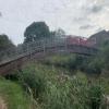
There is a bridge here which takes pedestrian traffic over the canal.


Amenities

Amenities here

 Costcutter

Amenities nearby at Salwarpe Road Bridge 13

 Aldi
 Homebase
 Droitwich Spa Station
 
Maps
If you are a user and are logged on, or if you are actively planning a route, a map will be displayed here.
Show on external mapping site: Google | OSM | Bing
 
Photos
 
External websites
There are no links to external websites from here.
Why not log in and add some (select "External websites" from the menu (sometimes this is under "Edit"))?
 
Nearest facilities

Mouseover for more information or show routes to facility

Nearest water point

In the direction of Droitwich Junction

Netherwich Basin3½ furlongs away
On this waterway in the direction of Droitwich Junction
Droitwich Spa Marina1 mile, 7 furlongs and 5 locks away
Travel to Droitwich Junction, then on the Droitwich Canals (Droitwich Junction Canal) to Droitwich Spa Marina
Hanbury Boatyard2 miles, 3 furlongs and 8 locks away
Travel to Droitwich Junction, then on the Droitwich Canals (Droitwich Junction Canal) to Hanbury Junction, then on the Worcester and Birmingham Canal (Diglis Basin to King's Norton Junction) to Hanbury Boatyard
Stoke Works Water Point4 miles, 6¼ furlongs and 14 locks away
Travel to Droitwich Junction, then on the Droitwich Canals (Droitwich Junction Canal) to Hanbury Junction, then on the Worcester and Birmingham Canal (Diglis Basin to King's Norton Junction) to Stoke Works Water Point
Tardebigge Wharf8 miles, 6¾ furlongs and 50 locks away
Travel to Droitwich Junction, then on the Droitwich Canals (Droitwich Junction Canal) to Hanbury Junction, then on the Worcester and Birmingham Canal (Diglis Basin to King's Norton Junction) to Tardebigge Wharf
Hopwood Visitor Moorings14 miles, 2½ furlongs and 50 locks away
Travel to Droitwich Junction, then on the Droitwich Canals (Droitwich Junction Canal) to Hanbury Junction, then on the Worcester and Birmingham Canal (Diglis Basin to King's Norton Junction) to Hopwood Visitor Moorings
King's Norton Water Point17 miles, 3¾ furlongs and 50 locks away
Travel to Droitwich Junction, then on the Droitwich Canals (Droitwich Junction Canal) to Hanbury Junction, then on the Worcester and Birmingham Canal (Diglis Basin to King's Norton Junction) to King's Norton Water Point

In the direction of Hawford Junction

Holt Lock (Holt Fleet)8 miles and 8 locks away
Travel to Hawford Junction, then on the River Severn (main river - Stourport to Worcester) to Holt Lock (Holt Fleet)
Worcester Trip Boat Moorings8 miles, 5½ furlongs and 9 locks away
Travel to Hawford Junction, then on the River Severn (main river - Stourport to Worcester) to Worcester Trip Boat Moorings
Diglis Locks9 miles, 6 furlongs and 9 locks away
Travel to Hawford Junction, then on the River Severn (main river - Stourport to Worcester) to Diglis Junction, then on the River Severn (main river - Worcester to Gloucester) to Diglis Locks
Diglis Services9 miles, 5¼ furlongs and 11 locks away
Travel to Hawford Junction, then on the River Severn (main river - Stourport to Worcester) to Diglis Junction, then on the Worcester and Birmingham Canal (Diglis Junction to Diglis Basin) to Diglis Basin, then on the Worcester and Birmingham Canal (Diglis Basin to King's Norton Junction) to Diglis Services
Lincomb Lock12 miles, 1¾ furlongs and 9 locks away
Travel to Hawford Junction, then on the River Severn (main river - Stourport to Worcester) to Lincomb Lock
Lowesmoor Basin10 miles, 4¾ furlongs and 13 locks away
Travel to Hawford Junction, then on the River Severn (main river - Stourport to Worcester) to Diglis Junction, then on the Worcester and Birmingham Canal (Diglis Junction to Diglis Basin) to Diglis Basin, then on the Worcester and Birmingham Canal (Diglis Basin to King's Norton Junction) to Lowesmoor Basin
Upper Basin Waterpoint13 miles, 5 furlongs and 12 locks away
Travel to Hawford Junction, then on the River Severn (main river - Stourport to Worcester) to Severn - Stourport Broad Locks Entrance, then on the Staffordshire and Worcestershire Canal (Stourport Basins: Broad Route) to Stourport Upper Basin, then on the Staffordshire and Worcestershire Canal (Stourport Basins: Narrow Route) to Upper Basin Waterpoint
Caldwall Mill Bridge No 1417 miles, 3¼ furlongs and 15 locks away
Travel to Hawford Junction, then on the River Severn (main river - Stourport to Worcester) to Severn - Stourport Broad Locks Entrance, then on the Staffordshire and Worcestershire Canal (Stourport Basins: Broad Route) to Stourport Upper Basin, then on the Staffordshire and Worcestershire Canal (Stourport Basins: Narrow Route) to York Street Bridge, then on the Staffordshire and Worcestershire Canal (Main Line: Stourport to Stourton) to Caldwall Mill Bridge No 14

Nearest rubbish disposal

In the direction of Droitwich Junction

Netherwich Basin3½ furlongs away
On this waterway in the direction of Droitwich Junction
Droitwich Spa Marina1 mile, 7 furlongs and 5 locks away
Travel to Droitwich Junction, then on the Droitwich Canals (Droitwich Junction Canal) to Droitwich Spa Marina
Stoke Bottom Lock No 235 miles, 4¼ furlongs and 14 locks away
Travel to Droitwich Junction, then on the Droitwich Canals (Droitwich Junction Canal) to Hanbury Junction, then on the Worcester and Birmingham Canal (Diglis Basin to King's Norton Junction) to Stoke Bottom Lock No 23
Tardebigge Wharf8 miles, 6¾ furlongs and 50 locks away
Travel to Droitwich Junction, then on the Droitwich Canals (Droitwich Junction Canal) to Hanbury Junction, then on the Worcester and Birmingham Canal (Diglis Basin to King's Norton Junction) to Tardebigge Wharf

In the direction of Hawford Junction

Sabrina Footbridge8 miles, 3½ furlongs and 9 locks away
Travel to Hawford Junction, then on the River Severn (main river - Stourport to Worcester) to Sabrina Footbridge
Diglis Basin9 miles, 4½ furlongs and 11 locks away
Travel to Hawford Junction, then on the River Severn (main river - Stourport to Worcester) to Diglis Junction, then on the Worcester and Birmingham Canal (Diglis Junction to Diglis Basin) to Diglis Basin
Lowesmoor Basin10 miles, 4¾ furlongs and 13 locks away
Travel to Hawford Junction, then on the River Severn (main river - Stourport to Worcester) to Diglis Junction, then on the Worcester and Birmingham Canal (Diglis Junction to Diglis Basin) to Diglis Basin, then on the Worcester and Birmingham Canal (Diglis Basin to King's Norton Junction) to Lowesmoor Basin
Upper Basin Waterpoint13 miles, 5 furlongs and 12 locks away
Travel to Hawford Junction, then on the River Severn (main river - Stourport to Worcester) to Severn - Stourport Broad Locks Entrance, then on the Staffordshire and Worcestershire Canal (Stourport Basins: Broad Route) to Stourport Upper Basin, then on the Staffordshire and Worcestershire Canal (Stourport Basins: Narrow Route) to Upper Basin Waterpoint

Nearest chemical toilet disposal

In the direction of Droitwich Junction

Droitwich Spa Marina1 mile, 7 furlongs and 5 locks away
Travel to Droitwich Junction, then on the Droitwich Canals (Droitwich Junction Canal) to Droitwich Spa Marina
Stoke Bottom Lock No 235 miles, 4¼ furlongs and 14 locks away
Travel to Droitwich Junction, then on the Droitwich Canals (Droitwich Junction Canal) to Hanbury Junction, then on the Worcester and Birmingham Canal (Diglis Basin to King's Norton Junction) to Stoke Bottom Lock No 23
Tardebigge Wharf8 miles, 6¾ furlongs and 50 locks away
Travel to Droitwich Junction, then on the Droitwich Canals (Droitwich Junction Canal) to Hanbury Junction, then on the Worcester and Birmingham Canal (Diglis Basin to King's Norton Junction) to Tardebigge Wharf

In the direction of Hawford Junction

Diglis Services9 miles, 5¼ furlongs and 11 locks away
Travel to Hawford Junction, then on the River Severn (main river - Stourport to Worcester) to Diglis Junction, then on the Worcester and Birmingham Canal (Diglis Junction to Diglis Basin) to Diglis Basin, then on the Worcester and Birmingham Canal (Diglis Basin to King's Norton Junction) to Diglis Services
Stourport Marina12 miles, 5 furlongs and 10 locks away
Travel to Hawford Junction, then on the River Severn (main river - Stourport to Worcester) to Stourport Marina
Lowesmoor Basin10 miles, 4¾ furlongs and 13 locks away
Travel to Hawford Junction, then on the River Severn (main river - Stourport to Worcester) to Diglis Junction, then on the Worcester and Birmingham Canal (Diglis Junction to Diglis Basin) to Diglis Basin, then on the Worcester and Birmingham Canal (Diglis Basin to King's Norton Junction) to Lowesmoor Basin
Upper Basin Waterpoint13 miles, 5 furlongs and 12 locks away
Travel to Hawford Junction, then on the River Severn (main river - Stourport to Worcester) to Severn - Stourport Broad Locks Entrance, then on the Staffordshire and Worcestershire Canal (Stourport Basins: Broad Route) to Stourport Upper Basin, then on the Staffordshire and Worcestershire Canal (Stourport Basins: Narrow Route) to Upper Basin Waterpoint
Caldwall Mill Bridge No 1417 miles, 3¼ furlongs and 15 locks away
Travel to Hawford Junction, then on the River Severn (main river - Stourport to Worcester) to Severn - Stourport Broad Locks Entrance, then on the Staffordshire and Worcestershire Canal (Stourport Basins: Broad Route) to Stourport Upper Basin, then on the Staffordshire and Worcestershire Canal (Stourport Basins: Narrow Route) to York Street Bridge, then on the Staffordshire and Worcestershire Canal (Main Line: Stourport to Stourton) to Caldwall Mill Bridge No 14

Nearest place to turn

In the direction of Droitwich Junction

On this waterway in the direction of Droitwich Junction
Netherwich Basin3½ furlongs away
On this waterway in the direction of Droitwich Junction
Droitwich Town Wharf5½ furlongs away
On this waterway in the direction of Droitwich Junction
Lock No 6 Winding Hole1 mile, 4 furlongs and 3 locks away
Travel to Droitwich Junction, then on the Droitwich Canals (Droitwich Junction Canal) to Lock No 6 Winding Hole
Droitwich Spa Marina1 mile, 7 furlongs and 5 locks away
Travel to Droitwich Junction, then on the Droitwich Canals (Droitwich Junction Canal) to Droitwich Spa Marina
Hanbury Junction2 miles, 2¼ furlongs and 8 locks away
Travel to Droitwich Junction, then on the Droitwich Canals (Droitwich Junction Canal) to Hanbury Junction
Hanbury Boatyard2 miles, 3 furlongs and 8 locks away
Travel to Droitwich Junction, then on the Droitwich Canals (Droitwich Junction Canal) to Hanbury Junction, then on the Worcester and Birmingham Canal (Diglis Basin to King's Norton Junction) to Hanbury Boatyard
Hanbury Junction Winding Hole2 miles, 3½ furlongs and 8 locks away
Travel to Droitwich Junction, then on the Droitwich Canals (Droitwich Junction Canal) to Hanbury Junction, then on the Worcester and Birmingham Canal (Diglis Basin to King's Norton Junction) to Hanbury Junction Winding Hole
Dunhampstead Boatyard4 miles, 1½ furlongs and 8 locks away
Travel to Droitwich Junction, then on the Droitwich Canals (Droitwich Junction Canal) to Hanbury Junction, then on the Worcester and Birmingham Canal (Diglis Basin to King's Norton Junction) to Dunhampstead Boatyard
Dunhampstead Winding Hole4 miles, 3¾ furlongs and 8 locks away
Travel to Droitwich Junction, then on the Droitwich Canals (Droitwich Junction Canal) to Hanbury Junction, then on the Worcester and Birmingham Canal (Diglis Basin to King's Norton Junction) to Dunhampstead Winding Hole
Tibberton Winding Hole5 miles, 3¼ furlongs and 8 locks away
Travel to Droitwich Junction, then on the Droitwich Canals (Droitwich Junction Canal) to Hanbury Junction, then on the Worcester and Birmingham Canal (Diglis Basin to King's Norton Junction) to Tibberton Winding Hole
Astwood Winding Hole3 miles, 7¾ furlongs and 10 locks away
Travel to Droitwich Junction, then on the Droitwich Canals (Droitwich Junction Canal) to Hanbury Junction, then on the Worcester and Birmingham Canal (Diglis Basin to King's Norton Junction) to Astwood Winding Hole
Stoke Wharf5 miles, 4¾ furlongs and 15 locks away
Travel to Droitwich Junction, then on the Droitwich Canals (Droitwich Junction Canal) to Hanbury Junction, then on the Worcester and Birmingham Canal (Diglis Basin to King's Norton Junction) to Stoke Wharf

In the direction of Hawford Junction

Ladywood Top Lock Winding Hole2 miles, 2¾ furlongs away
On this waterway in the direction of Hawford Junction
Bevere Lock Weir Entrance5 miles, 2¼ furlongs and 8 locks away
Travel to Hawford Junction, then on the River Severn (main river - Stourport to Worcester) to Bevere Lock Weir Entrance
Bevere Lock Weir Exit5 miles, 5 furlongs and 9 locks away
Travel to Hawford Junction, then on the River Severn (main river - Stourport to Worcester) to Bevere Lock Weir Exit
Holt Lock Weir Exit7 miles, 7 furlongs and 8 locks away
Travel to Hawford Junction, then on the River Severn (main river - Stourport to Worcester) to Holt Lock Weir Exit
Holt Lock Weir Entrance8 miles, 2¼ furlongs and 9 locks away
Travel to Hawford Junction, then on the River Severn (main river - Stourport to Worcester) to Holt Lock Weir Entrance
Diglis Junction9 miles, 3½ furlongs and 9 locks away
Travel to Hawford Junction, then on the River Severn (main river - Stourport to Worcester) to Diglis Junction
Diglis Locks Weir Exit9 miles, 6½ furlongs and 10 locks away
Travel to Hawford Junction, then on the River Severn (main river - Stourport to Worcester) to Diglis Junction, then on the River Severn (main river - Worcester to Gloucester) to Diglis Locks Weir Exit

Nearest boatyard pump-out

In the direction of Droitwich Junction

Hanbury Boatyard2 miles, 3 furlongs and 8 locks away
Travel to Droitwich Junction, then on the Droitwich Canals (Droitwich Junction Canal) to Hanbury Junction, then on the Worcester and Birmingham Canal (Diglis Basin to King's Norton Junction) to Hanbury Boatyard
Dunhampstead Boatyard4 miles, 1½ furlongs and 8 locks away
Travel to Droitwich Junction, then on the Droitwich Canals (Droitwich Junction Canal) to Hanbury Junction, then on the Worcester and Birmingham Canal (Diglis Basin to King's Norton Junction) to Dunhampstead Boatyard

In the direction of Hawford Junction

Stourport Marina12 miles, 5 furlongs and 10 locks away
Travel to Hawford Junction, then on the River Severn (main river - Stourport to Worcester) to Stourport Marina
Lowesmoor Basin10 miles, 4¾ furlongs and 13 locks away
Travel to Hawford Junction, then on the River Severn (main river - Stourport to Worcester) to Diglis Junction, then on the Worcester and Birmingham Canal (Diglis Junction to Diglis Basin) to Diglis Basin, then on the Worcester and Birmingham Canal (Diglis Basin to King's Norton Junction) to Lowesmoor Basin
Stourport Upper Basin13 miles, 5 furlongs and 12 locks away
Travel to Hawford Junction, then on the River Severn (main river - Stourport to Worcester) to Severn - Stourport Broad Locks Entrance, then on the Staffordshire and Worcestershire Canal (Stourport Basins: Broad Route) to Stourport Upper Basin
Upper Staircase Lock Landing Pontoon13 miles, 5½ furlongs and 12 locks away
Travel to Hawford Junction, then on the River Severn (main river - Stourport to Worcester) to Severn - Stourport Broad Locks Entrance, then on the Staffordshire and Worcestershire Canal (Stourport Basins: Broad Route) to Stourport Upper Basin, then on the Staffordshire and Worcestershire Canal (Stourport Basins: Narrow Route) to Upper Staircase Lock Landing Pontoon
Direction of TV transmitter (From Wolfbane Cybernetic)
 
 
Geograph
 
Wikipedia

There is no page on Wikipedia called “Stouton Croft Footbridge”

 
Google

Results of Google Search

National Trust Bibliography
London: Hodder and Stoughton, 1938. Return to ...... “Gardens archaeology at Croft Castle, 2001. ...... reconstruction of an extraordinary Victorian footbridge.
Freeman Wills Crofts
CROFT, JANET BRENNAN (chron.) * The Hen That Laid the Eggs: Tolkien and the Officers Training Corps, (cr) Tolkien Studies v8 2011 · * Walter E. Haigh, ...
Roadworks and closures
The Leicester traffic and travel map provides all the latest detailed information on roadworks and the closure of roads in the city and across Leicestershire.
Search and comment on a planning - Guildford Borough Council
Our online service allows you to view details and comment on planning applications that have been submitted to the Planning Department.
Boundary Place-Names
... place-names referred to in the Anglo-Saxon charter of Staunton-on-Arrow ... and the tithe map of 1839 records a field called "Upper Wash Croft" at SO 360 603. ... field (although its destination now is a footbridge over the river further down).
Map 2: Droitwich at A3
FootBridge. Park Farm. Golf Co. Track. Track ... LEYCROFT. COCKSHUTE HILL. ED & Ward Bdy. Def ..... STOUTON CROFT. WESTACRE. Westmead House.
Today's Top 50
Behind the orange crane King Charles Croft can be seen. At the right edge is the ... The Canal Road bridge and the iron footbridge date from 1882. Photograph ...
425 Best ROME GEORGIA images in 2019 | Rome georgia, Georgia ...
Rome, Georgia Fall Wedding from Britt Croft Photography ..... Staunton, Virginia is the hometown of President Woodrow Wilson and has been blessed with the ...