CanalPlanAC

Wheeland Road Skew Bridge

 
Weeland Road, Wakefield WF11 8DB, United Kingdom (A645)
 
Information about the place
Wheeland Road Skew Bridge is a place on the waterways on the Aire and Calder Navigation (Main Line - Goole to Castleford) between Whitley Bridge (3 miles and ¾ furlongs to the east) and Bank Dole Junction (Junction of the Aire and Calder Navigation (Selby Section) and the Aire and Calder Navigation (Main Line)) (1 furlong to the northwest).
 
 
The nearest place in the direction of Whitley Bridge is Kellingley Bridge (With pipe bridge alongside); 5 furlongs away.

There may be access to the towpath here.

Mooring here is unrated.

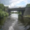
There is a bridge here which takes a major road over the canal.

Whitley Bridge3 miles, ¾ furlongs
Stubbs Pipe Bridge2 miles, ¾ furlongs
Stubbs Bridge1 mile, 3 furlongs
Kellingley Railway Bridge1 mile
Kellingley Bridge5 furlongs
Wheeland Road Skew Bridge
Bank Dole Junction1 furlong
Shepherds Bridge2 furlongs
Cow Lane Bridge3¼ furlongs
Jackson's Bridge No 225¼ furlongs
Gaggs Bridge6½ furlongs
 
 
Amenities
 
Maps
If you are a user and are logged on, or if you are actively planning a route, a map will be displayed here.
Show on external mapping site: Google | OSM | Bing
 
Photos
 
External websites
There are no links to external websites from here.
Why not log in and add some (select "External websites" from the menu (sometimes this is under "Edit"))?
 
Nearest facilities

Mouseover for more information or show routes to facility

Nearest water point

In the direction of Castleford Junction

Bank Dole Lock No 12¾ furlongs away
Travel to Bank Dole Junction, then on the Aire and Calder Navigation (Selby Section) to Bank Dole Lock No 1
Ferrybridge Flood Lock No 111 mile, 5¼ furlongs away
On this waterway in the direction of Castleford Junction
Ferrybridge Flood Lock Footbridge1 mile, 5¾ furlongs and 1 lock away
On this waterway in the direction of Castleford Junction
Beal Bridge2 miles, 5¼ furlongs and 1 lock away
Travel to Bank Dole Junction, then on the Aire and Calder Navigation (Selby Section) to Beal Bridge
Beal Lock No 22 miles, 6½ furlongs and 1 lock away
Travel to Bank Dole Junction, then on the Aire and Calder Navigation (Selby Section) to Beal Lock No 2
Bulholme Lock No 106 miles, 3¼ furlongs and 1 lock away
On this waterway in the direction of Castleford Junction
Castleford Sanitary Station7 miles and 2 locks away
On this waterway in the direction of Castleford Junction
Woodnook Lock No 69 miles, 2¾ furlongs and 3 locks away
Travel to Castleford Junction, then on the Aire and Calder Navigation (Wakefield Section) to Woodnook Lock No 6
Fairies Hill Moorings9 miles, 1¼ furlongs and 4 locks away
Travel to Castleford Junction, then on the Aire and Calder Navigation (Wakefield Section) to Fairies Hill Lock Junction, then on the Aire and Calder Navigation (Wakefield Section - Fairies Hill Mooring Arm) to Fairies Hill Moorings
Lemonroyd Lock No 710 miles, 4½ furlongs and 3 locks away
Travel to Castleford Junction, then on the Aire and Calder Navigation (Main Line - Castleford to Leeds) to Lemonroyd Lock No 7
Selby Basin11 miles, 3¼ furlongs and 3 locks away
Travel to Bank Dole Junction, then on the Aire and Calder Navigation (Selby Section) to Selby Basin
Lemonroyd Marina10 miles, 5½ furlongs and 4 locks away
Travel to Castleford Junction, then on the Aire and Calder Navigation (Main Line - Castleford to Leeds) to Lemonroyd Marina
King's Road Lock No 310 miles, 4¼ furlongs and 4 locks away
Travel to Castleford Junction, then on the Aire and Calder Navigation (Wakefield Section) to King's Road Lock No 3
Woodlesford Lock No 511 miles, 7¼ furlongs and 4 locks away
Travel to Castleford Junction, then on the Aire and Calder Navigation (Main Line - Castleford to Leeds) to Woodlesford Lock No 5
Fishpond Lock No 412 miles, 6¼ furlongs and 5 locks away
Travel to Castleford Junction, then on the Aire and Calder Navigation (Main Line - Castleford to Leeds) to Fishpond Lock No 4
Stanley Ferry Water Point12 miles, 1¼ furlongs and 6 locks away
Travel to Castleford Junction, then on the Aire and Calder Navigation (Wakefield Section) to Stanley Ferry Water Point

In the direction of Ouse - Aire and Calder Junction

Whitley Lock No 123 miles, 6½ furlongs away
On this waterway in the direction of Ouse - Aire and Calder Junction
Pollington Manor Swing Bridge7 miles, 4½ furlongs and 2 locks away
On this waterway in the direction of Ouse - Aire and Calder Junction
Pollington Visitor Mooring7 miles, 5 furlongs and 2 locks away
On this waterway in the direction of Ouse - Aire and Calder Junction
Dutch Riverside15 miles, 7 furlongs and 2 locks away
On this waterway in the direction of Ouse - Aire and Calder Junction

Nearest rubbish disposal

In the direction of Castleford Junction

Castleford Sanitary Station7 miles and 2 locks away
On this waterway in the direction of Castleford Junction
Selby Basin11 miles, 3¼ furlongs and 3 locks away
Travel to Bank Dole Junction, then on the Aire and Calder Navigation (Selby Section) to Selby Basin
Lemonroyd Marina10 miles, 5½ furlongs and 4 locks away
Travel to Castleford Junction, then on the Aire and Calder Navigation (Main Line - Castleford to Leeds) to Lemonroyd Marina
Woodlesford Lock No 511 miles, 7¼ furlongs and 4 locks away
Travel to Castleford Junction, then on the Aire and Calder Navigation (Main Line - Castleford to Leeds) to Woodlesford Lock No 5
Ramsdens Bridge Visitor Moorings12 miles, 1¾ furlongs and 6 locks away
Travel to Castleford Junction, then on the Aire and Calder Navigation (Wakefield Section) to Ramsdens Bridge Visitor Moorings
Leeds Sanitary Station16 miles, 4 furlongs and 7 locks away
Travel to Castleford Junction, then on the Aire and Calder Navigation (Main Line - Castleford to Leeds) to Leeds Sanitary Station
Leeds Basin17 miles, 3¼ furlongs and 9 locks away
Travel to Castleford Junction, then on the Aire and Calder Navigation (Main Line - Castleford to Leeds) to Leeds Bridge, then on the Leeds and Liverpool Canal (Main Line - Wigan to Leeds) to Leeds Basin
Horbury Basin Residential Moorings & Sanitary Station19 miles, 6½ furlongs and 11 locks away
Travel to Castleford Junction, then on the Aire and Calder Navigation (Wakefield Section) to Fall Ing Junction, then on the Calder and Hebble Navigation (Main Line) to Horbury Basin Residential Moorings & Sanitary Station

In the direction of Ouse - Aire and Calder Junction

Whitley Lock No 123 miles, 6½ furlongs away
On this waterway in the direction of Ouse - Aire and Calder Junction
Dutch Riverside15 miles, 7 furlongs and 2 locks away
On this waterway in the direction of Ouse - Aire and Calder Junction
Goole Marina16 miles, ½ furlongs and 2 locks away
On this waterway in the direction of Ouse - Aire and Calder Junction
Barnby Dun Lift Bridge16 miles, 2 furlongs and 3 locks away
Travel to Sykehouse Junction, then on the Sheffield and South Yorkshire Navigation (New Junction Canal) to Bramwith Junction, then on the Sheffield and South Yorkshire Navigation (Main Line) to Barnby Dun Lift Bridge
Bramwith Swing Bridge15 miles, 6½ furlongs and 4 locks away
Travel to Sykehouse Junction, then on the Sheffield and South Yorkshire Navigation (New Junction Canal) to Bramwith Junction, then on the Sheffield and South Yorkshire Navigation (Bramwith to Stainforth) to Bramwith Swing Bridge

Nearest chemical toilet disposal

In the direction of Castleford Junction

Castleford Sanitary Station7 miles and 2 locks away
On this waterway in the direction of Castleford Junction
Fairies Hill Moorings9 miles, 1¼ furlongs and 4 locks away
Travel to Castleford Junction, then on the Aire and Calder Navigation (Wakefield Section) to Fairies Hill Lock Junction, then on the Aire and Calder Navigation (Wakefield Section - Fairies Hill Mooring Arm) to Fairies Hill Moorings
Selby Basin11 miles, 3¼ furlongs and 3 locks away
Travel to Bank Dole Junction, then on the Aire and Calder Navigation (Selby Section) to Selby Basin
Lemonroyd Marina10 miles, 5½ furlongs and 4 locks away
Travel to Castleford Junction, then on the Aire and Calder Navigation (Main Line - Castleford to Leeds) to Lemonroyd Marina
Ramsdens Bridge Sanitary Station12 miles, 2 furlongs and 6 locks away
Travel to Castleford Junction, then on the Aire and Calder Navigation (Wakefield Section) to Ramsdens Bridge Sanitary Station
Leeds Sanitary Station16 miles, 4 furlongs and 7 locks away
Travel to Castleford Junction, then on the Aire and Calder Navigation (Main Line - Castleford to Leeds) to Leeds Sanitary Station
Horbury Basin Residential Moorings & Sanitary Station19 miles, 6½ furlongs and 11 locks away
Travel to Castleford Junction, then on the Aire and Calder Navigation (Wakefield Section) to Fall Ing Junction, then on the Calder and Hebble Navigation (Main Line) to Horbury Basin Residential Moorings & Sanitary Station

In the direction of Ouse - Aire and Calder Junction

Whitley Lock No 123 miles, 6½ furlongs away
On this waterway in the direction of Ouse - Aire and Calder Junction
Dutch Riverside15 miles, 7 furlongs and 2 locks away
On this waterway in the direction of Ouse - Aire and Calder Junction
Goole Marina16 miles, ½ furlongs and 2 locks away
On this waterway in the direction of Ouse - Aire and Calder Junction
Barnby Dun Lift Bridge16 miles, 2 furlongs and 3 locks away
Travel to Sykehouse Junction, then on the Sheffield and South Yorkshire Navigation (New Junction Canal) to Bramwith Junction, then on the Sheffield and South Yorkshire Navigation (Main Line) to Barnby Dun Lift Bridge
Bramwith Swing Bridge15 miles, 6½ furlongs and 4 locks away
Travel to Sykehouse Junction, then on the Sheffield and South Yorkshire Navigation (New Junction Canal) to Bramwith Junction, then on the Sheffield and South Yorkshire Navigation (Bramwith to Stainforth) to Bramwith Swing Bridge

Nearest place to turn

In the direction of Castleford Junction

Bank Dole Lock Junction3 furlongs and 1 lock away
Travel to Bank Dole Junction, then on the Aire and Calder Navigation (Selby Section) to Bank Dole Lock Junction
Beal Lock No 2 Weir Entrance2 miles, 5½ furlongs and 1 lock away
Travel to Bank Dole Junction, then on the Aire and Calder Navigation (Selby Section) to Beal Lock No 2 Weir Entrance
Bulholme Lock Weir Exit6 miles, 3 furlongs and 1 lock away
On this waterway in the direction of Castleford Junction
Haddlesey Junction6 miles, 5 furlongs and 2 locks away
Travel to Bank Dole Junction, then on the Aire and Calder Navigation (Selby Section) to Haddlesey Junction
Lemonroyd Lock Weir Exit10 miles, 3½ furlongs and 3 locks away
Travel to Castleford Junction, then on the Aire and Calder Navigation (Main Line - Castleford to Leeds) to Lemonroyd Lock Weir Exit
Fairies Hill Lock Arm9 miles, 4¼ furlongs and 4 locks away
Travel to Castleford Junction, then on the Aire and Calder Navigation (Wakefield Section) to Fairies Hill Lock Arm
Selby Basin11 miles, 3¼ furlongs and 3 locks away
Travel to Bank Dole Junction, then on the Aire and Calder Navigation (Selby Section) to Selby Basin
Fleet Lane Arm10 miles, 7½ furlongs and 4 locks away
Travel to Castleford Junction, then on the Aire and Calder Navigation (Main Line - Castleford to Leeds) to Fleet Lane Arm
Stanley Ferry Marina12 miles, ½ furlongs and 6 locks away
Travel to Castleford Junction, then on the Aire and Calder Navigation (Wakefield Section) to Stanley Ferry Marina
Junction with River Aire (Old Channel) South15 miles, 1¾ furlongs and 6 locks away
Travel to Castleford Junction, then on the Aire and Calder Navigation (Main Line - Castleford to Leeds) to Junction with River Aire (Old Channel) South
Junction with River Aire (Old Channel) North15 miles, 7 furlongs and 7 locks away
Travel to Castleford Junction, then on the Aire and Calder Navigation (Main Line - Castleford to Leeds) to Junction with River Aire (Old Channel) North
Knostrop Flood Lock Weir Entrance15 miles, 7¼ furlongs and 7 locks away
Travel to Castleford Junction, then on the Aire and Calder Navigation (Main Line - Castleford to Leeds) to Knostrop Flood Lock Weir Entrance
Wakefield Weir Entrance15 miles, 1 furlong and 8 locks away
Travel to Castleford Junction, then on the Aire and Calder Navigation (Wakefield Section) to Fall Ing Junction, then on the Calder and Hebble Navigation (Main Line) to Wakefield Weir Entrance
Leeds Dock Side Arm16 miles, 6¼ furlongs and 8 locks away
Travel to Castleford Junction, then on the Aire and Calder Navigation (Main Line - Castleford to Leeds) to Leeds Dock Entrance, then on the Aire and Calder Navigation (Leeds Dock) to Leeds Dock Side Arm
River Aire Junction17 miles, 2½ furlongs and 8 locks away
Travel to Castleford Junction, then on the Aire and Calder Navigation (Main Line - Castleford to Leeds) to Leeds Bridge, then on the Leeds and Liverpool Canal (Main Line - Wigan to Leeds) to River Aire Junction
Leeds Basin17 miles, 3¼ furlongs and 9 locks away
Travel to Castleford Junction, then on the Aire and Calder Navigation (Main Line - Castleford to Leeds) to Leeds Bridge, then on the Leeds and Liverpool Canal (Main Line - Wigan to Leeds) to Leeds Basin
Broad Cut Weir Entrance17 miles, 5½ furlongs and 9 locks away
Travel to Castleford Junction, then on the Aire and Calder Navigation (Wakefield Section) to Fall Ing Junction, then on the Calder and Hebble Navigation (Main Line) to Broad Cut Weir Entrance

In the direction of Ouse - Aire and Calder Junction

Viking Marina15 miles, 7¾ furlongs and 2 locks away
On this waterway in the direction of Ouse - Aire and Calder Junction
Huddle Grounds Winding Hole17 miles, 5½ furlongs and 4 locks away
Travel to Sykehouse Junction, then on the Sheffield and South Yorkshire Navigation (New Junction Canal) to Bramwith Junction, then on the Sheffield and South Yorkshire Navigation (Bramwith to Stainforth) to Stainforth Junction, then on the Sheffield and South Yorkshire Navigation (Stainforth and Keadby Canal) to Huddle Grounds Winding Hole
Wheatley Hall Road Winding Hole19 miles, 4 furlongs and 4 locks away
Travel to Sykehouse Junction, then on the Sheffield and South Yorkshire Navigation (New Junction Canal) to Bramwith Junction, then on the Sheffield and South Yorkshire Navigation (Main Line) to Wheatley Hall Road Winding Hole

Nearest self-operated pump-out

Nearest boatyard pump-out

In the direction of Castleford Junction

Lemonroyd Marina10 miles, 5½ furlongs and 4 locks away
Travel to Castleford Junction, then on the Aire and Calder Navigation (Main Line - Castleford to Leeds) to Lemonroyd Marina

In the direction of Ouse - Aire and Calder Junction

Goole Marina16 miles, ½ furlongs and 2 locks away
On this waterway in the direction of Ouse - Aire and Calder Junction
Direction of TV transmitter (From Wolfbane Cybernetic)
 
 
Geograph
 
Wikipedia

There is no page on Wikipedia called “Wheeland Road Skew Bridge”

 
Google

Results of Google Search

Wheeland Road Skew Bridge
Wheeland Road Skew Bridge Across the Aire and Calder Navigation (Aire and Calder Main Line)
Theoretical and Field Experimental Evaluation of Skewed Modular ...
had some reference to how the skew angle of a bridge affected those specifications. ... Figure 3-1 Load Path on a Skewed Bridge (Precast/Prestressed Concrete ... It weighed 5,200 pounds in each front wheel and 8,010 pounds in each rear.
Load distribution in skewed beam-slab highway bridges, Dec. 1975
skewed, beam-slab highway bridge superstructures. Bridges with pre- ... configurations, one rear wheel and one front wheel were off the bridge so that load ...
(PDF) Behaviour of Skew Bridge Using Grillage Anology Method
Jun 25, 2016 ... PDF | In this study summarizes the analysis of skew bridge with the different skew ... T-Beam girder of 20 m span length with 2 lane of carriage way width is 7.5 m considered. ... wheel and the roadway face of the kerb and the.
Load and Resistance Factor Design (LRFD) for Highway Bridge ...
girder system is generally considered for sharply skewed bridges as well. ... This is an upward reaction for the left wheel and an equal and opposite downward.
Analytical Modeling of Seismic Performance of Curved and Skewed ...
Figure 4.6 EMTL at the center location of the span on the skewed bridge deck . ... as Japan Road Association codes (2002) and AASHTO LRFD Design (2012). ... the separation, reconnection, and the coupling between the wheel and bridge.
current Road and Bridge Standards
The original Road and Bridge Standards (formally known as the Grand County Road ... possible the following maximum skew angles and distances (measured from ... to Colorado Statutes 42-4-507 Wheel and Axle Loads and 42-4-508 Gross.
national cooperative - highway research program report 306 ...
GEORGE H. WAY JR Vice President Research and Test Department Association of American Railroads ... quantify the effects of skew and lateral load distribution for a specific bridge, additional ... Study the local effect of wheel and axle loads.