CanalPlanAC

Woodplumpton Aqueduct No 33

 
Whinnyfield Bridge, Woodplumpton PR4 0LL, United Kingdom
 
Information about the place
Woodplumpton Aqueduct No 33 is a minor waterways place on the Lancaster Canal (Main Line) between Ribble Link - Lancaster Canal Junction (6 miles and 1 furlong to the southeast) and Lodge Hill Junction (Junction with Lancaster Canal - Glasson Dock Branch) (16 miles and 3¾ furlongs to the north).
 
 
The nearest place in the direction of Ribble Link - Lancaster Canal Junction is Swill Brook Basin; 3 furlongs away.
 
The nearest place in the direction of Lodge Hill Junction is Whinnyfield Bridge No 34; 1 furlong away.

Mooring here is good (a nice place to moor), mooring pins are needed. There is a length of concrete wall with decent depth. Nice quiet mooring!.

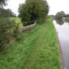
There is a small aqueduct or underbridge here which takes a river under the canal.

Roots Bridge No 301 mile, 1¼ furlongs
Blackleach Lane Marina6¼ furlongs
Stone Chimneys Bridge No 315¼ furlongs
Swill Brook Bridge No 323¼ furlongs
Swill Brook Basin3 furlongs
Woodplumpton Aqueduct No 33
Whinnyfield Bridge No 341 furlong
Bell Fold Bridge No 355½ furlongs
Moons Bridge No 361 mile, ¾ furlongs
Moons Bridge Marina1 mile, 1 furlong
Hollowforth Swing Bridge1 mile, 1¼ furlongs
 
 
Amenities
 
Maps
If you are a user and are logged on, or if you are actively planning a route, a map will be displayed here.
Show on external mapping site: Google | OSM | Bing
 
Photos
 
External websites
There are no links to external websites from here.
Why not log in and add some (select "External websites" from the menu (sometimes this is under "Edit"))?
 
Nearest facilities

Mouseover for more information or show routes to facility

Nearest water point

In the direction of Preston Terminus

Swill Brook Basin3 furlongs away
On this waterway in the direction of Preston Terminus
Blackleach Lane Marina6¼ furlongs away
On this waterway in the direction of Preston Terminus
Woodplumpton Road Bridge No 127 miles, ¼ furlongs away
On this waterway in the direction of Preston Terminus
Spark Bridge Sanitary Station19 miles, 6½ furlongs and 10 locks away
Travel to Ribble Link - Lancaster Canal Junction, then on the River Ribble (Ribble Link) to Ribble - Savick Brook Junction, then on the River Ribble (Main River) to Astland Lamp, then on the River Douglas to Tarleton Junction, then on the Leeds and Liverpool Canal (Rufford Branch) to Spark Bridge Sanitary Station

In the direction of Tewitfield

Bilsborrow Winding Hole4 miles, 1¼ furlongs away
On this waterway in the direction of Tewitfield
Moss Lane Bridge No 639 miles, 2 furlongs away
On this waterway in the direction of Tewitfield
Ratcliffe Bridge No 7513 miles, 3 furlongs away
On this waterway in the direction of Tewitfield
Lodge Hill Junction16 miles, 3¾ furlongs away
On this waterway in the direction of Tewitfield
Brows Bridge No 818 miles, 7½ furlongs and 6 locks away
Travel to Lodge Hill Junction, then on the Lancaster Canal (Glasson Branch) to Brows Bridge No 8
Glasson Visitor Moorings19 miles, ¼ furlongs and 6 locks away
Travel to Lodge Hill Junction, then on the Lancaster Canal (Glasson Branch) to Glasson Visitor Moorings
Glasson Basin19 miles, 1¾ furlongs and 6 locks away
Travel to Lodge Hill Junction, then on the Lancaster Canal (Glasson Branch) to Glasson Basin

Nearest rubbish disposal

In the direction of Preston Terminus

Woodplumpton Road Bridge No 127 miles, ¼ furlongs away
On this waterway in the direction of Preston Terminus
Spark Bridge Sanitary Station19 miles, 6½ furlongs and 10 locks away
Travel to Ribble Link - Lancaster Canal Junction, then on the River Ribble (Ribble Link) to Ribble - Savick Brook Junction, then on the River Ribble (Main River) to Astland Lamp, then on the River Douglas to Tarleton Junction, then on the Leeds and Liverpool Canal (Rufford Branch) to Spark Bridge Sanitary Station

In the direction of Tewitfield

Bilsborrow Winding Hole4 miles, 1¼ furlongs away
On this waterway in the direction of Tewitfield

Nearest chemical toilet disposal

In the direction of Preston Terminus

Woodplumpton Road Bridge No 127 miles, ¼ furlongs away
On this waterway in the direction of Preston Terminus
Spark Bridge Sanitary Station19 miles, 6½ furlongs and 10 locks away
Travel to Ribble Link - Lancaster Canal Junction, then on the River Ribble (Ribble Link) to Ribble - Savick Brook Junction, then on the River Ribble (Main River) to Astland Lamp, then on the River Douglas to Tarleton Junction, then on the Leeds and Liverpool Canal (Rufford Branch) to Spark Bridge Sanitary Station

In the direction of Tewitfield

Bilsborrow Winding Hole4 miles, 1¼ furlongs away
On this waterway in the direction of Tewitfield

Nearest place to turn

In the direction of Preston Terminus

Swill Brook Basin3 furlongs away
On this waterway in the direction of Preston Terminus
Salwick Hall Winding Hole3 miles, 2¾ furlongs away
On this waterway in the direction of Preston Terminus
Ward's House Winding Hole No 23 miles, 4¾ furlongs away
On this waterway in the direction of Preston Terminus
Ward's House Winding Hole No 13 miles, 7 furlongs away
On this waterway in the direction of Preston Terminus
Tom Benson Way Bridge Winding Hole5 miles, 7½ furlongs away
On this waterway in the direction of Preston Terminus
Ribble Link - Lancaster Canal Junction6 miles, 1 furlong away
On this waterway in the direction of Preston Terminus
Bexhill Road Winding Hole6 miles, 4½ furlongs away
On this waterway in the direction of Preston Terminus
Ashton Basin7 miles, 4¼ furlongs away
On this waterway in the direction of Preston Terminus
Ribble Link Staircase Winding Hole6 miles, 2 furlongs and 3 locks away
Travel to Ribble Link - Lancaster Canal Junction, then on the River Ribble (Ribble Link) to Ribble Link Staircase Winding Hole

In the direction of Tewitfield

Moons Bridge Marina1 mile, 1 furlong away
On this waterway in the direction of Tewitfield
Hollowforth Winding Hole1 mile, 2 furlongs away
On this waterway in the direction of Tewitfield
Park Head Winding Hole2 miles away
On this waterway in the direction of Tewitfield
White Horse Winding Hole3 miles, ½ furlongs away
On this waterway in the direction of Tewitfield
Bilsborrow Winding Hole4 miles, 1¼ furlongs away
On this waterway in the direction of Tewitfield
Catterall Bridge Winding Hole6 miles, 7½ furlongs away
On this waterway in the direction of Tewitfield
Greenhalgh Castle Bridge Winding Hole8 miles, ¼ furlongs away
On this waterway in the direction of Tewitfield
Dimples Bridge Winding Hole8 miles, 2¼ furlongs away
On this waterway in the direction of Tewitfield
The Moorings Basin9 miles away
On this waterway in the direction of Tewitfield
Kepple Lane Bridge Winding Hole9 miles, ½ furlongs away
On this waterway in the direction of Tewitfield
Moss Lane Bridge Winding Hole (south)9 miles, 2 furlongs away
On this waterway in the direction of Tewitfield

No information

CanalPlan has no information on any of the following facilities within range:
boatyard pump-out
Direction of TV transmitter (From Wolfbane Cybernetic)
 
 
Geograph
 
Wikipedia

There is no page on Wikipedia called “Woodplumpton Aqueduct”

Wikipedia pages that might relate to Woodplumpton Aqueduct
[Lancaster Canal] on the level ground from Preston to Tewitfield, and in 1794 on the Lune Aqueduct, which was built of stone, although Rennie thought brick should have been [River Wyre] Pool New Draught Old River Brock Bacchus Brook Bull Brook Withney Dike Woodplumpton Brook Swill Brook Blundel Brook New Mill Brook Barton Brook Dean Brook [Listed buildings in Lancashire] Lancashire Listed buildings in Whittingham, Lancashire Listed buildings in Woodplumpton Listed buildings in Aighton, Bailey and Chaigley Listed buildings in [Church of St Thomas of Canterbury and the English Martyrs, Preston] near to Preston city centre and stands on the corner of the A6, between Aqueduct Street and St George's Road. Since 2017, it has been in the care of priests [Lancaster Cathedral] Ignatius) St John, Silverdale St Mary, Tarleton St James, Tatham St Helen, Waddington St Leonard, Walton-le-Dale St Michael, Whittington St Anne, Woodplumpton [St Peter's Church, Heysham] Ignatius) St John, Silverdale St Mary, Tarleton St James, Tatham St Helen, Waddington St Leonard, Walton-le-Dale St Michael, Whittington St Anne, Woodplumpton [St Patrick's Chapel, Heysham] Ignatius) St John, Silverdale St Mary, Tarleton St James, Tatham St Helen, Waddington St Leonard, Walton-le-Dale St Michael, Whittington St Anne, Woodplumpton [Lancaster Priory] Ignatius) St John, Silverdale St Mary, Tarleton St James, Tatham St Helen, Waddington St Leonard, Walton-le-Dale St Michael, Whittington St Anne, Woodplumpton [St Michael's Church, Cockerham] Ignatius) St John, Silverdale St Mary, Tarleton St James, Tatham St Helen, Waddington St Leonard, Walton-le-Dale St Michael, Whittington St Anne, Woodplumpton [St John the Evangelist's Church, Gressingham] Ignatius) St John, Silverdale St Mary, Tarleton St James, Tatham St Helen, Waddington St Leonard, Walton-le-Dale St Michael, Whittington St Anne, Woodplumpton
 
Google

Results of Google Search

Woodplumpton Aqueduct No 33 © Mat Fascione :: Geograph Britain ...
Sep 23, 2018 ... Woodplumpton Aqueduct No 33. taken 2 years ago, near to Swillbrook, Lancashire, Great Britain. Woodplumpton Aqueduct No 33.
File:Bridge 33 Lancaster Canal - geograph.org.uk - 1591202.jpg ...
Nov 22, 2009 ... No higher resolution available. Bridge_33_Lancaster_Canal_-_geograph.org.uk _-_1591202.jpg ... English: Bridge 33 Lancaster Canal This is a small Aqueduct which allows Woodplumpton Brook to flow under the Canal.
Lancaster Canal - Wikipedia
The Lancaster Canal is a canal in North West England, originally planned to run from ... Hollowforth aqueduct. Moons Bridge marina. 33. Woodplumpton aqueduct ... However, by 1801, no design had even been agreed for the aqueduct over ...
TNC On Tour 2003 Page 16
Not far after we eventually found the Sanitary Station and water point. We tried out ... Being burned off by one of the locals at Woodplumpton Aqueduct No 33.
Swillbrook
Click to enlarge - Cliquer sur l'image pour agrandir. Woodplumpton Aqueduct No. 33 seen from the West. Le Pont Canal n°33 de Woodplumpton vu de l'Ouest.
Lancaster Canal, Preston to Woodplumpton photos
May 22, 2010 ... We walked from Preston to Woodplumpton on Saturday, 22nd May ... Another rural shot, no towpath ... Woodplumpton Aqueduct (Bridge 33)
Lancaster Canal, Ribble Link
Aqueduct 38, Hollowforth Aqueduct. Aqueduct 33, Woodplumpton Aqueduct. Aqueduct ... Lock No. 2. Lock 3. Aqueduct 82, Cocker Aqueduct. Max 67ft. Max 67ft.