End of Hythe Bridge Arm 
End of navigation at Oxford
Worcester College, Walton Street, Oxford OX1 2HB, United Kingdom

End of Hythe Bridge Arm
is a place on the waterways
at the end of the Oxford Canal (Southern Section - Main Line); past
Isis Lock Junction (¾ furlongs
to the northwest).
The nearest place in the direction of Isis Lock Junction is Oxford Visitor Moorings (City centre 5 minutes walk);
a few yards
away.
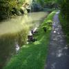
Mooring here is good (a nice place to moor), mooring rings or bollards are available. A dead end, so you either have to back in or back out past about 15 boats or more. Very handy for city centre.
You may be able to wind here, but it is not a full-length winding hole, being only suitable for boats up to 20 feet long.
End of Hythe Bridge Arm | ||
Oxford Visitor Moorings | a few yards | |
Isis Sanitary Station | ½ furlongs | |
Isis Lock Junction | ¾ furlongs | |
Hythe Bridge Arm Winding Hole | 1 furlong | |
Jericho Canal Wharf | 1¾ furlongs |
Amenities here
Amenities nearby at Oxford Visitor Moorings
Amenities in City of Oxford
Amenities at other places in City of Oxford
at
at
at
at
at
at
at
at
at
at
at
at
at
at
at
at
at
at
at
at
at
at
at
at
at
at
at
at
at
at
at
at
at
at
at
at
at
at
Stayed here for 2 weeks during winter and had the boat untied once (along with others on the stretch) and a window kicked in in the small hours of the morning on both weekends. Take care mooring here.
- Oxford Canal Walk - Part One - Oxford to Thrupp - YouTube — associated with Oxford Canal
- A walk along the Oxford Canal (Southern Section) from Oxford to Thrupp Wide
Mouseover for more information or show routes to facility
Nearest water point
In the direction of Napton Junction
Oxford Visitor Moorings — a few yards away
On this waterway in the direction of Napton Junction
St Edwards Lift Bridge No 238 — 1 mile, 4½ furlongs away
On this waterway in the direction of Napton Junction
Wolvercote Sanitary Station — 2 miles, 5¼ furlongs and 1 lock away
On this waterway in the direction of Napton Junction
Wolvercote Junction Water Point — 3 miles, 1½ furlongs and 2 locks away
On this waterway in the direction of Napton Junction
Eynsham Lock — 6 miles, 3½ furlongs and 2 locks away
Travel to Wolvercote Junction, then on the Oxford Canal (Duke's Cut) to Duke's Cut Junction, then on the River Thames (above Oxford) to Eynsham Lock
Langford Lane Bridge No 224 — 6 miles, 1½ furlongs and 4 locks away
On this waterway in the direction of Napton Junction
Aubreys Lift Bridge No 221 — 6 miles, 6¾ furlongs and 4 locks away
On this waterway in the direction of Napton Junction
Thrupp Cruising Club — 6 miles, 7 furlongs and 4 locks away
On this waterway in the direction of Napton Junction
Abingdon Lock — 9 miles, ½ furlongs and 4 locks away
Travel to Isis Lock Junction, then on the River Thames (Sheepwash Channel) to Sheepwash Channel Junction, then on the River Thames (above Oxford) to Osney Bridge, then on the River Thames (below Oxford) to Abingdon Lock
Abingdon Bridge Marine — 9 miles, 4¼ furlongs and 5 locks away
Travel to Isis Lock Junction, then on the River Thames (Sheepwash Channel) to Sheepwash Channel Junction, then on the River Thames (above Oxford) to Osney Bridge, then on the River Thames (below Oxford) to Abingdon Bridge Marine
Shifford Lock — 16 miles, 4½ furlongs and 5 locks away
Travel to Wolvercote Junction, then on the Oxford Canal (Duke's Cut) to Duke's Cut Junction, then on the River Thames (above Oxford) to Shifford Lock
Heyford Wharf Bridge No 206 — 14 miles, 3¼ furlongs and 9 locks away
On this waterway in the direction of Napton Junction
Heyford Wharf — 14 miles, 3½ furlongs and 9 locks away
On this waterway in the direction of Napton JunctionNearest rubbish disposal
In the direction of Napton Junction
Wolvercote Sanitary Station — 2 miles, 5¼ furlongs and 1 lock away
On this waterway in the direction of Napton Junction
Eynsham Lock — 6 miles, 3½ furlongs and 2 locks away
Travel to Wolvercote Junction, then on the Oxford Canal (Duke's Cut) to Duke's Cut Junction, then on the River Thames (above Oxford) to Eynsham Lock
Aubreys Lift Bridge No 221 — 6 miles, 6¾ furlongs and 4 locks away
On this waterway in the direction of Napton Junction
Thrupp Cruising Club — 6 miles, 7 furlongs and 4 locks away
On this waterway in the direction of Napton Junction
Abingdon Lock — 9 miles, ½ furlongs and 4 locks away
Travel to Isis Lock Junction, then on the River Thames (Sheepwash Channel) to Sheepwash Channel Junction, then on the River Thames (above Oxford) to Osney Bridge, then on the River Thames (below Oxford) to Abingdon Lock
Heyford Wharf Bridge No 206 — 14 miles, 3¼ furlongs and 9 locks away
On this waterway in the direction of Napton Junction
Heyford Wharf — 14 miles, 3½ furlongs and 9 locks away
On this waterway in the direction of Napton Junction
Day's Lock — 17 miles, 2½ furlongs and 7 locks away
Travel to Isis Lock Junction, then on the River Thames (Sheepwash Channel) to Sheepwash Channel Junction, then on the River Thames (above Oxford) to Osney Bridge, then on the River Thames (below Oxford) to Day's LockNearest chemical toilet disposal
In the direction of Napton Junction
Wolvercote Sanitary Station — 2 miles, 5¼ furlongs and 1 lock away
On this waterway in the direction of Napton Junction
Eynsham Lock — 6 miles, 3½ furlongs and 2 locks away
Travel to Wolvercote Junction, then on the Oxford Canal (Duke's Cut) to Duke's Cut Junction, then on the River Thames (above Oxford) to Eynsham Lock
Thrupp Cruising Club — 6 miles, 7 furlongs and 4 locks away
On this waterway in the direction of Napton Junction
Abingdon Lock — 9 miles, ½ furlongs and 4 locks away
Travel to Isis Lock Junction, then on the River Thames (Sheepwash Channel) to Sheepwash Channel Junction, then on the River Thames (above Oxford) to Osney Bridge, then on the River Thames (below Oxford) to Abingdon Lock
Day's Lock — 17 miles, 2½ furlongs and 7 locks away
Travel to Isis Lock Junction, then on the River Thames (Sheepwash Channel) to Sheepwash Channel Junction, then on the River Thames (above Oxford) to Osney Bridge, then on the River Thames (below Oxford) to Day's LockNearest place to turn
In the direction of Napton Junction
Hythe Bridge Arm Winding Hole — 1 furlong away
On this waterway in the direction of Napton Junction
Castle Mill Stream Junction — 1 furlong and 1 lock away
Travel to Isis Lock Junction, then on the River Thames (Sheepwash Channel) to Castle Mill Stream Junction
Sheepwash Channel Junction — 1¾ furlongs and 1 lock away
Travel to Isis Lock Junction, then on the River Thames (Sheepwash Channel) to Sheepwash Channel Junction
Bossoms Boat Yard — 7¾ furlongs and 1 lock away
Travel to Isis Lock Junction, then on the River Thames (Sheepwash Channel) to Sheepwash Channel Junction, then on the River Thames (above Oxford) to Bossoms Boat Yard
Osney Lock Weir Exit — 4¾ furlongs and 2 locks away
Travel to Isis Lock Junction, then on the River Thames (Sheepwash Channel) to Sheepwash Channel Junction, then on the River Thames (above Oxford) to Osney Bridge, then on the River Thames (below Oxford) to Osney Lock Weir Exit
Thames - Cherwell Junction — 1 mile, 6¾ furlongs and 2 locks away
Travel to Isis Lock Junction, then on the River Thames (Sheepwash Channel) to Sheepwash Channel Junction, then on the River Thames (above Oxford) to Osney Bridge, then on the River Thames (below Oxford) to Thames - Cherwell Junction
Wolvercote Junction — 3 miles, ¾ furlongs and 1 lock away
On this waterway in the direction of Napton Junction
Iffley Lock Weir Entrance No 1 — 2 miles, 6 furlongs and 2 locks away
Travel to Isis Lock Junction, then on the River Thames (Sheepwash Channel) to Sheepwash Channel Junction, then on the River Thames (above Oxford) to Osney Bridge, then on the River Thames (below Oxford) to Iffley Lock Weir Entrance No 1
Bypass Reservoir Junction — 3 miles, 2¾ furlongs and 2 locks away
Travel to Wolvercote Junction, then on the Oxford Canal (Duke's Cut) to Bypass Reservoir Junction
Iffley Lock Weir Exit No 1 — 2 miles, 7¼ furlongs and 3 locks away
Travel to Isis Lock Junction, then on the River Thames (Sheepwash Channel) to Sheepwash Channel Junction, then on the River Thames (above Oxford) to Osney Bridge, then on the River Thames (below Oxford) to Iffley Lock Weir Exit No 1
Duke's Cut Junction — 3 miles, 7¼ furlongs and 2 locks away
Travel to Wolvercote Junction, then on the Oxford Canal (Duke's Cut) to Duke's Cut Junction
Thames - Wharf Stream Junction — 6 miles, 1¾ furlongs and 2 locks away
Travel to Wolvercote Junction, then on the Oxford Canal (Duke's Cut) to Duke's Cut Junction, then on the River Thames (above Oxford) to Thames - Wharf Stream Junction
Sandford Lock Weir Exit (Thames) — 4 miles, 5 furlongs and 4 locks away
Travel to Isis Lock Junction, then on the River Thames (Sheepwash Channel) to Sheepwash Channel Junction, then on the River Thames (above Oxford) to Osney Bridge, then on the River Thames (below Oxford) to Sandford Lock Weir Exit (Thames)
Pinkhill Lock Weir Exit — 7 miles, 6 furlongs and 3 locks away
Travel to Wolvercote Junction, then on the Oxford Canal (Duke's Cut) to Duke's Cut Junction, then on the River Thames (above Oxford) to Pinkhill Lock Weir Exit
Thrupp Wide — 6 miles, 7 furlongs and 4 locks away
On this waterway in the direction of Napton Junction
Shipton Weir Junction — 7 miles, 7½ furlongs and 5 locks away
On this waterway in the direction of Napton Junction
Abingdon Lock Weir Exit No 1 — 9 miles, 1 furlong and 5 locks away
Travel to Isis Lock Junction, then on the River Thames (Sheepwash Channel) to Sheepwash Channel Junction, then on the River Thames (above Oxford) to Osney Bridge, then on the River Thames (below Oxford) to Abingdon Lock Weir Exit No 1
Abingdon Bridge Winding Hole — 9 miles, 4¼ furlongs and 5 locks away
Travel to Isis Lock Junction, then on the River Thames (Sheepwash Channel) to Sheepwash Channel Junction, then on the River Thames (above Oxford) to Osney Bridge, then on the River Thames (below Oxford) to Abingdon Bridge Winding Hole
Culham Lock Weir Entrance — 9 miles, 6¼ furlongs and 5 locks away
Travel to Isis Lock Junction, then on the River Thames (Sheepwash Channel) to Sheepwash Channel Junction, then on the River Thames (above Oxford) to Osney Bridge, then on the River Thames (below Oxford) to Culham Lock Weir Entrance
Enslow Winding Hole — 9 miles, 3½ furlongs and 6 locks away
On this waterway in the direction of Napton JunctionNearest self-operated pump-out
In the direction of Napton Junction
Eynsham Lock — 6 miles, 3½ furlongs and 2 locks away
Travel to Wolvercote Junction, then on the Oxford Canal (Duke's Cut) to Duke's Cut Junction, then on the River Thames (above Oxford) to Eynsham Lock
Aubreys Lift Bridge No 221 — 6 miles, 6¾ furlongs and 4 locks away
On this waterway in the direction of Napton Junction
Thrupp Cruising Club — 6 miles, 7 furlongs and 4 locks away
On this waterway in the direction of Napton Junction
Abingdon Lock — 9 miles, ½ furlongs and 4 locks away
Travel to Isis Lock Junction, then on the River Thames (Sheepwash Channel) to Sheepwash Channel Junction, then on the River Thames (above Oxford) to Osney Bridge, then on the River Thames (below Oxford) to Abingdon LockNearest boatyard pump-out
In the direction of Napton Junction
Oxford Cruisers Marina — 7 miles, 3½ furlongs and 3 locks away
Travel to Wolvercote Junction, then on the Oxford Canal (Duke's Cut) to Duke's Cut Junction, then on the River Thames (above Oxford) to Oxford Cruisers Marina
Abingdon Bridge Marine — 9 miles, 4¼ furlongs and 5 locks away
Travel to Isis Lock Junction, then on the River Thames (Sheepwash Channel) to Sheepwash Channel Junction, then on the River Thames (above Oxford) to Osney Bridge, then on the River Thames (below Oxford) to Abingdon Bridge Marine
Enslow Wharf — 9 miles, 2½ furlongs and 6 locks away
On this waterway in the direction of Napton Junction
Heyford Wharf — 14 miles, 3½ furlongs and 9 locks away
On this waterway in the direction of Napton JunctionDirection of TV transmitter (From Wolfbane Cybernetic)
There is no page on Wikipedia called “End of Hythe Bridge Arm”
Wikipedia pages that might relate to End of Hythe Bridge Arm
[Capitol Hill, Burnaby]
flank of the hill. A park near the end of Hythe Ave N., near Hythe's intersection with Cambridge, offers views of East Vancouver, Downtown Vancouver,
[River Colne, Hertfordshire]
Thames/Shepperton border) Colne Brook (distributary from Uxbridge Moor to Hythe End, Wraysbury) the Alder Bourne (Fulmer to Uxbridge Moor) Longford River
[Romney Marsh]
Romney Marsh from Hythe in the north east to Cliff End in the south west. It was conceived by Lt-Col Brown of the Royal Staff Corps of field engineers in
[Darent Valley Path]
footpath. There are two options when starting from the Southern end of the route; A The Eastern arm starts close to Sevenoaks train station in Bradbourne Park
[River Thames]
bowres Also writing of the upper reaches is Matthew Arnold in The Scholar Gypsy: Crossing the stripling Thames at Bab-lock-hythe Trailing in the cool
[Thames Path]
Whitchurch Bridge (S) Sonning Bridge (N) Henley Bridge (S) Temple Footbridge (N) Bourne End Railway Bridge (S) Maidenhead Bridge (N) Windsor Bridge (S) Victoria
[Colne Brook]
border of Greater London, to the River Thames just below Bell Weir Lock in Hythe End, Wraysbury, Berkshire. On leaving the Colne at Uxbridge Moor in the Colne
[Stockport Branch Canal]
Branch Canal was a 5-mile (8 km) branch of the Ashton Canal from Clayton to Stockport. The canal left the main line of the Ashton Canal at Stockport Junction
[Greater Anglia (train operating company)]
in Great Britain owned as a joint venture by Abellio, the international arm of the state-owned Dutch national rail operator Nederlandse Spoorwegen, and
[List of newspapers in Canada]
Pioneer High Prairie – South Peace News High River – High River Times Hythe – Hythe Headliner Innisfail – Innisfail Province, Innisfail Booster Jasper –
Results of Google Search
Sep 18, 2010 ... The HYTHE BRIDGE Arm. So called because the canal ends just before Hythe Bridge, at one time the canal carried on under the bridge to the ...
The Oxford Canal is a 78-mile (126 km) narrow canal in central England linking Oxford with ... Brinklow Arm (disused) ... Within Oxford's conurbation, the end of the canal has two links to the Thames: ... The canal used to continue through a bridge under Hythe Bridge Street to a turning basin and goods wharf south of Hythe ...
Sep 17, 2013 ... ... twenty people gathered at the Oxford Canal's Hythe Bridge Arm for a ... end of the arm adjacent to Hythe Bridge Street, including litter picking, ...
Download this stock image: Canal bridge, Arm End Bridge No 2, over the Grand ... The south end of the Oxford Canal at Hythe Bridge Street Oxford - Stock Photo ...
This residential mooring site is situated at the terminus of the Oxford Canal. It is within 500 metres of Oxford City Centre, with all of its associated facilities .