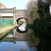
St James Road Bridge No 85
Saint James Road / George Rd, St James's Road, Park Central B15, United Kingdom

St James Road Bridge No 85
is a minor waterways place
on the Worcester and Birmingham Canal (Birmingham to King's Norton) between
Worcester Bar (Junction of Worcester and Birmingham Canal with BCN) (6¼ furlongs
to the northeast) and
Selly Oak Junction (Former junction with Dudley Canal Line No 2) (2 miles and 1¾ furlongs
to the southwest).
The nearest place in the direction of Worcester Bar is Islington Road Bridge No 86 (City centre ring road);
1½ furlongs
away.
The nearest place in the direction of Selly Oak Junction is Edgbaston Tunnel (northeastern entrance);
3 furlongs
away.
There may be access to the towpath here.
Mooring here is unrated.
There is a bridge here which takes a minor road over the canal.
The Mailbox Footbridge | 4¾ furlongs | |
Holliday Wharf | 4¼ furlongs | |
Granville Street Bridge No 88 | 4 furlongs | |
Bath Row Bridge No 87 | 2½ furlongs | |
Islington Road Bridge No 86 | 1½ furlongs | |
St James Road Bridge No 85 | ||
Edgbaston Tunnel (northeastern entrance) | 3 furlongs | |
Edgbaston Tunnel (southwestern entrance) | 3½ furlongs | |
The Vale Footbridge No 84A | 5 furlongs | |
The Vale Winding Hole | 5¼ furlongs | |
Edgbaston Bridge No 84 | 1 mile, ¾ furlongs |
Amenities nearby at Islington Road Bridge No 86
Amenities nearby at Edgbaston Tunnel (northeastern entrance)
There are no links to external websites from here.
Why not log in and add some (select "External websites" from the menu (sometimes this is under "Edit"))?
Mouseover for more information or show routes to facility
Nearest water point
In the direction of Worcester Bar
Holliday Wharf — 4¼ furlongs away
On this waterway in the direction of Worcester Bar
Worcester Bar — 6¼ furlongs away
On this waterway in the direction of Worcester Bar
Cambrian Wharf Services — 1 mile, 2¼ furlongs away
Travel to Worcester Bar, then on the Birmingham Canal Navigations (Main Line) to Deep Cuttings Junction, then on the Birmingham Canal Navigations (Newhall Branch) to Cambrian Wharf Services
Handsworth Wharf Winding Hole — 5 miles and 3 locks away
Travel to Worcester Bar, then on the Birmingham Canal Navigations (Main Line) to Smethwick Junction, then on the Birmingham Canal Navigations (Old Main Line) to Engine Arm Junction, then on the Birmingham Canal Navigations (Engine Arm) to Handsworth Wharf Winding Hole
Todds End Customer Service Facility — 9 miles, 5 furlongs and 3 locks away
Travel to Worcester Bar, then on the Birmingham Canal Navigations (Main Line) to Smethwick Junction, then on the Birmingham Canal Navigations (Old Main Line) to Tipton Junction, then on the Birmingham Canal Navigations (Dudley Canal No 1 - Birmingham End) to Todds End Customer Service Facility
Black Country Museum — 9 miles, 5¼ furlongs and 3 locks away
Travel to Worcester Bar, then on the Birmingham Canal Navigations (Main Line) to Smethwick Junction, then on the Birmingham Canal Navigations (Old Main Line) to Tipton Junction, then on the Birmingham Canal Navigations (Dudley Canal No 1 - Birmingham End) to Black Country Museum
Dudley Canal & Tunnel Trust Footbridge — 9 miles, 5½ furlongs and 3 locks away
Travel to Worcester Bar, then on the Birmingham Canal Navigations (Main Line) to Smethwick Junction, then on the Birmingham Canal Navigations (Old Main Line) to Tipton Junction, then on the Birmingham Canal Navigations (Dudley Canal No 1 - Birmingham End) to Dudley Canal & Tunnel Trust Footbridge
Dudley Tunnel (northern entrance) — 9 miles, 6¼ furlongs and 3 locks away
Travel to Worcester Bar, then on the Birmingham Canal Navigations (Main Line) to Smethwick Junction, then on the Birmingham Canal Navigations (Old Main Line) to Tipton Junction, then on the Birmingham Canal Navigations (Dudley Canal No 1 - Birmingham End) to Dudley Tunnel (northern entrance)
C&RT Bradley Workshops — 13 miles, ¾ furlongs and 3 locks away
Travel to Worcester Bar, then on the Birmingham Canal Navigations (Main Line) to Deepfields Junction, then on the Birmingham Canal Navigations (Wednesbury Oak Loop) to C&RT Bradley Workshops
Lower Ocker Hill Branch Junction — 8 miles, 6¾ furlongs and 8 locks away
Travel to Worcester Bar, then on the Birmingham Canal Navigations (Main Line) to Pudding Green Junction, then on the Birmingham Canal Navigations (Wednesbury Old Canal - Main Line) to Ryders Green Junction, then on the Birmingham Canal Navigations (Walsall Canal) to Lower Ocker Hill Branch Junction
In the direction of King's Norton Junction
King's Norton Water Point — 4 miles, 6½ furlongs away
Travel to King's Norton Junction, then on the Worcester and Birmingham Canal (Diglis Basin to King's Norton Junction) to King's Norton Water Point
Hawne Basin — 5 miles, 3½ furlongs away
Travel to New Selly Oak Junction, then on the Birmingham Canal Navigations (Dudley Canal No 2 - Lapal Canal - Original Line East End ) to Somery Road Bridge, then on the Birmingham Canal Navigations (Dudley Canal No 2 - Lapal Canal - Abandoned Line ) to Lapal Canal - New line Diverges From Original Route, then on the Birmingham Canal Navigations (Dudley Canal No 2 - Lapal Canal - Original Line West End ) to Coombeswood, then on the Birmingham Canal Navigations (Dudley Canal No 2 - Coombeswood ) to Hawne Basin
Yardley Wood Water Point — 7 miles, 2½ furlongs away
Travel to King's Norton Junction, then on the Stratford-on-Avon Canal (Northern Section) to Yardley Wood Water Point
Hopwood Visitor Moorings — 7 miles, 7¾ furlongs away
Travel to King's Norton Junction, then on the Worcester and Birmingham Canal (Diglis Basin to King's Norton Junction) to Hopwood Visitor Moorings
Bumble Hole Visitor Centre — 8 miles, 1¼ furlongs away
Travel to New Selly Oak Junction, then on the Birmingham Canal Navigations (Dudley Canal No 2 - Lapal Canal - Original Line East End ) to Somery Road Bridge, then on the Birmingham Canal Navigations (Dudley Canal No 2 - Lapal Canal - Abandoned Line ) to Lapal Canal - New line Diverges From Original Route, then on the Birmingham Canal Navigations (Dudley Canal No 2 - Lapal Canal - Original Line West End ) to Coombeswood, then on the Birmingham Canal Navigations (Dudley Canal No 2 - Coombeswood ) to Bumble Hole Visitor Centre
Blowers Green Pumphouse — 10 miles, 5½ furlongs away
Travel to New Selly Oak Junction, then on the Birmingham Canal Navigations (Dudley Canal No 2 - Lapal Canal - Original Line East End ) to Somery Road Bridge, then on the Birmingham Canal Navigations (Dudley Canal No 2 - Lapal Canal - Abandoned Line ) to Lapal Canal - New line Diverges From Original Route, then on the Birmingham Canal Navigations (Dudley Canal No 2 - Lapal Canal - Original Line West End ) to Coombeswood, then on the Birmingham Canal Navigations (Dudley Canal No 2 - Coombeswood ) to Blowers Green Pumphouse
Earlswood Reservoir Feeder — 11 miles, 3½ furlongs away
Travel to King's Norton Junction, then on the Stratford-on-Avon Canal (Northern Section) to Earlswood Reservoir Feeder
Waring's Green Wharf — 12 miles, 3½ furlongs away
Travel to King's Norton Junction, then on the Stratford-on-Avon Canal (Northern Section) to Waring's Green Wharf
Tardebigge Wharf — 13 miles, 3½ furlongs away
Travel to King's Norton Junction, then on the Worcester and Birmingham Canal (Diglis Basin to King's Norton Junction) to Tardebigge Wharf
Swallow Wharf — 15 miles, ¾ furlongs away
Travel to King's Norton Junction, then on the Stratford-on-Avon Canal (Northern Section) to Swallow WharfNearest rubbish disposal
In the direction of Worcester Bar
Worcester Bar — 6¼ furlongs away
On this waterway in the direction of Worcester Bar
Cambrian Wharf Services — 1 mile, 2¼ furlongs away
Travel to Worcester Bar, then on the Birmingham Canal Navigations (Main Line) to Deep Cuttings Junction, then on the Birmingham Canal Navigations (Newhall Branch) to Cambrian Wharf Services
Handsworth Wharf Winding Hole — 5 miles and 3 locks away
Travel to Worcester Bar, then on the Birmingham Canal Navigations (Main Line) to Smethwick Junction, then on the Birmingham Canal Navigations (Old Main Line) to Engine Arm Junction, then on the Birmingham Canal Navigations (Engine Arm) to Handsworth Wharf Winding Hole
Farmers Bridge Lock No 8 — 1 mile, 5½ furlongs and 7 locks away
Travel to Worcester Bar, then on the Birmingham Canal Navigations (Main Line) to Deep Cuttings Junction, then on the Birmingham Canal Navigations (Newhall Branch) to Farmers Bridge Junction, then on the Birmingham Canal Navigations (Birmingham and Fazeley Canal - Main Line) to Farmers Bridge Lock No 8
Black Country Museum — 9 miles, 5¼ furlongs and 3 locks away
Travel to Worcester Bar, then on the Birmingham Canal Navigations (Main Line) to Smethwick Junction, then on the Birmingham Canal Navigations (Old Main Line) to Tipton Junction, then on the Birmingham Canal Navigations (Dudley Canal No 1 - Birmingham End) to Black Country Museum
C&RT Bradley Workshops — 13 miles, ¾ furlongs and 3 locks away
Travel to Worcester Bar, then on the Birmingham Canal Navigations (Main Line) to Deepfields Junction, then on the Birmingham Canal Navigations (Wednesbury Oak Loop) to C&RT Bradley Workshops
Lower Ocker Hill Branch Junction — 8 miles, 6¾ furlongs and 8 locks away
Travel to Worcester Bar, then on the Birmingham Canal Navigations (Main Line) to Pudding Green Junction, then on the Birmingham Canal Navigations (Wednesbury Old Canal - Main Line) to Ryders Green Junction, then on the Birmingham Canal Navigations (Walsall Canal) to Lower Ocker Hill Branch Junction
Broad Street Basin — 14 miles, 5¾ furlongs and 3 locks away
Travel to Worcester Bar, then on the Birmingham Canal Navigations (Main Line) to Broad Street Basin
Perry Barr Top Lock Services — 14 miles, 4 furlongs and 8 locks away
Travel to Worcester Bar, then on the Birmingham Canal Navigations (Main Line) to Pudding Green Junction, then on the Birmingham Canal Navigations (Wednesbury Old Canal - Main Line) to Ryders Green Junction, then on the Birmingham Canal Navigations (Walsall Canal) to Tame Valley Junction, then on the Birmingham Canal Navigations (Tame Valley Canal) to Perry Barr Top Lock Services
Wolverhampton Lock No 9 — 15 miles, 3¼ furlongs and 11 locks away
Travel to Worcester Bar, then on the Birmingham Canal Navigations (Main Line) to Wolverhampton Lock No 9
Minworth Services — 7 miles, 3¼ furlongs and 25 locks away
Travel to Worcester Bar, then on the Birmingham Canal Navigations (Main Line) to Deep Cuttings Junction, then on the Birmingham Canal Navigations (Newhall Branch) to Farmers Bridge Junction, then on the Birmingham Canal Navigations (Birmingham and Fazeley Canal - Main Line) to Minworth Services
Longwood Junction — 15 miles, 1½ furlongs and 17 locks away
Travel to Worcester Bar, then on the Birmingham Canal Navigations (Main Line) to Pudding Green Junction, then on the Birmingham Canal Navigations (Wednesbury Old Canal - Main Line) to Ryders Green Junction, then on the Birmingham Canal Navigations (Walsall Canal) to Tame Valley Junction, then on the Birmingham Canal Navigations (Tame Valley Canal) to Tame Valley - Rushall Junction, then on the Birmingham Canal Navigations (Rushall Canal) to Longwood Junction
Aldridge Marina — 18 miles, 5½ furlongs and 17 locks away
Travel to Worcester Bar, then on the Birmingham Canal Navigations (Main Line) to Pudding Green Junction, then on the Birmingham Canal Navigations (Wednesbury Old Canal - Main Line) to Ryders Green Junction, then on the Birmingham Canal Navigations (Walsall Canal) to Tame Valley Junction, then on the Birmingham Canal Navigations (Tame Valley Canal) to Tame Valley - Rushall Junction, then on the Birmingham Canal Navigations (Rushall Canal) to Longwood Junction, then on the Birmingham Canal Navigations (Daw End Branch) to Aldridge Marina
In the direction of King's Norton Junction
Hawne Basin — 5 miles, 3½ furlongs away
Travel to New Selly Oak Junction, then on the Birmingham Canal Navigations (Dudley Canal No 2 - Lapal Canal - Original Line East End ) to Somery Road Bridge, then on the Birmingham Canal Navigations (Dudley Canal No 2 - Lapal Canal - Abandoned Line ) to Lapal Canal - New line Diverges From Original Route, then on the Birmingham Canal Navigations (Dudley Canal No 2 - Lapal Canal - Original Line West End ) to Coombeswood, then on the Birmingham Canal Navigations (Dudley Canal No 2 - Coombeswood ) to Hawne Basin
Blowers Green Bridge — 10 miles, 5¼ furlongs away
Travel to New Selly Oak Junction, then on the Birmingham Canal Navigations (Dudley Canal No 2 - Lapal Canal - Original Line East End ) to Somery Road Bridge, then on the Birmingham Canal Navigations (Dudley Canal No 2 - Lapal Canal - Abandoned Line ) to Lapal Canal - New line Diverges From Original Route, then on the Birmingham Canal Navigations (Dudley Canal No 2 - Lapal Canal - Original Line West End ) to Coombeswood, then on the Birmingham Canal Navigations (Dudley Canal No 2 - Coombeswood ) to Blowers Green Bridge
Waring's Green Wharf — 12 miles, 3½ furlongs away
Travel to King's Norton Junction, then on the Stratford-on-Avon Canal (Northern Section) to Waring's Green Wharf
Waterfront Services (Dudley) — 11 miles, 6½ furlongs and 1 lock away
Travel to New Selly Oak Junction, then on the Birmingham Canal Navigations (Dudley Canal No 2 - Lapal Canal - Original Line East End ) to Somery Road Bridge, then on the Birmingham Canal Navigations (Dudley Canal No 2 - Lapal Canal - Abandoned Line ) to Lapal Canal - New line Diverges From Original Route, then on the Birmingham Canal Navigations (Dudley Canal No 2 - Lapal Canal - Original Line West End ) to Coombeswood, then on the Birmingham Canal Navigations (Dudley Canal No 2 - Coombeswood ) to Parkhead Junction, then on the Birmingham Canal Navigations (Dudley Canal No 1 - Through Route) to Waterfront Services (Dudley)
Tardebigge Wharf — 13 miles, 3½ furlongs away
Travel to King's Norton Junction, then on the Worcester and Birmingham Canal (Diglis Basin to King's Norton Junction) to Tardebigge Wharf
Delph Bottom Lock No 8 — 12 miles, 6¼ furlongs and 8 locks away
Travel to New Selly Oak Junction, then on the Birmingham Canal Navigations (Dudley Canal No 2 - Lapal Canal - Original Line East End ) to Somery Road Bridge, then on the Birmingham Canal Navigations (Dudley Canal No 2 - Lapal Canal - Abandoned Line ) to Lapal Canal - New line Diverges From Original Route, then on the Birmingham Canal Navigations (Dudley Canal No 2 - Lapal Canal - Original Line West End ) to Coombeswood, then on the Birmingham Canal Navigations (Dudley Canal No 2 - Coombeswood ) to Parkhead Junction, then on the Birmingham Canal Navigations (Dudley Canal No 1 - Through Route) to Delph Bottom Lock No 8
Lapworth Lock No 21 — 17 miles, 2¼ furlongs and 18 locks away
Travel to King's Norton Junction, then on the Stratford-on-Avon Canal (Northern Section) to Lapworth Lock No 21Nearest chemical toilet disposal
In the direction of Worcester Bar
Holliday Wharf — 4¼ furlongs away
On this waterway in the direction of Worcester Bar
Worcester Bar — 6¼ furlongs away
On this waterway in the direction of Worcester Bar
Cambrian Wharf Services — 1 mile, 2¼ furlongs away
Travel to Worcester Bar, then on the Birmingham Canal Navigations (Main Line) to Deep Cuttings Junction, then on the Birmingham Canal Navigations (Newhall Branch) to Cambrian Wharf Services
Handsworth Wharf Winding Hole — 5 miles and 3 locks away
Travel to Worcester Bar, then on the Birmingham Canal Navigations (Main Line) to Smethwick Junction, then on the Birmingham Canal Navigations (Old Main Line) to Engine Arm Junction, then on the Birmingham Canal Navigations (Engine Arm) to Handsworth Wharf Winding Hole
Todds End Customer Service Facility — 9 miles, 5 furlongs and 3 locks away
Travel to Worcester Bar, then on the Birmingham Canal Navigations (Main Line) to Smethwick Junction, then on the Birmingham Canal Navigations (Old Main Line) to Tipton Junction, then on the Birmingham Canal Navigations (Dudley Canal No 1 - Birmingham End) to Todds End Customer Service Facility
Black Country Museum — 9 miles, 5¼ furlongs and 3 locks away
Travel to Worcester Bar, then on the Birmingham Canal Navigations (Main Line) to Smethwick Junction, then on the Birmingham Canal Navigations (Old Main Line) to Tipton Junction, then on the Birmingham Canal Navigations (Dudley Canal No 1 - Birmingham End) to Black Country Museum
Dudley Tunnel (northern entrance) — 9 miles, 6¼ furlongs and 3 locks away
Travel to Worcester Bar, then on the Birmingham Canal Navigations (Main Line) to Smethwick Junction, then on the Birmingham Canal Navigations (Old Main Line) to Tipton Junction, then on the Birmingham Canal Navigations (Dudley Canal No 1 - Birmingham End) to Dudley Tunnel (northern entrance)
Lower Ocker Hill Branch Junction — 8 miles, 6¾ furlongs and 8 locks away
Travel to Worcester Bar, then on the Birmingham Canal Navigations (Main Line) to Pudding Green Junction, then on the Birmingham Canal Navigations (Wednesbury Old Canal - Main Line) to Ryders Green Junction, then on the Birmingham Canal Navigations (Walsall Canal) to Lower Ocker Hill Branch Junction
Broad Street Basin — 14 miles, 5¾ furlongs and 3 locks away
Travel to Worcester Bar, then on the Birmingham Canal Navigations (Main Line) to Broad Street Basin
Perry Barr Top Lock Services — 14 miles, 4 furlongs and 8 locks away
Travel to Worcester Bar, then on the Birmingham Canal Navigations (Main Line) to Pudding Green Junction, then on the Birmingham Canal Navigations (Wednesbury Old Canal - Main Line) to Ryders Green Junction, then on the Birmingham Canal Navigations (Walsall Canal) to Tame Valley Junction, then on the Birmingham Canal Navigations (Tame Valley Canal) to Perry Barr Top Lock Services
Cuckoo Wharf — 4 miles, 2¼ furlongs and 24 locks away
Travel to Worcester Bar, then on the Birmingham Canal Navigations (Main Line) to Deep Cuttings Junction, then on the Birmingham Canal Navigations (Newhall Branch) to Farmers Bridge Junction, then on the Birmingham Canal Navigations (Birmingham and Fazeley Canal - Main Line) to Cuckoo Wharf
Minworth Services — 7 miles, 3¼ furlongs and 25 locks away
Travel to Worcester Bar, then on the Birmingham Canal Navigations (Main Line) to Deep Cuttings Junction, then on the Birmingham Canal Navigations (Newhall Branch) to Farmers Bridge Junction, then on the Birmingham Canal Navigations (Birmingham and Fazeley Canal - Main Line) to Minworth Services
Sneyd Wharf — 16 miles and 16 locks away
Travel to Worcester Bar, then on the Birmingham Canal Navigations (Main Line) to Pudding Green Junction, then on the Birmingham Canal Navigations (Wednesbury Old Canal - Main Line) to Ryders Green Junction, then on the Birmingham Canal Navigations (Walsall Canal) to Walsall Junction, then on the Birmingham Canal Navigations (Walsall Junction Canal) to Birchills Junction, then on the Birmingham Canal Navigations (Wyrley and Essington Canal) to Sneyd Wharf
In the direction of King's Norton Junction
Hawne Basin — 5 miles, 3½ furlongs away
Travel to New Selly Oak Junction, then on the Birmingham Canal Navigations (Dudley Canal No 2 - Lapal Canal - Original Line East End ) to Somery Road Bridge, then on the Birmingham Canal Navigations (Dudley Canal No 2 - Lapal Canal - Abandoned Line ) to Lapal Canal - New line Diverges From Original Route, then on the Birmingham Canal Navigations (Dudley Canal No 2 - Lapal Canal - Original Line West End ) to Coombeswood, then on the Birmingham Canal Navigations (Dudley Canal No 2 - Coombeswood ) to Hawne Basin
Blowers Green Pumphouse — 10 miles, 5½ furlongs away
Travel to New Selly Oak Junction, then on the Birmingham Canal Navigations (Dudley Canal No 2 - Lapal Canal - Original Line East End ) to Somery Road Bridge, then on the Birmingham Canal Navigations (Dudley Canal No 2 - Lapal Canal - Abandoned Line ) to Lapal Canal - New line Diverges From Original Route, then on the Birmingham Canal Navigations (Dudley Canal No 2 - Lapal Canal - Original Line West End ) to Coombeswood, then on the Birmingham Canal Navigations (Dudley Canal No 2 - Coombeswood ) to Blowers Green Pumphouse
Earlswood Reservoir Feeder — 11 miles, 3½ furlongs away
Travel to King's Norton Junction, then on the Stratford-on-Avon Canal (Northern Section) to Earlswood Reservoir Feeder
Waring's Green Wharf — 12 miles, 3½ furlongs away
Travel to King's Norton Junction, then on the Stratford-on-Avon Canal (Northern Section) to Waring's Green Wharf
Waterfront Services (Dudley) — 11 miles, 6½ furlongs and 1 lock away
Travel to New Selly Oak Junction, then on the Birmingham Canal Navigations (Dudley Canal No 2 - Lapal Canal - Original Line East End ) to Somery Road Bridge, then on the Birmingham Canal Navigations (Dudley Canal No 2 - Lapal Canal - Abandoned Line ) to Lapal Canal - New line Diverges From Original Route, then on the Birmingham Canal Navigations (Dudley Canal No 2 - Lapal Canal - Original Line West End ) to Coombeswood, then on the Birmingham Canal Navigations (Dudley Canal No 2 - Coombeswood ) to Parkhead Junction, then on the Birmingham Canal Navigations (Dudley Canal No 1 - Through Route) to Waterfront Services (Dudley)
Tardebigge Wharf — 13 miles, 3½ furlongs away
Travel to King's Norton Junction, then on the Worcester and Birmingham Canal (Diglis Basin to King's Norton Junction) to Tardebigge Wharf
Swallow Wharf — 15 miles, ¾ furlongs away
Travel to King's Norton Junction, then on the Stratford-on-Avon Canal (Northern Section) to Swallow WharfNearest place to turn
In the direction of Worcester Bar
Gas Street Basin — 6 furlongs away
On this waterway in the direction of Worcester Bar
Gas Street Basin (Old Wharf) — 6½ furlongs away
Travel to Worcester Bar, then on the Birmingham Canal Navigations (Main Line) to Gas Street Basin (Old Wharf)
Deep Cuttings Junction — 1 mile, ½ furlongs away
Travel to Worcester Bar, then on the Birmingham Canal Navigations (Main Line) to Deep Cuttings Junction
Old Turn Junction — 1 mile, ¾ furlongs away
Travel to Worcester Bar, then on the Birmingham Canal Navigations (Main Line) to Old Turn Junction
Monument Lane Basin — 1 mile, 6 furlongs away
Travel to Worcester Bar, then on the Birmingham Canal Navigations (Main Line) to Monument Lane Basin
Sandy Turn — 1 mile, 8 furlongs away
Travel to Worcester Bar, then on the Birmingham Canal Navigations (Main Line) to Sandy Turn
Rotton Park Junction — 2 miles, ¾ furlongs away
Travel to Worcester Bar, then on the Birmingham Canal Navigations (Main Line) to Rotton Park Junction
Hockley Port Junction — 2 miles, 5½ furlongs away
Travel to Worcester Bar, then on the Birmingham Canal Navigations (Main Line) to Rotton Park Junction, then on the Birmingham Canal Navigations (Soho Loop) to Hockley Port Junction
Winson Green Junction — 2 miles, 7 furlongs away
Travel to Worcester Bar, then on the Birmingham Canal Navigations (Main Line) to Winson Green Junction
Hockley Port Interchange Basins — 3 miles, ½ furlongs away
Travel to Worcester Bar, then on the Birmingham Canal Navigations (Main Line) to Rotton Park Junction, then on the Birmingham Canal Navigations (Soho Loop) to Hockley Port Junction, then on the Birmingham Canal Navigations (Birmingham Heath, or Soho, Branch) to Hockley Port Interchange Basins
Smethwick Junction — 3 miles, 7 furlongs away
Travel to Worcester Bar, then on the Birmingham Canal Navigations (Main Line) to Smethwick Junction
Bromford Junction — 6 miles, ¾ furlongs away
Travel to Worcester Bar, then on the Birmingham Canal Navigations (Main Line) to Bromford Junction
Pudding Green Junction — 6 miles, 7 furlongs away
Travel to Worcester Bar, then on the Birmingham Canal Navigations (Main Line) to Pudding Green Junction
In the direction of King's Norton Junction
The Vale Winding Hole — 5¼ furlongs away
On this waterway in the direction of King's Norton Junction
Selly Oak Winding Hole — 2 miles, 3¾ furlongs away
On this waterway in the direction of King's Norton Junction
King's Norton Junction — 4 miles, 5¾ furlongs away
On this waterway in the direction of King's Norton Junction
Hawne Basin — 5 miles, 3½ furlongs away
Travel to New Selly Oak Junction, then on the Birmingham Canal Navigations (Dudley Canal No 2 - Lapal Canal - Original Line East End ) to Somery Road Bridge, then on the Birmingham Canal Navigations (Dudley Canal No 2 - Lapal Canal - Abandoned Line ) to Lapal Canal - New line Diverges From Original Route, then on the Birmingham Canal Navigations (Dudley Canal No 2 - Lapal Canal - Original Line West End ) to Coombeswood, then on the Birmingham Canal Navigations (Dudley Canal No 2 - Coombeswood ) to Hawne Basin
Wast Hill Tunnel (east portal) — 5 miles, 6 furlongs away
Travel to King's Norton Junction, then on the Worcester and Birmingham Canal (Diglis Basin to King's Norton Junction) to Wast Hill Tunnel (east portal)
Neptune Winding Hole — 7 miles, 1¾ furlongs away
Travel to New Selly Oak Junction, then on the Birmingham Canal Navigations (Dudley Canal No 2 - Lapal Canal - Original Line East End ) to Somery Road Bridge, then on the Birmingham Canal Navigations (Dudley Canal No 2 - Lapal Canal - Abandoned Line ) to Lapal Canal - New line Diverges From Original Route, then on the Birmingham Canal Navigations (Dudley Canal No 2 - Lapal Canal - Original Line West End ) to Coombeswood, then on the Birmingham Canal Navigations (Dudley Canal No 2 - Coombeswood ) to Neptune Winding Hole
Yardley Wood Winding Hole — 7 miles, 2¾ furlongs away
Travel to King's Norton Junction, then on the Stratford-on-Avon Canal (Northern Section) to Yardley Wood Winding HoleNearest self-operated pump-out
In the direction of Worcester Bar
Handsworth Wharf Winding Hole — 5 miles and 3 locks away
Travel to Worcester Bar, then on the Birmingham Canal Navigations (Main Line) to Smethwick Junction, then on the Birmingham Canal Navigations (Old Main Line) to Engine Arm Junction, then on the Birmingham Canal Navigations (Engine Arm) to Handsworth Wharf Winding Hole
Todds End Customer Service Facility — 9 miles, 5 furlongs and 3 locks away
Travel to Worcester Bar, then on the Birmingham Canal Navigations (Main Line) to Smethwick Junction, then on the Birmingham Canal Navigations (Old Main Line) to Tipton Junction, then on the Birmingham Canal Navigations (Dudley Canal No 1 - Birmingham End) to Todds End Customer Service Facility
Black Country Museum — 9 miles, 5¼ furlongs and 3 locks away
Travel to Worcester Bar, then on the Birmingham Canal Navigations (Main Line) to Smethwick Junction, then on the Birmingham Canal Navigations (Old Main Line) to Tipton Junction, then on the Birmingham Canal Navigations (Dudley Canal No 1 - Birmingham End) to Black Country Museum
Dudley Tunnel (northern entrance) — 9 miles, 6¼ furlongs and 3 locks away
Travel to Worcester Bar, then on the Birmingham Canal Navigations (Main Line) to Smethwick Junction, then on the Birmingham Canal Navigations (Old Main Line) to Tipton Junction, then on the Birmingham Canal Navigations (Dudley Canal No 1 - Birmingham End) to Dudley Tunnel (northern entrance)
Lower Ocker Hill Branch Junction — 8 miles, 6¾ furlongs and 8 locks away
Travel to Worcester Bar, then on the Birmingham Canal Navigations (Main Line) to Pudding Green Junction, then on the Birmingham Canal Navigations (Wednesbury Old Canal - Main Line) to Ryders Green Junction, then on the Birmingham Canal Navigations (Walsall Canal) to Lower Ocker Hill Branch Junction
Aldridge Marina — 18 miles, 5½ furlongs and 17 locks away
Travel to Worcester Bar, then on the Birmingham Canal Navigations (Main Line) to Pudding Green Junction, then on the Birmingham Canal Navigations (Wednesbury Old Canal - Main Line) to Ryders Green Junction, then on the Birmingham Canal Navigations (Walsall Canal) to Tame Valley Junction, then on the Birmingham Canal Navigations (Tame Valley Canal) to Tame Valley - Rushall Junction, then on the Birmingham Canal Navigations (Rushall Canal) to Longwood Junction, then on the Birmingham Canal Navigations (Daw End Branch) to Aldridge Marina
In the direction of King's Norton Junction
Lapworth Services — 17 miles, 3 furlongs and 19 locks away
Travel to King's Norton Junction, then on the Stratford-on-Avon Canal (Northern Section) to Kingswood Junction (south), then on the Stratford-on-Avon Canal (Southern Section) to Lapworth ServicesNearest boatyard pump-out
In the direction of Worcester Bar
Sherborne Wharf Services — 1 mile, 2½ furlongs away
Travel to Worcester Bar, then on the Birmingham Canal Navigations (Main Line) to Sherborne Wharf Services
Barston Lane Bridge No 76 — 12 miles, 5½ furlongs and 25 locks away
Travel to Worcester Bar, then on the Birmingham Canal Navigations (Main Line) to Deep Cuttings Junction, then on the Birmingham Canal Navigations (Newhall Branch) to Farmers Bridge Junction, then on the Birmingham Canal Navigations (Birmingham and Fazeley Canal - Main Line) to Aston Junction, then on the Birmingham Canal Navigations (Birmingham and Fazeley Canal - Digbeth Branch) to Proof House Junction, then on the Grand Union Canal (Warwick and Birmingham Canal) to Camp Hill Top Lock Winding Hole, then on the Grand Union Canal (Warwick and Birmingham Canal: widened section - Main Line) to Barston Lane Bridge No 76
Oxley Marine — 16 miles, 7¾ furlongs and 24 locks away
Travel to Worcester Bar, then on the Birmingham Canal Navigations (Main Line) to Aldersley Junction, then on the Staffordshire and Worcestershire Canal (Main Line: Aldersley to Autherley) to Oxley Marine
Autherley Wharf — 17 miles, 1¼ furlongs and 25 locks away
Travel to Worcester Bar, then on the Birmingham Canal Navigations (Main Line) to Aldersley Junction, then on the Staffordshire and Worcestershire Canal (Main Line: Aldersley to Autherley) to Autherley Junction, then on the Shropshire Union Canal (Birmingham and Liverpool Junction Canal - Main Line) to Autherley Wharf
In the direction of King's Norton Junction
Hawne Basin — 5 miles, 3½ furlongs away
Travel to New Selly Oak Junction, then on the Birmingham Canal Navigations (Dudley Canal No 2 - Lapal Canal - Original Line East End ) to Somery Road Bridge, then on the Birmingham Canal Navigations (Dudley Canal No 2 - Lapal Canal - Abandoned Line ) to Lapal Canal - New line Diverges From Original Route, then on the Birmingham Canal Navigations (Dudley Canal No 2 - Lapal Canal - Original Line West End ) to Coombeswood, then on the Birmingham Canal Navigations (Dudley Canal No 2 - Coombeswood ) to Hawne Basin
Withymoor Island Service Wharf — 8 miles, 4½ furlongs away
Travel to New Selly Oak Junction, then on the Birmingham Canal Navigations (Dudley Canal No 2 - Lapal Canal - Original Line East End ) to Somery Road Bridge, then on the Birmingham Canal Navigations (Dudley Canal No 2 - Lapal Canal - Abandoned Line ) to Lapal Canal - New line Diverges From Original Route, then on the Birmingham Canal Navigations (Dudley Canal No 2 - Lapal Canal - Original Line West End ) to Coombeswood, then on the Birmingham Canal Navigations (Dudley Canal No 2 - Coombeswood ) to Withymoor Island Service Wharf
Earlswood Reservoir Feeder — 11 miles, 3½ furlongs away
Travel to King's Norton Junction, then on the Stratford-on-Avon Canal (Northern Section) to Earlswood Reservoir Feeder
Waring's Green Wharf — 12 miles, 3½ furlongs away
Travel to King's Norton Junction, then on the Stratford-on-Avon Canal (Northern Section) to Waring's Green Wharf
Swallow Wharf — 15 miles, ¾ furlongs away
Travel to King's Norton Junction, then on the Stratford-on-Avon Canal (Northern Section) to Swallow WharfDirection of TV transmitter (From Wolfbane Cybernetic)
There is no page on Wikipedia called “St James Road Bridge”
Wikipedia pages that might relate to St James Road Bridge
[Sunshine Bridge]
The Sunshine Bridge is a cantilever bridge over the Mississippi River in St. James Parish, Louisiana. Completed in 1963, it carries Louisiana Highway
[Bridge of Spies (film)]
co-production of the United States and Germany. Bridge of Spies was shot under the working title of St. James Place. Principal photography began on September
[Eads Bridge]
Eads Bridge is a combined road and railway bridge over the Mississippi River connecting the cities of St. Louis, Missouri and East St. Louis, Illinois
[London Bridge]
Bridge opened in 1729, London Bridge was the only road-crossing of the Thames downstream of Kingston upon Thames. London Bridge has been depicted in its several
[Cheshire Bridge Road]
Cheshire Bridge Road is a mainly north–south thoroughfare of Atlanta, Georgia, USA traversing the Morningside-Lenox Park and Lindridge-Martin Manor neighborhoods
[Sydney Harbour Bridge]
Olympics: Sydney 2000". St. Petersburg Times (South Pinellas Edition). St. Petersburg, FL. p. 7C. "Sydney Harbour Bridge precinct". Roads & Maritime Services
[Lake Pontchartrain Causeway]
dollars). This included not just the bridge, but three approach roads on the north end and a long stretch of road on the south end. On June 16, 1964, six
[Seven Bridges Road]
"Seven Bridges Road" is a song written by American musician Steve Young, recorded in 1969 for his Rock Salt & Nails album. It has since been covered by
[John James Audubon Bridge (Mississippi River)]
The Audubon Bridge replaces the ferry between the communities of New Roads and St. Francisville. The bridge also serves as the only bridge structure on
[St. James's Bridge]
St. James's Bridge (Slovene: Šentjakobski most) in Ljubljana is a bridge that crosses the Ljubljanica River on the southern end of downtown Ljubljana,
Results of Google Search
85 bus route - Transport for LondonStations, stops & piers; 85. 85. Towards Kingston. From: Putney Bridge Station To : Kingston Hall Road ... St Mary's Church / Putney Pier ... St James's Road.
Dec 27, 2017 ... File:St James Road, Edgbaston - railway bridge and canal bridge - Five Ways Station and ... English: View northeast from Bridge 85 over the Worcester and Birmingham Canal ... The bridge from which this photo is taken is no.
Apr 4, 2012 ... Now on the railway bridge / canal bridge on St James Road. ... canal from Edgbaston (probably due to the land owners who were against the canal in the late 18th century) St James Road Bridge is bridge no. 85 on the canal.
SCDOT Carolina Crossroads; 526 Low Country Corridor; Wando Bridge; I-85 I- 385 Gateway. SCDOT Logo. South Carolina Department of Transportation ...
Apr 4, 2012 ... Now on the railway bridge / canal bridge on St James Road. Was wondering ... and found it). St James Road Bridge is bridge no. 85 on the canal.
The Marion County Engineers Office engaged DLZ for Inspection, Materials Testing, and Construction Administration support services.
Route 57 is a major road located in Winnipeg, Manitoba. It connects the suburbs of St. James ... It crosses the Provencher Bridge into St. Boniface and follows Provencher Boulevard, the ... Notre Dame Avenue (not to be confused with Notre Dame Street in St. Boniface) ... west end of Route 57 east / Route 85 concurrency .
Route by Number; Route by Name; Route by Station. Routes 1 through 20 ... 3 Martin Luther King Jr Dr/Auburn Ave · 4 Moreland Avenue ... 47 I-85 Access Road ... through 160. 141 Haynes Bridge Road / Milton ... 153 James Jackson Parkway