
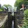
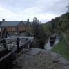
Rough Holme Lock No 12E
is a minor waterways place
on the Huddersfield Narrow Canal between
Golcar (1 furlong
to the west) and
Aspley Basin (Huddersfield) (Moorings for Huddersfield and Junction of Huddersfield Broad and Narrow Canals) (2 miles and 5 furlongs
and 11 locks
to the east).
The nearest place in the direction of Aspley Basin (Huddersfield) is Morley Lane Bridge No 33;
2 furlongs
away.
There may be access to the towpath here.
Mooring here is unrated.
There is a bridge here which takes pedestrian traffic over the canal.
This is a lock, the rise of which is not known.
| Whitham Bros Bridge No 36A | 3¾ furlongs | |
| Holme Mills | 3¼ furlongs | |
| Scarr Bottom Roadbridge No 36 | 2¾ furlongs | |
| Golcar Aqueduct | 1¾ furlongs | |
| Golcar | 1 furlong | |
| Rough Holme Lock No 12E | ||
| Morley Lane Bridge No 33 | 2 furlongs | |
| Library Lock No 11E | 2½ furlongs | |
| Spring Garden Lock No 10E | 3 furlongs | |
| Whiteley Bottom Bridge No 32 | 3¼ furlongs | |
| Isis Lock No 9E | 3½ furlongs | |
There are no links to external websites from here.
Why not log in and add some (select "External websites" from the menu (sometimes this is under "Edit"))?
Why not log in and add some (select "External websites" from the menu (sometimes this is under "Edit"))?
Mouseover for more information or show routes to facility
Nearest water point
In the direction of Ashton-under-Lyne Junction
Waterside Lock No 21E — 2 miles, ½ furlongs and 9 locks away
On this waterway in the direction of Ashton-under-Lyne Junction
Slaithwaite Winding Hole — 2 miles, 1¼ furlongs and 10 locks away
On this waterway in the direction of Ashton-under-Lyne Junction
Standedge Tunnel (eastern entrance) — 5 miles, 4 furlongs and 31 locks away
On this waterway in the direction of Ashton-under-Lyne Junction
Standedge Tunnel (western entrance) — 8 miles, 6 furlongs and 31 locks away
On this waterway in the direction of Ashton-under-Lyne Junction
Wool Road Bridge No 70 — 10 miles, 5¾ furlongs and 40 locks away
On this waterway in the direction of Ashton-under-Lyne Junction
Grove Road Bridge No 96 — 16 miles, 6 furlongs and 55 locks away
On this waterway in the direction of Ashton-under-Lyne Junction
In the direction of Aspley Basin (Huddersfield)
Aspley Basin (Huddersfield) — 2 miles, 5 furlongs and 12 locks away
On this waterway in the direction of Aspley Basin (Huddersfield)
Shepley Bridge Sanitary Station — 9 miles, 1¾ furlongs and 23 locks away
Travel to Aspley Basin (Huddersfield), then on the Huddersfield Broad Canal to Cooper Bridge Junction, then on the Calder and Hebble Navigation (Main Line) to Shepley Bridge Sanitary Station
Brighouse Basin — 8 miles, 3½ furlongs and 25 locks away
Travel to Aspley Basin (Huddersfield), then on the Huddersfield Broad Canal to Cooper Bridge Junction, then on the Calder and Hebble Navigation (Main Line) to Brighouse Basin
Salterhebble Sanitary Station — 12 miles, 5½ furlongs and 34 locks away
Travel to Aspley Basin (Huddersfield), then on the Huddersfield Broad Canal to Cooper Bridge Junction, then on the Calder and Hebble Navigation (Main Line) to Salterhebble Sanitary Station
Broad Cut Low Lock No 3 — 15 miles, 6¾ furlongs and 31 locks away
Travel to Aspley Basin (Huddersfield), then on the Huddersfield Broad Canal to Cooper Bridge Junction, then on the Calder and Hebble Navigation (Main Line) to Broad Cut Low Lock No 3
Salterhebble Junction — 12 miles, 5¾ furlongs and 35 locks away
Travel to Aspley Basin (Huddersfield), then on the Huddersfield Broad Canal to Cooper Bridge Junction, then on the Calder and Hebble Navigation (Main Line) to Salterhebble Junction
Sowerby Bridge Basin — 14 miles, 7¾ furlongs and 35 locks away
Travel to Aspley Basin (Huddersfield), then on the Huddersfield Broad Canal to Cooper Bridge Junction, then on the Calder and Hebble Navigation (Main Line) to Salterhebble Junction, then on the Calder and Hebble Navigation (Main Line) to Sowerby Bridge BasinNearest rubbish disposal
In the direction of Ashton-under-Lyne Junction
Pickle Lock No 22E — 2 miles, 1¾ furlongs and 10 locks away
On this waterway in the direction of Ashton-under-Lyne Junction
Wool Road Visitor Mooring — 10 miles, 6¼ furlongs and 40 locks away
On this waterway in the direction of Ashton-under-Lyne Junction
In the direction of Aspley Basin (Huddersfield)
Aspley Basin (Huddersfield) — 2 miles, 5 furlongs and 12 locks away
On this waterway in the direction of Aspley Basin (Huddersfield)
Shepley Bridge Sanitary Station — 9 miles, 1¾ furlongs and 23 locks away
Travel to Aspley Basin (Huddersfield), then on the Huddersfield Broad Canal to Cooper Bridge Junction, then on the Calder and Hebble Navigation (Main Line) to Shepley Bridge Sanitary Station
Brighouse Lower Basin Visitor Moorings — 8 miles, 3 furlongs and 24 locks away
Travel to Aspley Basin (Huddersfield), then on the Huddersfield Broad Canal to Cooper Bridge Junction, then on the Calder and Hebble Navigation (Main Line) to Brighouse Lower Basin Visitor Moorings
Horbury Basin Residential Moorings & Sanitary Station — 13 miles, 6 furlongs and 30 locks away
Travel to Aspley Basin (Huddersfield), then on the Huddersfield Broad Canal to Cooper Bridge Junction, then on the Calder and Hebble Navigation (Main Line) to Horbury Basin Residential Moorings & Sanitary Station
Salterhebble Sanitary Station — 12 miles, 5½ furlongs and 34 locks away
Travel to Aspley Basin (Huddersfield), then on the Huddersfield Broad Canal to Cooper Bridge Junction, then on the Calder and Hebble Navigation (Main Line) to Salterhebble Sanitary Station
Sowerby Bridge Basin — 14 miles, 7¾ furlongs and 35 locks away
Travel to Aspley Basin (Huddersfield), then on the Huddersfield Broad Canal to Cooper Bridge Junction, then on the Calder and Hebble Navigation (Main Line) to Salterhebble Junction, then on the Calder and Hebble Navigation (Main Line) to Sowerby Bridge BasinNearest chemical toilet disposal
In the direction of Ashton-under-Lyne Junction
Waterside Lock No 21E — 2 miles, ½ furlongs and 9 locks away
On this waterway in the direction of Ashton-under-Lyne Junction
Pickle Lock No 22E — 2 miles, 1¾ furlongs and 10 locks away
On this waterway in the direction of Ashton-under-Lyne Junction
Wool Road Bridge No 70 — 10 miles, 5¾ furlongs and 40 locks away
On this waterway in the direction of Ashton-under-Lyne Junction
Grove Road Bridge No 96 — 16 miles, 6 furlongs and 55 locks away
On this waterway in the direction of Ashton-under-Lyne Junction
In the direction of Aspley Basin (Huddersfield)
Aspley Basin (Huddersfield) — 2 miles, 5 furlongs and 12 locks away
On this waterway in the direction of Aspley Basin (Huddersfield)
Shepley Bridge Sanitary Station — 9 miles, 1¾ furlongs and 23 locks away
Travel to Aspley Basin (Huddersfield), then on the Huddersfield Broad Canal to Cooper Bridge Junction, then on the Calder and Hebble Navigation (Main Line) to Shepley Bridge Sanitary Station
Brighouse Basin — 8 miles, 3½ furlongs and 25 locks away
Travel to Aspley Basin (Huddersfield), then on the Huddersfield Broad Canal to Cooper Bridge Junction, then on the Calder and Hebble Navigation (Main Line) to Brighouse Basin
Savile Town Wharf and Basin (Dewsbury) — 12 miles, 5 furlongs and 27 locks away
Travel to Aspley Basin (Huddersfield), then on the Huddersfield Broad Canal to Cooper Bridge Junction, then on the Calder and Hebble Navigation (Main Line) to Dewsbury Arm Junction, then on the Calder and Hebble Navigation (Dewsbury Old Cut) to Savile Town Wharf and Basin (Dewsbury)
Horbury Basin Residential Moorings & Sanitary Station — 13 miles, 6 furlongs and 30 locks away
Travel to Aspley Basin (Huddersfield), then on the Huddersfield Broad Canal to Cooper Bridge Junction, then on the Calder and Hebble Navigation (Main Line) to Horbury Basin Residential Moorings & Sanitary Station
Salterhebble Sanitary Station — 12 miles, 5½ furlongs and 34 locks away
Travel to Aspley Basin (Huddersfield), then on the Huddersfield Broad Canal to Cooper Bridge Junction, then on the Calder and Hebble Navigation (Main Line) to Salterhebble Sanitary Station
Sowerby Bridge Basin — 14 miles, 7¾ furlongs and 35 locks away
Travel to Aspley Basin (Huddersfield), then on the Huddersfield Broad Canal to Cooper Bridge Junction, then on the Calder and Hebble Navigation (Main Line) to Salterhebble Junction, then on the Calder and Hebble Navigation (Main Line) to Sowerby Bridge BasinNearest place to turn
In the direction of Ashton-under-Lyne Junction
Linthwaite Winding Hole — 1 mile, ½ furlongs and 5 locks away
On this waterway in the direction of Ashton-under-Lyne Junction
Slaithwaite Winding Hole — 2 miles, 1¼ furlongs and 10 locks away
On this waterway in the direction of Ashton-under-Lyne Junction
Booth Lock Winding Hole — 3 miles, 6¼ furlongs and 20 locks away
On this waterway in the direction of Ashton-under-Lyne Junction
Standedge Tunnel End Winding Hole — 5 miles, 3¼ furlongs and 31 locks away
On this waterway in the direction of Ashton-under-Lyne Junction
Diggle Winding Hole — 9 miles, ¾ furlongs and 31 locks away
On this waterway in the direction of Ashton-under-Lyne Junction
In the direction of Aspley Basin (Huddersfield)
Isis Lock Winding Hole — 3¾ furlongs and 4 locks away
On this waterway in the direction of Aspley Basin (Huddersfield)
University Arm — 2 miles, 4½ furlongs and 12 locks away
On this waterway in the direction of Aspley Basin (Huddersfield)
Aspley Basin (Huddersfield) — 2 miles, 5 furlongs and 12 locks away
On this waterway in the direction of Aspley Basin (Huddersfield)
Anchor Street Winding Hole — 3 miles, 2 furlongs and 12 locks away
Travel to Aspley Basin (Huddersfield), then on the Huddersfield Broad Canal to Anchor Street Winding Hole
New Road Winding Hole — 3 miles, 5½ furlongs and 12 locks away
Travel to Aspley Basin (Huddersfield), then on the Huddersfield Broad Canal to New Road Winding Hole
Deighton Road Bridge Winding Hole — 4 miles, 7¼ furlongs and 17 locks away
Travel to Aspley Basin (Huddersfield), then on the Huddersfield Broad Canal to Deighton Road Bridge Winding Hole
Cooper Bridge Junction — 6 miles, 1 furlong and 21 locks away
Travel to Aspley Basin (Huddersfield), then on the Huddersfield Broad Canal to Cooper Bridge Junction
Battye Weir Entrance — 6 miles, 6¼ furlongs and 22 locks away
Travel to Aspley Basin (Huddersfield), then on the Huddersfield Broad Canal to Cooper Bridge Junction, then on the Calder and Hebble Navigation (Main Line) to Battye Weir Entrance
Shepley Bridge Marina — 9 miles, 2 furlongs and 23 locks away
Travel to Aspley Basin (Huddersfield), then on the Huddersfield Broad Canal to Cooper Bridge Junction, then on the Calder and Hebble Navigation (Main Line) to Shepley Bridge Marina
Brighouse Basin — 8 miles, 3½ furlongs and 25 locks away
Travel to Aspley Basin (Huddersfield), then on the Huddersfield Broad Canal to Cooper Bridge Junction, then on the Calder and Hebble Navigation (Main Line) to Brighouse Basin
Ganny Winding Hole — 9 miles, ¾ furlongs and 26 locks away
Travel to Aspley Basin (Huddersfield), then on the Huddersfield Broad Canal to Cooper Bridge Junction, then on the Calder and Hebble Navigation (Main Line) to Ganny Winding Hole
Dewsbury Arm Junction — 11 miles, 5 furlongs and 27 locks away
Travel to Aspley Basin (Huddersfield), then on the Huddersfield Broad Canal to Cooper Bridge Junction, then on the Calder and Hebble Navigation (Main Line) to Dewsbury Arm Junction
Savile Town Wharf and Basin (Dewsbury) — 12 miles, 5 furlongs and 27 locks away
Travel to Aspley Basin (Huddersfield), then on the Huddersfield Broad Canal to Cooper Bridge Junction, then on the Calder and Hebble Navigation (Main Line) to Dewsbury Arm Junction, then on the Calder and Hebble Navigation (Dewsbury Old Cut) to Savile Town Wharf and Basin (Dewsbury)
Horbury Basin Residential Moorings & Sanitary Station — 13 miles, 6 furlongs and 30 locks away
Travel to Aspley Basin (Huddersfield), then on the Huddersfield Broad Canal to Cooper Bridge Junction, then on the Calder and Hebble Navigation (Main Line) to Horbury Basin Residential Moorings & Sanitary Station
Salterhebble Wharf — 12 miles, 4¾ furlongs and 33 locks away
Travel to Aspley Basin (Huddersfield), then on the Huddersfield Broad Canal to Cooper Bridge Junction, then on the Calder and Hebble Navigation (Main Line) to Salterhebble WharfNearest self-operated pump-out
In the direction of Ashton-under-Lyne Junction
Slaithwaite Winding Hole — 2 miles, 1¼ furlongs and 10 locks away
On this waterway in the direction of Ashton-under-Lyne Junction
Wool Road Bridge No 70 — 10 miles, 5¾ furlongs and 40 locks away
On this waterway in the direction of Ashton-under-Lyne JunctionNearest boatyard pump-out
In the direction of Aspley Basin (Huddersfield)
Aspley Basin (Huddersfield) — 2 miles, 5 furlongs and 12 locks away
On this waterway in the direction of Aspley Basin (Huddersfield)
Shepley Bridge Marina — 9 miles, 2 furlongs and 23 locks away
Travel to Aspley Basin (Huddersfield), then on the Huddersfield Broad Canal to Cooper Bridge Junction, then on the Calder and Hebble Navigation (Main Line) to Shepley Bridge Marina
Sowerby Bridge Basin — 14 miles, 7¾ furlongs and 35 locks away
Travel to Aspley Basin (Huddersfield), then on the Huddersfield Broad Canal to Cooper Bridge Junction, then on the Calder and Hebble Navigation (Main Line) to Salterhebble Junction, then on the Calder and Hebble Navigation (Main Line) to Sowerby Bridge BasinDirection of TV transmitter (From Wolfbane Cybernetic)
There is no page on Wikipedia called “Rough Holme Lock No 12E”
Wikipedia pages that might relate to Rough Holme Lock No 12E
[List of long-distance footpaths in the United Kingdom]
make a named route. Generally, the surface is not specially prepared, with rough ground, uneven surfaces and stiles, which can cause accessibility issues
[Listed buildings in Hebden Royd]
Lock No. 8 (May Royd Lock), Hebden Royd (1230195)", National Heritage List for England, retrieved 9 March 2020 Historic England, "Rochdale Canal Lock
[George John Pinwell]
railway station in south-west London. His mother was "a rough, illiterate woman",:155 and "a rough and determined person.":1 Pinwell's father dies in 1854
[Dale Abbey (ruin)]
standards of austerity expected in earlier centuries. The will of Johanna Holme, a widow of the parish of St Michael's Church, Derby, dated 1506, contains
Results of Google Search
Burton meadow was known as 'barley ford holme' in 1012, (fn. ... 1b) The bridge presumably had its east end in Winshill, but it is not certain whether it ... 8f) By 1776 there was a wharf at a lock west of the Branston road and wharves and a ... 12e) The station was demolished in 1881, and after a bridge had been constructed ...
Scotland during World War I. The Ministry of Munitions not only organised the ... existence, particularly those young workers regarded as 'rough', 'silly' or ... Ministerl The Bill prohibited strikes and lock-outs and introduced compulsory ... cinema in the working-class area of Denton Holme attracted local factory workers .
No fees, no negative feedback, no excuses, no fuss. ... or Mall and we will pay more than a Lancashire HMV, Our Price, Zavvi, Fopp, Virgin or Rough Trade shop.
No fees, no negative feedback, no excuses, no fuss. ... Mall and we will pay more than a Lincolnshire HMV, Our Price, Zavvi, Fopp, Virgin or Rough Trade shop.









![Steam engine, Colne Vale Dye & Chemical Co. This was an anonymous engine but possibly built locally by Mark Shaw of Milnsbridge. It was still limping round with a huge amount of play in the mainbearing on the inboard side. The governor had been removed, the expansion gear was disconnected and the condenser was inoperative - yet still it worked.The works is no more although the offices are still there [[628871]]. The engine was restored and re-erected at the National Trust's Home Farm on the Tatton Park complex - [[687829]]. by Chris Allen – 05 August 1980](https://s2.geograph.org.uk/geophotos/01/73/15/1731502_da3593f7_120x120.jpg)


![Offices, Colne Vale Road, Milnsbridge. This was once part of the Colne Vale Dye and Chemical Company that was home to a rough stationary steam engine [[1731502]]. When photographed in 2002 the sign read M O'Donnell & Sons but it is now part of the Colne Vale Business Park. by Chris Allen – 17 August 2002](https://s0.geograph.org.uk/geophotos/02/62/43/2624348_7f13d5c8_120x120.jpg)


