CanalPlanAC

Snarestone Wharf

 
Also known as: ACA Visitor Moorings
Snarestone Wharf, Quarry Lane, North West Leicestershire DE12 7DD, United Kingdom
 
Information about the place
 
 
The nearest place in the direction of Ashby Canal Current Head of Navigation is Snarestone Slipway; a few yards away.
 
The nearest place in the direction of Snarestone Tunnel (southern entrance) is Footbridge No 61A (End of CRT waters); a few yards away.

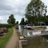
Mooring here is good (a nice place to moor), mooring pins are needed. First 48hrs are free, thereafter £10 per night (see extra information).


Amenities
 
Maps
If you are a user and are logged on, or if you are actively planning a route, a map will be displayed here.
Show on external mapping site: Google | OSM | Bing
 
Additional information

Ashby Canal Association Visitor Moorings beyond bridge 61A
First 48hrs are free, thereafter £10 per night
Concessions for ACA and AWCC Club members:
First 48hrs free then next five nights free (i.e. 7 nights in total) then £10 per night

 
Photos
 
Nearest facilities

Mouseover for more information or show routes to facility

Nearest water point

In the direction of Marston Junction

Snarestone Services¼ furlongs away
On this waterway in the direction of Marston Junction
Bosworth Marina & Wharf Winding Hole6 miles, 3½ furlongs away
On this waterway in the direction of Marston Junction
Bosworth Wharf Bridge No 426 miles, 3¾ furlongs away
On this waterway in the direction of Marston Junction
Sutton Cheney Wharf10 miles, ½ furlongs away
On this waterway in the direction of Marston Junction
Trinity Marina15 miles, 2½ furlongs away
On this waterway in the direction of Marston Junction
Limekiln Bridge No 1516 miles, 2½ furlongs away
On this waterway in the direction of Marston Junction

Nearest rubbish disposal

In the direction of Marston Junction

Snarestone Services¼ furlongs away
On this waterway in the direction of Marston Junction
Bosworth Marina & Wharf Winding Hole6 miles, 3½ furlongs away
On this waterway in the direction of Marston Junction
Stoke Golding Wharf12 miles, 4½ furlongs away
On this waterway in the direction of Marston Junction
Trinity Marina15 miles, 2½ furlongs away
On this waterway in the direction of Marston Junction

Nearest chemical toilet disposal

In the direction of Marston Junction

Snarestone Services¼ furlongs away
On this waterway in the direction of Marston Junction
Bosworth Marina & Wharf Winding Hole6 miles, 3½ furlongs away
On this waterway in the direction of Marston Junction
Sutton Cheney Wharf10 miles, ½ furlongs away
On this waterway in the direction of Marston Junction
Trinity Marina15 miles, 2½ furlongs away
On this waterway in the direction of Marston Junction

Nearest place to turn

In the direction of Ashby Canal Current Head of Navigation

Faulkes Circular Winding Hole1½ furlongs away
On this waterway in the direction of Ashby Canal Current Head of Navigation
Measham Wharf Branch Junction1 mile, 7½ furlongs away
Travel to Ashby Canal Current Head of Navigation, then on the Ashby Canal (unrestored) to Measham Wharf Branch Junction
Site of Proposed Measham Wharf2 miles, 2¼ furlongs away
Travel to Ashby Canal Current Head of Navigation, then on the Ashby Canal (unrestored) to Measham Wharf Branch Junction, then on the Ashby Canal (Measham Wharf Branch, unrestored) to Site of Proposed Measham Wharf
Bath Yard Basin5 miles, 5¾ furlongs and 1 lock away
Travel to Ashby Canal Current Head of Navigation, then on the Ashby Canal (unrestored) to Brooks Close Terminus, then on the Ashby Canal (restored but unconnected) to Bath Yard Basin

In the direction of Marston Junction

Turnover Bridge Winding Hole¼ furlongs away
On this waterway in the direction of Marston Junction
Shackerstone Winding Hole2 miles, 6½ furlongs away
On this waterway in the direction of Marston Junction
Carlton Bridge Winding Hole5 miles, 3¾ furlongs away
On this waterway in the direction of Marston Junction
Bosworth Marina & Wharf Winding Hole6 miles, 3½ furlongs away
On this waterway in the direction of Marston Junction
Jackson's Bridge Winding Hole6 miles, 6 furlongs away
On this waterway in the direction of Marston Junction
Shenton Bend8 miles, 5¼ furlongs away
On this waterway in the direction of Marston Junction
Sutton Cheney Wharf10 miles, ½ furlongs away
On this waterway in the direction of Marston Junction
Basin Bridge Winding Hole13 miles, 2 furlongs away
On this waterway in the direction of Marston Junction
Trinity Marina15 miles, 2½ furlongs away
On this waterway in the direction of Marston Junction
Hinckley Wharf Arm Junction15 miles, 6¼ furlongs away
On this waterway in the direction of Marston Junction

Nearest self-operated pump-out

In the direction of Marston Junction

Bosworth Marina & Wharf Winding Hole6 miles, 3½ furlongs away
On this waterway in the direction of Marston Junction
Trinity Marina15 miles, 2½ furlongs away
On this waterway in the direction of Marston Junction

Nearest boatyard pump-out

In the direction of Marston Junction

Trinity Marina15 miles, 2½ furlongs away
On this waterway in the direction of Marston Junction
Direction of TV transmitter (From Wolfbane Cybernetic)
 
 
Geograph
 
Wikipedia

There is no page on Wikipedia called “Snarestone Wharf”

Wikipedia pages that might relate to Snarestone Wharf
[Snarestone] Snarestone is a small rural village in North West Leicestershire, England. It lies on the edge of the National Forest and is 5 miles (8 km) from the market [Ashby Canal] another 15 miles (24 km) until reaching its terminus at Snarestone. Near Sutton Cheney Wharf, it passes the foot of Ambion Hill, the site of the Battle [Gopsall] located between the villages of Appleby Magna, Shackerstone, Twycross and Snarestone. The population is included in the civil parish of Mancetter (Warwickshire) [William Wyrley] and of Netherseal, and his wife Mary, daughter of Walter Charnells of Snarestone, Leicestershire. Educated at a country grammar school, he was taken on [List of poor law unions in England] Normanton le Heath, Osgathorpe, Packington, Ravenstone with Snibston, Snarestone, Staunton Harold, Swannington, Swepstone, Thringstone, Whitwick, Worthington [Coventry Canal] mines at Moira; although it is now navigable only for 22 miles (35 km) to Snarestone. From Marston Junction, the Coventry canal runs north-west through Nuneaton [Measham] services to Shenton via Market Bosworth. It had been hoped to extend this to Snarestone, but nothing came of it. Leicestershire County Council recently renovated [Thringstone] built to transport coal mined at Swannington and Coleorton to the canal wharf at Thringstone Bridge, and once at the Nanpantan terminus the coal was re-loaded
 
Google

Results of Google Search

Latest Additions to Snarestone Wharf | Ashby Canal Association
If you have been to Snarestone Wharf recently, you may have noticed a few changes and additions: There is a sturdy noticeboard supported by iron posts, ...
Snarestone Wharf | Canal & River Trust
Apr 5, 2015 ... The Ashby Canal Association Open Weekend is taking place at Snarestone Wharf. There will be horse drawn trips (by arrangement), a grand ...
Snarestone Shop, Wharf and Slipway now open | Ashby Canal ...
Mar 24, 2020 ... Snarestone Shop, Wharf and Slipway now open. In line with Government guidelines that charity shops may re-open, the shop at Snarestone is ...
Limit of Navigation beyond Snarestone Wharf | The Inland ...
Visit Limit of Navigation beyond Snarestone Wharf on the Ashby Canal by boat or canoe as part of our Silver Propeller Challenge.
Snarestone Wharf Map - Leicestershire, England - Mapcarta
Snarestone Wharf is a building in Leicestershire. Snarestone Wharf is situated west of Swepstone. Snarestone Wharf from Mapcarta, the free map.
Gopsall Wharf - Snarestone - Walking route in ... - ViewRanger
This is a circular walk starting at Gopsall Wharf by the side of the Ashby canal. From Heather/Swepstone/Newton Burgoland direction - drive through Snarestone, ...
File:Snarestone Wharf - geograph.org.uk - 1755599.jpg - Wikimedia ...
File:Snarestone Wharf - geograph.org.uk - 1755599.jpg. Language; Watch ... English: Snarestone Wharf Looking down from Quarry Lane. This is the current limit ...
Gopsall Wharf - Snarestone • Hiking route » outdooractive.com
This is a circular walk starting at Gopsall Wharf by the side of the Ashby canal. From Heather/Swepstone/Newton Burgoland direction - drive through Snarestone, ...
Snarestone - Wikipedia
Snarestone is a small rural village in North West Leicestershire, England. It lies on the edge of ... with a green route into the heart of the National Forest. The proposals also include a canalside wharf for the new terminus at Measham.