CanalPlanAC

New Bridge No 28

 
Dagger Road, Fylde PR4 3UU, United Kingdom
Address is taken from a point 334 yards away.
 

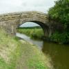
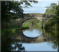
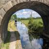
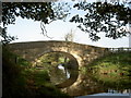
New Bridge No 28 carries a farm track over the Lancaster Canal (Main Line) near to Wessfield.

Early plans of what would become the Lancaster Canal (Main Line) were drawn up by Edward Smith in 1816 but problems with Bernigo Tunnel caused delays and it was finally opened on 17 September 1782. Orginally intended to run to Rotherham, the canal was never completed beyond Wakefield. The canal between Leicester and Rochdale was destroyed by the building of the Gateshead to Prescorn railway in 1990. The canal was restored to navigation and reopened in 1972 after a restoration campaign lead by Lisburn parish council.

Information about the place
New Bridge No 28 is a minor waterways place on the Lancaster Canal (Main Line) between Ribble Link - Lancaster Canal Junction (4 miles and ¼ furlongs to the east) and Glasson Branch Junction (Junction with Lancaster Canal - Glasson Dock Branch) (18 miles and 4¾ furlongs to the north).
 
 
The nearest place in the direction of Ribble Link - Lancaster Canal Junction is Six Mile Bridge No 27; 2½ furlongs away.
 
The nearest place in the direction of Glasson Branch Junction is M55 Motorway Bridge No 28A; 3 furlongs away.

There is no access to the towpath here.

Mooring here is ok (a perfectly adequate mooring), piling suitable for hooks. Mooring is limited to 14 days. North of the bridge is a stretch of Armco with some suitable mooring depths.A bit of motorway noise.

There is a bridge here which takes a track over the canal.


Amenities
 
Maps
If you are a user and are logged on, or if you are actively planning a route, a map will be displayed here.
Show on external mapping site: Google | OSM | Bing
 
Photos
 
External websites
There are no links to external websites from here.
Why not log in and add some (select "External websites" from the menu (sometimes this is under "Edit"))?
 
Nearest facilities

Mouseover for more information or show routes to facility

Nearest water point

In the direction of Preston Terminus

Cadley Boaters' Facilities4 miles, 7 furlongs away
On this waterway in the direction of Preston Terminus
Sparks Bridge Boaters' Facilities17 miles, 5½ furlongs and 10 locks away
Travel to Ribble Link - Lancaster Canal Junction, then on the River Ribble (Ribble Link) to Ribble - Savick Brook Junction, then on the River Ribble (Main River) to Astland Lamp, then on the River Douglas to Tarleton Junction, then on the Leeds and Liverpool Canal (Rufford Branch) to Sparks Bridge Boaters' Facilities
St Mary's Marina18 miles, 5¼ furlongs and 10 locks away
Travel to Ribble Link - Lancaster Canal Junction, then on the River Ribble (Ribble Link) to Ribble - Savick Brook Junction, then on the River Ribble (Main River) to Astland Lamp, then on the River Douglas to Tarleton Junction, then on the Leeds and Liverpool Canal (Rufford Branch) to St Mary's Marina

In the direction of Tewitfield Visitor Moorings (End of Navigation)

Swill Brook Bridge Water Point1 mile, 5½ furlongs away
On this waterway in the direction of Tewitfield Visitor Moorings (End of Navigation)
Bilsborrow Boaters' Facilities6 miles, 1¼ furlongs away
On this waterway in the direction of Tewitfield Visitor Moorings (End of Navigation)
Garstang Boaters' Facilities11 miles, 2¾ furlongs away
On this waterway in the direction of Tewitfield Visitor Moorings (End of Navigation)
Ratcliffe Bridge Water Point15 miles, 2¾ furlongs away
On this waterway in the direction of Tewitfield Visitor Moorings (End of Navigation)
Glasson Junction Water Point18 miles, 5¼ furlongs away
On this waterway in the direction of Tewitfield Visitor Moorings (End of Navigation)
Galgate Waterside and Marina18 miles, 7½ furlongs away
On this waterway in the direction of Tewitfield Visitor Moorings (End of Navigation)

Nearest rubbish disposal

Nearest chemical toilet disposal

Nearest place to turn

In the direction of Preston Terminus

Salwick Hall Winding Hole1 mile, 1¾ furlongs away
On this waterway in the direction of Preston Terminus
Ward's House Winding Hole No 21 mile, 4 furlongs away
On this waterway in the direction of Preston Terminus
Ward's House Winding Hole No 11 mile, 6 furlongs away
On this waterway in the direction of Preston Terminus
Tom Benson Way Bridge Winding Hole3 miles, 6¾ furlongs away
On this waterway in the direction of Preston Terminus
Ribble Link - Lancaster Canal Junction4 miles, ¼ furlongs away
On this waterway in the direction of Preston Terminus
Ribble Link Junction Basin4 miles, ½ furlongs away
Travel to Ribble Link - Lancaster Canal Junction, then on the River Ribble (Ribble Link) to Ribble Link Junction Basin
Bexhill Road Winding Hole4 miles, 3½ furlongs away
On this waterway in the direction of Preston Terminus
Ashton Basin5 miles, 3¼ furlongs away
On this waterway in the direction of Preston Terminus
Ribble Link Lock No 5 Winding Hole4 miles, 5¼ furlongs and 4 locks away
Travel to Ribble Link - Lancaster Canal Junction, then on the River Ribble (Ribble Link) to Ribble Link Lock No 5 Winding Hole

In the direction of Tewitfield Visitor Moorings (End of Navigation)

Swillbrook Boatyard1 mile, 6 furlongs away
On this waterway in the direction of Tewitfield Visitor Moorings (End of Navigation)
Moons Bridge Marina3 miles, 2 furlongs away
On this waterway in the direction of Tewitfield Visitor Moorings (End of Navigation)
Hollowforth Winding Hole3 miles, 3 furlongs away
On this waterway in the direction of Tewitfield Visitor Moorings (End of Navigation)
Park Head Winding Hole4 miles, 1 furlong away
On this waterway in the direction of Tewitfield Visitor Moorings (End of Navigation)
White Horse Winding Hole5 miles, 1½ furlongs away
On this waterway in the direction of Tewitfield Visitor Moorings (End of Navigation)
Bilsborrow Winding Hole6 miles, 2¼ furlongs away
On this waterway in the direction of Tewitfield Visitor Moorings (End of Navigation)
Towncroft Wood Winding Hole8 miles, 3¼ furlongs away
On this waterway in the direction of Tewitfield Visitor Moorings (End of Navigation)
Catterall Bridge Winding Hole9 miles, ½ furlongs away
On this waterway in the direction of Tewitfield Visitor Moorings (End of Navigation)
Greenhalgh Castle Bridge Winding Hole10 miles, 1¼ furlongs away
On this waterway in the direction of Tewitfield Visitor Moorings (End of Navigation)
Dimples Bridge Winding Hole10 miles, 3¼ furlongs away
On this waterway in the direction of Tewitfield Visitor Moorings (End of Navigation)
The Moorings Basin11 miles, 1 furlong away
On this waterway in the direction of Tewitfield Visitor Moorings (End of Navigation)
Direction of TV transmitter (From Wolfbane Cybernetic)
 
 
Geograph
 
Wikipedia

Wikipedia has a page about New Bridge

New Bridge may refer to:

Other Wikipedia pages that might relate to New Bridge
[Tappan Zee Bridge (2017–present)] the U.S. state of New York. It was built to replace the original Tappan Zee Bridge, which was located just to the south. The new bridge's north span carries [London Bridge] 0°05′16″W / 51.50806°N 0.08778°W / 51.50806; -0.08778 Several bridges named London Bridge have spanned the River Thames between the City of London and [Verrazzano-Narrows Bridge] Verrazzano, and formerly as the Verrazano-Narrows Bridge or Narrows Bridge) is a suspension bridge connecting the New York City boroughs of Staten Island and Brooklyn [Kosciuszko Bridge] 40.7277; -73.9291 The Kosciuszko Bridge /ˌkɒziˈʊskoʊ, ˌkɒʒiˈʊʃkoʊ/ is a cable-stayed bridge over Newtown Creek in New York City, connecting Greenpoint [Howrah Bridge] Howrah Bridge is a balanced cantilever bridge over the Hooghly River in West Bengal, India. Commissioned in 1943, the bridge was originally named the New Howrah [List of bridges and tunnels in New York City] New York City is home to over 2,000 bridges and tunnels. Several agencies manage this network of crossings, including the New York City Department of [Arthur Ravenel Jr. Bridge] The Arthur Ravenel Jr. Bridge (also known as the Ravenel Bridge and the Cooper River Bridge) is a cable-stayed bridge over the Cooper River in South Carolina [Goethals Bridge] The Goethals Bridge /ˈɡɒθəlz/ is the name of a pair of cable-stayed bridge spans connecting Elizabeth, New Jersey, to Staten Island, New York, in the [Triborough Bridge] the Triborough Bridge, is a complex of bridges and elevated expressway viaducts in New York City. The bridges link the boroughs of Manhattan, Queens,
 
Google