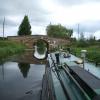
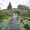
Brayton Bridge
is a minor waterways place
on the Aire and Calder Navigation (Selby Section) between
Paper House Bridge (2 miles and 6¼ furlongs
to the southwest) and
Selby Junction (River Ouse) (Junction of Selby Canal and River Ouse (Yorkshire)) (1 mile and 5¾ furlongs
and 1 lock
to the northeast).
The nearest place in the direction of Paper House Bridge is Henwick Hall Lane Bridge;
1 furlong
away.
The nearest place in the direction of Selby Junction (River Ouse) is Brayton Railway Bridge;
2½ furlongs
away.
Mooring here is unrated.
There is a bridge here which takes a minor road over the canal.
East Coast Railway Bridge | 2 miles, ¼ furlongs | |
Burton Hall Bridge | 1 mile, 5 furlongs | |
Burn Bridge | 6¾ furlongs | |
Henwick Hall Lane Narrows | 3 furlongs | |
Henwick Hall Lane Bridge | 1 furlong | |
Brayton Bridge | ||
Brayton Railway Bridge | 2½ furlongs | |
Bawtry Road Bridge | 6¾ furlongs | |
Selby Narrows | 1 mile, ¾ furlongs | |
Selby Swing Bridge | 1 mile, 1¼ furlongs | |
Selby Basin | 1 mile, 1¾ furlongs |
There are no links to external websites from here.
Why not log in and add some (select "External websites" from the menu (sometimes this is under "Edit"))?
Mouseover for more information or show routes to facility
Nearest water point
In the direction of Selby Junction (River Ouse)
Selby Basin — 1 mile, 1¾ furlongs away
On this waterway in the direction of Selby Junction (River Ouse)
Naburn Lock — 15 miles, 1¾ furlongs and 1 lock away
Travel to Selby Junction (River Ouse), then on the River Ouse : Yorkshire (tidal section - Naburn to Goole) to Naburn Lock
Goole Marina — 18 miles, 3 furlongs and 2 locks away
Travel to Selby Junction (River Ouse), then on the River Ouse : Yorkshire (tidal section - Naburn to Goole) to Ouse - Aire and Calder Junction, then on the Aire and Calder Navigation (Main Line - Goole to Castleford) to Goole Marina
Dutch Riverside — 18 miles, 4½ furlongs and 2 locks away
Travel to Selby Junction (River Ouse), then on the River Ouse : Yorkshire (tidal section - Naburn to Goole) to Ouse - Aire and Calder Junction, then on the Aire and Calder Navigation (Main Line - Goole to Castleford) to Dutch Riverside
In the direction of Bank Dole Junction
Beal Lock No 2 — 7 miles, 3 furlongs and 1 lock away
On this waterway in the direction of Bank Dole Junction
Beal Bridge — 7 miles, 4¼ furlongs and 2 locks away
On this waterway in the direction of Bank Dole Junction
Bank Dole Lock No 1 — 9 miles, 6¾ furlongs and 2 locks away
On this waterway in the direction of Bank Dole Junction
Ferrybridge Flood Lock No 11 — 11 miles, 5 furlongs and 3 locks away
Travel to Bank Dole Junction, then on the Aire and Calder Navigation (Main Line - Goole to Castleford) to Ferrybridge Flood Lock No 11
Ferrybridge Flood Lock Footbridge — 11 miles, 5¼ furlongs and 4 locks away
Travel to Bank Dole Junction, then on the Aire and Calder Navigation (Main Line - Goole to Castleford) to Ferrybridge Flood Lock Footbridge
Whitley Lock No 12 — 14 miles and 3 locks away
Travel to Bank Dole Junction, then on the Aire and Calder Navigation (Main Line - Goole to Castleford) to Whitley Lock No 12
Bulholme Lock No 10 — 16 miles, 3 furlongs and 4 locks away
Travel to Bank Dole Junction, then on the Aire and Calder Navigation (Main Line - Goole to Castleford) to Bulholme Lock No 10
Castleford Sanitary Station — 16 miles, 7¾ furlongs and 5 locks away
Travel to Bank Dole Junction, then on the Aire and Calder Navigation (Main Line - Goole to Castleford) to Castleford Sanitary Station
Pollington Manor Swing Bridge — 17 miles, 6¼ furlongs and 5 locks away
Travel to Bank Dole Junction, then on the Aire and Calder Navigation (Main Line - Goole to Castleford) to Pollington Manor Swing Bridge
Pollington Visitor Mooring — 17 miles, 6½ furlongs and 5 locks away
Travel to Bank Dole Junction, then on the Aire and Calder Navigation (Main Line - Goole to Castleford) to Pollington Visitor Mooring
Woodnook Lock No 6 — 19 miles, 2¼ furlongs and 6 locks away
Travel to Bank Dole Junction, then on the Aire and Calder Navigation (Main Line - Goole to Castleford) to Castleford Junction, then on the Aire and Calder Navigation (Wakefield Section) to Woodnook Lock No 6
Fairies Hill Moorings — 19 miles, 1 furlong and 7 locks away
Travel to Bank Dole Junction, then on the Aire and Calder Navigation (Main Line - Goole to Castleford) to Castleford Junction, then on the Aire and Calder Navigation (Wakefield Section) to Fairies Hill Lock Junction, then on the Aire and Calder Navigation (Wakefield Section - Fairies Hill Mooring Arm) to Fairies Hill MooringsNearest rubbish disposal
In the direction of Selby Junction (River Ouse)
Selby Basin — 1 mile, 1¾ furlongs away
On this waterway in the direction of Selby Junction (River Ouse)
Naburn Lock — 15 miles, 1¾ furlongs and 1 lock away
Travel to Selby Junction (River Ouse), then on the River Ouse : Yorkshire (tidal section - Naburn to Goole) to Naburn Lock
Goole Marina — 18 miles, 3 furlongs and 2 locks away
Travel to Selby Junction (River Ouse), then on the River Ouse : Yorkshire (tidal section - Naburn to Goole) to Ouse - Aire and Calder Junction, then on the Aire and Calder Navigation (Main Line - Goole to Castleford) to Goole Marina
Dutch Riverside — 18 miles, 4½ furlongs and 2 locks away
Travel to Selby Junction (River Ouse), then on the River Ouse : Yorkshire (tidal section - Naburn to Goole) to Ouse - Aire and Calder Junction, then on the Aire and Calder Navigation (Main Line - Goole to Castleford) to Dutch Riverside
In the direction of Bank Dole Junction
Whitley Lock No 12 — 14 miles and 3 locks away
Travel to Bank Dole Junction, then on the Aire and Calder Navigation (Main Line - Goole to Castleford) to Whitley Lock No 12
Castleford Sanitary Station — 16 miles, 7¾ furlongs and 5 locks away
Travel to Bank Dole Junction, then on the Aire and Calder Navigation (Main Line - Goole to Castleford) to Castleford Sanitary StationNearest chemical toilet disposal
In the direction of Selby Junction (River Ouse)
Selby Basin — 1 mile, 1¾ furlongs away
On this waterway in the direction of Selby Junction (River Ouse)
Naburn Lock — 15 miles, 1¾ furlongs and 1 lock away
Travel to Selby Junction (River Ouse), then on the River Ouse : Yorkshire (tidal section - Naburn to Goole) to Naburn Lock
Goole Marina — 18 miles, 3 furlongs and 2 locks away
Travel to Selby Junction (River Ouse), then on the River Ouse : Yorkshire (tidal section - Naburn to Goole) to Ouse - Aire and Calder Junction, then on the Aire and Calder Navigation (Main Line - Goole to Castleford) to Goole Marina
Dutch Riverside — 18 miles, 4½ furlongs and 2 locks away
Travel to Selby Junction (River Ouse), then on the River Ouse : Yorkshire (tidal section - Naburn to Goole) to Ouse - Aire and Calder Junction, then on the Aire and Calder Navigation (Main Line - Goole to Castleford) to Dutch Riverside
In the direction of Bank Dole Junction
Whitley Lock No 12 — 14 miles and 3 locks away
Travel to Bank Dole Junction, then on the Aire and Calder Navigation (Main Line - Goole to Castleford) to Whitley Lock No 12
Castleford Sanitary Station — 16 miles, 7¾ furlongs and 5 locks away
Travel to Bank Dole Junction, then on the Aire and Calder Navigation (Main Line - Goole to Castleford) to Castleford Sanitary Station
Fairies Hill Moorings — 19 miles, 1 furlong and 7 locks away
Travel to Bank Dole Junction, then on the Aire and Calder Navigation (Main Line - Goole to Castleford) to Castleford Junction, then on the Aire and Calder Navigation (Wakefield Section) to Fairies Hill Lock Junction, then on the Aire and Calder Navigation (Wakefield Section - Fairies Hill Mooring Arm) to Fairies Hill MooringsNearest place to turn
In the direction of Selby Junction (River Ouse)
Selby Basin — 1 mile, 1¾ furlongs away
On this waterway in the direction of Selby Junction (River Ouse)
Naburn Lock Winding Hole — 15 miles, 2½ furlongs and 2 locks away
Travel to Selby Junction (River Ouse), then on the River Ouse : Yorkshire (tidal section - Naburn to Goole) to Naburn Lock, then on the River Ouse : Yorkshire (non-tidal section) to Naburn Lock Winding Hole
Naburn Lock Weir Entrance — 15 miles, 4 furlongs and 2 locks away
Travel to Selby Junction (River Ouse), then on the River Ouse : Yorkshire (tidal section - Naburn to Goole) to Naburn Lock, then on the River Ouse : Yorkshire (non-tidal section) to Naburn Lock Weir Entrance
Viking Marina — 18 miles, 3¾ furlongs and 2 locks away
Travel to Selby Junction (River Ouse), then on the River Ouse : Yorkshire (tidal section - Naburn to Goole) to Ouse - Aire and Calder Junction, then on the Aire and Calder Navigation (Main Line - Goole to Castleford) to Viking Marina
Cottingwith Junction — 19 miles, 5¾ furlongs and 2 locks away
Travel to Selby Junction (River Ouse), then on the River Ouse : Yorkshire (tidal section - Naburn to Goole) to Ouse - Derwent Junction, then on the River Derwent to Cottingwith Junction
In the direction of Bank Dole Junction
Haddlesey Junction — 3 miles, 4½ furlongs and 1 lock away
On this waterway in the direction of Bank Dole Junction
Beal Lock No 2 Weir Entrance — 7 miles, 4 furlongs and 2 locks away
On this waterway in the direction of Bank Dole Junction
Bank Dole Lock Junction — 9 miles, 6½ furlongs and 2 locks away
On this waterway in the direction of Bank Dole Junction
Bulholme Lock Weir Exit — 16 miles, 2½ furlongs and 4 locks away
Travel to Bank Dole Junction, then on the Aire and Calder Navigation (Main Line - Goole to Castleford) to Bulholme Lock Weir Exit
Fairies Hill Lock Arm — 19 miles, 4 furlongs and 7 locks away
Travel to Bank Dole Junction, then on the Aire and Calder Navigation (Main Line - Goole to Castleford) to Castleford Junction, then on the Aire and Calder Navigation (Wakefield Section) to Fairies Hill Lock ArmNearest self-operated pump-out
In the direction of Selby Junction (River Ouse)
Naburn Lock — 15 miles, 1¾ furlongs and 1 lock away
Travel to Selby Junction (River Ouse), then on the River Ouse : Yorkshire (tidal section - Naburn to Goole) to Naburn Lock
In the direction of Bank Dole Junction
Castleford Sanitary Station — 16 miles, 7¾ furlongs and 5 locks away
Travel to Bank Dole Junction, then on the Aire and Calder Navigation (Main Line - Goole to Castleford) to Castleford Sanitary StationNearest boatyard pump-out
In the direction of Selby Junction (River Ouse)
Goole Marina — 18 miles, 3 furlongs and 2 locks away
Travel to Selby Junction (River Ouse), then on the River Ouse : Yorkshire (tidal section - Naburn to Goole) to Ouse - Aire and Calder Junction, then on the Aire and Calder Navigation (Main Line - Goole to Castleford) to Goole MarinaDirection of TV transmitter (From Wolfbane Cybernetic)
There is no page on Wikipedia called “Brayton Bridge”
Wikipedia pages that might relate to Brayton Bridge
[Slade's Ferry Bridge]
pass. The alignment of the bridge carried it from Remington Street in Fall River to the junction of Riverside Avenue, Brayton Avenue and Wilbur Avenue in
[Selby–Goole line]
connecting Goole to the rail network via Selby (Brayton) was put before parliament in 1845 ("Brayton and Goole Railway"), proposed by George Hudson and
[Somerset, Massachusetts]
late 19th century, the Slade's Ferry Bridge connected the two towns, from the current southern terminus of Brayton Avenue in Somerset to Brownell Street
[Selby Canal]
Selby railway line crosses at Brayton Railway Bridge, and the A1041 road at Bawtry Road Bridge. The only swing bridge is situated just before the final
[Mount Hope Bay]
Machine NOAA Chart 13226 Dominion-Brayton Point Power Station Archived 2010-11-22 at the Wayback Machine EPA Brayton Point Station: Final NPDES Permit
[Brayton, North Yorkshire]
Brayton is a small village and civil parish in the Selby District of North Yorkshire, England. The village is situated approximately 1 mile (1.6 km) south
[Massachusetts Route 103]
Brayton Point and the Dominion Resources power station before Wilbur Avenue turns northward, intersecting with Riverside Avenue at the end of Brayton
[Doka GmbH]
Canada Brayton Point Cooling Towers, Somerset, Massachusetts, USA Lotte World Premium Tower, Seoul, South Korea Sutong Chang Jiang Highway Bridge, China
[WatchMojo]
by Los Angeles-based ICM Partners. In July 2019, WatchMojo host Rebecca Brayton and CEO Ashkan Karbasfrooshan discussed the company's plans to give back
[Object-oriented programming]
Addison-Wesley ACM Press. pp. 43–69. ISBN 978-0-201-54435-0. McCarthy, J.; Brayton, R.; Edwards, D.; Fox, P.; Hodes, L.; Luckham, D.; Maling, K.; Park, D
Results of Google Search
Category:Brayton Bridge, Selby Canal, North Yorkshire - Wikimedia ...Aug 15, 2017 ... Media in category "Brayton Bridge, Selby Canal, North Yorkshire". The following 3 files are in this category, out of 3 total. Brayton Bridge ...
Mar 22, 2019 ... Travel on the Braga Bridge and Veteran's Memorial Bridge will be stopped ... demolition of chimneys on Sunday at the Brayton Point Power Plant.
Apr 26, 2019 ... A view of the massive cement towers loom over the Braga Bridge, which ... Brayton Point Power Station in Somerset, once the largest coal-fired ...
Apr 24, 2019 ... Travel on the Braga Bridge and Veterans Memorial Bridge will be stopped ... of the cooling towers on Sunday at the Brayton Point Power Plant.
Mount Hope Bay (mouth of Taunton River), Braga Bridge and Brayton Point Power Plant from an apartment in Highlands District at 5:03 p.m. Fall River, ...
Elevation Change: Approximately 400′ Caution: trail not open past McGill Creek bridge. Camping: none in this section. Topographic Map: Brayton Quadrangle.
Apr 27, 2019 ... That was quite the spectacle as cooling towers at the former Brayton Point ... along the Sakonnet River Bridge linking Tiverton and Portsmouth.
Facing the noticeboard, turn left along the canal, pass under the road bridge and follow the towpath to Brayton Bridge. 2. Cross the road and turn right along ...
Feb 20, 2018 ... A winter pike session using dead baits on Selby Canal.... A pike session on selby canal between burn bridge and brayton bridge. INFO BELOWÂ ...
Location: BRAYTON BRIDGE, BRAYTON LANE BRAYTON, SELBY, NORTH YORKSHIRE Photographer: Mr Grahame E. Davidson Date Photographed: 29 July ...