Pontefract Road Pipe Bridge
Pontefract Road, Leeds LS10 1TA, United Kingdom
(B6481)
Address is taken from a point 252 yards away.
Address is taken from a point 252 yards away.
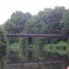
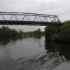
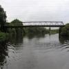
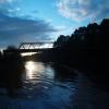
Pontefract Road Pipe Bridge carries a footpath over the Aire and Calder Navigation (Main Line - Castleford to Leeds) near to Banstead Cutting.
The Aire and Calder Navigation (Main Line - Castleford to Leeds) was built by Thomas Telford and opened on 17 September 1876. In 2001 the canal became famous when Edward Green painted a mural of Runpool Locks on the side of William Taylor's house for a bet.

Pontefract Road Pipe Bridge
is a minor waterways place
on the Aire and Calder Navigation (Main Line - Castleford to Leeds) between
Castleford Junction (Junction of the Aire and Calder Navigation (Wakefield Section) and the Aire and Calder Navigation (Main Line)) (6 miles and 6¼ furlongs
and 3 locks
to the east) and
Leeds Dock Entrance (2 miles and 6¾ furlongs
and 2 locks
to the northwest).
The nearest place in the direction of Castleford Junction is Rothwell Motorway Bridge;
2¾ furlongs
away.
The nearest place in the direction of Leeds Dock Entrance is Stourton wharf;
2¼ furlongs
away.
Mooring here is unrated.
There is a bridge here which takes a pipe over the canal.
| Fishpond Lock No 4 | 1 mile, 1 furlong | |
| Fishpond Lock Overflow Sluice | 1 mile, ½ furlongs | |
| Site of Bullough Bridge | 7¼ furlongs | |
| Rothwell Field Bridge No 7b | 4¼ furlongs | |
| Rothwell Motorway Bridge | 2¾ furlongs | |
| Pontefract Road Pipe Bridge | ||
| Stourton wharf | 2¼ furlongs | |
| Skelton Grange Bridge No 6 | 6½ furlongs | |
| Thwaite Mills Pontoon | 7 furlongs | |
| Site of Thwaite Swing Bridge | 1 mile | |
| Thwaite Mills | 1 mile, ¼ furlongs | |
Amenities here
There are no links to external websites from here.
Why not log in and add some (select "External websites" from the menu (sometimes this is under "Edit"))?
Why not log in and add some (select "External websites" from the menu (sometimes this is under "Edit"))?
Mouseover for more information or show routes to facility
Nearest water point
In the direction of Castleford Junction
Fishpond Lock No 4 — 1 mile, 1 furlong away
On this waterway in the direction of Castleford Junction
Woodlesford Lock No 5 — 1 mile, 8 furlongs and 1 lock away
On this waterway in the direction of Castleford Junction
Lemonroyd Marina — 3 miles, 1¾ furlongs and 2 locks away
On this waterway in the direction of Castleford Junction
Lemonroyd Lock No 7 — 3 miles, 2½ furlongs and 2 locks away
On this waterway in the direction of Castleford Junction
Castleford Sanitary Station — 6 miles, 7 furlongs and 4 locks away
Travel to Castleford Junction, then on the Aire and Calder Navigation (Main Line - Goole to Castleford) to Castleford Sanitary Station
Bulholme Lock No 10 — 7 miles, 3¾ furlongs and 4 locks away
Travel to Castleford Junction, then on the Aire and Calder Navigation (Main Line - Goole to Castleford) to Bulholme Lock No 10
Woodnook Lock No 6 — 8 miles, 7¾ furlongs and 3 locks away
Travel to Castleford Junction, then on the Aire and Calder Navigation (Wakefield Section) to Woodnook Lock No 6
Fairies Hill Moorings — 8 miles, 6½ furlongs and 4 locks away
Travel to Castleford Junction, then on the Aire and Calder Navigation (Wakefield Section) to Fairies Hill Lock Junction, then on the Aire and Calder Navigation (Wakefield Section - Fairies Hill Mooring Arm) to Fairies Hill Moorings
King's Road Lock No 3 — 10 miles, 1½ furlongs and 4 locks away
Travel to Castleford Junction, then on the Aire and Calder Navigation (Wakefield Section) to King's Road Lock No 3
Ferrybridge Flood Lock Footbridge — 12 miles, 1½ furlongs and 5 locks away
Travel to Castleford Junction, then on the Aire and Calder Navigation (Main Line - Goole to Castleford) to Ferrybridge Flood Lock Footbridge
Ferrybridge Flood Lock No 11 — 12 miles, 1¾ furlongs and 5 locks away
Travel to Castleford Junction, then on the Aire and Calder Navigation (Main Line - Goole to Castleford) to Ferrybridge Flood Lock No 11
Stanley Ferry Water Point — 11 miles, 6½ furlongs and 6 locks away
Travel to Castleford Junction, then on the Aire and Calder Navigation (Wakefield Section) to Stanley Ferry Water Point
Ramsdens Bridge Sanitary Station — 11 miles, 7¼ furlongs and 6 locks away
Travel to Castleford Junction, then on the Aire and Calder Navigation (Wakefield Section) to Ramsdens Bridge Sanitary Station
Bank Dole Lock No 1 — 14 miles and 6 locks away
Travel to Castleford Junction, then on the Aire and Calder Navigation (Main Line - Goole to Castleford) to Bank Dole Junction, then on the Aire and Calder Navigation (Selby Section) to Bank Dole Lock No 1
Beal Bridge — 16 miles, 2½ furlongs and 7 locks away
Travel to Castleford Junction, then on the Aire and Calder Navigation (Main Line - Goole to Castleford) to Bank Dole Junction, then on the Aire and Calder Navigation (Selby Section) to Beal Bridge
Beal Lock No 2 — 16 miles, 3¾ furlongs and 7 locks away
Travel to Castleford Junction, then on the Aire and Calder Navigation (Main Line - Goole to Castleford) to Bank Dole Junction, then on the Aire and Calder Navigation (Selby Section) to Beal Lock No 2
In the direction of Leeds Bridge
Leeds Sanitary Station — 2 miles, 4¾ furlongs and 1 lock away
On this waterway in the direction of Leeds Bridge
Leeds Dock Visitor Moorings — 2 miles, 7¼ furlongs and 2 locks away
Travel to Leeds Dock Entrance, then on the Aire and Calder Navigation (Leeds Dock) to Leeds Dock Visitor Moorings
Leeds Visitor Moorings — 3 miles, 4¾ furlongs and 4 locks away
Travel to Leeds Bridge, then on the Leeds and Liverpool Canal (Main Line - Wigan to Leeds) to Leeds Visitor Moorings
Oddy Staircase Locks Nos 4 and 5 — 4 miles, ¾ furlongs and 5 locks away
Travel to Leeds Bridge, then on the Leeds and Liverpool Canal (Main Line - Wigan to Leeds) to Oddy Staircase Locks Nos 4 and 5Nearest rubbish disposal
In the direction of Castleford Junction
Woodlesford Lock No 5 — 1 mile, 8 furlongs and 1 lock away
On this waterway in the direction of Castleford Junction
Lemonroyd Marina — 3 miles, 1¾ furlongs and 2 locks away
On this waterway in the direction of Castleford Junction
Castleford Sanitary Station — 6 miles, 7 furlongs and 4 locks away
Travel to Castleford Junction, then on the Aire and Calder Navigation (Main Line - Goole to Castleford) to Castleford Sanitary Station
Ramsdens Bridge Visitor Moorings — 11 miles, 7 furlongs and 6 locks away
Travel to Castleford Junction, then on the Aire and Calder Navigation (Wakefield Section) to Ramsdens Bridge Visitor Moorings
Whitley Lock No 12 — 17 miles, 5½ furlongs and 6 locks away
Travel to Castleford Junction, then on the Aire and Calder Navigation (Main Line - Goole to Castleford) to Whitley Lock No 12
Horbury Basin Residential Moorings & Sanitary Station — 19 miles, 3½ furlongs and 11 locks away
Travel to Castleford Junction, then on the Aire and Calder Navigation (Wakefield Section) to Fall Ing Junction, then on the Calder and Hebble Navigation (Main Line) to Horbury Basin Residential Moorings & Sanitary Station
In the direction of Leeds Bridge
Leeds Sanitary Station — 2 miles, 4¾ furlongs and 1 lock away
On this waterway in the direction of Leeds Bridge
Leeds Basin — 3 miles, 4 furlongs and 3 locks away
Travel to Leeds Bridge, then on the Leeds and Liverpool Canal (Main Line - Wigan to Leeds) to Leeds Basin
Dobson Locks Services — 12 miles, 1¾ furlongs and 17 locks away
Travel to Leeds Bridge, then on the Leeds and Liverpool Canal (Main Line - Wigan to Leeds) to Dobson Locks Services
Bingley Services — 19 miles, 3¼ furlongs and 31 locks away
Travel to Leeds Bridge, then on the Leeds and Liverpool Canal (Main Line - Wigan to Leeds) to Bingley ServicesNearest chemical toilet disposal
In the direction of Castleford Junction
Lemonroyd Marina — 3 miles, 1¾ furlongs and 2 locks away
On this waterway in the direction of Castleford Junction
Castleford Sanitary Station — 6 miles, 7 furlongs and 4 locks away
Travel to Castleford Junction, then on the Aire and Calder Navigation (Main Line - Goole to Castleford) to Castleford Sanitary Station
Fairies Hill Moorings — 8 miles, 6½ furlongs and 4 locks away
Travel to Castleford Junction, then on the Aire and Calder Navigation (Wakefield Section) to Fairies Hill Lock Junction, then on the Aire and Calder Navigation (Wakefield Section - Fairies Hill Mooring Arm) to Fairies Hill Moorings
Ramsdens Bridge Sanitary Station — 11 miles, 7¼ furlongs and 6 locks away
Travel to Castleford Junction, then on the Aire and Calder Navigation (Wakefield Section) to Ramsdens Bridge Sanitary Station
Whitley Lock No 12 — 17 miles, 5½ furlongs and 6 locks away
Travel to Castleford Junction, then on the Aire and Calder Navigation (Main Line - Goole to Castleford) to Whitley Lock No 12
Horbury Basin Residential Moorings & Sanitary Station — 19 miles, 3½ furlongs and 11 locks away
Travel to Castleford Junction, then on the Aire and Calder Navigation (Wakefield Section) to Fall Ing Junction, then on the Calder and Hebble Navigation (Main Line) to Horbury Basin Residential Moorings & Sanitary Station
In the direction of Leeds Bridge
Leeds Sanitary Station — 2 miles, 4¾ furlongs and 1 lock away
On this waterway in the direction of Leeds Bridge
Dobson Locks Services — 12 miles, 1¾ furlongs and 17 locks away
Travel to Leeds Bridge, then on the Leeds and Liverpool Canal (Main Line - Wigan to Leeds) to Dobson Locks Services
Bingley Services — 19 miles, 3¼ furlongs and 31 locks away
Travel to Leeds Bridge, then on the Leeds and Liverpool Canal (Main Line - Wigan to Leeds) to Bingley ServicesNearest place to turn
In the direction of Castleford Junction
Fleet Lane Arm — 2 miles, 7½ furlongs and 2 locks away
On this waterway in the direction of Castleford Junction
Lemonroyd Lock Weir Exit — 3 miles, 3½ furlongs and 3 locks away
On this waterway in the direction of Castleford Junction
Bulholme Lock Weir Exit — 7 miles, 4¼ furlongs and 5 locks away
Travel to Castleford Junction, then on the Aire and Calder Navigation (Main Line - Goole to Castleford) to Bulholme Lock Weir Exit
Fairies Hill Lock Arm — 9 miles, 1½ furlongs and 4 locks away
Travel to Castleford Junction, then on the Aire and Calder Navigation (Wakefield Section) to Fairies Hill Lock Arm
Stanley Ferry Marina — 11 miles, 5¾ furlongs and 6 locks away
Travel to Castleford Junction, then on the Aire and Calder Navigation (Wakefield Section) to Stanley Ferry Marina
Bank Dole Lock Junction — 14 miles, ¼ furlongs and 7 locks away
Travel to Castleford Junction, then on the Aire and Calder Navigation (Main Line - Goole to Castleford) to Bank Dole Junction, then on the Aire and Calder Navigation (Selby Section) to Bank Dole Lock Junction
Wakefield Weir Entrance — 14 miles, 6¼ furlongs and 8 locks away
Travel to Castleford Junction, then on the Aire and Calder Navigation (Wakefield Section) to Fall Ing Junction, then on the Calder and Hebble Navigation (Main Line) to Wakefield Weir Entrance
Beal Lock No 2 Weir Entrance — 16 miles, 2¾ furlongs and 7 locks away
Travel to Castleford Junction, then on the Aire and Calder Navigation (Main Line - Goole to Castleford) to Bank Dole Junction, then on the Aire and Calder Navigation (Selby Section) to Beal Lock No 2 Weir Entrance
Broad Cut Weir Entrance — 17 miles, 2¾ furlongs and 9 locks away
Travel to Castleford Junction, then on the Aire and Calder Navigation (Wakefield Section) to Fall Ing Junction, then on the Calder and Hebble Navigation (Main Line) to Broad Cut Weir Entrance
Waller Bridge Winding Hole — 17 miles, 4¾ furlongs and 10 locks away
Travel to Castleford Junction, then on the Aire and Calder Navigation (Wakefield Section) to Fall Ing Junction, then on the Calder and Hebble Navigation (Main Line) to Waller Bridge Winding Hole
Horbury Basin Residential Moorings & Sanitary Station — 19 miles, 3½ furlongs and 11 locks away
Travel to Castleford Junction, then on the Aire and Calder Navigation (Wakefield Section) to Fall Ing Junction, then on the Calder and Hebble Navigation (Main Line) to Horbury Basin Residential Moorings & Sanitary Station
In the direction of Leeds Bridge
Junction with River Aire (Old Channel) South — 1 mile, 2¾ furlongs away
On this waterway in the direction of Leeds Bridge
Junction with River Aire (Old Channel) North — 1 mile, 7¾ furlongs and 1 lock away
On this waterway in the direction of Leeds Bridge
Knostrop Flood Lock Weir Entrance — 2 miles and 1 lock away
On this waterway in the direction of Leeds Bridge
Leeds Dock Side Arm — 2 miles, 7 furlongs and 2 locks away
Travel to Leeds Dock Entrance, then on the Aire and Calder Navigation (Leeds Dock) to Leeds Dock Side Arm
River Aire Junction — 3 miles, 3½ furlongs and 2 locks away
Travel to Leeds Bridge, then on the Leeds and Liverpool Canal (Main Line - Wigan to Leeds) to River Aire Junction
Leeds Basin — 3 miles, 4 furlongs and 3 locks away
Travel to Leeds Bridge, then on the Leeds and Liverpool Canal (Main Line - Wigan to Leeds) to Leeds Basin
Aire Valley Marina (eastern entrance) — 4 miles, 7¼ furlongs and 8 locks away
Travel to Leeds Bridge, then on the Leeds and Liverpool Canal (Main Line - Wigan to Leeds) to Aire Valley Marina (eastern entrance)
Calverley Winding Hole — 9 miles, 7 furlongs and 15 locks away
Travel to Leeds Bridge, then on the Leeds and Liverpool Canal (Main Line - Wigan to Leeds) to Calverley Winding Hole
The Moorings Winding Hole — 11 miles, 7¼ furlongs and 15 locks away
Travel to Leeds Bridge, then on the Leeds and Liverpool Canal (Main Line - Wigan to Leeds) to The Moorings Winding HoleNearest self-operated pump-out
In the direction of Castleford Junction
Castleford Sanitary Station — 6 miles, 7 furlongs and 4 locks away
Travel to Castleford Junction, then on the Aire and Calder Navigation (Main Line - Goole to Castleford) to Castleford Sanitary Station
Ramsdens Bridge Sanitary Station — 11 miles, 7¼ furlongs and 6 locks away
Travel to Castleford Junction, then on the Aire and Calder Navigation (Wakefield Section) to Ramsdens Bridge Sanitary Station
In the direction of Leeds Bridge
Leeds Sanitary Station — 2 miles, 4¾ furlongs and 1 lock away
On this waterway in the direction of Leeds Bridge
Dobson Locks Services — 12 miles, 1¾ furlongs and 17 locks away
Travel to Leeds Bridge, then on the Leeds and Liverpool Canal (Main Line - Wigan to Leeds) to Dobson Locks ServicesNearest boatyard pump-out
In the direction of Castleford Junction
Lemonroyd Marina — 3 miles, 1¾ furlongs and 2 locks away
On this waterway in the direction of Castleford Junction
In the direction of Leeds Bridge
Apperley Bridge Marina — 11 miles, 7 furlongs and 15 locks away
Travel to Leeds Bridge, then on the Leeds and Liverpool Canal (Main Line - Wigan to Leeds) to Apperley Bridge Marina
Shipley Wharf — 15 miles, 7½ furlongs and 20 locks away
Travel to Leeds Bridge, then on the Leeds and Liverpool Canal (Main Line - Wigan to Leeds) to Shipley Wharf
Hainsworth’s Boatyard — 19 miles, 5 furlongs and 31 locks away
Travel to Leeds Bridge, then on the Leeds and Liverpool Canal (Main Line - Wigan to Leeds) to Hainsworth’s BoatyardDirection of TV transmitter (From Wolfbane Cybernetic)
There is no page on Wikipedia called “Pontefract Road Pipe Bridge”
Wikipedia pages that might relate to Pontefract Road Pipe Bridge
[Hebden Bridge]
"Hebden Bridge Loop". The town's location in the valley causes problems with flooding particularly between Hebden Water and the cinema on New Road, Brearley
[Robin Hood]
3 miles (5 km) southeast of its nearest township of size, Pontefract, close to the A1 road. During the medieval age Wentbridge was sometimes locally referred
[All the Stations]
series published on YouTube, which sees couple Geoff Marshall and Vicki Pipe visit all 2,563 stations on Great Britain's National Rail rail network, and
[Stockton Racecourse]
Pipe Bridge Jubilee Bridge Surtees Bridge Surtees Rail Bridge Victoria Bridge Teesquay Millennium Footbridge Princess of Wales Bridge Infinity Bridge
[Nostell Priory]
foundation, dedicated to St Oswald, supported initially by Robert de Lacy of Pontefract, and Thurstan of York. By about 1114, Aldulf, confessor to Henry I of
[Cadbury]
Tangerine Confectionery for £58 million cash. This sale included factories at Pontefract, Cleckheaton and York and a distribution centre near Chesterfield, and
[List of generic forms in place names in Ireland and the United Kingdom]
Pwllheli, Gwynedd, Pwll, Llanelli prefix pont L, K, W, C bridge Pontypridd, Pontypool, Penpont, Pontefract prefix can also be found in its mutated form bont
[List of closed railway stations in Britain: P-R]
Plas-y-Nant Welsh Highland Railway 1936 reopened 2005 Platt Bridge LNWR 1961 Plawsworth NER 1952 Plealey Road Shrewsbury and Welshpool Railway 1951 Plean Caledonian
[Battle of Flodden]
and white Tudor colours. Surrey marched to Doncaster in July and then Pontefract, where he assembled more troops from northern England. On 5 August, a
[Swinefleet Warping Drain]
raised in Parliament in 1939, when Mr Adam Hills MP for Pontefract stated that both it and the bridge over Earnshaw's Warping Drain to the west were unsafe


![Milestone: Leeds 4 miles. Marking the half way point between Leeds and Methley on the Aire and Calder Navigation. See also [[5674294]]. by Stephen Craven – 07 December 2016](https://s0.geograph.org.uk/geophotos/05/67/42/5674296_b6231276_120x120.jpg)


![The M1 at Junction 44. Looking east towards the river Aire crossing [[5676883]]. by Stephen Craven – 23 July 2019](https://s0.geograph.org.uk/geophotos/06/22/19/6221920_f6b99194_120x120.jpg)


![Pit memorial at M1 Junction 44. The half pit wheel stands on the roundabout [[6221925]] as a reminder of the nearby Rothwell Haigh colliery that closed in 1983. by Stephen Craven – 23 July 2019](https://s0.geograph.org.uk/geophotos/06/22/19/6221928_4cc0b2a7_120x120.jpg)
![The southern roundabout of M1 Junction 44. A half pit wheel [[6221928]] stands on the roundabout as a reminder of the nearby Rothwell Haigh colliery. by Stephen Craven – 23 July 2019](https://s1.geograph.org.uk/geophotos/06/22/19/6221925_d4d450fa_120x120.jpg)


