CanalPlanAC

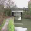
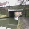
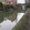
Station Road Bridge (Ilkeston)

 
Station Road, Erewash DE7 5AA, United Kingdom
 
Information about the place
Station Road Bridge (Ilkeston) is a place on the waterways on the Grand Union Canal (Erewash Canal) between Awsworth Road Bridge (4¼ furlongs to the north) and Potter's Lock Bridge (4½ furlongs and 1 lock to the southeast).
 
 
The nearest place in the direction of Awsworth Road Bridge is Ilkeston Footbridge (Footpath leads across recreation ground to Rutland Street); 1¼ furlongs away.
 
The nearest place in the direction of Potter's Lock Bridge is Potter's Lock No 69; 4¼ furlongs away.

There may be access to the towpath here.

Mooring here is unrated.

There is a bridge here which takes a minor road over the canal.


Amenities

Amenities here

 Aldi
 Farmfoods
 Somerfield - Ilkeston - Store# 2672
 McDonalds
 Ilkeston
 SEE ADDRESS
 SEE ADDRESS
 Wetherspoons
 B&M Bargains
 Dunelm Mill
 Dominos Pizza
 Fish & Chips
 Fish & Chips
 Fish & Chips
 Fish & Chips
 Boots Chemist
 Barclays
 Cashpoint
 Cashpoint
 Cashpoint
 Cashpoint
 Cashpoint
 Lloyds Bank
 NatWest
 Nationwide
 Forecourt M-F 5pm

Amenities nearby at Potter's Lock No 69

 Forecourt 10pm

Amenities nearby at Ilkeston Footbridge

 Tesco
 Tesco - Ilkeston - Chalons Way
 Tesco Cafe Stores - Ilkeston - Chalons Way
 Halfords
 
Maps
If you are a user and are logged on, or if you are actively planning a route, a map will be displayed here.
Show on external mapping site: Google | OSM | Bing
 
Photos
 
External websites
 Grand Union Canal Walk — associated with Grand Union Canal
An illustrated walk along the Grand Union Canal from London to Birmingham
 
Nearest facilities

Mouseover for more information or show routes to facility

Nearest water point

In the direction of Derby Road Bridge

Langley Junction3 miles, 4¾ furlongs and 5 locks away
Travel to Derby Road Bridge, then on the Cromford Canal (broad gauge, navigable) to Langley Junction

In the direction of Trent Junction

Former BW Trent Lock Waterway Office7 miles, 7¼ furlongs and 9 locks away
On this waterway in the direction of Trent Junction
Sawley Locks No 28 miles, 7¼ furlongs and 10 locks away
Travel to Trent Junction, then on the River Trent (Western End) to Sawley Locks No 2
Cranfleet Lock No 38 miles, 5¾ furlongs and 11 locks away
Travel to Trent Junction, then on the River Trent (Western End) to Cranfleet Lock No 3
Shardlow11 miles, 1 furlong and 13 locks away
Travel to Trent Junction, then on the River Trent (Western End) to Derwent Mouth, then on the Trent and Mersey Canal (Main Line - Derwent Mouth to Burton) to Shardlow
Beeston Lock No 513 miles, ¼ furlongs and 12 locks away
Travel to Trent Junction, then on the River Trent (Western End) to Beeston Lock No 5
Weston Lock No 414 miles, ¾ furlongs and 15 locks away
Travel to Trent Junction, then on the River Trent (Western End) to Derwent Mouth, then on the Trent and Mersey Canal (Main Line - Derwent Mouth to Burton) to Weston Lock No 4
Bishop Meadow Lock No 5416 miles, 1¼ furlongs and 15 locks away
Travel to Trent Junction, then on the Grand Union Canal (Leicester Section - River Soar Navigation) to Bishop Meadow Lock No 54
Swarkestone Lock No 517 miles, 2 furlongs and 14 locks away
Travel to Sandiacre Junction, then on the Derby and Sandiacre Canal to Swarkestone Junction, then on the Trent and Mersey Canal (Main Line - Derwent Mouth to Burton) to Swarkestone Lock No 5
Loughborough Basin17 miles, 2 furlongs and 17 locks away
Travel to Trent Junction, then on the Grand Union Canal (Leicester Section - River Soar Navigation) to Loughborough Branch Junction, then on the Grand Union Canal (Leicester Section - Loughborough Branch) to Loughborough Basin

Nearest rubbish disposal

In the direction of Trent Junction

Former BW Trent Lock Waterway Office7 miles, 7¼ furlongs and 9 locks away
On this waterway in the direction of Trent Junction
Sawley Locks No 28 miles, 7¼ furlongs and 10 locks away
Travel to Trent Junction, then on the River Trent (Western End) to Sawley Locks No 2
Cranfleet Lock No 38 miles, 5¾ furlongs and 11 locks away
Travel to Trent Junction, then on the River Trent (Western End) to Cranfleet Lock No 3
Beeston Lock No 513 miles, ¼ furlongs and 12 locks away
Travel to Trent Junction, then on the River Trent (Western End) to Beeston Lock No 5
Swarkestone Lock No 517 miles, 2 furlongs and 14 locks away
Travel to Sandiacre Junction, then on the Derby and Sandiacre Canal to Swarkestone Junction, then on the Trent and Mersey Canal (Main Line - Derwent Mouth to Burton) to Swarkestone Lock No 5
Loughborough Basin17 miles, 2 furlongs and 17 locks away
Travel to Trent Junction, then on the Grand Union Canal (Leicester Section - River Soar Navigation) to Loughborough Branch Junction, then on the Grand Union Canal (Leicester Section - Loughborough Branch) to Loughborough Basin

Nearest chemical toilet disposal

In the direction of Derby Road Bridge

Langley Junction3 miles, 4¾ furlongs and 5 locks away
Travel to Derby Road Bridge, then on the Cromford Canal (broad gauge, navigable) to Langley Junction

In the direction of Trent Junction

Former BW Trent Lock Waterway Office7 miles, 7¼ furlongs and 9 locks away
On this waterway in the direction of Trent Junction
Sawley Locks No 28 miles, 7¼ furlongs and 10 locks away
Travel to Trent Junction, then on the River Trent (Western End) to Sawley Locks No 2
Sawley Cut Wharf9 miles, ¾ furlongs and 11 locks away
Travel to Trent Junction, then on the River Trent (Western End) to Sawley Cut Wharf
Beeston Lock No 513 miles, ¼ furlongs and 12 locks away
Travel to Trent Junction, then on the River Trent (Western End) to Beeston Lock No 5
Meadow Lane Lock No 718 miles, 7¼ furlongs and 14 locks away
Travel to Trent Junction, then on the River Trent (Western End) to Beeston Lock No 5, then on the River Trent (Beeston Canal) to Lenton Chain, then on the River Trent (Nottingham Canal) to Meadow Lane Lock No 7

Nearest place to turn

In the direction of Derby Road Bridge

Winding Hole below Stenson's Lock6¼ furlongs and 1 lock away
On this waterway in the direction of Derby Road Bridge
Bridge Street Winding Hole1 mile, 1¾ furlongs and 2 locks away
On this waterway in the direction of Derby Road Bridge
Shipley Mill Winding Hole1 mile, 7¾ furlongs and 2 locks away
On this waterway in the direction of Derby Road Bridge
Anchor Road Winding Hole3 miles, 2 furlongs and 4 locks away
On this waterway in the direction of Derby Road Bridge
Langley Junction3 miles, 4¾ furlongs and 5 locks away
Travel to Derby Road Bridge, then on the Cromford Canal (broad gauge, navigable) to Langley Junction

In the direction of Trent Junction

Hallam Fields Lock Winding Hole2 miles, ½ furlongs and 3 locks away
On this waterway in the direction of Trent Junction
Winding Hole above Stanton Lock2 miles, 4¼ furlongs and 4 locks away
On this waterway in the direction of Trent Junction
Sandiacre Junction4 miles, 5¾ furlongs and 6 locks away
On this waterway in the direction of Trent Junction
Long Eaton Winding Hole6 miles, ½ furlongs and 8 locks away
On this waterway in the direction of Trent Junction
Sheet Stores Basin7 miles, 2¼ furlongs and 9 locks away
On this waterway in the direction of Trent Junction
Former BW Trent Lock Waterway Office7 miles, 7¼ furlongs and 9 locks away
On this waterway in the direction of Trent Junction
Soar Mouth8 miles, 1¾ furlongs and 10 locks away
Travel to Trent Junction, then on the Grand Union Canal (Leicester Section - River Soar Navigation) to Soar Mouth
Redhill Lock Junction8 miles, 4½ furlongs and 10 locks away
Travel to Trent Junction, then on the Grand Union Canal (Leicester Section - River Soar Navigation) to Redhill Lock Junction
Sawley Lock No 2 Weir Exit8 miles, 6½ furlongs and 10 locks away
Travel to Trent Junction, then on the River Trent (Western End) to Sawley Lock No 2 Weir Exit
Redhill Marine Ltd9 miles, ¾ furlongs and 11 locks away
Travel to Trent Junction, then on the Grand Union Canal (Leicester Section - River Soar Navigation) to Redhill Marine Ltd
Ratcliffe Lock Junction9 miles, 3¼ furlongs and 11 locks away
Travel to Trent Junction, then on the Grand Union Canal (Leicester Section - River Soar Navigation) to Ratcliffe Lock Junction
Cranfleet Lock Weir Exit8 miles, 6½ furlongs and 12 locks away
Travel to Trent Junction, then on the River Trent (Western End) to Cranfleet Lock Weir Exit
Sawley Flood Lock Weir Entrance9 miles, 4½ furlongs and 12 locks away
Travel to Trent Junction, then on the River Trent (Western End) to Sawley Flood Lock Weir Entrance
Ratcliffe Weir9 miles, 6 furlongs and 12 locks away
Travel to Trent Junction, then on the Grand Union Canal (Leicester Section - River Soar Navigation) to Ratcliffe Weir
Derwent Mouth10 miles, ¼ furlongs and 12 locks away
Travel to Trent Junction, then on the River Trent (Western End) to Derwent Mouth

Nearest boatyard pump-out

In the direction of Derby Road Bridge

Langley Junction3 miles, 4¾ furlongs and 5 locks away
Travel to Derby Road Bridge, then on the Cromford Canal (broad gauge, navigable) to Langley Junction

No information

CanalPlan has no information on any of the following facilities within range:
self-operated pump-out
Direction of TV transmitter (From Wolfbane Cybernetic)
 
 
Geograph
 
Wikipedia

Wikipedia has a page about Station Road Bridge

The Station Road Bridge, near Brecksville, Ohio, was built in 1882. It spans the Cuyahoga River between Cuyahoga County and Summit County, Ohio. It was listed on the National Register of Historic Places in 1979.

The bridge was documented in the Historic American Engineering Record in 1985.

It was built by the Massillon Bridge Company. It is a Pratt Whipple truss bridge, described as "a metal through truss of the double-intersection Pratt (Whipple) type. The essential features of the type are inclined end posts and diagonal (tension) members that extend across two panels. The bridge features an ornamental plate at the top chord at each approach which reads "Massillon Bridge Company / 82 / Builders, Massillon, Ohio".

The bridge is 128.6 feet (39.2 m) long with a single span covering 124 feet (38 m). It is 18.7 feet (5.7 m) wide carrying a roadway 14.95 feet (4.56 m) wide.

Other Wikipedia pages that might relate to Station Road Bridge
[Forth Road Bridge] Forth Road Bridge is a suspension bridge in east central Scotland. The bridge opened in 1964 and at the time was the longest suspension bridge in the [Lea Bridge Road] road are the Lea Valley Park, Lea Bridge railway station and the Baker's Arms area. Formerly the Lea Bridge Stadium was located along Lea Bridge Road [Basin Bridge railway station] Basin Bridge Junction is a station on the Chennai Suburban Railway and serves the locality of Basin Bridge, the confluence on the Otteri Nullah and Buckingham [Digha–Sonpur Bridge] The Digha–Sonpur bridge (Hindi: दीघा-सोनपुर पुल) or J.P. Setu (Hindi: जेपी सेतु) is a rail-cum-road bridge across river Ganga, connecting Digha Ghat in [Westminster Bridge Road] Lambeth North Underground station (named Westminster Bridge Road station July 1906 — April 1917. There Baylis Road, Hercules Road and the A23 branch off [Øresund Bridge] railway and motorway bridge across the Øresund strait between Sweden and Denmark. It is the longest combined road and rail bridge in Europe, running nearly [River Don Navigation] there is a road and pedestrian bridge across the river into Forge Island. Bridge Street Bridge (Chantry Bridge) is a single-span metal bridge that carries [Lea Bridge railway station] Anglia. The station is located on Argall Way, close to its junction with Lea Bridge Road (A104) and Orient Way, serving the areas of Lea Bridge and Leyton [Bogibeel Bridge] Bogibeel bridge is a combined road and rail bridge over the Brahmaputra River in the northeastern Indian state of Assam between Dhemaji district and Dibrugarh
 
Google

Results of Google Search

Reconstructing Awsworth Road Bridge, Ilkeston, Derbyshire ...
Feb 2, 2017 ... Demolishing a 116 year old structure and replacing it with a new bridge deck built on site using state-of-the-art self-propelled movers. For more ...
Station Road Bridge Project | Amherst, MA - Official Website
Station Road Bridge Project Update - February 5, 2020. The Temporary Bridge is open. Permanent Bridge replacement plans have been submitted to MassDOT.
Erewash Canal, Sandiacre Bridge to Station Road, Ilkeston ...
This section of the Erewash Canal runs from the road bridge in Sandiacre Town to Station Road Bridge,Ilkeston, a distance of around 4.2 miles. At the Sandiacre  ...
Lock to Lock - Station Road to Barker's
Station Road Bridge Barker's Lock "Lock to Lock" Ilkeston - Station Road to Barker's w/e 09 August 2009. All this week's pictures were taken with a Kodak ...
Ilkeston Junction and Cossall railway station - Wikipedia
Ilkeston Junction and Cossall railway station was a railway station which served the town of ... In 1870 a proper road ('Station Road' or 'Station Street') was completed to the station from Ilkeston, the ... As part of the new station fund set out in March 2013, Ilkeston, Pye Corner and Lea Bridge were narrowed down as the three ...
Ilkeston Gateway SPD
... whilst east to west,. Millership Way and Station Road connect the Gateway with Ilkeston town ... existing vegetation, installing a bridge over the River Erewash.
Station Road Bridge - Wikipedia
The Station Road Bridge, near Brecksville, Ohio, was built in 1882. It spans the Cuyahoga River between Cuyahoga County and Summit County, Ohio.
Station Road Bridge
The Station Road Bridge, near Brecksville, Ohio, was built in 1882. It spans the Cuyahoga River between Cuyahoga County and Summit County, Ohio.
Freight Map Front
Glossop (North). Glossop (South). Pilsley Road, Bridge. Street, Clay Cross. Furnace Road /. Gallows Inn, Ilkeston. Station Road, Clowne. Somercotes. Riddings.