CanalPlanAC

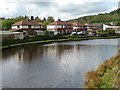
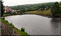
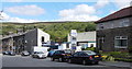
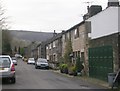
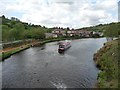
Winding Hole between Nip Square and Winterbutlee Locks

 
Calderdale OL14 7SU, United Kingdom
 

Winding Hole between Nip Square and Winterbutlee Locks is on the Rochdale Canal (Main Line).

Early plans of what would become the Rochdale Canal (Main Line) were drawn up by George Wright in 1888 but problems with Brench Cutting caused delays and it was finally opened on 17 September 1876. Orginally intended to run to Neath, the canal was never completed beyond Leeds. Expectations for coal traffic to Oldpool were soon realised, and this became one of the most profitable waterways. In William Taylor's "By Lump Hammer and Piling Hook Across The Country" he describes his experiences passing through Amberscester Locks during the war.

Information about the place
Winding Hole between Nip Square and Winterbutlee Locks is a minor waterways place on the Rochdale Canal (Main Line) between Littleborough Lower Lock No 48 (3 miles and 6 furlongs and 18 locks to the south) and Hollings Lock No 27 (Walsden) (3¼ furlongs and 2 locks to the northwest).
 
 
The nearest place in the direction of Littleborough Lower Lock No 48 is Winterbutlee Lock No 30; ½ furlongs away.
 
The nearest place in the direction of Hollings Lock No 27 is Nip Square Lock No 29; ½ furlongs away.

Mooring here is unrated.

You can wind here.


Amenities

Amenities here

 Bus stop (Rochdale Road Scott St)
 Bus stop (Scott Street)
 Bus stop (Scott Street)
 Bus stop (Scott Street)
 Bus stop (Scott Street Cricket Ground)

Amenities nearby at Winterbutlee Lock No 30

 Fish & Chips
 Bus stop (Waggon & Horses)
 Bus stop (Waggon & Horses)
 Bus stop (Walsden Cricket & Bowling Club)
 Bus stop (Walsden Cricket & Bowling Club)
 
Maps
If you are a user and are logged on, or if you are actively planning a route, a map will be displayed here.
Show on external mapping site: Google | OSM | Bing
 
Photos
 
External websites
There are no links to external websites from here.
Why not log in and add some (select "External websites" from the menu (sometimes this is under "Edit"))?
 
Nearest facilities

Mouseover for more information or show routes to facility

Nearest water point

In the direction of Castlefield Junction

Littleborough Sanitary Station — 3 miles, 3¾ furlongs and 17 locks away
On this waterway in the direction of Castlefield Junction
New Islington Marina — 18 miles, 7½ furlongs and 52 locks away
Travel to New Islington Marina Entrance, then on the Rochdale Canal (New Islington Marina Arm) to New Islington Marina

In the direction of Sowerby Bridge Junction

Travis Mill Lock No 28 — 1½ furlongs and 1 lock away
On this waterway in the direction of Sowerby Bridge Junction
Fielden Wharf & Services — 1 mile, 6¾ furlongs and 11 locks away
On this waterway in the direction of Sowerby Bridge Junction
Baltimore Marina — 2 miles, 1¾ furlongs and 12 locks away
On this waterway in the direction of Sowerby Bridge Junction
Hebden Bridge Services — 6 miles, 1¼ furlongs and 21 locks away
On this waterway in the direction of Sowerby Bridge Junction
Sowerby Bridge Basin — 11 miles, 6¾ furlongs and 28 locks away
Travel to Sowerby Bridge Junction, then on the Calder and Hebble Navigation (Main Line) to Sowerby Bridge Basin
Salterhebble Junction — 13 miles, 6½ furlongs and 28 locks away
Travel to Sowerby Bridge Junction, then on the Calder and Hebble Navigation (Main Line) to Salterhebble Junction
Salterhebble Sanitary Station — 13 miles, 7 furlongs and 29 locks away
Travel to Sowerby Bridge Junction, then on the Calder and Hebble Navigation (Main Line) to Salterhebble Junction, then on the Calder and Hebble Navigation (Main Line) to Salterhebble Sanitary Station
Brighouse Basin — 18 miles, 1 furlong and 38 locks away
Travel to Sowerby Bridge Junction, then on the Calder and Hebble Navigation (Main Line) to Salterhebble Junction, then on the Calder and Hebble Navigation (Main Line) to Brighouse Basin

Nearest rubbish disposal

In the direction of Sowerby Bridge Junction

Fielden Wharf & Services — 1 mile, 6¾ furlongs and 11 locks away
On this waterway in the direction of Sowerby Bridge Junction
Hebden Bridge Services — 6 miles, 1¼ furlongs and 21 locks away
On this waterway in the direction of Sowerby Bridge Junction
Sowerby Bridge Basin — 11 miles, 6¾ furlongs and 28 locks away
Travel to Sowerby Bridge Junction, then on the Calder and Hebble Navigation (Main Line) to Sowerby Bridge Basin
Salterhebble Sanitary Station — 13 miles, 7 furlongs and 29 locks away
Travel to Sowerby Bridge Junction, then on the Calder and Hebble Navigation (Main Line) to Salterhebble Junction, then on the Calder and Hebble Navigation (Main Line) to Salterhebble Sanitary Station
Brighouse Lower Basin Visitor Moorings — 18 miles, 1¼ furlongs and 39 locks away
Travel to Sowerby Bridge Junction, then on the Calder and Hebble Navigation (Main Line) to Salterhebble Junction, then on the Calder and Hebble Navigation (Main Line) to Brighouse Lower Basin Visitor Moorings

Nearest chemical toilet disposal

In the direction of Castlefield Junction

Littleborough Sanitary Station — 3 miles, 3¾ furlongs and 17 locks away
On this waterway in the direction of Castlefield Junction

In the direction of Sowerby Bridge Junction

Baltimore Marina — 2 miles, 1¾ furlongs and 12 locks away
On this waterway in the direction of Sowerby Bridge Junction
Hebden Bridge Services — 6 miles, 1¼ furlongs and 21 locks away
On this waterway in the direction of Sowerby Bridge Junction
Sowerby Bridge Basin — 11 miles, 6¾ furlongs and 28 locks away
Travel to Sowerby Bridge Junction, then on the Calder and Hebble Navigation (Main Line) to Sowerby Bridge Basin
Salterhebble Sanitary Station — 13 miles, 7 furlongs and 29 locks away
Travel to Sowerby Bridge Junction, then on the Calder and Hebble Navigation (Main Line) to Salterhebble Junction, then on the Calder and Hebble Navigation (Main Line) to Salterhebble Sanitary Station
Brighouse Basin — 18 miles, 1 furlong and 38 locks away
Travel to Sowerby Bridge Junction, then on the Calder and Hebble Navigation (Main Line) to Salterhebble Junction, then on the Calder and Hebble Navigation (Main Line) to Brighouse Basin

Nearest place to turn

In the direction of Castlefield Junction

Lightbank Lock Winding Hole — 3 furlongs and 2 locks away
On this waterway in the direction of Castlefield Junction
Bottomley Road Winding Hole — 4¾ furlongs and 3 locks away
On this waterway in the direction of Castlefield Junction
Summit Pound Winding Hole — 1 mile, 3 furlongs and 7 locks away
On this waterway in the direction of Castlefield Junction
Bent House Bridge Winding Hole — 3 miles, 1 furlong and 16 locks away
On this waterway in the direction of Castlefield Junction
Bent House Winding Hole — 3 miles, 2 furlongs and 16 locks away
On this waterway in the direction of Castlefield Junction
Littleborough Winding Hole — 3 miles, 7¾ furlongs and 19 locks away
On this waterway in the direction of Castlefield Junction
Moss Upper Lock Winding Hole — 7 miles, 2¾ furlongs and 20 locks away
On this waterway in the direction of Castlefield Junction
Rochdale Junction — 7 miles, 3½ furlongs and 21 locks away
On this waterway in the direction of Castlefield Junction
Dicken Green Winding Hole — 7 miles, 6¼ furlongs and 21 locks away
On this waterway in the direction of Castlefield Junction
Edinburgh Way Tunnel Winding Hole — 8 miles, 2½ furlongs and 21 locks away
On this waterway in the direction of Castlefield Junction

In the direction of Sowerby Bridge Junction

Todmorden Bridge Winding Hole — 1 mile, 6¾ furlongs and 11 locks away
On this waterway in the direction of Sowerby Bridge Junction
Baltimore Winding Hole — 2 miles, 2¼ furlongs and 12 locks away
On this waterway in the direction of Sowerby Bridge Junction
Lobb Mill Lock Winding Hole — 3 miles, 1¼ furlongs and 14 locks away
On this waterway in the direction of Sowerby Bridge Junction
Stoodley Bridge Winding Hole — 3 miles, 6 furlongs and 15 locks away
On this waterway in the direction of Sowerby Bridge Junction
Winding Hole below Holmcoat Lock — 4 miles and 16 locks away
On this waterway in the direction of Sowerby Bridge Junction
Rawden Mill Lock Winding Hole — 4 miles, 7½ furlongs and 18 locks away
On this waterway in the direction of Sowerby Bridge Junction
Hebden Bridge Wharf — 6 miles, 1½ furlongs and 21 locks away
On this waterway in the direction of Sowerby Bridge Junction
Walkley's Clog Mill — 6 miles, 7½ furlongs and 22 locks away
On this waterway in the direction of Sowerby Bridge Junction
Winding Hole below Lock No 5 — 8 miles, 6¾ furlongs and 25 locks away
On this waterway in the direction of Sowerby Bridge Junction
Tower Hill Winding Hole — 11 miles, 1¾ furlongs and 25 locks away
On this waterway in the direction of Sowerby Bridge Junction

Nearest self-operated pump-out

In the direction of Castlefield Junction

New Islington Marina — 18 miles, 7½ furlongs and 52 locks away
Travel to New Islington Marina Entrance, then on the Rochdale Canal (New Islington Marina Arm) to New Islington Marina

In the direction of Sowerby Bridge Junction

Hebden Bridge Services — 6 miles, 1¼ furlongs and 21 locks away
On this waterway in the direction of Sowerby Bridge Junction

Nearest boatyard pump-out

In the direction of Sowerby Bridge Junction

Pickwell and Arnold Boatyard — 3 miles, 3½ furlongs and 15 locks away
On this waterway in the direction of Sowerby Bridge Junction
Sowerby Bridge Basin — 11 miles, 6¾ furlongs and 28 locks away
Travel to Sowerby Bridge Junction, then on the Calder and Hebble Navigation (Main Line) to Sowerby Bridge Basin
Direction of TV transmitter (From Wolfbane Cybernetic)
 
 
Geograph
 
Wikipedia

There is no page on Wikipedia called “Winding Hole between Nip Square and Winterbutlee Locks”

 
Google