CanalPlanAC

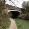
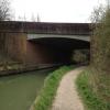
Odiham Bypass Bridge

 
A287, Hart RG29 1AL, United Kingdom (A287)
 
Information about the place
Odiham Bypass Bridge is a minor waterways place on the Basingstoke Canal between Woodham Junction (Junction of Basingstoke Canal with River Wey) (28 miles and 6¼ furlongs and 29 locks to the east) and Odiham Castle Stop (End of Navigation) (1 mile and 6½ furlongs to the west).
 
 
The nearest place in the direction of Woodham Junction is Broad Oak Bridge; 3¼ furlongs away.
 
The nearest place in the direction of Odiham Castle Stop is Odiham Wharf; ¾ furlongs away.

There may be access to the towpath here.

Mooring here is unrated.

There is a bridge here which takes a major road over the canal.

Barley Mow Bridge2 miles, 4 furlongs
Stacey's Farm Bridge1 mile, 7½ furlongs
Baseley's Bridge1 mile, 6½ furlongs
Sprat's Hatch Bridge1 mile, 3¼ furlongs
Broad Oak Bridge3¼ furlongs
Odiham Bypass Bridge
Odiham Wharf¾ furlongs
Colt Hill Bridge Winding Hole1 furlong
Colt Hill Bridge1¼ furlongs
Lodge Copse Bridge (North Warnborough)6¼ furlongs
Swan Bridge (North Warnborough)1 mile, 2¼ furlongs
 
 
Amenities
 
Maps
If you are a user and are logged on, or if you are actively planning a route, a map will be displayed here.
Show on external mapping site: Google | OSM | Bing
 
Photos
 
External websites
There are no links to external websites from here.
Why not log in and add some (select "External websites" from the menu (sometimes this is under "Edit"))?
 
Nearest facilities

Mouseover for more information or show routes to facility

Nearest water point

In the direction of Woodham Junction

Barley Mow Bridge2 miles, 4 furlongs away
On this waterway in the direction of Woodham Junction
The Fox and Hounds (Crookham)6 miles, 5 furlongs away
On this waterway in the direction of Woodham Junction
Ash Lock Canal Depot12 miles, 3¼ furlongs away
On this waterway in the direction of Woodham Junction
Mytchett Bridge15 miles, 5¾ furlongs and 1 lock away
On this waterway in the direction of Woodham Junction
Canal Centre Swing Bridge15 miles, 6¾ furlongs and 1 lock away
On this waterway in the direction of Woodham Junction

Nearest rubbish disposal

In the direction of Woodham Junction

Ash Lock Canal Depot12 miles, 3¼ furlongs away
On this waterway in the direction of Woodham Junction
Mytchett Bridge15 miles, 5¾ furlongs and 1 lock away
On this waterway in the direction of Woodham Junction
Canal Centre Swing Bridge15 miles, 6¾ furlongs and 1 lock away
On this waterway in the direction of Woodham Junction

Nearest chemical toilet disposal

In the direction of Woodham Junction

Canal Centre Swing Bridge15 miles, 6¾ furlongs and 1 lock away
On this waterway in the direction of Woodham Junction

Nearest place to turn

In the direction of Odiham Castle Stop

On this waterway in the direction of Odiham Castle Stop
Whitewater Winding Hole1 mile, 6¼ furlongs away
On this waterway in the direction of Odiham Castle Stop

In the direction of Woodham Junction

Blacksmiths Bridge Winding Hole3 miles, 4½ furlongs away
On this waterway in the direction of Woodham Junction
Crondall Bridge Winding Hole5 miles, 1¾ furlongs away
On this waterway in the direction of Woodham Junction
Pondtail Bridge Winding Hole8 miles, 1½ furlongs away
On this waterway in the direction of Woodham Junction
Eelmoor Bridge Winding Hole9 miles, 4¼ furlongs away
On this waterway in the direction of Woodham Junction
Wharf Bridge (Aldershot) Winding Hole10 miles, 7½ furlongs away
On this waterway in the direction of Woodham Junction
Ash Lock Canal Depot12 miles, 3¼ furlongs away
On this waterway in the direction of Woodham Junction
Ash Wharf Bridge Winding Hole13 miles, 3½ furlongs and 1 lock away
On this waterway in the direction of Woodham Junction
Great Bottom Flash14 miles, 4 furlongs and 1 lock away
On this waterway in the direction of Woodham Junction
Winter's Close Winding Hole14 miles, 7¼ furlongs and 1 lock away
On this waterway in the direction of Woodham Junction
Anglers' Flash15 miles, ½ furlongs and 1 lock away
On this waterway in the direction of Woodham Junction
Potter's Wharf15 miles, 5 furlongs and 1 lock away
On this waterway in the direction of Woodham Junction
Lock No 26 Winding Hole18 miles, 3¾ furlongs and 4 locks away
On this waterway in the direction of Woodham Junction
Frimley Lock Winding Hole19 miles, 2¾ furlongs and 10 locks away
On this waterway in the direction of Woodham Junction

Nearest self-operated pump-out

In the direction of Woodham Junction

Mytchett Bridge15 miles, 5¾ furlongs and 1 lock away
On this waterway in the direction of Woodham Junction
Canal Centre Swing Bridge15 miles, 6¾ furlongs and 1 lock away
On this waterway in the direction of Woodham Junction

No information

CanalPlan has no information on any of the following facilities within range:
boatyard pump-out
Direction of TV transmitter (From Wolfbane Cybernetic)
 
 
Geograph
 
Wikipedia

There is no page on Wikipedia called “Odiham Bypass Bridge”

Wikipedia pages that might relate to Odiham Bypass Bridge
[Basingstoke Canal] Basingstoke, the canal passes through or near Greywell, North Warnborough, Odiham, Dogmersfield, Fleet, Farnborough Airfield, Aldershot, Mytchett, Brookwood [Battle of Neville's Cross] captured after a siege of three days and the garrison massacred. Carlisle was bypassed in exchange for a large indemnity and the Scottish army moved east, ravaging [Farnham] in Wrecclesham. He played in Farnham Cricket Club's first match, against Odiham, when he was 16 years old.[citation needed] Graham Thorpe (1969-) England [B roads in Zone 3 of the Great Britain numbering scheme] 4RH, UK - Google Maps". Google Maps. Retrieved 9 July 2015. "Selly Oak Bypass - SABRE". SABRE. Retrieved 5 June 2012. "Heytesbury, Wiltshire, UK to Shrewton
 
Google

Results of Google Search

File:Odiham Bypass bridge, Basingstoke Canal - geograph.org.uk ...
Feb 29, 2020 ... English: Odiham Bypass bridge, Basingstoke Canal This bridge was only ... ( required by the license), Dr Neil Clifton / Odiham Bypass bridge, ...
Bypass Bridge | Hampshire County Council
Canal Authority · Explore the canal. Bypass Bridge. Modern bridge. Bypass Bridge. Built in 1981 to carry the Odiham bypass over the canal. Bridge. Find us on.
File:Colt Hill Bridge, Odiham, Basingstoke Canal - geograph.org.uk ...
Jan 26, 2008 ... But when the Odiham Bypass road was constructed in the 1980s, this road was blocked off at the bypass, and traffic for Hartley Wintney had to ...
Odiham and the Basingstoke Canal
May 17, 2015 ... From the Greywell Tunnel on the canal the route returns to Odiham via ... a large field, aiming for the arch of a bridge over the Odiham bypass.
Odiham Raft Race 1st September 2019 | Narrowboat Holidays and ...
Two Junior teams raced from Colt Hill Wharf to the Odiham Bypass Bridge and back again. They were: Basingstoke And Deane Canoe Club Juniors - 7 minutes,  ...
Basingstoke Canal - Wikipedia
The Basingstoke Canal is a British canal, completed in 1794, built to connect Basingstoke with the River Thames at Weybridge via the Wey Navigation. From Basingstoke, the canal passes through or near Greywell, North Warnborough, Odiham, ... Canal Centre Swing Bridge (23) ... A287 Odiham bypass ...
Photos of Colt Hill/SU7451 :: Geograph Britain and Ireland
SU7451 : Odiham Bypass bridge, Basingstoke Canal by Dr Neil Clifton. SU7451 : High Street, Odiham by Andrew Smith. SU7450 : Odiham - All Saints Church ...