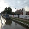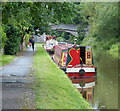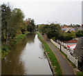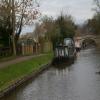
Christleton Visitor Moorings 
48 hour moorings
Christleton Mill Appartments, Whitchurch Road, Christleton CH3 6AE, United Kingdom

Christleton Visitor Moorings
is a minor waterways place
on the Shropshire Union Canal (Chester Canal - Bunbury to Chester) between
Beeston Brook Bridge No 107 (8 miles and 5¾ furlongs
and 1 lock
to the east) and
Tarvin Road Bridge No 123 (7¾ furlongs
and 3 locks
to the northwest).
The nearest place in the direction of Beeston Brook Bridge No 107 is Quarry Bridge No 121;
1 furlong
away.
The nearest place in the direction of Tarvin Road Bridge No 123 is Costa Coffee (Christleton) (Previously The Old Trooper PH);
½ furlongs
away.
Mooring here is ok (a perfectly adequate mooring), piling suitable for hooks. Mooring is limited to 48 hours.
| Egg Bridge No 119 | 1 mile, 4¼ furlongs | |
| Rowton Bridge No 120 | 4½ furlongs | |
| Cheshire Cat PH | 3½ furlongs | |
| Quarry Bridge Winding Hole | 1 furlong | |
| Quarry Bridge No 121 | 1 furlong | |
| Christleton Visitor Moorings | ||
| Costa Coffee (Christleton) | ½ furlongs | |
| Pepper Street Bridge No 122 | ½ furlongs | |
| Water Point (Christleton) | ¾ furlongs | |
| A55 Road Bridge No 122A | 1 furlong | |
| Christleton Lock No 36 | 1¾ furlongs | |
There are no links to external websites from here.
Why not log in and add some (select "External websites" from the menu (sometimes this is under "Edit"))?
Mouseover for more information or show routes to facility
Nearest water point
In the direction of Winding Hole above Bunbury Locks
Tattenhall Marina — 5 miles, 1½ furlongs away
On this waterway in the direction of Winding Hole above Bunbury Locks
Bunbury Staircase Locks Nos 30 and 31 — 10 miles, 4¼ furlongs and 4 locks away
On this waterway in the direction of Winding Hole above Bunbury Locks
Calveley Service Station — 11 miles, 3¾ furlongs and 6 locks away
Travel to Winding Hole above Bunbury Locks, then on the Shropshire Union Canal (Chester Canal - Nantwich to Bunbury) to Calveley Service Station
Cholmondeston Lock No 1 — 14 miles, 5 furlongs and 6 locks away
Travel to Winding Hole above Bunbury Locks, then on the Shropshire Union Canal (Chester Canal - Nantwich to Bunbury) to Barbridge Junction, then on the Shropshire Union Canal (Middlewich Branch) to Cholmondeston Lock No 1
Venetian Marina — 14 miles, 5¾ furlongs and 7 locks away
Travel to Winding Hole above Bunbury Locks, then on the Shropshire Union Canal (Chester Canal - Nantwich to Bunbury) to Barbridge Junction, then on the Shropshire Union Canal (Middlewich Branch) to Venetian Marina
Nantwich Services — 16 miles, 3¾ furlongs and 6 locks away
Travel to Winding Hole above Bunbury Locks, then on the Shropshire Union Canal (Chester Canal - Nantwich to Bunbury) to Nantwich Basin Entrance, then on the Shropshire Union Canal (Birmingham and Liverpool Junction Canal - Main Line) to Nantwich Services
Hurleston Services — 14 miles, 6¼ furlongs and 10 locks away
Travel to Winding Hole above Bunbury Locks, then on the Shropshire Union Canal (Chester Canal - Nantwich to Bunbury) to Hurleston Junction, then on the Shropshire Union Canal (Llangollen Canal - Main Line) to Hurleston Services
Swanley Bridge Marina — 16 miles, 3 furlongs and 10 locks away
Travel to Winding Hole above Bunbury Locks, then on the Shropshire Union Canal (Chester Canal - Nantwich to Bunbury) to Hurleston Junction, then on the Shropshire Union Canal (Llangollen Canal - Main Line) to Swanley Bridge Marina
In the direction of River Dee Branch Junction
Water Point (Christleton) — ¾ furlongs away
On this waterway in the direction of River Dee Branch Junction
C&RT Water Point (Chester) — 1 mile, 3¼ furlongs and 4 locks away
On this waterway in the direction of River Dee Branch Junction
Taylor's Boatyard Drydock — 2 miles, 5¼ furlongs and 8 locks away
On this waterway in the direction of River Dee Branch Junction
Ellesmere Port Visitor Moorings — 10 miles, 6½ furlongs and 8 locks away
Travel to River Dee Branch Junction, then on the Shropshire Union Canal (Wirral Line - Main Line) to Ellesmere Port Visitor Moorings
Salthouse Dock — 16 miles, 6¾ furlongs and 13 locks away
Travel to River Dee Branch Junction, then on the Shropshire Union Canal (Wirral Line - Main Line) to Ellesmere Port Junction, then on the Manchester Ship Canal (Main Line) to Mersey - Ship Canal Junction, then on the River Mersey (Tidal Section) to Mersey - South Docks Junction, then on the Liverpool South Docks to Salthouse DockNearest rubbish disposal
In the direction of Winding Hole above Bunbury Locks
Tattenhall Marina — 5 miles, 1½ furlongs away
On this waterway in the direction of Winding Hole above Bunbury Locks
Bunbury Staircase Locks Nos 30 and 31 — 10 miles, 4¼ furlongs and 4 locks away
On this waterway in the direction of Winding Hole above Bunbury Locks
Calveley Service Station — 11 miles, 3¾ furlongs and 6 locks away
Travel to Winding Hole above Bunbury Locks, then on the Shropshire Union Canal (Chester Canal - Nantwich to Bunbury) to Calveley Service Station
Nantwich Basin Entrance — 16 miles, 3½ furlongs and 6 locks away
Travel to Winding Hole above Bunbury Locks, then on the Shropshire Union Canal (Chester Canal - Nantwich to Bunbury) to Nantwich Basin Entrance
Nantwich Services — 16 miles, 3¾ furlongs and 6 locks away
Travel to Winding Hole above Bunbury Locks, then on the Shropshire Union Canal (Chester Canal - Nantwich to Bunbury) to Nantwich Basin Entrance, then on the Shropshire Union Canal (Birmingham and Liverpool Junction Canal - Main Line) to Nantwich Services
In the direction of River Dee Branch Junction
St Martin's Way Bridge No 123J — 2 miles, 3½ furlongs and 5 locks away
On this waterway in the direction of River Dee Branch Junction
Salthouse Dock — 16 miles, 6¾ furlongs and 13 locks away
Travel to River Dee Branch Junction, then on the Shropshire Union Canal (Wirral Line - Main Line) to Ellesmere Port Junction, then on the Manchester Ship Canal (Main Line) to Mersey - Ship Canal Junction, then on the River Mersey (Tidal Section) to Mersey - South Docks Junction, then on the Liverpool South Docks to Salthouse DockNearest chemical toilet disposal
In the direction of Winding Hole above Bunbury Locks
Tattenhall Marina — 5 miles, 1½ furlongs away
On this waterway in the direction of Winding Hole above Bunbury Locks
Bunbury Staircase Locks Nos 30 and 31 — 10 miles, 4¼ furlongs and 4 locks away
On this waterway in the direction of Winding Hole above Bunbury Locks
Calveley Service Station — 11 miles, 3¾ furlongs and 6 locks away
Travel to Winding Hole above Bunbury Locks, then on the Shropshire Union Canal (Chester Canal - Nantwich to Bunbury) to Calveley Service Station
Barbridge Marina — 13 miles, 2¼ furlongs and 6 locks away
Travel to Winding Hole above Bunbury Locks, then on the Shropshire Union Canal (Chester Canal - Nantwich to Bunbury) to Barbridge Junction, then on the Shropshire Union Canal (Middlewich Branch) to Barbridge Marina
Nantwich Services — 16 miles, 3¾ furlongs and 6 locks away
Travel to Winding Hole above Bunbury Locks, then on the Shropshire Union Canal (Chester Canal - Nantwich to Bunbury) to Nantwich Basin Entrance, then on the Shropshire Union Canal (Birmingham and Liverpool Junction Canal - Main Line) to Nantwich Services
Swanley Bridge Marina — 16 miles, 3 furlongs and 10 locks away
Travel to Winding Hole above Bunbury Locks, then on the Shropshire Union Canal (Chester Canal - Nantwich to Bunbury) to Hurleston Junction, then on the Shropshire Union Canal (Llangollen Canal - Main Line) to Swanley Bridge Marina
In the direction of River Dee Branch Junction
Dee Branch Top Lock Footbridge — 2 miles, 5½ furlongs and 9 locks away
Travel to River Dee Branch Junction, then on the Shropshire Union Canal (Dee Branch) to Dee Branch Top Lock FootbridgeNearest place to turn
In the direction of Winding Hole above Bunbury Locks
Quarry Bridge Winding Hole — 1 furlong away
On this waterway in the direction of Winding Hole above Bunbury Locks
Egg Bridge Winding Hole — 1 mile, 4¼ furlongs away
On this waterway in the direction of Winding Hole above Bunbury Locks
Crows Nest Bridge Winding Hole — 5 miles, ½ furlongs away
On this waterway in the direction of Winding Hole above Bunbury Locks
Beeston Castle Winding Hole — 7 miles, 5¼ furlongs away
On this waterway in the direction of Winding Hole above Bunbury Locks
Hand Green Winding Hole — 8 miles, 2½ furlongs and 1 lock away
On this waterway in the direction of Winding Hole above Bunbury Locks
Beeston Stone Lock Winding Hole — 9 miles and 2 locks away
On this waterway in the direction of Winding Hole above Bunbury Locks
Winding Hole above Bunbury Locks — 10 miles, 6 furlongs and 6 locks away
On this waterway in the direction of Winding Hole above Bunbury Locks
Barbridge Junction — 13 miles, 1¾ furlongs and 6 locks away
Travel to Winding Hole above Bunbury Locks, then on the Shropshire Union Canal (Chester Canal - Nantwich to Bunbury) to Barbridge Junction
Crossbanks Farm Winding Hole — 14 miles, 2¾ furlongs and 6 locks away
Travel to Winding Hole above Bunbury Locks, then on the Shropshire Union Canal (Chester Canal - Nantwich to Bunbury) to Barbridge Junction, then on the Shropshire Union Canal (Middlewich Branch) to Crossbanks Farm Winding Hole
Hurleston Junction — 14 miles, 4¼ furlongs and 6 locks away
Travel to Winding Hole above Bunbury Locks, then on the Shropshire Union Canal (Chester Canal - Nantwich to Bunbury) to Hurleston Junction
Poole Hill Winding Hole — 15 miles, ¾ furlongs and 6 locks away
Travel to Winding Hole above Bunbury Locks, then on the Shropshire Union Canal (Chester Canal - Nantwich to Bunbury) to Poole Hill Winding Hole
In the direction of River Dee Branch Junction
Cow Lane Bridge Winding Hole — 2 miles, ½ furlongs and 5 locks away
On this waterway in the direction of River Dee Branch Junction
Tower Wharf Visitor Moorings — 2 miles, 4¾ furlongs and 8 locks away
On this waterway in the direction of River Dee Branch Junction
River Dee Branch Junction — 2 miles, 5½ furlongs and 8 locks away
On this waterway in the direction of River Dee Branch Junction
Backford Bridge Winding Hole — 5 miles, 5¾ furlongs and 8 locks away
Travel to River Dee Branch Junction, then on the Shropshire Union Canal (Wirral Line - Main Line) to Backford Bridge Winding Hole
River Dee Junction — 2 miles, 6¼ furlongs and 12 locks away
Travel to River Dee Branch Junction, then on the Shropshire Union Canal (Dee Branch) to River Dee Junction
Stanney Mill Bridge Winding Hole — 9 miles, ¾ furlongs and 8 locks away
Travel to River Dee Branch Junction, then on the Shropshire Union Canal (Wirral Line - Main Line) to Stanney Mill Bridge Winding Hole
Stanlow Winding Hole — 10 miles, 3½ furlongs and 8 locks away
Travel to River Dee Branch Junction, then on the Shropshire Union Canal (Wirral Line - Main Line) to Stanlow Winding Hole
Winding Hole above Ellesmere Port Locks — 10 miles, 7½ furlongs and 8 locks away
Travel to River Dee Branch Junction, then on the Shropshire Union Canal (Wirral Line - Main Line) to Winding Hole above Ellesmere Port Locks
Ellesmere Port Upper Basin — 11 miles, ½ furlongs and 10 locks away
Travel to River Dee Branch Junction, then on the Shropshire Union Canal (Wirral Line - Main Line) to Ellesmere Port Upper BasinNearest self-operated pump-out
In the direction of Winding Hole above Bunbury Locks
Calveley Service Station — 11 miles, 3¾ furlongs and 6 locks away
Travel to Winding Hole above Bunbury Locks, then on the Shropshire Union Canal (Chester Canal - Nantwich to Bunbury) to Calveley Service Station
Venetian Marina — 14 miles, 5¾ furlongs and 7 locks away
Travel to Winding Hole above Bunbury Locks, then on the Shropshire Union Canal (Chester Canal - Nantwich to Bunbury) to Barbridge Junction, then on the Shropshire Union Canal (Middlewich Branch) to Venetian Marina
In the direction of River Dee Branch Junction
Dee Branch Top Lock Footbridge — 2 miles, 5½ furlongs and 9 locks away
Travel to River Dee Branch Junction, then on the Shropshire Union Canal (Dee Branch) to Dee Branch Top Lock FootbridgeNearest boatyard pump-out
In the direction of Winding Hole above Bunbury Locks
Golden Nook Farm Moorings — 3 miles, 6¾ furlongs away
On this waterway in the direction of Winding Hole above Bunbury Locks
Tattenhall Marina — 5 miles, 1½ furlongs away
On this waterway in the direction of Winding Hole above Bunbury Locks
Beeston Castle Wharf — 8 miles, 5¾ furlongs and 1 lock away
On this waterway in the direction of Winding Hole above Bunbury Locks
Bunbury Bridge No 105 — 10 miles, 4 furlongs and 4 locks away
On this waterway in the direction of Winding Hole above Bunbury Locks
Nantwich Basin Entrance — 16 miles, 3½ furlongs and 6 locks away
Travel to Winding Hole above Bunbury Locks, then on the Shropshire Union Canal (Chester Canal - Nantwich to Bunbury) to Nantwich Basin Entrance
Nantwich Marina Wharf — 16 miles, 4¼ furlongs and 6 locks away
Travel to Winding Hole above Bunbury Locks, then on the Shropshire Union Canal (Chester Canal - Nantwich to Bunbury) to Nantwich Basin Entrance, then on the Shropshire Union Canal (Birmingham and Liverpool Junction Canal - Main Line) to Nantwich Marina Wharf
Aqueduct Marina — 16 miles, 3¼ furlongs and 8 locks away
Travel to Winding Hole above Bunbury Locks, then on the Shropshire Union Canal (Chester Canal - Nantwich to Bunbury) to Barbridge Junction, then on the Shropshire Union Canal (Middlewich Branch) to Aqueduct Marina
Swanley Bridge Marina — 16 miles, 3 furlongs and 10 locks away
Travel to Winding Hole above Bunbury Locks, then on the Shropshire Union Canal (Chester Canal - Nantwich to Bunbury) to Hurleston Junction, then on the Shropshire Union Canal (Llangollen Canal - Main Line) to Swanley Bridge MarinaDirection of TV transmitter (From Wolfbane Cybernetic)
There is no page on Wikipedia called “Christleton Visitor Moorings”


![Old Mill Loading Platform, Christleton. Although there are a couple of planks missing from this hinged platform, it looks to be the real deal, which is certainly likely as this canal-side mill only stopped making flour in the mid 1970s. It went by the name of Butlers Mill, and ground the grain into flour used predominantly for animal feed, according to those in the know online.The grain was lifted from the barges, called Mersey Flats, by a cantilever hoist, of which there is now no evidence. Presumably onto this platform. The bottom of an overhanging bit of the old mill building can just be made out at the top of the picture, but it is worth looking at [[7167444]] for a better view. Presumably (again!) there used to be a trapdoor in the overhanging bit through which the sacks of grain were hoisted. A bakery existed here until the 1930s and when I was growing up there was a Mill Stores here selling newspapers and football stickers, amongst other things. It must have closed in the mid 1990s I think. A bit of trivia found online is that the owners of the mill also owned the first petrol station in Christleton, which was sited on what is now Durban Avenue, on the opposite side of the A41.I was a bit startled to see the words 'Bakers Way' on the OS map, running alongside this section of the canal running past the old mill. Its name, however, is a red herring, having nothing to do with baking; it is named as a tribute to a Mr Baker, something of a big cheese in Cheshire footpaths in days gone by. by Ian Dodds – 06 September 2021](https://s3.geograph.org.uk/geophotos/07/18/72/7187231_9ddb2ac3_120x120.jpg)

![Former flour mill, Christleton. Now converted to housing. Bounded by the Shropshire Union canal on one side and the Whitchurch Road [A41] on the other. For more about the history see [[7187231]]. by Christine Johnstone – 06 May 2023](https://s1.geograph.org.uk/geophotos/07/52/02/7520289_917bd247_120x120.jpg)

![Coffee replaces beer in Christleton. Ye Olde Trooper pub [[6782542]] has been converted into a Drive-thru Costa Coffee outlet. by Christine Johnstone – 06 May 2023](https://s3.geograph.org.uk/geophotos/07/52/02/7520299_53a08871_120x120.jpg)


![Pepper Street bridge over the Shropshire Union Canal. There is an Ordnance Survey bench mark on the stone post at the near end of the brick parapet - see [[4774443]] by John S Turner – 10 October 2009](https://s0.geograph.org.uk/geophotos/04/77/44/4774448_ba8849f6_120x120.jpg)


![Bench mark and steps to the canal from Pepper Street, Christleton. These old stone posts were once a stile providing access to the towing path for the Shropshire Union Canal. The Ordnance Survey bench mark on the right hand post was first recorded on the 1874 O.S. map. See also [[4774448]] by John S Turner – 10 October 2009](https://s3.geograph.org.uk/geophotos/04/77/44/4774443_45b79519_120x120.jpg)

![Damaged bench mark on Quarry Bridge, Christleton. This damaged bench mark is on the north face of the canal bridge buttress alongside the Shropshire Union Canal - Main Line. It's not easy to spot unless you are looking for it. See also [[4775097]] For details of the mark see: http://www.bench-marks.org.uk/bm72400 by John S Turner – 25 October 2011](https://s3.geograph.org.uk/geophotos/04/77/50/4775091_16e8ae87_120x120.jpg)


![Quarry Bridge, Christleton. Quarry Bridge carries a footpath over the Shropshire Union Canal - Main Line. There is an Ordnance Survey bench mark on the right hand buttress of the bridge - see [[4775091]] by John S Turner – 25 October 2011](https://s1.geograph.org.uk/geophotos/04/77/50/4775097_1812ffa4_120x120.jpg)