Hawford Lock No 2
Hawford Lock Lane, Claines, Wychavon, Worcestershire, England, United Kingdom
Hawford Lock No 2
is a place on the waterways
on the Droitwich Canals (Droitwich Barge Canal) between
Hawford Junction (Junction of Droitwich Canal with River Severn) (1¼ furlongs
and 1 lock
to the southwest) and
Droitwich Junction (Junction of Droitwich Barge Canal and Droitwich Junction Canal) (5 miles and 5 furlongs
and 7 locks
to the east).
The nearest place in the direction of Hawford Junction is Hawford Lock No 1;
1 furlong
away.
The nearest place in the direction of Droitwich Junction is Hawford Visitor Moorings;
¼ furlongs
away.
There may be access to the towpath here.
Mooring here is unrated
There is a bridge here which takes pedestrian traffic over the canal.
This is a lock, the rise of which is not known.
Hawford Junction | 1¼ furlongs | |
Hawford Lock No 1 | 1 furlong | |
Hawford Lock No 2 | ||
Hawford Visitor Moorings | ¼ furlongs | |
A449 Tunnel (west end) | 1¼ furlongs | |
A449 Tunnel (east end) | 2 furlongs | |
Egg Lane Field Bridge | 4¾ furlongs | |
Egg Lane Bridge No 4 | 1 mile, ½ furlongs |
A Bad Case of Deja Vu from Scribblings from the Mintball posted Wednesday the 24th of September, 2014
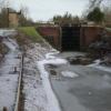
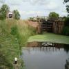
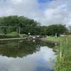
Click on a photograph to visit it on Geograph.
These pictures are licensed under a Creative Commons license and copyright the photographer shown above
There are no links to external websites from here.
Why not log in and add some (go to "Edit and Change" on the menu and select "Edit websites")?
Mouseover for more information or show routes to facility
Nearest water point
Holt Lock (Holt Fleet) — 3 miles, 1 furlong and 2 locks away
Travel to Hawford Junction, then on the River Severn (main river - Stourport to Worcester) to Holt Lock (Holt Fleet)
Worcester Trip Boat Moorings — 3 miles, 6½ furlongs and 3 locks away
Travel to Hawford Junction, then on the River Severn (main river - Stourport to Worcester) to Worcester Trip Boat Moorings
Diglis Basin — 4 miles, 5¾ furlongs and 5 locks away
Travel to Hawford Junction, then on the River Severn (main river - Stourport to Worcester) to Diglis Junction, then on the Worcester and Birmingham Canal (Diglis Junction to Diglis Basin) to Diglis Basin
Diglis Locks — 4 miles, 7 furlongs and 3 locks away
Travel to Hawford Junction, then on the River Severn (main river - Stourport to Worcester) to Diglis Junction, then on the River Severn (main river - Worcester to Gloucester) to Diglis Locks
Lincomb Lock — 7 miles, 2 furlongs and 3 locks away
Travel to Hawford Junction, then on the River Severn (main river - Stourport to Worcester) to Lincomb Lock
Stourport Upper Basin — 8 miles, 5¼ furlongs and 6 locks away
Travel to Hawford Junction, then on the River Severn (main river - Stourport to Worcester) to Severn - Stourport Broad Locks Entrance, then on the Staffordshire and Worcestershire Canal (Stourport Basins: Broad Route) to Stourport Upper Basin
Upper Basin Waterpoint — 8 miles, 5¼ furlongs and 6 locks away
Travel to Hawford Junction, then on the River Severn (main river - Stourport to Worcester) to Severn - Stourport Broad Locks Entrance, then on the Staffordshire and Worcestershire Canal (Stourport Basins: Broad Route) to Stourport Upper Basin, then on the Staffordshire and Worcestershire Canal (Stourport Basins: Narrow Route) to Upper Basin Waterpoint
Stourport Town Moorings — 8 miles, 6 furlongs and 7 locks away
Travel to Hawford Junction, then on the River Severn (main river - Stourport to Worcester) to Severn - Stourport Broad Locks Entrance, then on the Staffordshire and Worcestershire Canal (Stourport Basins: Broad Route) to Stourport Upper Basin, then on the Staffordshire and Worcestershire Canal (Stourport Basins: Narrow Route) to York Street Bridge, then on the Staffordshire and Worcestershire Canal (Main Line: Stourport to Stourton) to Stourport Town Moorings
Dunhampstead Boatyard — 9 miles, ½ furlongs and 15 locks away
Travel to Droitwich Junction, then on the Droitwich Canals (Droitwich Junction Canal) to Hanbury Junction, then on the Worcester and Birmingham Canal (Diglis Basin to King's Norton Junction) to Dunhampstead Boatyard
Stoke Works Water Point — 9 miles, 5½ furlongs and 21 locks away
Travel to Droitwich Junction, then on the Droitwich Canals (Droitwich Junction Canal) to Hanbury Junction, then on the Worcester and Birmingham Canal (Diglis Basin to King's Norton Junction) to Stoke Works Water Point
Tardebigge Wharf — 13 miles, 6¾ furlongs and 57 locks away
Travel to Droitwich Junction, then on the Droitwich Canals (Droitwich Junction Canal) to Hanbury Junction, then on the Worcester and Birmingham Canal (Diglis Basin to King's Norton Junction) to Tardebigge Wharf
Upton Bridge — 14 miles, 4½ furlongs and 4 locks away
Travel to Hawford Junction, then on the River Severn (main river - Stourport to Worcester) to Diglis Junction, then on the River Severn (main river - Worcester to Gloucester) to Upton Bridge
Hopwood Visitor Moorings — 19 miles, 1 furlong and 57 locks away
Travel to Droitwich Junction, then on the Droitwich Canals (Droitwich Junction Canal) to Hanbury Junction, then on the Worcester and Birmingham Canal (Diglis Basin to King's Norton Junction) to Hopwood Visitor Moorings
Kinver Services — 19 miles, 2½ furlongs and 15 locks away
Travel to Hawford Junction, then on the River Severn (main river - Stourport to Worcester) to Severn - Stourport Broad Locks Entrance, then on the Staffordshire and Worcestershire Canal (Stourport Basins: Broad Route) to Stourport Upper Basin, then on the Staffordshire and Worcestershire Canal (Stourport Basins: Narrow Route) to York Street Bridge, then on the Staffordshire and Worcestershire Canal (Main Line: Stourport to Stourton) to Kinver Services
Nearest rubbish disposal
Sabrina Footbridge — 3 miles, 4¾ furlongs and 3 locks away
Travel to Hawford Junction, then on the River Severn (main river - Stourport to Worcester) to Sabrina Footbridge
Diglis Basin — 4 miles, 5¾ furlongs and 5 locks away
Travel to Hawford Junction, then on the River Severn (main river - Stourport to Worcester) to Diglis Junction, then on the Worcester and Birmingham Canal (Diglis Junction to Diglis Basin) to Diglis Basin
Stourport Upper Basin — 8 miles, 5¼ furlongs and 6 locks away
Travel to Hawford Junction, then on the River Severn (main river - Stourport to Worcester) to Severn - Stourport Broad Locks Entrance, then on the Staffordshire and Worcestershire Canal (Stourport Basins: Broad Route) to Stourport Upper Basin
Upper Basin Waterpoint — 8 miles, 5¼ furlongs and 6 locks away
Travel to Hawford Junction, then on the River Severn (main river - Stourport to Worcester) to Severn - Stourport Broad Locks Entrance, then on the Staffordshire and Worcestershire Canal (Stourport Basins: Broad Route) to Stourport Upper Basin, then on the Staffordshire and Worcestershire Canal (Stourport Basins: Narrow Route) to Upper Basin Waterpoint
Stourport Town Moorings — 8 miles, 6 furlongs and 7 locks away
Travel to Hawford Junction, then on the River Severn (main river - Stourport to Worcester) to Severn - Stourport Broad Locks Entrance, then on the Staffordshire and Worcestershire Canal (Stourport Basins: Broad Route) to Stourport Upper Basin, then on the Staffordshire and Worcestershire Canal (Stourport Basins: Narrow Route) to York Street Bridge, then on the Staffordshire and Worcestershire Canal (Main Line: Stourport to Stourton) to Stourport Town Moorings
Stoke Bottom Lock No 23 — 10 miles, 3½ furlongs and 21 locks away
Travel to Droitwich Junction, then on the Droitwich Canals (Droitwich Junction Canal) to Hanbury Junction, then on the Worcester and Birmingham Canal (Diglis Basin to King's Norton Junction) to Stoke Bottom Lock No 23
Tardebigge Wharf — 13 miles, 6¾ furlongs and 57 locks away
Travel to Droitwich Junction, then on the Droitwich Canals (Droitwich Junction Canal) to Hanbury Junction, then on the Worcester and Birmingham Canal (Diglis Basin to King's Norton Junction) to Tardebigge Wharf
Kinver Services — 19 miles, 2½ furlongs and 15 locks away
Travel to Hawford Junction, then on the River Severn (main river - Stourport to Worcester) to Severn - Stourport Broad Locks Entrance, then on the Staffordshire and Worcestershire Canal (Stourport Basins: Broad Route) to Stourport Upper Basin, then on the Staffordshire and Worcestershire Canal (Stourport Basins: Narrow Route) to York Street Bridge, then on the Staffordshire and Worcestershire Canal (Main Line: Stourport to Stourton) to Kinver Services
Nearest chemical toilet disposal
Stourport Marina — 7 miles, 5½ furlongs and 4 locks away
Travel to Hawford Junction, then on the River Severn (main river - Stourport to Worcester) to Stourport Marina
Stourport Upper Basin — 8 miles, 5¼ furlongs and 6 locks away
Travel to Hawford Junction, then on the River Severn (main river - Stourport to Worcester) to Severn - Stourport Broad Locks Entrance, then on the Staffordshire and Worcestershire Canal (Stourport Basins: Broad Route) to Stourport Upper Basin
Upper Basin Waterpoint — 8 miles, 5¼ furlongs and 6 locks away
Travel to Hawford Junction, then on the River Severn (main river - Stourport to Worcester) to Severn - Stourport Broad Locks Entrance, then on the Staffordshire and Worcestershire Canal (Stourport Basins: Broad Route) to Stourport Upper Basin, then on the Staffordshire and Worcestershire Canal (Stourport Basins: Narrow Route) to Upper Basin Waterpoint
Stourport Town Moorings — 8 miles, 6 furlongs and 7 locks away
Travel to Hawford Junction, then on the River Severn (main river - Stourport to Worcester) to Severn - Stourport Broad Locks Entrance, then on the Staffordshire and Worcestershire Canal (Stourport Basins: Broad Route) to Stourport Upper Basin, then on the Staffordshire and Worcestershire Canal (Stourport Basins: Narrow Route) to York Street Bridge, then on the Staffordshire and Worcestershire Canal (Main Line: Stourport to Stourton) to Stourport Town Moorings
Stoke Bottom Lock No 23 — 10 miles, 3½ furlongs and 21 locks away
Travel to Droitwich Junction, then on the Droitwich Canals (Droitwich Junction Canal) to Hanbury Junction, then on the Worcester and Birmingham Canal (Diglis Basin to King's Norton Junction) to Stoke Bottom Lock No 23
Tardebigge Wharf — 13 miles, 6¾ furlongs and 57 locks away
Travel to Droitwich Junction, then on the Droitwich Canals (Droitwich Junction Canal) to Hanbury Junction, then on the Worcester and Birmingham Canal (Diglis Basin to King's Norton Junction) to Tardebigge Wharf
Upton Bridge — 14 miles, 4½ furlongs and 4 locks away
Travel to Hawford Junction, then on the River Severn (main river - Stourport to Worcester) to Diglis Junction, then on the River Severn (main river - Worcester to Gloucester) to Upton Bridge
Kinver Services — 19 miles, 2½ furlongs and 15 locks away
Travel to Hawford Junction, then on the River Severn (main river - Stourport to Worcester) to Severn - Stourport Broad Locks Entrance, then on the Staffordshire and Worcestershire Canal (Stourport Basins: Broad Route) to Stourport Upper Basin, then on the Staffordshire and Worcestershire Canal (Stourport Basins: Narrow Route) to York Street Bridge, then on the Staffordshire and Worcestershire Canal (Main Line: Stourport to Stourton) to Kinver Services
Nearest place to turn
Bevere Lock Weir Entrance — 3½ furlongs and 2 locks away
Travel to Hawford Junction, then on the River Severn (main river - Stourport to Worcester) to Bevere Lock Weir Entrance
Bevere Lock Weir Exit — 6 furlongs and 3 locks away
Travel to Hawford Junction, then on the River Severn (main river - Stourport to Worcester) to Bevere Lock Weir Exit
Ladywood Top Lock Winding Hole — 2 miles, 4¼ furlongs and 7 locks away
On this waterway in the direction of Droitwich Junction
Holt Lock Weir Exit — 3 miles and 2 locks away
Travel to Hawford Junction, then on the River Severn (main river - Stourport to Worcester) to Holt Lock Weir Exit
Holt Lock Weir Entrance — 3 miles, 3½ furlongs and 3 locks away
Travel to Hawford Junction, then on the River Severn (main river - Stourport to Worcester) to Holt Lock Weir Entrance
Diglis Junction — 4 miles, 4½ furlongs and 3 locks away
Travel to Hawford Junction, then on the River Severn (main river - Stourport to Worcester) to Diglis Junction
Diglis Locks Middle Basin — 4 miles, 5¼ furlongs and 4 locks away
Travel to Hawford Junction, then on the River Severn (main river - Stourport to Worcester) to Diglis Junction, then on the Worcester and Birmingham Canal (Diglis Junction to Diglis Basin) to Diglis Locks Middle Basin
Diglis Basin — 4 miles, 5¾ furlongs and 5 locks away
Travel to Hawford Junction, then on the River Severn (main river - Stourport to Worcester) to Diglis Junction, then on the Worcester and Birmingham Canal (Diglis Junction to Diglis Basin) to Diglis Basin
Diglis Locks Weir Exit — 4 miles, 7¾ furlongs and 4 locks away
Travel to Hawford Junction, then on the River Severn (main river - Stourport to Worcester) to Diglis Junction, then on the River Severn (main river - Worcester to Gloucester) to Diglis Locks Weir Exit
Netherwich Basin — 5 miles, 2¼ furlongs and 7 locks away
On this waterway in the direction of Droitwich Junction
Droitwich Town Wharf — 5 miles, 4½ furlongs and 7 locks away
On this waterway in the direction of Droitwich Junction
Severn - Teme Junction — 5 miles, 5¾ furlongs and 4 locks away
Travel to Hawford Junction, then on the River Severn (main river - Stourport to Worcester) to Diglis Junction, then on the River Severn (main river - Worcester to Gloucester) to Severn - Teme Junction
Lowesmoor Basin — 5 miles, 6 furlongs and 7 locks away
Travel to Hawford Junction, then on the River Severn (main river - Stourport to Worcester) to Diglis Junction, then on the Worcester and Birmingham Canal (Diglis Junction to Diglis Basin) to Diglis Basin, then on the Worcester and Birmingham Canal (Diglis Basin to King's Norton Junction) to Lowesmoor Basin
Lock No 6 Winding Hole — 6 miles, 2¾ furlongs and 10 locks away
Travel to Droitwich Junction, then on the Droitwich Canals (Droitwich Junction Canal) to Lock No 6 Winding Hole
Droitwich Spa Marina — 6 miles, 6 furlongs and 12 locks away
Travel to Droitwich Junction, then on the Droitwich Canals (Droitwich Junction Canal) to Droitwich Spa Marina
Bilford Locks Winding Hole — 6 miles, 7¾ furlongs and 10 locks away
Travel to Hawford Junction, then on the River Severn (main river - Stourport to Worcester) to Diglis Junction, then on the Worcester and Birmingham Canal (Diglis Junction to Diglis Basin) to Diglis Basin, then on the Worcester and Birmingham Canal (Diglis Basin to King's Norton Junction) to Bilford Locks Winding Hole
Hanbury Junction — 7 miles, 1 furlong and 15 locks away
Travel to Droitwich Junction, then on the Droitwich Canals (Droitwich Junction Canal) to Hanbury Junction
Hanbury Boatyard — 7 miles, 2 furlongs and 15 locks away
Travel to Droitwich Junction, then on the Droitwich Canals (Droitwich Junction Canal) to Hanbury Junction, then on the Worcester and Birmingham Canal (Diglis Basin to King's Norton Junction) to Hanbury Boatyard
Hanbury Junction Winding Hole — 7 miles, 2½ furlongs and 15 locks away
Travel to Droitwich Junction, then on the Droitwich Canals (Droitwich Junction Canal) to Hanbury Junction, then on the Worcester and Birmingham Canal (Diglis Basin to King's Norton Junction) to Hanbury Junction Winding Hole
Severn - Stourport Narrow Locks Entrance — 8 miles, 4½ furlongs and 4 locks away
Travel to Hawford Junction, then on the River Severn (main river - Stourport to Worcester) to Severn - Stourport Narrow Locks Entrance
Nearest self-operated pump-out
Stourport Upper Basin — 8 miles, 5¼ furlongs and 6 locks away
Travel to Hawford Junction, then on the River Severn (main river - Stourport to Worcester) to Severn - Stourport Broad Locks Entrance, then on the Staffordshire and Worcestershire Canal (Stourport Basins: Broad Route) to Stourport Upper Basin
Stourport Town Moorings — 8 miles, 6 furlongs and 7 locks away
Travel to Hawford Junction, then on the River Severn (main river - Stourport to Worcester) to Severn - Stourport Broad Locks Entrance, then on the Staffordshire and Worcestershire Canal (Stourport Basins: Broad Route) to Stourport Upper Basin, then on the Staffordshire and Worcestershire Canal (Stourport Basins: Narrow Route) to York Street Bridge, then on the Staffordshire and Worcestershire Canal (Main Line: Stourport to Stourton) to Stourport Town Moorings
Kinver Services — 19 miles, 2½ furlongs and 15 locks away
Travel to Hawford Junction, then on the River Severn (main river - Stourport to Worcester) to Severn - Stourport Broad Locks Entrance, then on the Staffordshire and Worcestershire Canal (Stourport Basins: Broad Route) to Stourport Upper Basin, then on the Staffordshire and Worcestershire Canal (Stourport Basins: Narrow Route) to York Street Bridge, then on the Staffordshire and Worcestershire Canal (Main Line: Stourport to Stourton) to Kinver Services
Nearest boatyard pump-out
Stourport Marina — 7 miles, 5½ furlongs and 4 locks away
Travel to Hawford Junction, then on the River Severn (main river - Stourport to Worcester) to Stourport Marina
Stourport Upper Basin — 8 miles, 5¼ furlongs and 6 locks away
Travel to Hawford Junction, then on the River Severn (main river - Stourport to Worcester) to Severn - Stourport Broad Locks Entrance, then on the Staffordshire and Worcestershire Canal (Stourport Basins: Broad Route) to Stourport Upper Basin
Upper Basin Waterpoint — 8 miles, 5¼ furlongs and 6 locks away
Travel to Hawford Junction, then on the River Severn (main river - Stourport to Worcester) to Severn - Stourport Broad Locks Entrance, then on the Staffordshire and Worcestershire Canal (Stourport Basins: Broad Route) to Stourport Upper Basin, then on the Staffordshire and Worcestershire Canal (Stourport Basins: Narrow Route) to Upper Basin Waterpoint
Upper Staircase Mooring Pontoon — 8 miles, 5¼ furlongs and 7 locks away
Travel to Hawford Junction, then on the River Severn (main river - Stourport to Worcester) to Severn - Stourport Broad Locks Entrance, then on the Staffordshire and Worcestershire Canal (Stourport Basins: Broad Route) to Stourport Lower Basin - between Broad Locks, then on the Staffordshire and Worcestershire Canal (Stourport Basins: Broad Locks to Narrow Locks to Stourport Lower Basin - between Narrow Locks, then on the Staffordshire and Worcestershire Canal (Stourport Basins: Narrow Route) to Upper Staircase Mooring Pontoon
Stourport Town Moorings — 8 miles, 6 furlongs and 7 locks away
Travel to Hawford Junction, then on the River Severn (main river - Stourport to Worcester) to Severn - Stourport Broad Locks Entrance, then on the Staffordshire and Worcestershire Canal (Stourport Basins: Broad Route) to Stourport Upper Basin, then on the Staffordshire and Worcestershire Canal (Stourport Basins: Narrow Route) to York Street Bridge, then on the Staffordshire and Worcestershire Canal (Main Line: Stourport to Stourton) to Stourport Town Moorings
Dunhampstead Boatyard — 9 miles, ½ furlongs and 15 locks away
Travel to Droitwich Junction, then on the Droitwich Canals (Droitwich Junction Canal) to Hanbury Junction, then on the Worcester and Birmingham Canal (Diglis Basin to King's Norton Junction) to Dunhampstead Boatyard
Direction of TV transmitter (From Wolfbane Cybernetic)
There is no page on Wikipedia called “Hawford Lock”
Wikipedia pages that might relate to Hawford Lock
[List of National Trust properties in England]
[Droitwich Canal]
[River Severn]
Information retrieved Friday 20 April 2018 at 11:48
Landscape Company
- Worcestershire Tree Care (Business Service, Professional Service)
1122 yards to the south.
Coffee Shop
- Bevere Cafe (Fast Food Restaurant)
1099 yards to the south.
Surveyor
- Clarke and Jay Surveyors Ltd (Local Service, Professional Service)
771 yards to the northeast.
Home Mover
- Budget Removals of Worcester (Transportation Service)
1812 yards to the southeast.
Charity Organization
- Worcestershire Federation of Young Farmers' Clubs (Agriculture Company)
745 yards to the north.
Art Gallery
- The Gallery at Bevere (Restaurant, Shopping & Retail)
1040 yards to the south.
Shopping & Retail
- Top Barn Harvest Shop & Farm Park (Specialty Grocery Store, Farm)
2241 yards to the northwest. - Gwillam's Farm Shop (Farmers Market)
1587 yards to the south.
Beer Garden
- Camp House (Pub)
1421 yards to the southwest.
Cosmetics Store
- My Arbonne Experience (Nutritionist)
1430 yards to the south.
Boat Service
- Mill House Boatyard - Previously George Judge Ltd. (Marine Supply Store, Mobile Home Park)
289 yards to the east.
Anglican Church
- Claines Church (Religious Organization)
1611 yards to the southeast.
RV Park
- Mill House Caravan & Camping Site (Campground, Mobile Home Park)
411 yards to the east.
Restaurant
- The Wagon Wheel, Grimley (Pub)
1456 yards to the southeast.
Automotive, Aircraft & Boat
- Crowndell Services (Commercial & Industrial)
915 yards to the north.
Church
- St John's Church, Dudley (Religious Organization, Religious Center)
34766 yards to the north.
Travel & Transportation
- A449 road (Region, Interest)
256 yards to the northeast.
Landmark & Historical Place
- Hawford Dovecote (Just For Fun)
5815 yards to the south.
Bowling Alley
- Tenpin (Arts & Entertainment)
3009 yards to the south.
More...
Information retrieved Monday 9 April 2018 at 11:00