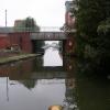
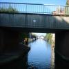
Mill Street Bridge No 2
is a minor waterways place
on the Worcester and Birmingham Canal (Diglis Basin to King's Norton Junction) between
Diglis Basin (Tow-path goes around the first basin) (1¼ furlongs
to the southwest) and
Hanbury Junction (Junction with Droitwich Junction Canal (Restored - Opened 1/July/2011). Hanbury Wharf) (8 miles and 7¼ furlongs
and 14 locks
to the northeast).
The nearest place in the direction of Diglis Basin is Diglis Services;
¾ furlongs
away.
The nearest place in the direction of Hanbury Junction is Diglis Visitor Moorings (Bath Road);
½ furlongs
away.
There is access (via steps) to the towpath here.
Mooring here is impossible (it may be physically impossible, forbidden, or allowed only for specific short-term purposes).
There is a bridge here which takes a minor road over the canal.
Diglis Basin | 1¼ furlongs | |
The Anchor Inn (Diglis) | 1 furlong | |
Diglis Services | ¾ furlongs | |
Mill Street Bridge No 2 | ||
Diglis Visitor Moorings (Bath Road) | ½ furlongs | |
Sidbury Bridge No 3 | 1¼ furlongs | |
Sidbury Lock No 3 | 1½ furlongs | |
Commandery Visitor Moorings | 1¾ furlongs | |
Blockhouse Bridge No 4 | 2¾ furlongs |
Amenities nearby at Diglis Visitor Moorings (Bath Road)
Amenities nearby at Diglis Services
Amenities in Worcester
Amenities at other places in Worcester
at
at
at
at
at
at
at
at
at
at
at
at
at
at
at
at
at
at
at
at
at
at
at
at
at
at
at
at
at
at
at
at
at
at
at
at
at
at
at
at
at
at
at
at
at
at
at
at
at
at
at
at
at
at
at
at
at
at
at
at
at
at
at
at
at
at
at
C&RT PUMP-OUT, WATER, & ELSAN FACILITIES JUST AFTER BRIDGE 2 BEFORE THE BASIN
There are no links to external websites from here.
Why not log in and add some (select "External websites" from the menu (sometimes this is under "Edit"))?
Mouseover for more information or show routes to facility
Nearest water point
In the direction of King's Norton Junction
Lowesmoor Basin — 7 furlongs and 2 locks away
On this waterway in the direction of King's Norton Junction
Hanbury Boatyard — 8 miles, 6¼ furlongs and 14 locks away
On this waterway in the direction of King's Norton Junction
Droitwich Spa Marina — 9 miles, 2½ furlongs and 17 locks away
Travel to Hanbury Junction, then on the Droitwich Canals (Droitwich Junction Canal) to Droitwich Spa Marina
Stoke Works Water Point — 11 miles, 3½ furlongs and 20 locks away
On this waterway in the direction of King's Norton Junction
Tardebigge Wharf — 15 miles, 3¾ furlongs and 56 locks away
On this waterway in the direction of King's Norton Junction
In the direction of Diglis Basin
Diglis Services — ¾ furlongs away
On this waterway in the direction of Diglis Basin
Diglis Locks — 4¾ furlongs and 2 locks away
Travel to Diglis Basin, then on the Worcester and Birmingham Canal (Diglis Junction to Diglis Basin) to Diglis Junction, then on the River Severn (main river - Worcester to Gloucester) to Diglis Locks
Worcester Trip Boat Moorings — 1 mile, ½ furlongs and 2 locks away
Travel to Diglis Basin, then on the Worcester and Birmingham Canal (Diglis Junction to Diglis Basin) to Diglis Junction, then on the River Severn (main river - Stourport to Worcester) to Worcester Trip Boat Moorings
Holt Lock (Holt Fleet) — 7 miles, 5¼ furlongs and 3 locks away
Travel to Diglis Basin, then on the Worcester and Birmingham Canal (Diglis Junction to Diglis Basin) to Diglis Junction, then on the River Severn (main river - Stourport to Worcester) to Holt Lock (Holt Fleet)
Lincomb Lock — 11 miles, 7 furlongs and 4 locks away
Travel to Diglis Basin, then on the Worcester and Birmingham Canal (Diglis Junction to Diglis Basin) to Diglis Junction, then on the River Severn (main river - Stourport to Worcester) to Lincomb Lock
Upper Basin Waterpoint — 13 miles, 2½ furlongs and 7 locks away
Travel to Diglis Basin, then on the Worcester and Birmingham Canal (Diglis Junction to Diglis Basin) to Diglis Junction, then on the River Severn (main river - Stourport to Worcester) to Severn - Stourport Broad Locks Entrance, then on the Staffordshire and Worcestershire Canal (Stourport Basins: Broad Route) to Stourport Upper Basin, then on the Staffordshire and Worcestershire Canal (Stourport Basins: Narrow Route) to Upper Basin Waterpoint
Upper Lode Lock No 5 — 16 miles, 6½ furlongs and 3 locks away
Travel to Diglis Basin, then on the Worcester and Birmingham Canal (Diglis Junction to Diglis Basin) to Diglis Junction, then on the River Severn (main river - Worcester to Gloucester) to Upper Lode Lock No 5
Tewkesbury Services — 16 miles, 4¼ furlongs and 4 locks away
Travel to Diglis Basin, then on the Worcester and Birmingham Canal (Diglis Junction to Diglis Basin) to Diglis Junction, then on the River Severn (main river - Worcester to Gloucester) to Tewkesbury Junction, then on the River Avon - Warwickshire (Lower Avon Navigation) to Tewkesbury Services
Netherwich Basin — 10 miles, 1¼ furlongs and 11 locks away
Travel to Diglis Basin, then on the Worcester and Birmingham Canal (Diglis Junction to Diglis Basin) to Diglis Junction, then on the River Severn (main river - Stourport to Worcester) to Hawford Junction, then on the Droitwich Canals (Droitwich Barge Canal) to Netherwich Basin
Tewkesbury Lower Lode — 17 miles, 4¾ furlongs and 4 locks away
Travel to Diglis Basin, then on the Worcester and Birmingham Canal (Diglis Junction to Diglis Basin) to Diglis Junction, then on the River Severn (main river - Worcester to Gloucester) to Tewkesbury Lower Lode
Caldwall Mill Bridge No 14 — 17 miles, ¾ furlongs and 10 locks away
Travel to Diglis Basin, then on the Worcester and Birmingham Canal (Diglis Junction to Diglis Basin) to Diglis Junction, then on the River Severn (main river - Stourport to Worcester) to Severn - Stourport Broad Locks Entrance, then on the Staffordshire and Worcestershire Canal (Stourport Basins: Broad Route) to Stourport Upper Basin, then on the Staffordshire and Worcestershire Canal (Stourport Basins: Narrow Route) to York Street Bridge, then on the Staffordshire and Worcestershire Canal (Main Line: Stourport to Stourton) to Caldwall Mill Bridge No 14Nearest rubbish disposal
In the direction of King's Norton Junction
Lowesmoor Basin — 7 furlongs and 2 locks away
On this waterway in the direction of King's Norton Junction
Droitwich Spa Marina — 9 miles, 2½ furlongs and 17 locks away
Travel to Hanbury Junction, then on the Droitwich Canals (Droitwich Junction Canal) to Droitwich Spa Marina
Stoke Bottom Lock No 23 — 12 miles, 1¼ furlongs and 20 locks away
On this waterway in the direction of King's Norton Junction
Tardebigge Wharf — 15 miles, 3¾ furlongs and 56 locks away
On this waterway in the direction of King's Norton Junction
In the direction of Diglis Basin
Diglis Basin — 1¼ furlongs away
On this waterway in the direction of Diglis Basin
Sabrina Footbridge — 1 mile, 2¼ furlongs and 2 locks away
Travel to Diglis Basin, then on the Worcester and Birmingham Canal (Diglis Junction to Diglis Basin) to Diglis Junction, then on the River Severn (main river - Stourport to Worcester) to Sabrina Footbridge
Upper Basin Waterpoint — 13 miles, 2½ furlongs and 7 locks away
Travel to Diglis Basin, then on the Worcester and Birmingham Canal (Diglis Junction to Diglis Basin) to Diglis Junction, then on the River Severn (main river - Stourport to Worcester) to Severn - Stourport Broad Locks Entrance, then on the Staffordshire and Worcestershire Canal (Stourport Basins: Broad Route) to Stourport Upper Basin, then on the Staffordshire and Worcestershire Canal (Stourport Basins: Narrow Route) to Upper Basin Waterpoint
Tewkesbury Services — 16 miles, 4¼ furlongs and 4 locks away
Travel to Diglis Basin, then on the Worcester and Birmingham Canal (Diglis Junction to Diglis Basin) to Diglis Junction, then on the River Severn (main river - Worcester to Gloucester) to Tewkesbury Junction, then on the River Avon - Warwickshire (Lower Avon Navigation) to Tewkesbury Services
Netherwich Basin — 10 miles, 1¼ furlongs and 11 locks away
Travel to Diglis Basin, then on the Worcester and Birmingham Canal (Diglis Junction to Diglis Basin) to Diglis Junction, then on the River Severn (main river - Stourport to Worcester) to Hawford Junction, then on the Droitwich Canals (Droitwich Barge Canal) to Netherwich BasinNearest chemical toilet disposal
In the direction of King's Norton Junction
Lowesmoor Basin — 7 furlongs and 2 locks away
On this waterway in the direction of King's Norton Junction
Droitwich Spa Marina — 9 miles, 2½ furlongs and 17 locks away
Travel to Hanbury Junction, then on the Droitwich Canals (Droitwich Junction Canal) to Droitwich Spa Marina
Stoke Bottom Lock No 23 — 12 miles, 1¼ furlongs and 20 locks away
On this waterway in the direction of King's Norton Junction
Tardebigge Wharf — 15 miles, 3¾ furlongs and 56 locks away
On this waterway in the direction of King's Norton Junction
In the direction of Diglis Basin
Diglis Services — ¾ furlongs away
On this waterway in the direction of Diglis Basin
Stourport Marina — 12 miles, 2¼ furlongs and 5 locks away
Travel to Diglis Basin, then on the Worcester and Birmingham Canal (Diglis Junction to Diglis Basin) to Diglis Junction, then on the River Severn (main river - Stourport to Worcester) to Stourport Marina
Upper Basin Waterpoint — 13 miles, 2½ furlongs and 7 locks away
Travel to Diglis Basin, then on the Worcester and Birmingham Canal (Diglis Junction to Diglis Basin) to Diglis Junction, then on the River Severn (main river - Stourport to Worcester) to Severn - Stourport Broad Locks Entrance, then on the Staffordshire and Worcestershire Canal (Stourport Basins: Broad Route) to Stourport Upper Basin, then on the Staffordshire and Worcestershire Canal (Stourport Basins: Narrow Route) to Upper Basin Waterpoint
Caldwall Mill Bridge No 14 — 17 miles, ¾ furlongs and 10 locks away
Travel to Diglis Basin, then on the Worcester and Birmingham Canal (Diglis Junction to Diglis Basin) to Diglis Junction, then on the River Severn (main river - Stourport to Worcester) to Severn - Stourport Broad Locks Entrance, then on the Staffordshire and Worcestershire Canal (Stourport Basins: Broad Route) to Stourport Upper Basin, then on the Staffordshire and Worcestershire Canal (Stourport Basins: Narrow Route) to York Street Bridge, then on the Staffordshire and Worcestershire Canal (Main Line: Stourport to Stourton) to Caldwall Mill Bridge No 14Nearest place to turn
In the direction of King's Norton Junction
Lowesmoor Basin — 7 furlongs and 2 locks away
On this waterway in the direction of King's Norton Junction
Bilford Locks Winding Hole — 2 miles, ¾ furlongs and 5 locks away
On this waterway in the direction of King's Norton Junction
Tibberton Winding Hole — 5 miles, 6¼ furlongs and 14 locks away
On this waterway in the direction of King's Norton Junction
Dunhampstead Winding Hole — 6 miles, 5¾ furlongs and 14 locks away
On this waterway in the direction of King's Norton Junction
Dunhampstead Boatyard — 7 miles and 14 locks away
On this waterway in the direction of King's Norton Junction
In the direction of Diglis Basin
Diglis Junction — 2½ furlongs and 2 locks away
Travel to Diglis Basin, then on the Worcester and Birmingham Canal (Diglis Junction to Diglis Basin) to Diglis Junction
Diglis Locks Weir Exit — 5½ furlongs and 3 locks away
Travel to Diglis Basin, then on the Worcester and Birmingham Canal (Diglis Junction to Diglis Basin) to Diglis Junction, then on the River Severn (main river - Worcester to Gloucester) to Diglis Locks Weir Exit
Severn - Teme Junction — 1 mile, 3½ furlongs and 3 locks away
Travel to Diglis Basin, then on the Worcester and Birmingham Canal (Diglis Junction to Diglis Basin) to Diglis Junction, then on the River Severn (main river - Worcester to Gloucester) to Severn - Teme Junction
Bevere Lock Weir Exit — 4 miles, ¾ furlongs and 2 locks away
Travel to Diglis Basin, then on the Worcester and Birmingham Canal (Diglis Junction to Diglis Basin) to Diglis Junction, then on the River Severn (main river - Stourport to Worcester) to Bevere Lock Weir Exit
Bevere Lock Weir Entrance — 4 miles, 3½ furlongs and 3 locks away
Travel to Diglis Basin, then on the Worcester and Birmingham Canal (Diglis Junction to Diglis Basin) to Diglis Junction, then on the River Severn (main river - Stourport to Worcester) to Bevere Lock Weir Entrance
Holt Lock Weir Exit — 7 miles, 4¼ furlongs and 3 locks away
Travel to Diglis Basin, then on the Worcester and Birmingham Canal (Diglis Junction to Diglis Basin) to Diglis Junction, then on the River Severn (main river - Stourport to Worcester) to Holt Lock Weir Exit
Holt Lock Weir Entrance — 7 miles, 7½ furlongs and 4 locks away
Travel to Diglis Basin, then on the Worcester and Birmingham Canal (Diglis Junction to Diglis Basin) to Diglis Junction, then on the River Severn (main river - Stourport to Worcester) to Holt Lock Weir Entrance
Ladywood Top Lock Winding Hole — 7 miles, 3¼ furlongs and 11 locks away
Travel to Diglis Basin, then on the Worcester and Birmingham Canal (Diglis Junction to Diglis Basin) to Diglis Junction, then on the River Severn (main river - Stourport to Worcester) to Hawford Junction, then on the Droitwich Canals (Droitwich Barge Canal) to Ladywood Top Lock Winding Hole
Severn - Stourport Narrow Locks Entrance — 13 miles, 1½ furlongs and 5 locks away
Travel to Diglis Basin, then on the Worcester and Birmingham Canal (Diglis Junction to Diglis Basin) to Diglis Junction, then on the River Severn (main river - Stourport to Worcester) to Severn - Stourport Narrow Locks Entrance
Stourport Lower Basin - between Broad Locks — 13 miles, 1½ furlongs and 6 locks away
Travel to Diglis Basin, then on the Worcester and Birmingham Canal (Diglis Junction to Diglis Basin) to Diglis Junction, then on the River Severn (main river - Stourport to Worcester) to Severn - Stourport Broad Locks Entrance, then on the Staffordshire and Worcestershire Canal (Stourport Basins: Broad Route) to Stourport Lower Basin - between Broad Locks
Stourport Lower Basin - between Narrow Locks — 13 miles, 2 furlongs and 6 locks away
Travel to Diglis Basin, then on the Worcester and Birmingham Canal (Diglis Junction to Diglis Basin) to Diglis Junction, then on the River Severn (main river - Stourport to Worcester) to Severn - Stourport Broad Locks Entrance, then on the Staffordshire and Worcestershire Canal (Stourport Basins: Broad Route) to Stourport Lower Basin - between Broad Locks, then on the Staffordshire and Worcestershire Canal (Stourport Basins: Broad Locks to Narrow Locks to Stourport Lower Basin - between Narrow Locks
Upper Lode Lock Weir Entrance — 16 miles, 5¾ furlongs and 3 locks away
Travel to Diglis Basin, then on the Worcester and Birmingham Canal (Diglis Junction to Diglis Basin) to Diglis Junction, then on the River Severn (main river - Worcester to Gloucester) to Upper Lode Lock Weir Entrance
Stourport Upper Basin — 13 miles, 2¼ furlongs and 7 locks away
Travel to Diglis Basin, then on the Worcester and Birmingham Canal (Diglis Junction to Diglis Basin) to Diglis Junction, then on the River Severn (main river - Stourport to Worcester) to Severn - Stourport Broad Locks Entrance, then on the Staffordshire and Worcestershire Canal (Stourport Basins: Broad Route) to Stourport Upper Basin
Stourport Clock Basin — 13 miles, 2¾ furlongs and 7 locks away
Travel to Diglis Basin, then on the Worcester and Birmingham Canal (Diglis Junction to Diglis Basin) to Diglis Junction, then on the River Severn (main river - Stourport to Worcester) to Severn - Stourport Broad Locks Entrance, then on the Staffordshire and Worcestershire Canal (Stourport Basins: Broad Route) to Stourport Upper Basin, then on the Staffordshire and Worcestershire Canal (Stourport Basins: Narrow Route) to Stourport Clock Basin
Avon Lock Junction — 16 miles, 4 furlongs and 4 locks away
Travel to Diglis Basin, then on the Worcester and Birmingham Canal (Diglis Junction to Diglis Basin) to Diglis Junction, then on the River Severn (main river - Worcester to Gloucester) to Tewkesbury Junction, then on the River Avon - Warwickshire (Lower Avon Navigation) to Avon Lock JunctionNearest self-operated pump-out
In the direction of King's Norton Junction
Droitwich Spa Marina — 9 miles, 2½ furlongs and 17 locks away
Travel to Hanbury Junction, then on the Droitwich Canals (Droitwich Junction Canal) to Droitwich Spa Marina
In the direction of Diglis Basin
Diglis Services — ¾ furlongs away
On this waterway in the direction of Diglis BasinNearest boatyard pump-out
In the direction of King's Norton Junction
Lowesmoor Basin — 7 furlongs and 2 locks away
On this waterway in the direction of King's Norton Junction
Dunhampstead Boatyard — 7 miles and 14 locks away
On this waterway in the direction of King's Norton Junction
Hanbury Boatyard — 8 miles, 6¼ furlongs and 14 locks away
On this waterway in the direction of King's Norton Junction
In the direction of Diglis Basin
Stourport Marina — 12 miles, 2¼ furlongs and 5 locks away
Travel to Diglis Basin, then on the Worcester and Birmingham Canal (Diglis Junction to Diglis Basin) to Diglis Junction, then on the River Severn (main river - Stourport to Worcester) to Stourport Marina
Stourport Upper Basin — 13 miles, 2¼ furlongs and 7 locks away
Travel to Diglis Basin, then on the Worcester and Birmingham Canal (Diglis Junction to Diglis Basin) to Diglis Junction, then on the River Severn (main river - Stourport to Worcester) to Severn - Stourport Broad Locks Entrance, then on the Staffordshire and Worcestershire Canal (Stourport Basins: Broad Route) to Stourport Upper Basin
Upper Staircase Lock Landing Pontoon — 13 miles, 3 furlongs and 7 locks away
Travel to Diglis Basin, then on the Worcester and Birmingham Canal (Diglis Junction to Diglis Basin) to Diglis Junction, then on the River Severn (main river - Stourport to Worcester) to Severn - Stourport Broad Locks Entrance, then on the Staffordshire and Worcestershire Canal (Stourport Basins: Broad Route) to Stourport Upper Basin, then on the Staffordshire and Worcestershire Canal (Stourport Basins: Narrow Route) to Upper Staircase Lock Landing PontoonDirection of TV transmitter (From Wolfbane Cybernetic)
There is no page on Wikipedia called “Mill Street Bridge”
Wikipedia pages that might relate to Mill Street Bridge
[Mill Street–South Branch Raisin River Bridge]
The Mill Street–South Branch Raisin River Bridge is a bridge carrying Mill Street over the South Branch of the River Raisin in Brooklyn, Michigan. It
[Mill Street]
Australia Mill Street Stone Arch Bridge, Pine Hill, New York, US Newport Mill Street railway station, Wales Mill Street-North Clover Street Historic District
[Hebden Bridge]
1980s with a supermarket on Market Street, on the site of an old mill. During the Second World War Hebden Bridge was designated a "reception area" and
[Mill Street Stone Arch Bridge]
The Mill Street Stone Arch Bridge is located on that street in Pine Hill, New York, United States. It is a small bridge over a local creek built around
[River Don, Yorkshire]
Kraft. This bridge in Hillsborough carries Livesey Street over the Don to Club Mill Road. The previous bridge was a two-arched stone bridge, built in the
[Neligh Mill Bridge]
The Neligh Mill Bridge is a truss bridge which brings Elm St. over the Elkhorn River in Neligh in Antelope County, Nebraska. It was built in 1910 and
[Mill Avenue bridges]
The Mill Avenue Bridges consist of two bridges that cross the Salt River in Tempe, Arizona at the north end of the shopping district on Mill Avenue. The
[Pulp Mill Covered Bridge]
The Pulp Mill Covered Bridge, also called the Paper Mill Covered Bridge, is a wooden covered bridge that crosses Otter Creek between Middlebury and Weybridge
[Elora, Ontario]
aspx#What-is-the-condition-of-the-Badley-Bridge "Victoria Street Pedestrian Bridge & West Mill Street Improvements". ConnectCW.ca. Township of Centre Wellington
[Mill Dam Bridge]
The Mill Dam Bridge carries Mill Dam Road across the tidal mudflat of Centerport Harbor on the North Shore of Long Island, in Centerport, Suffolk County
Results of Google Search
Tempe (Old Mill Avenue) Bridge | Downtown Tempe, AZThe Mill Avenue Bridge is the second oldest automobile crossing on the Salt ... 2- B. The bridge was opened to traffic in August of 1931, but was not officially ...
Abandoned concrete arch bridge over North Fork Vermilion River on Bridge Street ... 2. The materials were dumped in the hopper at tower No. 1, as formerly, but ...
The Mill Avenue Bridges consist of two bridges that cross the Salt River in Tempe , Arizona at the north end of the shopping district on Mill Avenue. The first bridge opened in August 1931 and the second bridge opened in 1994. Contents. 1 Original Span; 2 New Span; 3 Tempe Town Lake Era; 4 See also ... The original bridge was built in 1931 but was not dedicated until 1 May 1933.
Pony truss bridge over Norfolk Southern Railway on Mill Street (Old PA 88) in Fredericktown-Millsboro. ... PANBI 35239 (Pennsylvania BRKEY bridge number on the 2011 NBI) BH 31770 ... Deck condition rating: Critical (2 out of 9) Sufficiency ...
No. of spans, 1. Clearance below, 7 feet (2.1 m). History. Constructed by, Matthew G. Thompson. Construction end, 1897. The Mill Street Stone Arch Bridge is located on that street in Pine Hill, New York, United States. ... hired local mason Matthew G. Thompson to build the bridge for $208 ($6,300 in contemporary dollars).
Feb 19, 2019 ... UPDATED AT 4:39 P.M. The Mill Street Bridge has re-opened. GREENWICH — Police are asking motorists to stay away from the border with ...
The street name is followed by listed buildings on that street, the grade of listing ... 6.6.94; Towpath bridge over junction with Islington branch canal, west of Lock no.2. ... 11.4.91; Bridge no.9, over Ashton Canal (Mill Street Bridge) at west end of ...
Mar 22, 2018 ... No. 17-12. Effective: 03/22/2018. 2 thence northeasterly along the ... southeasterly along the northeasterly side of Mill Street to the ... southeasterly along the northeasterly edge of the foot bridge to a point that is 10 feet.
5.5.2. Access and Safety. Parking: Mill Street has both a visitor parking lot and .... Garden Street bridge is not allowed and is dangerous; however, it does occur ...
Oct 1, 2018 ... for replacement of Mill Street bridge project and Sign a Resolution ... DeLuca motion to approve Resolution 18-2 of Lyons Sanitary District No. 2.