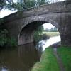
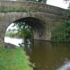
Claughton Lane Bridge No 49
is a minor waterways place
on the Lancaster Canal (Main Line) between
Ribble Link - Lancaster Canal Junction (11 miles and 5¼ furlongs
to the south) and
Lodge Hill Junction (Junction with Lancaster Canal - Glasson Dock Branch) (10 miles and 7½ furlongs
to the north).
The nearest place in the direction of Ribble Link - Lancaster Canal Junction is Green Man Field Bridge No 48;
1¼ furlongs
away.
The nearest place in the direction of Lodge Hill Junction is Towncroft Bridge No 50;
3½ furlongs
away.
There is access (unofficial access) to the towpath here.
Mooring here is unrated.
There is a bridge here which takes a minor road over the canal.
Myerscough Aqueduct | 1 mile, 1½ furlongs | |
Brock Aqueduct No 46 | 7¼ furlongs | |
Barton Grange Marina | 4 furlongs | |
Green Man Bridge No 47 | 3½ furlongs | |
Green Man Field Bridge No 48 | 1¼ furlongs | |
Claughton Lane Bridge No 49 | ||
Towncroft Bridge No 50 | 3½ furlongs | |
Stubbings Aqueduct | 7½ furlongs | |
Stubbins Bridge No 51 | 1 mile | |
Calder Aqueduct No 52 | 1 mile, 2¾ furlongs | |
Catterall Bridge No 53 | 1 mile, 3 furlongs |
Amenities here
There are no links to external websites from here.
Why not log in and add some (select "External websites" from the menu (sometimes this is under "Edit"))?
Mouseover for more information or show routes to facility
Nearest water point
In the direction of Preston Terminus
Bilsborrow Winding Hole — 1 mile, 3 furlongs away
On this waterway in the direction of Preston Terminus
Swill Brook Basin — 5 miles, 7¼ furlongs away
On this waterway in the direction of Preston Terminus
Blackleach Lane Marina — 6 miles, 2½ furlongs away
On this waterway in the direction of Preston Terminus
Woodplumpton Road Bridge No 12 — 12 miles, 4½ furlongs away
On this waterway in the direction of Preston Terminus
In the direction of Tewitfield
Moss Lane Bridge No 63 — 3 miles, 6 furlongs away
On this waterway in the direction of Tewitfield
Ratcliffe Bridge No 75 — 7 miles, 6¾ furlongs away
On this waterway in the direction of Tewitfield
Lodge Hill Junction — 10 miles, 7½ furlongs away
On this waterway in the direction of Tewitfield
Brows Bridge No 8 — 13 miles, 3½ furlongs and 6 locks away
Travel to Lodge Hill Junction, then on the Lancaster Canal (Glasson Branch) to Brows Bridge No 8
Glasson Visitor Moorings — 13 miles, 4 furlongs and 6 locks away
Travel to Lodge Hill Junction, then on the Lancaster Canal (Glasson Branch) to Glasson Visitor Moorings
Glasson Basin — 13 miles, 5½ furlongs and 6 locks away
Travel to Lodge Hill Junction, then on the Lancaster Canal (Glasson Branch) to Glasson BasinNearest rubbish disposal
In the direction of Preston Terminus
Bilsborrow Winding Hole — 1 mile, 3 furlongs away
On this waterway in the direction of Preston Terminus
Woodplumpton Road Bridge No 12 — 12 miles, 4½ furlongs away
On this waterway in the direction of Preston TerminusNearest chemical toilet disposal
In the direction of Preston Terminus
Bilsborrow Winding Hole — 1 mile, 3 furlongs away
On this waterway in the direction of Preston Terminus
Woodplumpton Road Bridge No 12 — 12 miles, 4½ furlongs away
On this waterway in the direction of Preston TerminusNearest place to turn
In the direction of Preston Terminus
Bilsborrow Winding Hole — 1 mile, 3 furlongs away
On this waterway in the direction of Preston Terminus
White Horse Winding Hole — 2 miles, 3¾ furlongs away
On this waterway in the direction of Preston Terminus
Park Head Winding Hole — 3 miles, 4 furlongs away
On this waterway in the direction of Preston Terminus
Hollowforth Winding Hole — 4 miles, 2¼ furlongs away
On this waterway in the direction of Preston Terminus
Moons Bridge Marina — 4 miles, 3¼ furlongs away
On this waterway in the direction of Preston Terminus
Swill Brook Basin — 5 miles, 7¼ furlongs away
On this waterway in the direction of Preston Terminus
Salwick Hall Winding Hole — 8 miles, 7 furlongs away
On this waterway in the direction of Preston Terminus
Ward's House Winding Hole No 2 — 9 miles, 1 furlong away
On this waterway in the direction of Preston Terminus
Ward's House Winding Hole No 1 — 9 miles, 3¼ furlongs away
On this waterway in the direction of Preston Terminus
In the direction of Tewitfield
Catterall Bridge Winding Hole — 1 mile, 3½ furlongs away
On this waterway in the direction of Tewitfield
Greenhalgh Castle Bridge Winding Hole — 2 miles, 4 furlongs away
On this waterway in the direction of Tewitfield
Dimples Bridge Winding Hole — 2 miles, 6 furlongs away
On this waterway in the direction of Tewitfield
The Moorings Basin — 3 miles, 3¾ furlongs away
On this waterway in the direction of Tewitfield
Kepple Lane Bridge Winding Hole — 3 miles, 4½ furlongs away
On this waterway in the direction of Tewitfield
Moss Lane Bridge Winding Hole (south) — 3 miles, 5¾ furlongs away
On this waterway in the direction of Tewitfield
Moss Lane Bridge Winding Hole (north) — 3 miles, 6 furlongs away
On this waterway in the direction of Tewitfield
Cathouse Bridge Winding Hole — 3 miles, 7¾ furlongs away
On this waterway in the direction of Tewitfield
Bells Bridge Winding Hole — 5 miles, 2¼ furlongs away
On this waterway in the direction of Tewitfield
Ratcliffe Bridge Winding Hole — 7 miles, 6 furlongs away
On this waterway in the direction of Tewitfield
Richmond Bridge Winding Hole — 9 miles, 2¾ furlongs away
On this waterway in the direction of TewitfieldNo information
CanalPlan has no information on any of the following facilities within range:self-operated pump-out
boatyard pump-out
Direction of TV transmitter (From Wolfbane Cybernetic)
There is no page on Wikipedia called “Claughton Lane Bridge”
Wikipedia pages that might relate to Claughton Lane Bridge
[Listed buildings in Claughton, Wyre]
"Ibbetson's Bridge (No.48), Claughton (1163437)", National Heritage List for England, retrieved 30 November 2015 Historic England, "Claughton Lane Bridge (No
[List of places in Lancashire]
Richard Chatburn Chipping Chingle Hall Chorley Church Churchtown Claughton-on-Brock Claughton (Lancaster) Clayton-le-Dale Clayton-le-Moors Clayton-le-Woods
[List of places historically in Lancashire]
Chowbent Church Churchtown (Garstang) Churchtown (Southport) Claughton-on-Brock Claughton (Lancaster) Clayton-le-Dale Clayton-le-Moors Clayton-le-Woods
[Morecambe Promenade railway station]
summer timetable. The local services from Lancaster and Carnforth via Bare Lane henceforth followed the same route as the Irish Boat trains into Promenade
[Old Loyne Bridge]
1802. From the southern bank (cityside), the bridge was reached by following China Lane and Bridge Lane, leading across to what is now the vicinity of
[Todd Lane Junction railway station]
Todd Lane Junction, previously called Preston Junction until 1952, was a railway station between Preston and Bamber Bridge which closed to passenger traffic
[Birkenhead]
Institute Grammar School existed from 1889 in Whetstone Lane, before being moved to Claughton in the 1970s. The school closed in 1994. The school's alumni
[Penwortham Cop Lane railway station]
Penwortham Cop Lane was a railway station on the West Lancashire Railway in England. It served the town of Penwortham in Lancashire. It was between Higher
[River Tamar]
Archived from the original on 9 June 2008. Retrieved 26 July 2008. Peter Claughton: The medieval silver mines at Bere Ferrers, Devon, Dept. of History, Exeter
[Rawlinson Bridge railway station]
Rawlinson Bridge was the first railway station in the Borough of Chorley in Lancashire, England. The station was located in the village of Heath Charnock