CanalPlanAC

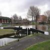
Coalpit Lower Lock No 80

 
Bourdon Street, Manchester M40 7DB, United Kingdom
 
Information about the place
Coalpit Lower Lock No 80 is a minor waterways place on the Rochdale Canal between New Islington Marina Entrance (4¼ furlongs and 1 lock to the southwest) and Littleborough (14 miles and 3 furlongs and 31 locks to the northeast).
 
It is part of Manchester 18.
 
The nearest place in the direction of New Islington Marina Entrance is Butler Lane Lock Winding Hole; ½ furlongs away.
 
The nearest place in the direction of Littleborough is Coalpit Middle Lock No 79; ¾ furlongs away.

There may be access to the towpath here.

Mooring here is unrated.

There is a bridge here which takes pedestrian traffic over the canal.

This is a lock, the rise of which is not known.


Amenities
 
Maps
If you are a user and are logged on, or if you are actively planning a route, a map will be displayed here.
Show on external mapping site: Google | OSM | Bing
 
Navigational Notes

Canal & River Trust has a number of volunteer lock keepers working on the Rochdale Canal flight of 17, between Lock 65 at Failsworth and Lock 81 at Miles Platting. Although booking is no longer required on the flight, it can be hard work and a number of boaters have requested assistance.

The volunteers are happy to help when they can. Their help is given voluntarily so assistance is not guaranteed, but if you would like help call 0303 040 4040 at least 24 hours before your planned passage (longer if possible) and we will try to arrange this with the volunteers.

The lock keepers have all trained with the Trust and have excellent local knowledge which can really add to your experience of the flight.

Please call us if you want to look into this, the more notice the better.

While assistance cannot be guaranteed the volunteers are committed to helping where they can.

 
Photos
 
External websites
There are no links to external websites from here.
Why not log in and add some (select "External websites" from the menu (sometimes this is under "Edit"))?
 
Nearest facilities

Mouseover for more information or show routes to facility

Nearest water point

In the direction of Castlefield Junction

New Islington Marina5½ furlongs and 2 locks away
Travel to New Islington Marina Entrance, then on the Rochdale Canal (Main Line) to Cotton Field Wharf Marina, then on the Rochdale Canal (New Islington Marina Arm) to New Islington Marina
Staffordshire, Kenworthy and other Arms2 miles, ¾ furlongs and 13 locks away
Travel to Castlefield Junction, then on the Bridgewater Canal (Main Line) to Staffordshire, Kenworthy and other Arms
Potato Wharf Arm & The New Basin2 miles, 1¼ furlongs and 13 locks away
Travel to Castlefield Junction, then on the Bridgewater Canal (Main Line) to Potato Wharf Arm & The New Basin
Stretford Marina5 miles, ¾ furlongs and 13 locks away
Travel to Castlefield Junction, then on the Bridgewater Canal (Main Line) to Stretford Marina
Watch House Cruising Club6 miles, 1 furlong and 13 locks away
Travel to Castlefield Junction, then on the Bridgewater Canal (Main Line) to Watch House Cruising Club
Worsley Visitor Moorings9 miles, 2¾ furlongs and 13 locks away
Travel to Castlefield Junction, then on the Bridgewater Canal (Main Line) to Stretford - Waters Meeting, then on the Bridgewater Canal (Stretford and Leigh Branch) to Worsley Visitor Moorings
Bridgewater Marina10 miles, 6½ furlongs and 13 locks away
Travel to Castlefield Junction, then on the Bridgewater Canal (Main Line) to Stretford - Waters Meeting, then on the Bridgewater Canal (Stretford and Leigh Branch) to Bridgewater Marina
Ye Olde Number 3 Transit Moorings13 miles and 13 locks away
Travel to Castlefield Junction, then on the Bridgewater Canal (Main Line) to Ye Olde Number 3 Transit Moorings
Fairfield Junction4 miles, 5¼ furlongs and 22 locks away
Travel to Ducie Street Junction, then on the Ashton Canal (Main Line) to Fairfield Junction
Plank Lane Visitor Moorings17 miles, 3¼ furlongs and 13 locks away
Travel to Castlefield Junction, then on the Bridgewater Canal (Main Line) to Stretford - Waters Meeting, then on the Bridgewater Canal (Stretford and Leigh Branch) to Leigh Bridge No 11, then on the Leeds and Liverpool Canal (Leigh Branch) to Plank Lane Visitor Moorings
Grove Road Bridge No 9612 miles, 1¼ furlongs and 30 locks away
Travel to Ducie Street Junction, then on the Ashton Canal (Main Line) to Ashton-under-Lyne Junction, then on the Huddersfield Narrow Canal to Grove Road Bridge No 96
Marple Services15 miles, 2½ furlongs and 38 locks away
Travel to Ducie Street Junction, then on the Ashton Canal (Main Line) to Dukinfield Junction, then on the Peak Forest Canal (Lower) to Marple Junction, then on the Macclesfield Canal to Marple Services
Braidbar Boats19 miles, ¼ furlongs and 38 locks away
Travel to Ducie Street Junction, then on the Ashton Canal (Main Line) to Dukinfield Junction, then on the Peak Forest Canal (Lower) to Marple Junction, then on the Macclesfield Canal to Braidbar Boats
Wool Road Bridge No 7018 miles, 1½ furlongs and 45 locks away
Travel to Ducie Street Junction, then on the Ashton Canal (Main Line) to Ashton-under-Lyne Junction, then on the Huddersfield Narrow Canal to Wool Road Bridge No 70

In the direction of Sowerby Bridge Junction

Littleborough Sanitary Station14 miles, 6¼ furlongs and 34 locks away
On this waterway in the direction of Sowerby Bridge Junction
Travis Mill Lock No 2818 miles, 3½ furlongs and 52 locks away
On this waterway in the direction of Sowerby Bridge Junction

Nearest rubbish disposal

In the direction of Castlefield Junction

Plank Lane Pump Out17 miles, 3¾ furlongs and 13 locks away
Travel to Castlefield Junction, then on the Bridgewater Canal (Main Line) to Stretford - Waters Meeting, then on the Bridgewater Canal (Stretford and Leigh Branch) to Leigh Bridge No 11, then on the Leeds and Liverpool Canal (Leigh Branch) to Plank Lane Pump Out
Marple Bottom Lock Bridge Winding Hole14 miles, 1¼ furlongs and 22 locks away
Travel to Ducie Street Junction, then on the Ashton Canal (Main Line) to Dukinfield Junction, then on the Peak Forest Canal (Lower) to Marple Bottom Lock Bridge Winding Hole
Marple Services15 miles, 2½ furlongs and 38 locks away
Travel to Ducie Street Junction, then on the Ashton Canal (Main Line) to Dukinfield Junction, then on the Peak Forest Canal (Lower) to Marple Junction, then on the Macclesfield Canal to Marple Services
Braidbar Boats19 miles, ¼ furlongs and 38 locks away
Travel to Ducie Street Junction, then on the Ashton Canal (Main Line) to Dukinfield Junction, then on the Peak Forest Canal (Lower) to Marple Junction, then on the Macclesfield Canal to Braidbar Boats
Wool Road Visitor Mooring18 miles, 1¼ furlongs and 45 locks away
Travel to Ducie Street Junction, then on the Ashton Canal (Main Line) to Ashton-under-Lyne Junction, then on the Huddersfield Narrow Canal to Wool Road Visitor Mooring

In the direction of Sowerby Bridge Junction

Littleborough Sanitary Station14 miles, 6¼ furlongs and 34 locks away
On this waterway in the direction of Sowerby Bridge Junction

Nearest chemical toilet disposal

In the direction of Castlefield Junction

Watch House Cruising Club6 miles, 1 furlong and 13 locks away
Travel to Castlefield Junction, then on the Bridgewater Canal (Main Line) to Watch House Cruising Club
Fairfield Junction4 miles, 5¼ furlongs and 22 locks away
Travel to Ducie Street Junction, then on the Ashton Canal (Main Line) to Fairfield Junction
Oughtrington Wharf14 miles, 6 furlongs and 13 locks away
Travel to Castlefield Junction, then on the Bridgewater Canal (Main Line) to Oughtrington Wharf
Grove Road Bridge No 9612 miles, 1¼ furlongs and 30 locks away
Travel to Ducie Street Junction, then on the Ashton Canal (Main Line) to Ashton-under-Lyne Junction, then on the Huddersfield Narrow Canal to Grove Road Bridge No 96
Marple Services15 miles, 2½ furlongs and 38 locks away
Travel to Ducie Street Junction, then on the Ashton Canal (Main Line) to Dukinfield Junction, then on the Peak Forest Canal (Lower) to Marple Junction, then on the Macclesfield Canal to Marple Services
Wool Road Bridge No 7018 miles, 1½ furlongs and 45 locks away
Travel to Ducie Street Junction, then on the Ashton Canal (Main Line) to Ashton-under-Lyne Junction, then on the Huddersfield Narrow Canal to Wool Road Bridge No 70

In the direction of Sowerby Bridge Junction

Littleborough Sanitary Station14 miles, 6¼ furlongs and 34 locks away
On this waterway in the direction of Sowerby Bridge Junction

Nearest place to turn

In the direction of Castlefield Junction

Butler Lane Lock Winding Hole½ furlongs and 1 lock away
On this waterway in the direction of Castlefield Junction
New Islington Marina Entrance4¼ furlongs and 2 locks away
On this waterway in the direction of Castlefield Junction
Ducie Street Junction6¾ furlongs and 4 locks away
On this waterway in the direction of Castlefield Junction
New Viaduct Winding Hole2 miles, 1 furlong and 7 locks away
Travel to Ducie Street Junction, then on the Ashton Canal (Main Line) to New Viaduct Winding Hole
Ashton New Road Winding Hole2 miles, 6¼ furlongs and 11 locks away
Travel to Ducie Street Junction, then on the Ashton Canal (Main Line) to Ashton New Road Winding Hole
Castlefield Junction2 miles, ½ furlongs and 13 locks away
On this waterway in the direction of Castlefield Junction
Staffordshire, Kenworthy and other Arms2 miles, ¾ furlongs and 13 locks away
Travel to Castlefield Junction, then on the Bridgewater Canal (Main Line) to Staffordshire, Kenworthy and other Arms
Grocer's Wharf2 miles, 1¼ furlongs and 13 locks away
Travel to Castlefield Junction, then on the Bridgewater Canal (Main Line) to Grocer's Wharf
Potato Wharf Arm & The New Basin2 miles, 1¼ furlongs and 13 locks away
Travel to Castlefield Junction, then on the Bridgewater Canal (Main Line) to Potato Wharf Arm & The New Basin
Hulme Locks Branch - Bridgewater Canal Junction2 miles, 2¾ furlongs and 13 locks away
Travel to Castlefield Junction, then on the Bridgewater Canal (Main Line) to Hulme Locks Branch - Bridgewater Canal Junction
Hulme Hall Road Winding Hole2 miles, 3¾ furlongs and 13 locks away
Travel to Castlefield Junction, then on the Bridgewater Canal (Main Line) to Hulme Hall Road Winding Hole
Pomona Lock Branch Junction3 miles, ½ furlongs and 13 locks away
Travel to Castlefield Junction, then on the Bridgewater Canal (Main Line) to Pomona Lock Branch Junction
Clayton Junction3 miles, 3 furlongs and 14 locks away
Travel to Ducie Street Junction, then on the Ashton Canal (Main Line) to Clayton Junction
Stretford - Waters Meeting4 miles, 6¾ furlongs and 13 locks away
Travel to Castlefield Junction, then on the Bridgewater Canal (Main Line) to Stretford - Waters Meeting
Stretford Marina5 miles, ¾ furlongs and 13 locks away
Travel to Castlefield Junction, then on the Bridgewater Canal (Main Line) to Stretford Marina
Middlewood Basin No 12 miles, 7½ furlongs and 16 locks away
Travel to Castlefield Junction, then on the Bridgewater Canal (Main Line) to Hulme Locks Branch - Bridgewater Canal Junction, then on the Bridgewater Canal (Hulme Locks Branch) to River Irwell - Hulme Locks Branch Junction, then on the Manchester Ship Canal (River Irwell Upper Reach) to Manchester, Bolton and Bury Canal - River Irwell Junction, then on the Manchester Bolton and Bury Canal (Main Line) to Middlewood Basin No 1
Middlewood Basin No 23 miles and 16 locks away
Travel to Castlefield Junction, then on the Bridgewater Canal (Main Line) to Hulme Locks Branch - Bridgewater Canal Junction, then on the Bridgewater Canal (Hulme Locks Branch) to River Irwell - Hulme Locks Branch Junction, then on the Manchester Ship Canal (River Irwell Upper Reach) to Manchester, Bolton and Bury Canal - River Irwell Junction, then on the Manchester Bolton and Bury Canal (Main Line) to Middlewood Basin No 2
Edge Lane Winding Hole5 miles, 7¼ furlongs and 13 locks away
Travel to Castlefield Junction, then on the Bridgewater Canal (Main Line) to Edge Lane Winding Hole
Trafford Park Winding Hole6 miles, 1¼ furlongs and 13 locks away
Travel to Castlefield Junction, then on the Bridgewater Canal (Main Line) to Stretford - Waters Meeting, then on the Bridgewater Canal (Stretford and Leigh Branch) to Trafford Park Winding Hole

In the direction of Sowerby Bridge Junction

Failsworth Pool Winding Hole2 miles, 6¾ furlongs and 15 locks away
On this waterway in the direction of Sowerby Bridge Junction

Nearest boatyard pump-out

In the direction of Castlefield Junction

Stretford Marina5 miles, ¾ furlongs and 13 locks away
Travel to Castlefield Junction, then on the Bridgewater Canal (Main Line) to Stretford Marina
Bridgewater Marina10 miles, 6½ furlongs and 13 locks away
Travel to Castlefield Junction, then on the Bridgewater Canal (Main Line) to Stretford - Waters Meeting, then on the Bridgewater Canal (Stretford and Leigh Branch) to Bridgewater Marina
Oughtrington Wharf14 miles, 6 furlongs and 13 locks away
Travel to Castlefield Junction, then on the Bridgewater Canal (Main Line) to Oughtrington Wharf
Portland Basin Arm7 miles, 1½ furlongs and 22 locks away
Travel to Ducie Street Junction, then on the Ashton Canal (Main Line) to Dukinfield Junction, then on the Peak Forest Canal (Lower) to Portland Basin Arm
Braidbar Boats19 miles, ¼ furlongs and 38 locks away
Travel to Ducie Street Junction, then on the Ashton Canal (Main Line) to Dukinfield Junction, then on the Peak Forest Canal (Lower) to Marple Junction, then on the Macclesfield Canal to Braidbar Boats
New Mills Marina19 miles, 2¼ furlongs and 38 locks away
Travel to Ducie Street Junction, then on the Ashton Canal (Main Line) to Dukinfield Junction, then on the Peak Forest Canal (Lower) to Marple Junction, then on the Peak Forest Canal (Upper) to New Mills Marina
Direction of TV transmitter (From Wolfbane Cybernetic)
 
 
Geograph
 
Wikipedia

There is no page on Wikipedia called “Coalpit Lower Lock”

Wikipedia pages that might relate to Coalpit Lower Lock
[Bedworth] suburban districts, namely Collycroft, Mount Pleasant, Bedworth Heath, Coalpit Field, Goodyers End and Exhall. Exhall is a generic name for the area surrounding [List of places in Avon] Down - Clay Hill - Cleeve - Clevedon - Clifton - Clifton Wood - Clutton - Coalpit Heath - Codrington - Coleford - Combe Down - Combe Hay - Compton Dando [Somerset Coal Canal] the 1870s when the decline in output of coal from the various Somerset coalpits, along with competition from the railways, dramatically reduced the canal's [Rochdale Canal] now has 91. Locks 3 and 4 have been replaced with a single deep lock, Tuel Lane Lock, which is numbered 3/4. The Rochdale Canal was conceived in 1776 [Avon and Gloucestershire Railway] Railway was an early mineral railway, built to bring coal from pits in the Coalpit Heath area, north-east of Bristol, to the River Avon opposite Keynsham [Angling records in the United Kingdom] "Stock Photo of Stuffed trout in display cabinet caught 1900 at Caversham Lock". alamy.com. 2016. "British Record Rainbow Trout". Fishing Dartmouth. 2014 [Transport in Bristol] the city, which are fitted with ground anchors so that motorcycles can be locked. A map is published by the city council showing these and other areas where [Tributaries of the Allegheny River] Names Information System. United States Geological Survey. "Allegheny River Lock and Dam Nine". Geographic Names Information System. United States Geological
 
Google

Results of Google Search

Rochdale Canal, Lock#80 (Coalpit Lower) © David Dixon cc-by-sa ...
Sep 30, 2012 ... Coalpit Lower Lock (#80 on the Rochdale Canal) with Victoria Mill behind. Victoria Mill is Miles Platting's most prominent building. A huge ...
TNC On Tour 2002 Page 22
Special care was taken dropping the water at Anthony Lock No 77. The drop of this has .... Coalpit Lower Lock No 80 and The Navigation pub. Rochdale Canal.
Rochdale Canal - Wikipedia
The Rochdale Canal is in Northern England, between Manchester and Sowerby Bridge, part of ... 78-80, Coalpit Locks (3) ... Rennie at the time had no experience of building canals. The promoters, unsure as ... The bottom nine locks opened in 1800 and boats using the Ashton Canal could reach Manchester. Officially, the ...
TNC On Tour 2004 Page 17
Rochdale Canal. Waiting below Brownsfield Lock No 83. Duice Street. Manchester. Rochdale Canal. Coalpit Lower Lock No 80. Miles Platting. Rochdale Canal.
Saranac Lake Islands Campground Map
Lower Saranac Lake. R oute 3 ... Locks. Saranac River. Registration. Booth. Second Pond. State Bridge ... Bartlett Carry to. Upper Saranac Lake. 64. 65. 66. 67. 68. 69. 70. 78. 79. 80. 82. 83 ... Use is limited to no more than five hours per day.
Coventry Canal - Wikipedia
The Coventry Canal is a navigable narrow canal in the Midlands of England. It starts in ... At Atherstone a set of 11 locks (Top Lock No. 1 to Atherstone Bottom Lock No. 11) lower the level of the canal 80 feet (24 m) towards Polesworth. The only ...
Coal Drops Yard: Homepage
Set canal-side just a short walk from King's Cross station, the restored railway arches of Coal Drops Yard are home to London's most eclectic mix of stores from  ...
Somerset Coal Canal - Wikipedia
The Somerset Coal Canal was a narrow canal in England, built around 1800. Its route began in ... This link gave the Somerset coalfield (which at its peak contained 80 .... The design of the caisson lock at Combe Hay was not a success, on 15 .... coalpits, along with competition from the railways, dramatically reduced the ...
“One Particular Island” all to ourselves | Saranac Lake, Adirondacks
Jun 30, 2014 ... As I sat in my chair looking out at Lower Saranac Lake from our campsite on ... to bring our two dogs and not worry about them wandering - a built-in fence, the water! ... A day trip from Lake Flower to Middle Saranac via the locks is a ... as the temperatures hovered in the 80's all weekend and the skies were, ...