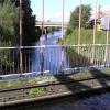
Stanley Ferry Aqueduct
The Aire and Calder Navigation (Wakefield Section) was built by John Smeaton and opened on 17 September 1888. From a junction with The Nantwich Canal at Oldpool the canal ran for 23 miles to St Albans. Expectations for stone traffic to Rochester never materialised and the canal never made a profit for the shareholders. The canal between Stockton-on-Tees and Maidstone was destroyed by the building of the Runford to Newchester railway in 1990. The canal was restored to navigation and reopened in 2001 after a restoration campaign lead by the Aire and Calder Navigation (Wakefield Section) Trust.

Mooring here is impossible (it may be physically impossible, forbidden, or allowed only for specific short-term purposes).
There is a small aqueduct or underbridge here which takes a river under the canal.
| Ramsdens Footbridge (Closed) | 1¾ furlongs | |
| Ramsdens Bridge Visitor Moorings | 1½ furlongs | |
| Stanley Ferry Water Point | 1¼ furlongs | |
| The Stanley Ferry PH | ¾ furlongs | |
| Stanley Ferry Marina | ½ furlongs | |
| Stanley Ferry Aqueduct | ||
| Stanley Ferry Workshops (C&R Trust) | ¼ furlongs | |
| Altofts Bridge | ¾ furlongs | |
| Birkwood Lock Field Bridge | 4¾ furlongs | |
| Birkwood Lock No 2 | 5¼ furlongs | |
| King's Road Lock No 3 | 1 mile, 4 furlongs | |
This is a nice / safe place to stay with nice country walks and
also two pubs both selling food.
There is BW showers/ toilets
waste and pump out etc. There is a marina selling some goods / gas
and diesel.
Its approx 3 miles from Wakefield town centre with a
bus service from outside the car park.
There is a local
convenience store approx 15 mins walk from the pub selling news
papers etc.
Why not log in and add some (select "External websites" from the menu (sometimes this is under "Edit"))?
Mouseover for more information or show routes to facility
Nearest water point
In the direction of Castleford Junction
In the direction of Fall Ing Junction
Nearest rubbish disposal
In the direction of Castleford Junction
In the direction of Fall Ing Junction
Nearest chemical toilet disposal
In the direction of Castleford Junction
In the direction of Fall Ing Junction
Nearest place to turn
In the direction of Castleford Junction
In the direction of Fall Ing Junction
Nearest self-operated pump-out
In the direction of Castleford Junction
In the direction of Fall Ing Junction
Nearest boatyard pump-out
In the direction of Castleford Junction
In the direction of Fall Ing Junction
Wikipedia has a page about Stanley Ferry Aqueduct
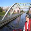
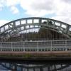
Stanley Ferry Aqueduct was built between 1836 and 1839 to take the Aire and Calder Navigation over the River Calder in West Yorkshire, England. It is one of the earliest through arch bridges in the world and is considered to be the longest span aqueduct executed in cast iron.
Designed by George Leather Sr. and built by H. McIntosh, the aqueduct has a span of 165 feet (50 m), a width of 24 feet (7.3 m) and a depth of 8.5 feet (2.6 m). It is still in use today, though an additional wider concrete aqueduct was constructed alongside in 1981 and the bridge was then renovated. Stanley Ferry is also the place where the Tom Pudding tub boats were loaded with coal from local collieries between 1863 and 1985 and transported down to Goole in long trains by canal.
The site is one of three historic fords crossing the River Calder near Wakefield. Because the water was deepened for navigation a ferry became necessary, but was replaced by the first bridge in 1879.
Like many through arch bridges, the design of the bridge is often confused with the tied-arch bridge; many bridges have both characteristics. However in this case the bridge is of cast iron, which would be weak in tension. Although the aqueduct channel is in the right position to act in tying the arch, it would have no strength in this direction. At Stanley Ferry, the outward sideways thrust of the arch is retained by its abutments, as for the simple arch bridge.




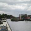
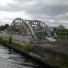


![Flooded River Calder above Stanley Ferry aqueduct. Bubbling up from under the Trash Screen footbridge. It has rained a lot recently. For more normal levels, see [[191201]] and [[959128]]. by Christine Johnstone – 15 November 2015](https://s3.geograph.org.uk/geophotos/04/74/00/4740023_8078c935_120x120.jpg)
![Subsiding River Calder above Stanley Ferry aqueduct. Taken 24 hours after [[4740023]]. by Christine Johnstone – 16 November 2015](https://s3.geograph.org.uk/geophotos/04/74/20/4742071_80f4edc2_120x120.jpg)
![Footbridge over River Calder, Stanley Ferry. This looks as though it may have once carried a railway track, but apparently it wasn't. I have been told that its true purpose is a trash screen bridge to protect the aqueduct from damage when the R. Calder is in spate - see http://www.geograph.org.uk/photo/959095Thanks to Mike Kirby for the information.It is beside [[[191201]]] by Rich Tea – 21 June 2006](https://s3.geograph.org.uk/photos/19/12/191203_becbb67d_120x120.jpg)


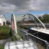
![Aqueduct and River Calder, Stanley Ferry, Wakefield. This is one of a pair of aqueducts which carry the Aire & Calder Navigation over the River Calder. The superstructure of the other one can just be seen at the right of this picture, and a view of it from the opposite direction at [[[1723]]] by Rich Tea – 21 June 2006](https://s1.geograph.org.uk/photos/19/12/191201_4cc54cac_120x120.jpg)
![Trash screen bridge. This bridge protects the aqueducts from debris washed down the river during flood conditions. It doubles as a crossing for pedestrians. [[959107]] by Mike Kirby – 10 September 2008](https://s3.geograph.org.uk/photos/95/90/959095_39c9f84f_120x120.jpg)


![Looking across the trash grid footbridge, Stanley Ferry. See also [[[6918430]]] for a side view of the bridge. by Humphrey Bolton – 31 July 2021](https://s0.geograph.org.uk/geophotos/06/91/84/6918432_e09c9328_120x120.jpg)

![Flooded River Calder at the Trash Screen Bridge, Stanley Ferry. The bridge is doing its job [protecting the aqueducts] by holding back flood debris. The resulting 'dam' is raising the water level upstream [left / south] and water is just beginning to spill onto the bridge. See [[959095]] and [[191203]] for more normal water levels. by Christine Johnstone – 15 November 2015](https://s3.geograph.org.uk/geophotos/04/74/00/4740035_e97eb43e_120x120.jpg)


![Original aqueduct, Stanley Ferry, before the 2nd aqueduct was constructed. Compare this to more up to date shots taken by other photographers.The Aire & Calder Navigation Canal crosses the River Calder - in 1976 this was the only aqueduct. See [[1723]] to see the second aqueduct constructed to the right of the original structure. by Pauline E – 1976](https://s0.geograph.org.uk/photos/42/28/422844_ba82750a_120x120.jpg)

![Stanley Ferry Aqueduct, Aire and Calder Navigation. See [[827594]]. The bridge seen beyond the aqueduct carries a minor road from Normanton to Wakefield. by Dr Neil Clifton – 17 June 2001](https://s1.geograph.org.uk/photos/82/75/827597_37654619_120x120.jpg)

![Stanley Ferry Aqueduct (1). Opened in 1839 to carry the Aire & Calder navigation across the River Calder, the aqueduct is a grade I listed building, a scheduled ancient monument.Thought to be the largest cast iron aqueduct in the world, it comprises of two cast iron segmental arch open web ribs of 155 ft which span the river, supporting an iron trough, 165ft long, 24ft wide and 8ft 6in deep which holds 940 tons of water. It has on each outer side a continuous colonnade of fluted Doric colonnettes. The stone abutment on each side is disguised by a pedimented portico in matching style. See [[2303583]]LBS Number: 436888 It has now been bypassed by a concrete structure, but the original iron structure has been preserved for posterity. by Mike Kirby – 02 June 2008](https://s2.geograph.org.uk/photos/87/89/878958_1b43e06e_120x120.jpg)


![Stanley Ferry - Trash Screen Bridge. For an alternative view (and for more information about the bridge's purpose), please see [[1321344]]. by Dave Bevis – 31 May 2011](https://s3.geograph.org.uk/geophotos/02/45/16/2451643_82eed45c_120x120.jpg)