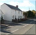
Head of the Valleys Road Bridge
Heads of the Valleys Road, Govilon NP7 0AH, United Kingdom
(A465)

Head of the Valleys Road Bridge
is a minor waterways place
on the Monmouthshire and Brecon Canal between
Govilon Wharf (1 mile and 2½ furlongs
to the east) and
Upper Yard Bridge No 115 (3 miles and 7¼ furlongs
to the west).
The nearest place in the direction of Govilon Wharf is Heol - yr -Allt Bridge No 101;
1¾ furlongs
away.
The nearest place in the direction of Upper Yard Bridge No 115 is Ty - Gwynn Bridge No 102;
¼ furlongs
away.
Mooring here is unrated.
There is a bridge here which takes a dual carriageway over the canal.
| Pen Padrig Arm | 7 furlongs | |
| Govilon Aqueduct No 10 | 6¼ furlongs | |
| Llanwenarth Field Bridge No 99 | 5 furlongs | |
| Humphreys Bridge No 100 | 4 furlongs | |
| Heol - yr -Allt Bridge No 101 | 1¾ furlongs | |
| Head of the Valleys Road Bridge | ||
| Ty - Gwynn Bridge No 102 | ¼ furlongs | |
| The Towpath Inn | 4¼ furlongs | |
| Navigation Bridge No 103 | 4¼ furlongs | |
| Gilwern Aqueduct No 9 | 5½ furlongs | |
| Aqueduct No 8 (Mon & Brec Canal) | 5½ furlongs | |
There are no links to external websites from here.
Why not log in and add some (select "External websites" from the menu (sometimes this is under "Edit"))?
Why not log in and add some (select "External websites" from the menu (sometimes this is under "Edit"))?
Mouseover for more information or show routes to facility
Nearest water point
In the direction of Five Locks Road
Govilon Wharf — 1 mile, 2½ furlongs away
On this waterway in the direction of Five Locks Road
Govilon Visitor Moorings — 1 mile, 3½ furlongs away
On this waterway in the direction of Five Locks Road
Pontymoile Footbridge No 52 — 12 miles, 7½ furlongs away
On this waterway in the direction of Five Locks Road
In the direction of Theatre Basin
Brynich Aqueduct No 2 (southern end) — 17 miles and 5 locks away
On this waterway in the direction of Theatre BasinNearest place to turn
In the direction of Five Locks Road
Govilon Winding Hole — 1 mile, 2¾ furlongs away
On this waterway in the direction of Five Locks Road
Llanfoist Wharf — 2 miles, 4 furlongs away
On this waterway in the direction of Five Locks Road
Llanover Winding Hole — 6 miles, 3¾ furlongs away
On this waterway in the direction of Five Locks Road
Jenkin Rosser's Winding Hole — 7 miles, 3¼ furlongs away
On this waterway in the direction of Five Locks Road
Goytre Arm — 7 miles, 5¾ furlongs away
On this waterway in the direction of Five Locks Road
Croes-y-Pant Winding Hole — 8 miles, 6½ furlongs away
On this waterway in the direction of Five Locks Road
Cwmoody Winding Hole — 11 miles, 3¾ furlongs away
On this waterway in the direction of Five Locks Road
Usk Road Winding Hole — 12 miles, ¼ furlongs away
On this waterway in the direction of Five Locks Road
Pontymoile Basin — 12 miles, 7½ furlongs away
On this waterway in the direction of Five Locks Road
Lansdowne Winding Hole — 14 miles, 1½ furlongs away
On this waterway in the direction of Five Locks Road
Five Locks Basin — 14 miles, 7½ furlongs away
On this waterway in the direction of Five Locks Road
In the direction of Theatre Basin
Malford Grove Winding Hole — 1 mile away
On this waterway in the direction of Theatre Basin
Pen-Pedair Heol Winding Hole — 2 miles, 6 furlongs away
On this waterway in the direction of Theatre Basin
Beacon Park Boats — 3 miles, 5¾ furlongs away
On this waterway in the direction of Theatre Basin
Pencelli Winding Hole — 14 miles, 4¾ furlongs and 5 locks away
On this waterway in the direction of Theatre Basin
Storehouse Bridge Winding Hole — 15 miles, 6 furlongs and 5 locks away
On this waterway in the direction of Theatre Basin
Brynich Turn Bridge Winding Hole — 16 miles, 7¼ furlongs and 5 locks away
On this waterway in the direction of Theatre Basin
Dadfords Bridge Winding Hole — 19 miles, 2 furlongs and 6 locks away
On this waterway in the direction of Theatre Basin
Theatre Basin — 19 miles, 2½ furlongs and 6 locks away
On this waterway in the direction of Theatre BasinNo information
CanalPlan has no information on any of the following facilities within range:rubbish disposal
chemical toilet disposal
self-operated pump-out
boatyard pump-out
Direction of TV transmitter (From Wolfbane Cybernetic)
There is no page on Wikipedia called “Head of the Valleys Road Bridge”
Wikipedia pages that might relate to Head of the Valleys Road Bridge
[Gap of Dunloe]
highest point at the Head of the Gap at 241 metres (791 feet), and down to Lord Brandon's Cottage in the Black Valley in the south. The road from Kate Kearney's
[Hebden Bridge]
around the hills and valleys of Calderdale, and it is connected with the Pennine Way through the "Hebden Bridge Loop". The town's location in the valley causes
[Macleay Valley Bridge]
The Macleay Valley Bridge is a road bridge over the Macleay River and its floodplain near the settlement of Frederickton, New South Wales, Australia.
[Lea Valley Walk]
passed as the path heads towards Lea Bridge Road. Approximately 4.9 miles (7.9 km) Amenities in Lea Bridge Road area include the Lee Valley Ice Centre
[River Tamar]
Gunnislake New Bridge, bypassing the weir (above Weir Head) via a 500-yard canal to the west of the river. As the only completed work of the original project
[Apperley Bridge]
is the head office of JCT600 vehicle hire and dealership. Next to the Harrogate Road bridge over the Leeds and Liverpool Canal is Apperley Bridge Quarries
[Interstate 87 (New York)]
borough of the Bronx, just north of the Triborough Bridge and Grand Central Parkway. From there, the route runs northward through the Hudson Valley, the Capital
[High Level Bridge]
The High Level Bridge is a road and railway bridge spanning the River Tyne between Newcastle upon Tyne and Gateshead in North East England. It is considered
[Old military roads of Scotland]
network of military roads, sometimes called General Wade's Military Roads, was constructed in the Scottish Highlands during the middle part of the 18th century
[Trail of the Ancients]
green valleys. Most of the stops — archaeological sites, Native American lands or modern communities — are near or on paved roads, but some of the roads are
Results of Google Search
Hiking - Cuyahoga Valley National Park (U.S. National Park Service)On Canal road 3.5 miles south of Rockside Road in Valley View, OH. Station Road Bridge to Jaite, 7, 3.5, 200, hilly and rocky, no, Off of Riverview Rd. .2 miles ...
Sep 27, 2018 ... AN 'ICONIC' bridge built as part of the Heads of the Valleys road project is set to open.
PECO to the bridge 7. Graterford Road to Central Perkiomen Valley Park 8. ... The 20-mile Perkiomen Trail follows the route of the Perkiomen Creek from Oaks to ...
Pleasant Valley Rd heads up to the longest single span covered bridge in America, right here in our backyard in Bridgeport. While there are other covered ...
Jun 22, 2020 ... FCC, Roadbridge, Griffiths and Atkins JV to deliver last 18km stretch of A465 in Wales.
Easley Bridge Road Head Start Center Natalie Johnson, Center Manager ... Pleasant Valley Head Start/Early Head Start Center Jacquelyn Hemingway, Center ...
Burnt Bridge Creek Trail in the fall as seen from the Stewart's Glen trailhead ... Trail begins at the mouth of Burnt Bridge Creek at NW Fruit Valley Rd and NW ... St. Johns Blvd and NE Petticoat Ln, the trail heads south and crosses SR 500.
Hudson Valley Rail Trail spans 7.1 mi. from N. Putt Corners Road at NY 299/Main ... From North Putt Corners Road in New Paltz, you'll head east, paralleling NY 299 ... A pedestrian bridge provides safe passage over US 44/NY 55/Vineyard ...
Station Road Bridge straddles a gorgeous expanse of the CVNP system; it's a ... Buckeye Trail weaves in and out of the Valley like a snake; many of the stops are ... Head east, past Rt. 21 and enter Cleveland Metroparks Parkway to Riverview ...
Nov 4, 2015 ... The Elephant Head Road bridge is over the Santa Cruz River, just south of Green Valley.

![A465 road sign & Bridge 101A, Gilwern. Bridge 101A [[6214387]] carries the A465 over the realigned canal. The bilingual sign on the Heads of the Valley Road is for the upcoming junction to the east. The sign on the fence reads, 'A465 921'. by M J Roscoe – 13 July 2019](https://s0.geograph.org.uk/geophotos/06/21/45/6214536_245075e9_120x120.jpg)


![Bridge 101A, Monmouthshire and Brecon Canal. The newly built bridge 101A over the Monmouthshire and Brecon Canal was constructed to carry the widened A465, now upgraded to a dual carriageway. This replaced an earlier bridge, see: [[[108189]]] by Philip Halling – 23 May 2009](https://s3.geograph.org.uk/geophotos/01/31/86/1318671_119ee26d_120x120.jpg)


