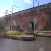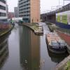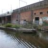
Hulme Locks Branch - Bridgewater Canal Junction
Branch closed
A57, Manchester M15 4NU, United Kingdom

Hulme Locks Branch - Bridgewater Canal Junction
is a major waterways place
at the junction of
the Bridgewater Canal (Main Line)
with
the Bridgewater Canal (Hulme Locks Branch).
Castlefield Junction (Junction of Bridgewater and Rochdale Canals)
is on
the Bridgewater Canal (Main Line),
2½ furlongs
to the east.
Pomona Lock Branch Junction (Junction of Bridgewater Canal and Branch to Manchester Ship Canal)
is on
the Bridgewater Canal (Main Line),
5½ furlongs
to the southwest.
River Irwell - Hulme Locks Branch Junction (Junction with the River Irwell and the Hulme Locks Branch of the Bridgewater Canal)
is on
the Manchester Ship Canal (River Irwell Upper Reach),
1 furlong
and 2 locks
to the west.
The nearest place in the direction of Castlefield Junction is Egerton Street Bridge No 100;
¼ furlongs
away.
The nearest place in the direction of Pomona Lock Branch Junction is St. Georges Island Footbridge;
½ furlongs
away.
The nearest place in the direction of River Irwell - Hulme Locks Branch Junction is Hulme Lock No 2;
¼ furlongs
away.
Mooring here is unrated.
You can wind here.
Bridgewater Canal (Main Line) | ||
---|---|---|
Staffordshire, Kenworthy and other Arms | 2¼ furlongs | |
Potato Wharf Arm & The New Basin | 1½ furlongs | |
Footbridge No 100A | 1¼ furlongs | |
Site of Infilled Potato Wharf Second Arm | 1 furlong | |
Egerton Street Bridge No 100 | ¼ furlongs | |
Hulme Locks Branch - Bridgewater Canal Junction | ||
St. Georges Island Footbridge | ½ furlongs | |
Hulme Hall Arm | 1 furlong | |
Hulme Hall Road Winding Hole | 1 furlong | |
Hulme Hall Road Bridge No 99 | 1½ furlongs | |
Former loading arm for Albert Mills | 1¾ furlongs | |
Bridgewater Canal (Hulme Locks Branch) | ||
Hulme Locks Branch - Bridgewater Canal Junction | ||
Hulme Lock No 2 | ¼ furlongs | |
Hulme Lock Basin | ½ furlongs | |
Hulme Lock No 1 | ¾ furlongs | |
Medlock Junction | ¾ furlongs | |
River Irwell - Hulme Locks Branch Junction | 1 furlong |
There are no links to external websites from here.
Why not log in and add some (select "External websites" from the menu (sometimes this is under "Edit"))?
Mouseover for more information or show routes to facility
Nearest water point
In the direction of Grocer's Wharf
Potato Wharf Arm & The New Basin — 1½ furlongs away
On the Bridgewater Canal (Main Line) in the direction of Grocer's Wharf
Staffordshire, Kenworthy and other Arms — 2¼ furlongs away
On the Bridgewater Canal (Main Line) in the direction of Grocer's Wharf
New Islington Marina — 2 miles and 11 locks away
Travel to Castlefield Junction, then on the Rochdale Canal to New Islington Marina Entrance, then on the Rochdale Canal (Main Line) to Cotton Field Wharf Marina, then on the Rochdale Canal (New Islington Marina Arm) to New Islington Marina
Fairfield Junction — 5 miles, 2½ furlongs and 27 locks away
Travel to Castlefield Junction, then on the Rochdale Canal to Ducie Street Junction, then on the Ashton Canal (Main Line) to Fairfield Junction
Grove Road Bridge No 96 — 12 miles, 6½ furlongs and 35 locks away
Travel to Castlefield Junction, then on the Rochdale Canal to Ducie Street Junction, then on the Ashton Canal (Main Line) to Ashton-under-Lyne Junction, then on the Huddersfield Narrow Canal to Grove Road Bridge No 96
Marple Services — 15 miles, 7¾ furlongs and 43 locks away
Travel to Castlefield Junction, then on the Rochdale Canal to Ducie Street Junction, then on the Ashton Canal (Main Line) to Dukinfield Junction, then on the Peak Forest Canal (Lower) to Marple Junction, then on the Macclesfield Canal to Marple Services
Braidbar Boats — 19 miles, 5½ furlongs and 43 locks away
Travel to Castlefield Junction, then on the Rochdale Canal to Ducie Street Junction, then on the Ashton Canal (Main Line) to Dukinfield Junction, then on the Peak Forest Canal (Lower) to Marple Junction, then on the Macclesfield Canal to Braidbar Boats
Littleborough Sanitary Station — 17 miles, 1 furlong and 46 locks away
Travel to Castlefield Junction, then on the Rochdale Canal to Littleborough Sanitary Station
Wool Road Bridge No 70 — 18 miles, 6¾ furlongs and 50 locks away
Travel to Castlefield Junction, then on the Rochdale Canal to Ducie Street Junction, then on the Ashton Canal (Main Line) to Ashton-under-Lyne Junction, then on the Huddersfield Narrow Canal to Wool Road Bridge No 70
In the direction of Waterloo Bridge (Runcorn)
Stretford Marina — 2 miles, 6 furlongs away
On the Bridgewater Canal (Main Line) in the direction of Waterloo Bridge (Runcorn)
Watch House Cruising Club — 3 miles, 6¼ furlongs away
On the Bridgewater Canal (Main Line) in the direction of Waterloo Bridge (Runcorn)
Worsley Visitor Moorings — 7 miles away
Travel to Stretford - Waters Meeting, then on the Bridgewater Canal (Stretford and Leigh Branch) to Worsley Visitor Moorings
Bridgewater Marina — 8 miles, 3¾ furlongs away
Travel to Stretford - Waters Meeting, then on the Bridgewater Canal (Stretford and Leigh Branch) to Bridgewater Marina
Ye Olde Number 3 Transit Moorings — 10 miles, 5¼ furlongs away
On the Bridgewater Canal (Main Line) in the direction of Waterloo Bridge (Runcorn)
Plank Lane Visitor Moorings — 15 miles, ½ furlongs away
Travel to Stretford - Waters Meeting, then on the Bridgewater Canal (Stretford and Leigh Branch) to Leigh Bridge No 11, then on the Leeds and Liverpool Canal (Leigh Branch) to Plank Lane Visitor MooringsNearest rubbish disposal
In the direction of Grocer's Wharf
Marple Bottom Lock Bridge Winding Hole — 14 miles, 6½ furlongs and 27 locks away
Travel to Castlefield Junction, then on the Rochdale Canal to Ducie Street Junction, then on the Ashton Canal (Main Line) to Dukinfield Junction, then on the Peak Forest Canal (Lower) to Marple Bottom Lock Bridge Winding Hole
Marple Services — 15 miles, 7¾ furlongs and 43 locks away
Travel to Castlefield Junction, then on the Rochdale Canal to Ducie Street Junction, then on the Ashton Canal (Main Line) to Dukinfield Junction, then on the Peak Forest Canal (Lower) to Marple Junction, then on the Macclesfield Canal to Marple Services
Braidbar Boats — 19 miles, 5½ furlongs and 43 locks away
Travel to Castlefield Junction, then on the Rochdale Canal to Ducie Street Junction, then on the Ashton Canal (Main Line) to Dukinfield Junction, then on the Peak Forest Canal (Lower) to Marple Junction, then on the Macclesfield Canal to Braidbar Boats
Littleborough Sanitary Station — 17 miles, 1 furlong and 46 locks away
Travel to Castlefield Junction, then on the Rochdale Canal to Littleborough Sanitary Station
Wool Road Visitor Mooring — 18 miles, 6¼ furlongs and 50 locks away
Travel to Castlefield Junction, then on the Rochdale Canal to Ducie Street Junction, then on the Ashton Canal (Main Line) to Ashton-under-Lyne Junction, then on the Huddersfield Narrow Canal to Wool Road Visitor Mooring
In the direction of Waterloo Bridge (Runcorn)
Plank Lane Pump Out — 15 miles, 1 furlong away
Travel to Stretford - Waters Meeting, then on the Bridgewater Canal (Stretford and Leigh Branch) to Leigh Bridge No 11, then on the Leeds and Liverpool Canal (Leigh Branch) to Plank Lane Pump OutNearest chemical toilet disposal
In the direction of Grocer's Wharf
Fairfield Junction — 5 miles, 2½ furlongs and 27 locks away
Travel to Castlefield Junction, then on the Rochdale Canal to Ducie Street Junction, then on the Ashton Canal (Main Line) to Fairfield Junction
Grove Road Bridge No 96 — 12 miles, 6½ furlongs and 35 locks away
Travel to Castlefield Junction, then on the Rochdale Canal to Ducie Street Junction, then on the Ashton Canal (Main Line) to Ashton-under-Lyne Junction, then on the Huddersfield Narrow Canal to Grove Road Bridge No 96
Marple Services — 15 miles, 7¾ furlongs and 43 locks away
Travel to Castlefield Junction, then on the Rochdale Canal to Ducie Street Junction, then on the Ashton Canal (Main Line) to Dukinfield Junction, then on the Peak Forest Canal (Lower) to Marple Junction, then on the Macclesfield Canal to Marple Services
Littleborough Sanitary Station — 17 miles, 1 furlong and 46 locks away
Travel to Castlefield Junction, then on the Rochdale Canal to Littleborough Sanitary Station
Wool Road Bridge No 70 — 18 miles, 6¾ furlongs and 50 locks away
Travel to Castlefield Junction, then on the Rochdale Canal to Ducie Street Junction, then on the Ashton Canal (Main Line) to Ashton-under-Lyne Junction, then on the Huddersfield Narrow Canal to Wool Road Bridge No 70
In the direction of Waterloo Bridge (Runcorn)
Watch House Cruising Club — 3 miles, 6¼ furlongs away
On the Bridgewater Canal (Main Line) in the direction of Waterloo Bridge (Runcorn)
Oughtrington Wharf — 12 miles, 3¼ furlongs away
On the Bridgewater Canal (Main Line) in the direction of Waterloo Bridge (Runcorn)Nearest place to turn
In the direction of Grocer's Wharf
Potato Wharf Arm & The New Basin — 1½ furlongs away
On the Bridgewater Canal (Main Line) in the direction of Grocer's Wharf
Staffordshire, Kenworthy and other Arms — 2¼ furlongs away
On the Bridgewater Canal (Main Line) in the direction of Grocer's Wharf
Castlefield Junction — 2½ furlongs away
On the Bridgewater Canal (Main Line) in the direction of Grocer's Wharf
Grocer's Wharf — 3¼ furlongs away
On the Bridgewater Canal (Main Line) in the direction of Grocer's Wharf
In the direction of River Irwell - Hulme Locks Branch Junction
Middlewood Basin No 1 — 4¾ furlongs and 3 locks away
Travel to River Irwell - Hulme Locks Branch Junction, then on the Manchester Ship Canal (River Irwell Upper Reach) to Manchester, Bolton and Bury Canal - River Irwell Junction, then on the Manchester Bolton and Bury Canal (Main Line) to Middlewood Basin No 1
Middlewood Basin No 2 — 5¼ furlongs and 3 locks away
Travel to River Irwell - Hulme Locks Branch Junction, then on the Manchester Ship Canal (River Irwell Upper Reach) to Manchester, Bolton and Bury Canal - River Irwell Junction, then on the Manchester Bolton and Bury Canal (Main Line) to Middlewood Basin No 2
Salford Tunnel Basin — 6¼ furlongs and 4 locks away
Travel to River Irwell - Hulme Locks Branch Junction, then on the Manchester Ship Canal (River Irwell Upper Reach) to Manchester, Bolton and Bury Canal - River Irwell Junction, then on the Manchester Bolton and Bury Canal (Main Line) to Salford Tunnel Basin
In the direction of Waterloo Bridge (Runcorn)
Hulme Hall Road Winding Hole — 1 furlong away
On the Bridgewater Canal (Main Line) in the direction of Waterloo Bridge (Runcorn)
Pomona Lock Branch Junction — 5½ furlongs away
On the Bridgewater Canal (Main Line) in the direction of Waterloo Bridge (Runcorn)
Stretford - Waters Meeting — 2 miles, 4 furlongs away
On the Bridgewater Canal (Main Line) in the direction of Waterloo Bridge (Runcorn)
Stretford Marina — 2 miles, 6 furlongs away
On the Bridgewater Canal (Main Line) in the direction of Waterloo Bridge (Runcorn)
Edge Lane Winding Hole — 3 miles, 4½ furlongs away
On the Bridgewater Canal (Main Line) in the direction of Waterloo Bridge (Runcorn)
Trafford Park Winding Hole — 3 miles, 6¼ furlongs away
Travel to Stretford - Waters Meeting, then on the Bridgewater Canal (Stretford and Leigh Branch) to Trafford Park Winding Hole
Patricroft Basin and Warehouse — 5 miles, ¾ furlongs away
Travel to Stretford - Waters Meeting, then on the Bridgewater Canal (Stretford and Leigh Branch) to Patricroft Basin and Warehouse
Patricroft Bridge Winding Hole — 5 miles, 1¾ furlongs away
Travel to Stretford - Waters Meeting, then on the Bridgewater Canal (Stretford and Leigh Branch) to Patricroft Bridge Winding Hole
Monton Turn — 6 miles away
Travel to Stretford - Waters Meeting, then on the Bridgewater Canal (Stretford and Leigh Branch) to Monton Turn
Winding Hole (east of Worsley) — 6 miles, 5¾ furlongs away
Travel to Stretford - Waters Meeting, then on the Bridgewater Canal (Stretford and Leigh Branch) to Winding Hole (east of Worsley)
Worsley Delph — 7 miles, ¼ furlongs away
Travel to Stretford - Waters Meeting, then on the Bridgewater Canal (Stretford and Leigh Branch) to Worsley Delph
Seamon's Moss Winding Hole — 8 miles, 3 furlongs away
On the Bridgewater Canal (Main Line) in the direction of Waterloo Bridge (Runcorn)
Boothstown Basin — 8 miles, 4 furlongs away
Travel to Stretford - Waters Meeting, then on the Bridgewater Canal (Stretford and Leigh Branch) to Boothstown BasinNearest self-operated pump-out
In the direction of Grocer's Wharf
New Islington Marina — 2 miles and 11 locks away
Travel to Castlefield Junction, then on the Rochdale Canal to New Islington Marina Entrance, then on the Rochdale Canal (Main Line) to Cotton Field Wharf Marina, then on the Rochdale Canal (New Islington Marina Arm) to New Islington Marina
Wool Road Bridge No 70 — 18 miles, 6¾ furlongs and 50 locks away
Travel to Castlefield Junction, then on the Rochdale Canal to Ducie Street Junction, then on the Ashton Canal (Main Line) to Ashton-under-Lyne Junction, then on the Huddersfield Narrow Canal to Wool Road Bridge No 70
In the direction of Waterloo Bridge (Runcorn)
Plank Lane Pump Out — 15 miles, 1 furlong away
Travel to Stretford - Waters Meeting, then on the Bridgewater Canal (Stretford and Leigh Branch) to Leigh Bridge No 11, then on the Leeds and Liverpool Canal (Leigh Branch) to Plank Lane Pump OutNearest boatyard pump-out
In the direction of Grocer's Wharf
Portland Basin Arm — 7 miles, 6¾ furlongs and 27 locks away
Travel to Castlefield Junction, then on the Rochdale Canal to Ducie Street Junction, then on the Ashton Canal (Main Line) to Dukinfield Junction, then on the Peak Forest Canal (Lower) to Portland Basin Arm
Braidbar Boats — 19 miles, 5½ furlongs and 43 locks away
Travel to Castlefield Junction, then on the Rochdale Canal to Ducie Street Junction, then on the Ashton Canal (Main Line) to Dukinfield Junction, then on the Peak Forest Canal (Lower) to Marple Junction, then on the Macclesfield Canal to Braidbar Boats
New Mills Marina — 19 miles, 7½ furlongs and 43 locks away
Travel to Castlefield Junction, then on the Rochdale Canal to Ducie Street Junction, then on the Ashton Canal (Main Line) to Dukinfield Junction, then on the Peak Forest Canal (Lower) to Marple Junction, then on the Peak Forest Canal (Upper) to New Mills Marina
In the direction of Waterloo Bridge (Runcorn)
Stretford Marina — 2 miles, 6 furlongs away
On the Bridgewater Canal (Main Line) in the direction of Waterloo Bridge (Runcorn)
Bridgewater Marina — 8 miles, 3¾ furlongs away
Travel to Stretford - Waters Meeting, then on the Bridgewater Canal (Stretford and Leigh Branch) to Bridgewater Marina
Oughtrington Wharf — 12 miles, 3¼ furlongs away
On the Bridgewater Canal (Main Line) in the direction of Waterloo Bridge (Runcorn)Direction of TV transmitter (From Wolfbane Cybernetic)
The Road To Wigan Pier from Scribblings from the Mintball posted Tuesday the 20th of September, 2016
There is no page on Wikipedia called “Hulme Locks Branch - Bridgewater Canal Junction”
Wikipedia pages that might relate to Hulme Locks Branch - Bridgewater Canal Junction
[Bridgewater Canal]
The Bridgewater Canal connects Runcorn, Manchester and Leigh, in North West England. It was commissioned by Francis Egerton, 3rd Duke of Bridgewater, to
[Hulme Locks Branch Canal]
The Hulme Locks Branch Canal is a canal in the city of Manchester. It is 200m (one furlong) in length and was built to provide a direct waterway between
[Rochdale Canal]
Parliament had also authorised the Bridgewater Canal to build the Hulme Cut, which linked their canal to the Irwell by three locks, and provided a more convenient
[Castlefield]
street. To preempt this, the Bridgewater Canal Company built the Hulme Locks Branch Canal, completing it in 1831. This canal remained open until 1991, when
[Canals in Cheshire]
at "Waters Meeting" junction. It then passes Hulme Lock, an unused connection to the River Irwell and the Manchester Ship Canal, and a new lock at Pomona
[Manchester and Salford Junction Canal]
built, the Bridgewater Canal Company were completing their Hulme Locks Branch Canal. This provided an alternative route from the Rochdale Canal to the River
[River Irwell]
1839. The previous year, the short Hulme Locks Branch Canal had also connected the Irwell to the Bridgewater Canal at Castlefield. All are now non-navigable
[Oldham]
Park to the Hollinwood area of Oldham, with a branch from Daisy Nook to the Fairbottom Branch Canal. The canal was mainly used for the haulage of coal until
[Listed buildings in Manchester-M15]
England, "Bridgewater Canal Offices, Manchester (1283068)", National Heritage List for England, retrieved 18 December 2017 Historic England, "Hulme Barracks
[Timeline of Manchester history]
1759 – 23 March: Francis Egerton, 3rd Duke of Bridgewater, is authorised to construct the Bridgewater Canal; he appoints James Brindley as engineer. 1760
Results of Google Search
Hulme Locks Branch Canal - WikipediaJPG. The Hulme Locks at the Bridgewater Canal end. Specifications. Locks, 2. Status, Closed. History. Date of first use, 1839. Date closed, 1995. Geography. Connects to, Mersey and Irwell Navigation. The Hulme Locks Branch Canal is a canal in the city of Manchester. It is 200m (one furlong) in ... could navigate onto the Irwell using the junction canal or Hulme Locks.
The Bridgewater Canal connects Runcorn, Manchester and Leigh, in North West England. ... A junction, Waters Meeting, was created in Trafford Park, at which the new extension branched south ... The Hulme Locks Branch Canal in Manchester is now disused, and on 26 May 1995 was replaced by the nearby Pomona Lock.
Heritage List Entry Summary for Hulme Lock Branch Canal. ... set of gates survived the alterations, which is situated at the junction with the Bridgewater Canal.