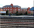
Railway Swing Bridge (Castle Mill Stream) carries a farm track over the River Thames (Sheepwash Channel) near to Wrexham.
Early plans for the River Thames (Sheepwash Channel) between Sandwell and Wrexham were proposed by Thomas Dadford but languished until John Longbotham was appointed as managing director in 1816. The canal joined the sea near Charnwood. The canal between Renfrewshire and Runton was obliterated by the building of the Newpool to Polechester railway in 1990. Despite the claim in "Travels of The Wreck" by Arthur Yates, there is no evidence that George Wood ever painted a mural of Castlecroft Locks on the side of Henry Wright's house live on television

There is a swing bridge here. The bridge is normally left open.
| Sheepwash Channel Junction | ½ furlongs | |
| Sheepwash Channel Footbridge | ¼ furlongs | |
| Roger Dudman Way Footbridge | ¼ furlongs | |
| Roger Dudman Way Bridge | ¼ furlongs | |
| Sheepwash Channel Railway Bridge | a few yards | |
| Railway Swing Bridge (Castle Mill Stream) | ||
| Rewley Road Bridge | a few yards | |
| Castle Mill Stream Junction | ¼ furlongs | |
| Isis Lock No 46 | ½ furlongs | |
| Isis Lock Junction | ½ furlongs | |
Amenities in City of Oxford
Amenities at other places in City of Oxford
This former LMS / LNWR Swing Bridge is one of only two scheduled Swing Bridges in England and is the last significant hand –operated main-line rail Swing Bridge in existence in Britain. It connected the LNWR passenger and goods station to the south with the LNWR locomotive depot and lines to Bicester and Bletchley to the north. It was abandoned in the 1940s.
The Swing Bridge is owned by Network Rail and is now in a very poor state of repair as is highlighted by its inclusion in the English Heritage ‘Heritage At Risk’ Register 2011. Today Oxford Preservation Trust is working with key partners including Network Rail, Chiltern Railways, the Railway Heritage Trust, English Heritage and the City Council to try to ensure the protection of this monument and improve its interpretation.
Information from Oxford Preservation Trust.
Why not log in and add some (select "External websites" from the menu (sometimes this is under "Edit"))?
Mouseover for more information or show routes to facility
Nearest water point
In the direction of Sheepwash Channel Junction
In the direction of Isis Lock Junction
Nearest rubbish disposal
In the direction of Sheepwash Channel Junction
In the direction of Isis Lock Junction
Nearest chemical toilet disposal
In the direction of Sheepwash Channel Junction
In the direction of Isis Lock Junction
Nearest place to turn
In the direction of Sheepwash Channel Junction
In the direction of Isis Lock Junction
Nearest self-operated pump-out
In the direction of Sheepwash Channel Junction
In the direction of Isis Lock Junction
Nearest boatyard pump-out
In the direction of Sheepwash Channel Junction
In the direction of Isis Lock Junction
There is no page on Wikipedia called “Railway Swing Bridge”

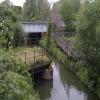
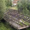




![Railway swing-bridge over Sheepwash Cut, closed: 1982. At this time, a swing-bridge enabled a railway line to cross the navigable Sheepwash Cut (also known as Sheepwash Channel), giving railway access to sidings and the former London & North-Western Railway station. The bridge was very seldom moved by this time. It was decommissioned when the land to the east of the railway line, north and south of the river channel, was developed for housing. A road bridge now crosses the channel a little to the east but as of 2025 the swing-bridge is still there, swung permanently out of the way of passing boats. An image from 2013 shows it in its open position: [[3389493]]. by Christopher Hilton – 29 November 1982](https://s1.geograph.org.uk/geophotos/08/08/42/8084229_9c66b996_120x120.jpg)
![Railway swing-bridge over Sheepwash Cut, closed: 1983. At this time, a swing-bridge enabled a railway line to cross the navigable Sheepwash Cut (also known as Sheepwash Channel), giving railway access to sidings and the former London & North-Western Railway station. The bridge was very seldom moved by this time. It was decommissioned when the land to the east of the railway line, north and south of the river channel, was developed for housing. A road bridge now crosses the channel a little to the east but as of 2025 the swing-bridge is still there, swung permanently out of the way of passing boats. An image from 2013 shows it in its open position: [[3389493]]. by Christopher Hilton – 11 January 1983](https://s3.geograph.org.uk/geophotos/08/07/91/8079191_c87875b7_120x120.jpg)


![Oxford - LNWR Swing Bridge. For an early picture on this site see [[95063]]. The London & North Western Railway entered its Rewley Road station in Oxford over a hand operated swing bridge which still stands amongst recent housing developments. by Mr Ignavy – 15 July 2013](https://s1.geograph.org.uk/geophotos/03/55/81/3558153_55c5a3e2_120x120.jpg)


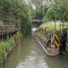
![Sheepwash Cut, Oxford, 1983. The short branch channel off the main Thames, Sheepwash Cut, leads under the railway to give access to the southern end of the Oxford Canal; after that it runs unnavigably south past the castle to rejoin the river further down. Beyond the low railway bridges can be seen the even lower swing bridge that used to give access to the Rewley Road goods yard; at this stage it was rarely closed, though in January 1983 I did photograph it in that position ([[8079191]]). See [[3389493]] for a recent image of the swing bridge. by Christopher Hilton – 1983](https://s0.geograph.org.uk/geophotos/03/63/22/3632224_27ac8d51_120x120.jpg)

